The BGS has a long history of collaborative international geochemical projects involving regional baseline mapping and health and environment studies (Johnson 2011).

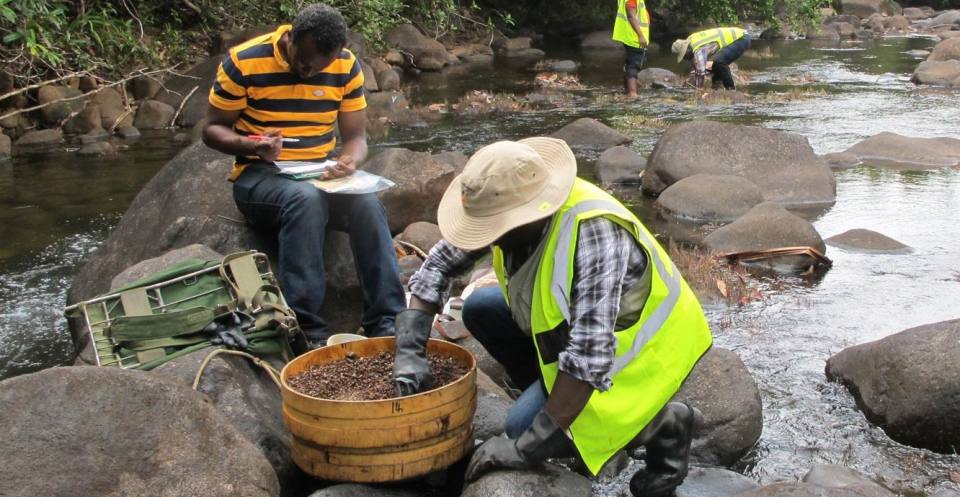
Stream sediment sampling, Sierra Leone
European geochemical mapping projects
We have collaborated with collagues across Europe in a range of geochemical mapping projects, including:
- Forum of European Geological Surveys (FOREGS)
- Geochemical Mapping of Agricultural Soils of Europe (GEMAS)
- Geochemistry of European Bottled Water — we provided UK bottled water samples for this project
- Urban Topsoil Geochemical Mapping Manual (URGE II) — recommendations for standardised urban geochemical mapping in Europe
- Tellus Border — BGS staff were seconded from the BGS G-BASE project to assist with the geochemical mapping programme in the Republic of Ireland
Demetriades, A, Reimann, C, Birke, M, and The Eurogeosurveys Geochemistry EGG Team. 2012. European groundwater geochemistry using bottled water as a sampling medium. 115-139 in Clean Soil and Safe Water. Quercia, F F, and Vidojevic, D (editors). NATO Science for Peace and Security Series C: Environmental Security. (Dordrecht: Springer.)
International regional geochemical mapping (outside Europe)
BGS staff have and continue to contribute to the development of international geochemical mapping methods and understanding, including to the International Union of Geological Sciences’ Global Geochemical Baselines project, which we co-led between 1994 and 2005. This project aims to standardise geochemical mapping at the global scale to provide systematic geochemical baseline information for the world.
Major geochemical mapping projects in the 1970s, 80s and early 90s were sponsored by the UK Overseas Development (ODA), now the Department for International Development (DfID).
Results from these early ODA projects exist in hardcopy reports or geochemical atlases. Digital data for Sumatra (Indonesia), Eastern Bolivia, Northern Peru, Kenya (Samburu-Marsabit), Zimbabwe (north-east and Harare) and Solomon Islands (Choiseul and New Georgia) are available on CD as part of the International Regional Geochemistry CD-ROM series.
The more recent geochemical mapping projects have been funded by national governments or international development banks, e.g. Ecuador, Morocco, Mauritania, Madagascar and Nigeria.
Responsibility for the geochemical reports and results for such projects rests with the respective geological surveys but we retain the knowledge and experience from completing such work.
Jones, R C, and Coats, J S. 1993. Sources of geochemical data collected by the International Division since 1965. British Geological Survey Technical Report WC/93/17. (Available from BGS Enquiries.)
Proposed sampling methods for the Madagascar regional geochemical mapping project
International environmental geochemistry/medical geology projects
Environmental geochemistry is principally concerned with understanding the sources, distribution, transport and fate of chemical substances in the surface environment, their chemical forms and pathways, to aid environmental management and protection.
Medical geology/geochemistry and health investigations apply this information to examine the uptake of substances into air, water, agricultural crops and animals and their effects on the health of plants, animals and humans.

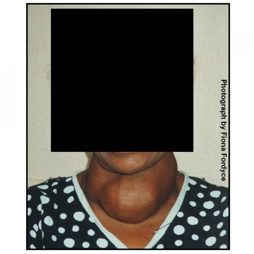
Goitre related to environmental iodine deficiency.
BGS has extensive expertise in environmental geochemistry and geochemistry and health studies and our staff collaborate with other national surveys and international groups on these topics.
Please view our projects page for more details on our international environmental geochemistry projects. Selected additional project reports are also available.
You may also be interested in

Applied geochemistry
Since the 1960s, the BGS has amassed considerable geochemical data holdings and developed significant expertise in applied geochemistry.
Footnotes
1. Johnson 2011
Section 2.11 of: Johnson, C C. 2011. Geochemistry@BGS: a guide to geochemical data at the British Geological Survey. British Geological Survey 64pp. (OR/09/028) - http://nora.nerc.ac.uk/id/eprint/13362/


