Rutland Water is a reservoir in Rutland, England, the reservoir’s construction was completed in 1975 by the damming of two rivers which flooded 6km2 of the Gwash Valley close to Oakham. Today the reservoir is central to walking and cycling around the water (the perimeter track is a 17 mile route). Much of the reservoir shoreline is conserved for birds with parts being internationally important wetlands. The wetlands on the western side of the water are managed by the Leicestershire and Rutland Wildlife Trust and designated areas of importance for many wild birds (including gadwall, shoveller, lapwing, coot, teal, grebe etc). The geology that surrounds the water (and which lies beneath the reservoir) is comprised of sedimentary rocks of the Jurassic period including sandstones, mudstones and limestones (mainly the Lias group clays overlain by limestones of the oolite group). Later deposits from glaciations obscure the geology in some parts of the region.
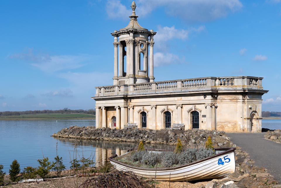

Normanton Church built from oolitic limestone sits on the edge of Rutland Water. Source: clubfoto © iStock
There are many nice walks around Rutland Water, one is on the south-east side (parking at Edith Weston Village by the sailing club). Here, buff-cream coloured oolitic limestone rocks can be found around the edges of the reservoir. Oolitic limestone is a sedimentary rock formed of ooids (sperical grains composed of centric layers of calcium carbonate). Ooids form in warm, tropical, salty seas where the intertidal motion causes the formation of the layers. Take a magnifying glass as ooids are very small! The blocks of oolitic limestone contain a few fragments of shelly material. A better fossil hunting spot is the nearby Ketton Quarry (see below).
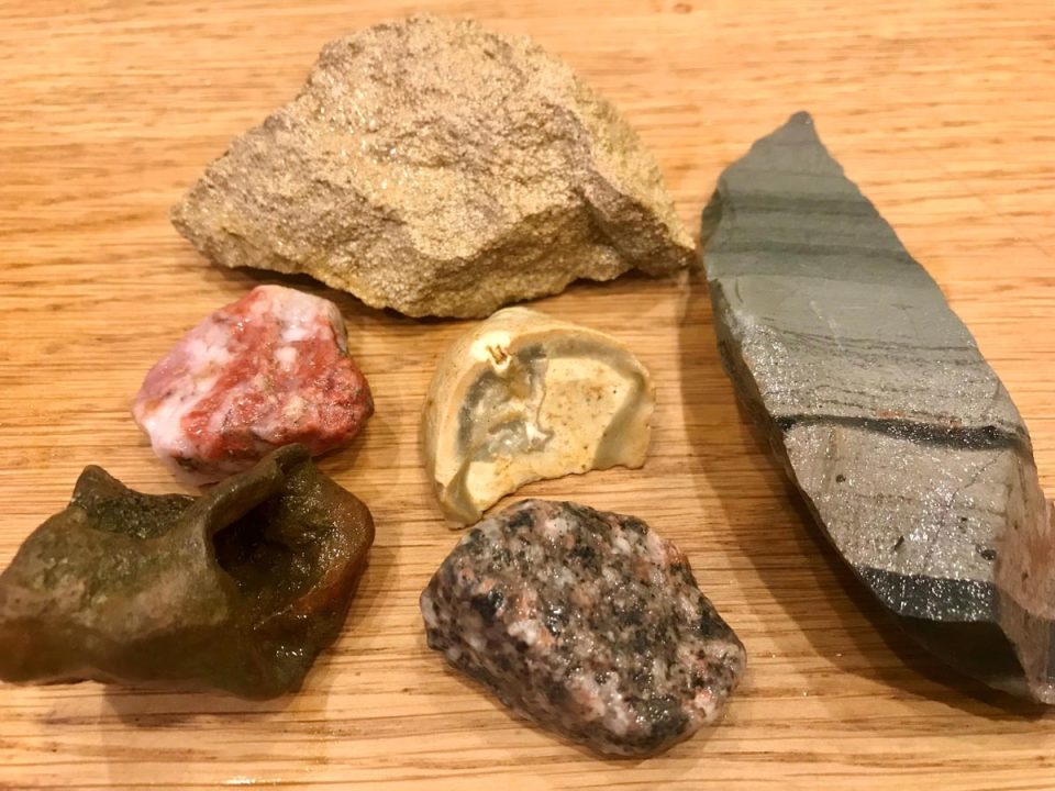
Fragments of rocks found around Rutland Water. The oolitic limestone is at the top, a green-grey stripy volcanic rock is to the right, then chert (white), quartz (red), ironstone (brown) and granite (grey, white, black, pink). Source: BGS © UKRI
There are two types of rocks that form the water defence around the edge of the reservoir, these are the buff-cream coloured oolitic limestone and a hard green-grey stripy rock probably an older ancient volcanic deposit similar to that found at Beacon Hill near Loughborough. Do not hammer the rocks. Fossils can be searched for in the fragments of limestone (hand specimens) that have broken off the main blocks and small pieces of rock can be collected. The soft banks of the reservoir are made of clay. When the water levels in the reservoir are low the shore line north of Edith Weston village reveals huge expanses of a stripy mussel, possibly zebra mussels but note the recent invasion of quagga mussels that look very similar. Also note small areas of gravel sized ironstone, chert, quartzite and granite can be seen along the edge of the path, these have probably been brought in from elsewhere and used as part of the maintenance of the area.
From Edith Weston car park, walking NE along the water edge track takes you to Normanton Church that sits on the waters edge. Normanton Church is mediaeval (back to the 14th century) but rebuilt in a classical style in the 18th century, the church is built out of the local oolitic limestone. The church was abandoned between 1920 to 1970, now the church serves as a beautiful wedding venue. If you continue to follow the coastal path to the NE you will reach the reservoirs’ dam. The dam lies at the eastern most end of Rutland Water. To the northern end of the dam there is a large car park and visitor centre. The dam is armoured with large blocks of limestone to protect it from wave action. It is a good spot for bird watching.
How it started Vs how it ended #RutlandSeaDragon #FossilFriday pic.twitter.com/uOb8coKvaj
— Dr Dean Lomax: Sea Dragon Dinosaur Dolphin saviour (@Dean_R_Lomax) January 14, 2022
Rutland Water was recently in the media in early 2022 when one of the longest and most complete Ichthyosaur fossils (the Rutland Sea Dragon) was discovered on the edge of Rutland water. Ichthyosaurs are marine reptiles that lived in the ocean during the Jurassic, a period spanning 195 and 160 million years ago. The ichthyosaur had been buried in soft clay rich rocks of around 180 million years (Whitby mudstone formation).
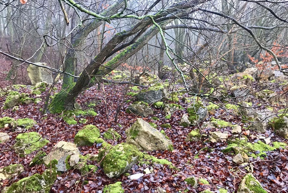
The Ketton Quarry SSSI with piles of rocks buried in moss and trees. Source: BGS © UKRI
If you would like to go fossil hunting at Ketton Quarry (go to the Industrial Park past the entrance to Ketton Quarry), a trail is marked. The quarry area is of the Blisworth limestone and it is rich in fossils. The site is of special scientific interest, meaning you can visit but hammering of the in-situ bedrock is not allowed. You can split loose rocks that are scattered around the reserve due to the former quarrying. Fossils can be found including ammonites, brachiopods, bivalves, gastropods, corals, echinoids, shark teeth and more. Ketton Quarry is heavily overgrown, paths are muddy in winter and the ground is rough and uneven in parts. Hammering loose blocks is allowed but wear sturdy footwear and protect your hands and eyes with goggles and gloves.
More detailed geological resources:
- Scan of the 1:50 000 scale geological map (‘Stamford’)
- BGS GeoIndex
- A 3D model of the region (parts can be cut-away to reveal the concealed bedrock)
Getting there
For more information about visiting Rutland Water please visit the Leicestershire and Rutland Wildlife Trust website.
About the author

Prof Melanie Leng
BGS Chief Scientist, environmental change, adaptation and resilience
Relative topics
You may also be interested in
Postcard geology
Find out more about sites of geological interest around the UK, as described by BGS staff.