Many of the pretty villages and towns of south Somerset contain attractive buildings constructed from a distinctive, warm honey-coloured building stone known as Hamstone.
This stone has a long history of use, with examples found at sites dating back as far as the Roman and Norman periods. During the Medieval period, Hamstone was transported from where it was extracted at Ham Hill, near Yeovil in Somerset, via horse and cart and then boat along the River Perrett to Taunton. From there it was transported for use in churches across Devon, Dorset and west Somerset. The Victorians transported the stone even further afield via railway networks. Hamstone is still in demand today for new buildings and extensions as well as for restoration work, especially in conservation areas where the stone has been traditionally used.
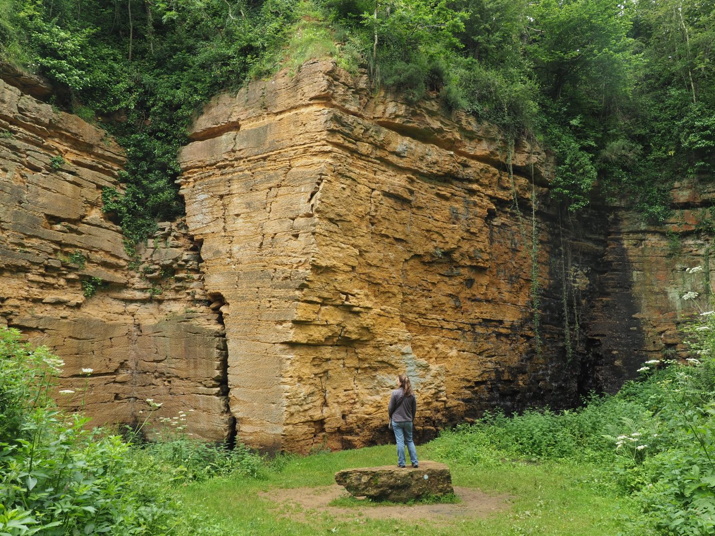

Deep Quarry on Ham Hill is a great place to see the Hamstone in situ but don’t get too close to the faces! BGS © UKRI.
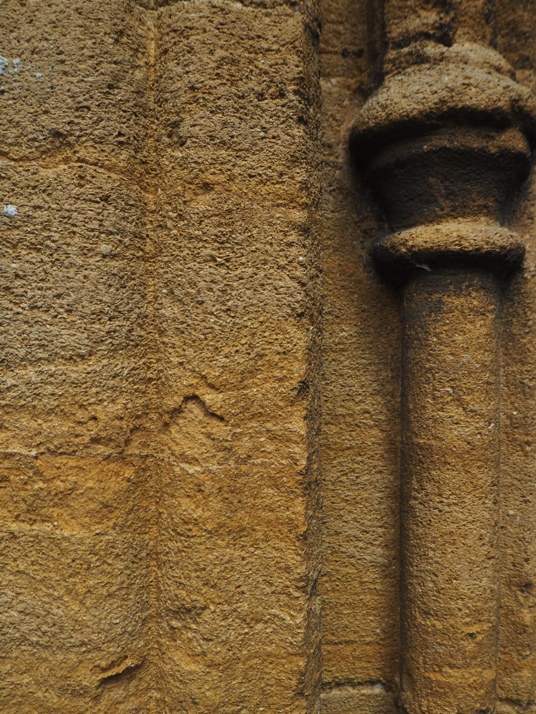
One of the quarry faces at Deep Quarry on Ham Hill, designated a geological Site of Special Scientific Interest (SSSI). This view, which is approximately 3 m high, shows the typical style of bedding, distinctive cross-bedding and thin clay layers. Don’t get too close to these faces! BGS © UKRI.
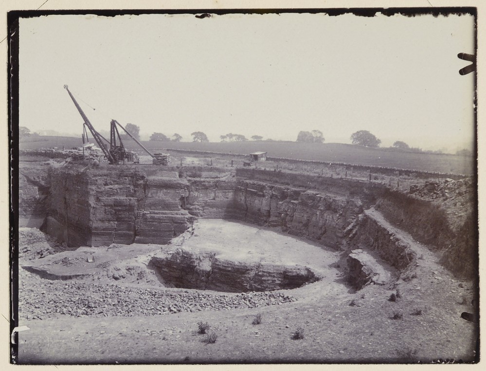
Quarries in Ham Hill Stone above Stoke, June 1911. This image is from the Geologists’ Association Carreck Archive (P804908), which has a number of images of the quarries in the early 20th century. This image shows the vertical fractures which the quarry workers called ‘gulls’. They utilised these to break stone away from the faces. BGS © UKRI.
Hamstone was extracted from quarries on Ham Hill, from which the stone takes its name. The rock unit was formerly known as the Ham Hill Limestone Member (now part of the Bridport Sand Formation), which is a sedimentary rock formed approximately 174 to 183 million years ago in the Jurassic Period (Upper Lias, Toarcian). The sediments were deposited in a shallow-marine environment and the rock is generally composed of coral and shell fragments, which accumulated in beds and reefs in the shallow, carbonate sea that covered this area at the time.
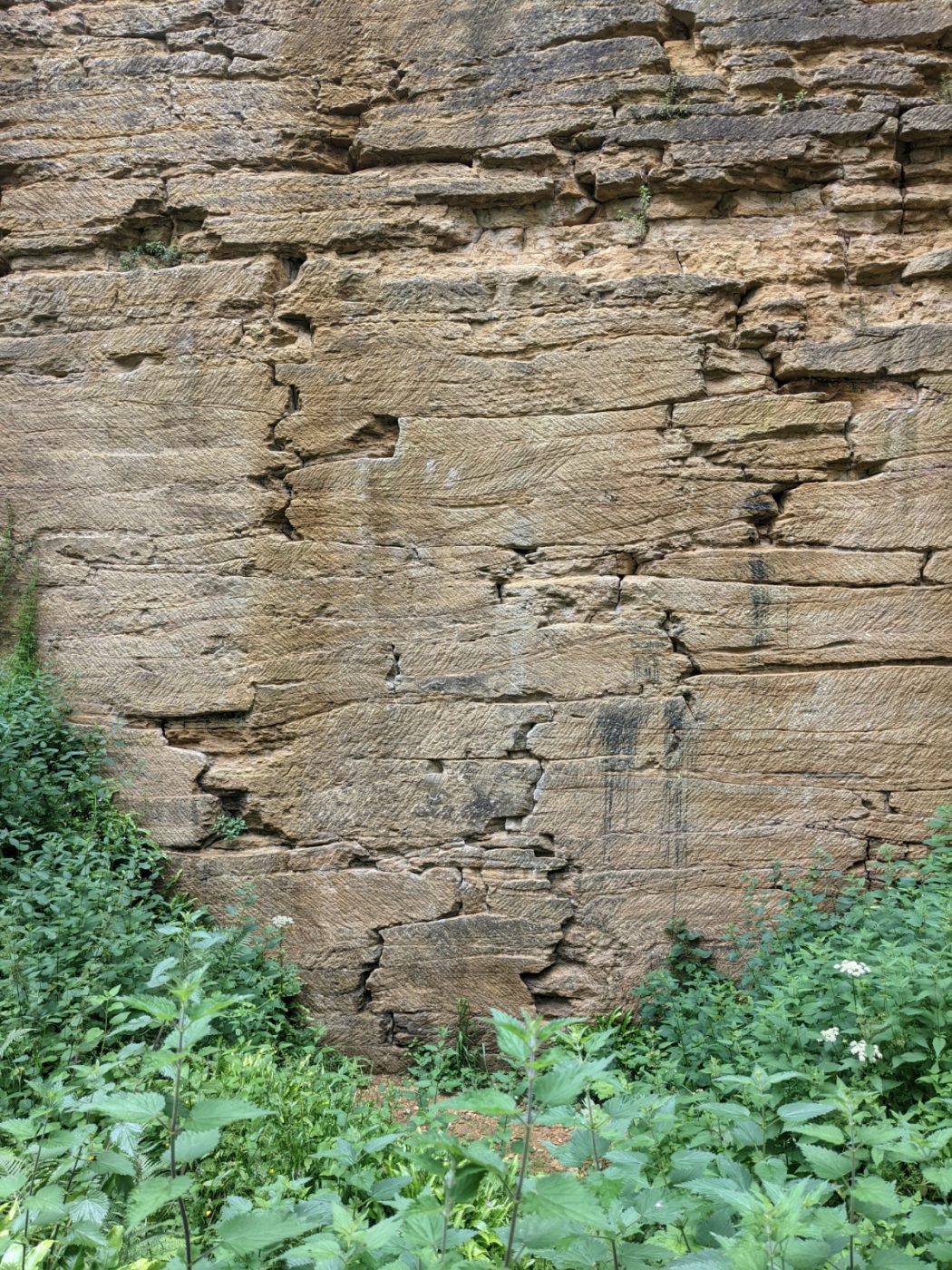
When fresh, Hamstone is a light golden-coloured stone, which can be readily sawn or split and dressed, making it useful as blocks, ashlar and door and window dressings. Weathering causes the stone to darken to richer-coloured tones, a process that also picks out the weaker, less well-cemented layers and cross-bedding in what is mainly a well-cemented, medium- to coarse-grained, shelly limestone with thin beds and inclusions of claystone.
Disused quarries that once produced Hamstone can be seen at Ham Hill Country Park, where there is a suggested geological trail to follow. The trail starts and finishes at the Ham Hill Centre where geological trail guides can be picked up.
Many of the local villages have buildings which use Hamstone and South Petherton is a great place to see examples as the town is largely built of the stone. Another fine example is the Elizabethan Montacute House, which was commissioned in 1588 and is mainly constructed of Hamstone.
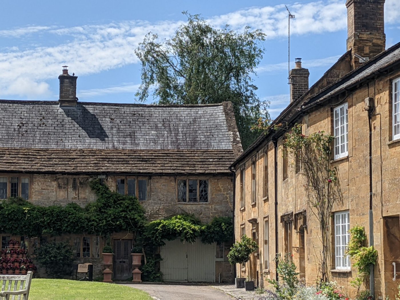
Hamstone is used in the walls of the cottages and window dressings in the village of Montacute. BGS © UKRI.

The church of All Saints at Martock dates back to the 13th century. It’s the second largest parish church in Somerset and is built of Hamstone. BGS © UKRI.
Detail of carving around a doorframe in Hamstone at Church of All Saints at Martock. BGS © UKRI.
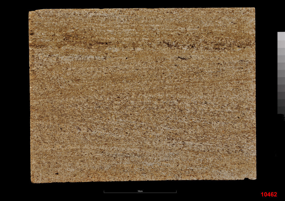
Limestone (Ham Hill). Ham Hill Quarry, Ham Hill, Stoke under Hamdon, near Yeovil, Somerset. Econ. 10462. Case: R & S 3165. Original Collection information: B.R.S. P750852. BGS © UKRI.
Ham Hill is an area of high ground on the southern edge of the Somerset Levels, with good views across this large area of mainly flat coastal plains and wetlands. For the most part, the Somerset Levels are only about 6 m above sea level and have a documented history of efforts to manage the water levels going back to the 13th century.
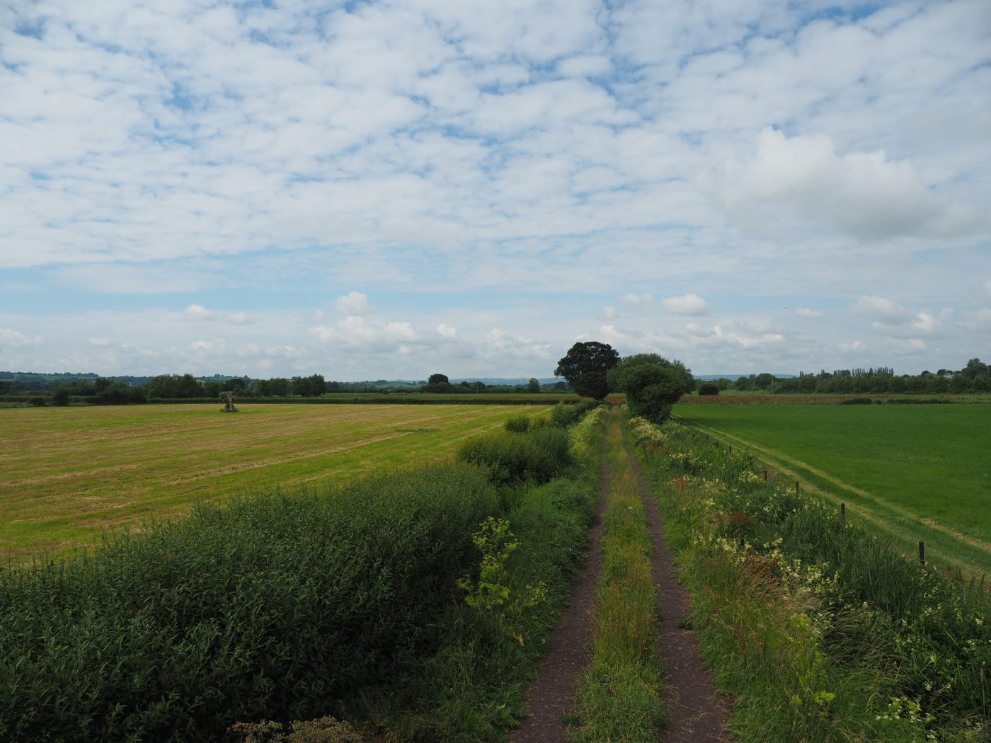
Drainage ditches such as these, either side of a track on West Moor on the New Road between Burrow and Hambridge, are used to manage the water levels. BGS © UKRI.
Ham Hill is well worth a visit to explore its geology as it is a Site of Special Scientific Interest (SSSI) and a Local Geological Site (LGS), scheduled for its geology. The hill also includes a Scheduled Ancient Monument, an Iron Age hill fort, a Roman site, and is a local nature reserve and country park.
Ham Hill is accessible by car with parking at the visitor centre. South West Coaches operate a bus service that stops in the centre of Stoke Sub Hamdon, from where you need to walk up the steep Ham Hill Road.
Caution: stay away from the base and top edges of the quarry faces and from the edges as they are loose and overhanging in places and could fall. It is illegal to hammer the rocks or collect fossils from this site as Ham Hill is a SSSI.
Further reading
Geology of Britain viewer [online]. (Nottingham, UK: British Geological Survey.)
GeoScenic [online] (BGS online image portal). (Nottingham, UK: British Geological Survey.)
Somerset Council. Ham Hill geology and quarrying [online].
Wilson, V, Welch, F B A, Robbie, J A Green, G W, Anderson, F W, Buchan, S, and Melville, R V. 1958. The geology of the country around Bridport and Yeovil: explanation of sheets 327 and 312. (London, UK: HMSO.)
About the author

Rhian Kendall
BGS Chief Geologist, Wales
Relative topics
You may also be interested in
Discovering Geology
Discovering Geology introduces a range of geoscience topics to school-age students and learners of all ages.
Maps and resources
Download and print free educational resources.
Postcard geology
Find out more about sites of geological interest around the UK, as described by BGS staff.