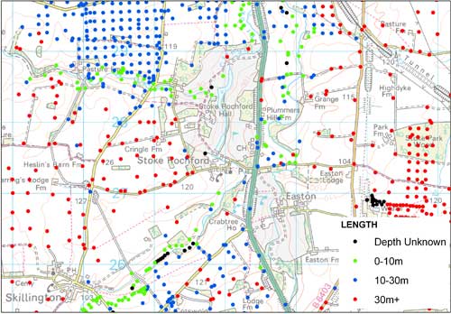

SOBI sample data. BGS © UKRI – Contains OS data © Crown copyright 2020.
Single Onshore Borehole Index (SOBI)
- Great Britain
- Open
The Single Onshore Borehole Index (SOBI) is an index of over one million records of boreholes, shafts and wells from all forms of drilling and site investigation work held by the BGS.
Key information
- Coverage:
- Great Britain
- Availability:
- Open
- Price:
Free for commercial, research and public use under the Open Government Licence. Please acknowledge the material
- Format:
- GIS point data (ESRI, MapInfo, others available by request)
- Uses:
- Site-level use
- Themes:
- Built environment, Geology, Geoscience information
The collection covers onshore and near-shore boreholes from Great Britain dating back to at least 1790 and ranging from one to several thousand metres deep. Each year thousands of new records are added.
Individual borehole scans are now freely available via the borehole scans page.
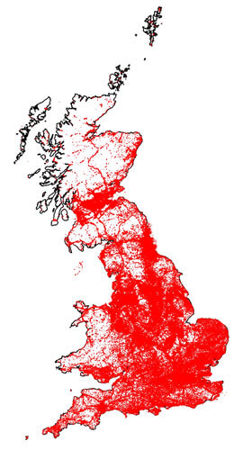
SOBI data coverage. BGS © UKRI – Contains OS data © Crown copyright 2020.
You may also be interested in
Borehole records
The BGS Borehole record viewer offers direct, online access to the National Geoscience Data Centre collection of onshore scanned boreholes, shafts and well records.