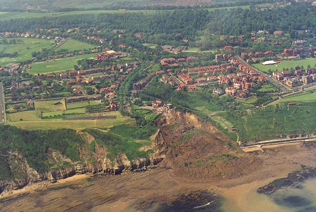
If active landsliding appears to be happening on or near your property, inform your insurance company, mortgage lender or landlord. Get specialist advice from a suitably qualified expert such as a structural surveyor, geotechnical engineer or chartered engineering geologist.
If active landsliding is not happening but the area has the potential for landslide activity, take specialist advice before starting major building or drainage work or modifying the ground around your property.
- Ensure water supply pipes and drains are in good repair and are not leaking.
- Ensure ditches and drains are directed away from potentially unstable ground and are maintained.
- Maintain gutters and down pipes and direct them to piped drainage systems.
- Manage wooded slope to enhance stability.
- Do not remove material from the bottom of slopes.
- Do not place material on or at the top of slopes.
- Do not dispose of rainwater or surface water to soakaways.
- Do not allow surface drainage to discharge water on to slopes or the ground behind slopes.
- Do not remove vegetation whose roots may be strengthening loose or weak material, or may be strengthening the slope by removing soil moisture.
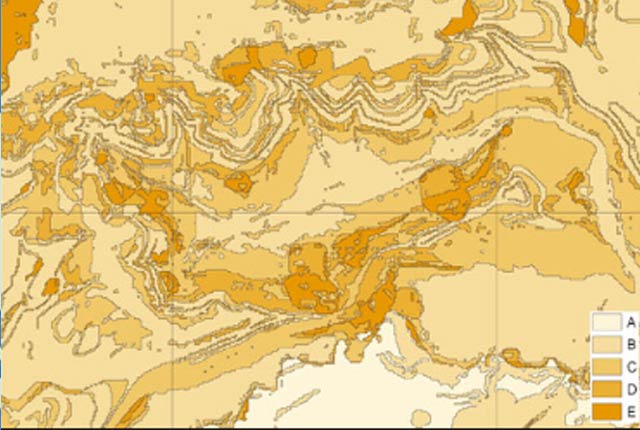
Hazard ratings and advice
| Hazard rating | Advice for public | Advice for specialist |
|---|---|---|
| A — no indicators for slope instability identified. | No actions required to avoid problems due to landslides. | No special ground investigation required or increased construction costs or increased financial risk due to potential problems with landslides. |
| B — slope instability problems are unlikely to be present. | No actions required to avoid problems due to landslides. | No special ground investigation required or increased construction costs or increased financial risk due to potential problems with landslides. |
| C — possibility of slope instability problems after major changes in ground conditions. | Ask about implication for stability if large changes to drainage or excavations take place near to buildings. | New build — consider possibility of trench side or slope movement during excavations, or consequence of changes to drainage. Possible increase in construction cost to remove possibility of potential slope stability problems.
Existing property — no significant increase in insurance risk due to natural slope instability problems. |
| D — significant potential for slope instability with relatively small changes in ground conditions. | Avoid large amounts of water entering the ground through pipe leakage or soakaways. Do not undercut or place large amounts of material on slopes without technical advice. | New build — assess slope stability of site and consequences of excavation, loading and water content changes during and after construction.
Existing property — probable increase in insurance risk due to natural slope instability after changes to ground conditions such as a very long, excessively wet winter. |
| E — very significant potential for slope instability. Active or inactive landslides may be present. | Seek expert advice about stability of the ground and its management to maintain and increase its stability. | New build — slope stability assessment necessary, special design may be necessary, construction may not be possible.
Existing property — significant increase in insurance risk in some cases. Site-specific consideration is necessary to separate cases where landslides are stabilised or ancient and stable from those that may be active or may fail. |
You may also be interested in

BGS GeoSure
The BGS GeoSure datasets identify areas of potential hazard and, therefore, potential natural ground movement, in Great Britain.

BGS GeoSure: landslides
The potential for landsliding (slope instability) to be a hazard has been assessed using 1:50 000 scale digital maps of superficial and bedrock deposits. These have been combined with information from the BGS National Landslide Database and scientific and engineering reports.


