BGS Geology data is provided as a series of layered themes. Depending on the scale of data chosen, up to five main themes are available:
Artificial ground
Artificial ground is the term we use for those areas where the ground surface has been significantly modified by human activity. Artificial ground is a vital component of our understanding of UK geology, which also includes bedrock and superficial deposits, because the near-surface ground conditions are so important to human activities and economic development.
For BGS Geology and related purposes, artificial ground information is placed in a separate theme. It may be regarded, in other uses in the BGS and elsewhere, as part of the superficial geology that includes both artificial and natural deposits. Further information on artificial ground can be found in the BGS Rock Classification Scheme Volume 4.
The artificial ground theme includes:
- made ground: artificial deposits, such as embankments and spoil heaps, on the natural ground surface
- worked ground: areas where the ground has been cut away, such as quarries and road cuttings
- infilled ground: areas where the ground has been cut away then wholly or partially backfilled
- landscaped ground: areas where the surface has been reshaped
- disturbed ground: areas of ill-defined shallow or near-surface mineral workings where it is impracticable to map made and worked ground separately
We have not previously mapped artificial ground; it became a common requirement of the applied geological mapping projects in the 1980s and is now routinely recorded, but information is only available for parts of the country. It is classified primarily on its mode of origin, which is usually apparent from the landform or the changes made to the topography.
Infilled ground can also be classified by its composition into types of fill, such as inert waste, ash or slag. This is not usually practicable in routine mapping as many landfills are mixed deposits with inadequate records of their actual content.
Caution must be exercised using the artificial theme, as it may become dated very rapidly. We cannot monitor every pit and landfill site in the country, recording changes from day to day. It is inevitable that many maps of artificial ground will be out of date. Also, many urban areas are built on artificial ground but it is impracticable to unravel the details in routine mapping.

Artificial ground theme. BGS © UKRI
Mass movement
Mass movement deposits on our geological maps are primarily superficial deposits that have moved downslope under gravity to form landslips. These affect bedrock, other superficial deposits and artificial ground. Various landslip types are recognised but they are rarely classified on our maps, apart from specialised maps for applied geology.
For BGS Geology and related purposes, mass movement information is placed in a separate theme. Here it also includes foundered strata, where the ground has collapsed due to subsidence. In the BGS Rock Classification Scheme Volume 4, though, foundered ground is excluded from the mass movement deposits.
Caution must be exercised using the mass movement theme because of the potential hazard caused by ground instability. We have not always mapped mass movement deposits and they may occur in places where none are mapped. Even on maps where landslips are recorded it is impossible to be sure that all occurrences were found. It is therefore useful to know the location of potential landslip areas, such as those determined in some applied geological mapping projects.
In addition to the mapped landslides, we have used GIS techniques integrating geological and topographical information, to create a natural hazards (BGS GeoSure) dataset, which gives an indication of likely slippage by finding, for example, the incidence of clays on steep slopes. This national dataset covers all of Great Britain. Further information is available on the BGS GeoSure pages.
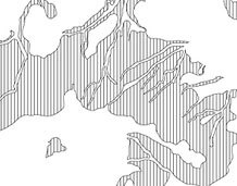
Mass movement theme. BGS © UKRI
Superficial deposits
Superficial deposits (which we used to call ‘drift’) are the youngest geological deposits formed during the most recent period of geological time, the Quaternary, which extends back about 2.6 million years from the present. They rest on older deposits or rocks referred to as bedrock.
For BGS Geology, superficial deposits that are of natural origin and ‘in place’, are held in the superficial deposits theme. Other superficial strata may be held in the mass movement theme where they have been moved, or in the artificial ground theme where they are of human origin. Further information on superficial deposits is found in the BGS Rock Classification Scheme Volume 4.
Superficial deposits were originally recorded only onshore and around the coast where they were laid down by various natural processes such as action by ice, water and wind. More recently, offshore deposits have been mapped and may be held in a separate seabed sediments theme.
Most of these superficial deposits are unconsolidated sediments, such as gravel, sand, silt and clay, and onshore they form relatively thin, often discontinuous patches or larger spreads. Almost all of these deposits were formerly classified on the basis of mode of origin with names such as ‘glacial deposits’, ‘river terrace deposits’ or ‘blown sand’, or on their composition such as ‘peat’. Recently, some of them have been given formal lithostratigraphic names such as ‘Lowestoft Formation’. More information on some units is available in the BGS Lexicon of named rock units.
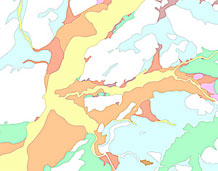
Superficial theme. BGS © UKRI
Bedrock geology
Bedrock geology (which we used to call ‘solid’ geology) is a term used for the main mass of rocks forming the Earth that are present everywhere, whether exposed at the surface in outcrops or concealed beneath superficial deposits or water. The bedrock has formed over vast lengths of geological tim,e ranging from ancient and highly altered rocks of the Proterozoic, some 2500 million years ago or older, up to the relatively young Pliocene, 2.6 million years ago.
For BGS Geology and related purposes all these rocks are placed in a separate bedrock theme of information. Wherever possible, they are referred to by their current name; for stratified units this will usually be of lithostratigraphic type. More information on units is available in the BGS Lexicon of named rock units.
Geological maps usually show all the bedrock strata onshore, apart perhaps from beneath extensive spreads of superficial deposits such as coastal plain alluvium. For BGS Geology 50K, the bedrock has been extrapolated where possible beneath these and out to about the low-water mark around the coast. On some recently published geological maps, bedrock is also mapped offshore on the continental shelf.
The bedrock geology includes many lithologies, often classified into three types based on origin: igneous, metamorphic and sedimentary. These are described in the BGS Rock Classification Scheme Volumes 1–3.
Igneous rocks are derived from molten magma in the Earth’s crust. They may, for example, be extruded at the surface by volcanic activity to form lavas and tuffs (ash) or intruded into other rocks to form large masses of granite and gabbro at depth or minor, cross-cutting basalt dykes near the surface.
Metamorphic rocks such as schist and gneiss are those that have been changed from one rock type to another in the solid state by the recrystallisation of minerals, often at high temperatures and pressures when buried deep in the Earth’s crust.
Sedimentary rocks are formed when grains and fragments of existing rocks are eroded away by ice, water and wind action, transported elsewhere and redeposited as a sediment. These sediments are often laid down in layers or strata of loose particles of gravel, sand, silt and clay. Over time they may be buried by later sediments and consolidated or cemented to form stratified or bedded rocks such as conglomerate, sandstone, siltstone and claystone. Other sedimentary rocks such as ironstone and limestone are created by chemical or biogenic (life) action.
The geological sequence of rocks preserved varies from place to place but packages of strata with similar characteristics may be recognisable over considerable distances. Such study has developed into the science of stratigraphy, of which lithostratigraphy is but one type.
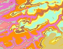
Bedrock theme. BGS © UKRI
Linear features
Linear features at the ground surface or bedrock surface (beneath superficial deposits) are digitised and geologically attributed. Their availability in the digital data therefore depends on the detail shown on the printed map. They are organised into six main categories:
- ROCK: e.g. coal seam, gypsum or ironstone bed; marine band
- FAULT: e.g. normal, thrust, reverse
- FOLD AXIS: e.g. anticline, syncline
- MINERAL_VEIN
- ALTERATION_AREA: e.g. limit of dolomitisation
- LANDFORM: e.g. buried channel margin, glacial drainage channel margin
These relate primarily to the bedrock theme, being either an intrinsic part of it (ROCK or MINERAL_VEIN) or affecting it (FAULT, FOLD AXIS or ALTERATION_AREA). LANDFORM may relate to either the bedrock or superficial theme. Most of these linear features are identified as either observed or inferred.
Many of the linear features are attributed generically, for example a ROCK line may be identified as a coal seam or gypsum bed, a marine band or a fossil horizon, for example a mussel bed. However, these rock units can also be identified with LEX_RCS codes in the same way as polygons and carry the same associated information fields. Thus particular coal seams or marine bands may be identified with specific LEX codes such as:
- YCL (Yard Coal, Leicestershire)
- AGMB (Aegiranum Marine Band)
Similarly, other linear features such as faults and mineral veins may also be attributed with more specific information, for example the name of the fault or the composition of the mineral.
Printed paper maps may also show other ‘concealed’ linear features such as faults or coal seams on the ‘sub-Triassic’ surface, i.e. the assumed outcrop of these features (probably identified in coal mines or boreholes) projected on the unconformity below Triassic strata. These underground features are not included in the BGS Geology linear theme in order to minimise the potential confusion they could cause to users if interpreted wrongly as being in overlying bedrock strata at the surface or just beneath superficial deposits.
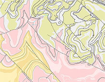
Linear theme. BGS © UKRI


