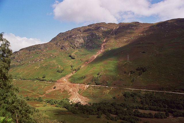
On Wednesday 18 August 2004, the A85 in Glen Ogle, north of Lochearnhead, Stirlingshire, was blocked by what was widely reported as two landslides. There had been considerable rainfall in the area prior to the event. Fifty-seven people were trapped on the roadway and either left the scene on foot or were rescued by helicopter. No injuries were reported. The landslides that caused the disruption on the A85 originated in two- , one leading to a culvert under the road and a second 435 m further down the road.
This landslide was a shallow planar movement that developed into a debris flow. This landslide is BGS National Landslide Database ID 10881/1.
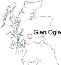

Glen Ogle, Lochearnhead, Stirlingshire location map. BGS © UKRI.
Specialist staff from the BGS Landslides Response Team carried out a survey of the landslide. BGS routinely responds to major landslide events in this way, sending specialist staff to the scene of landslide events to collate data from landslides whilst they are relatively fresh and often active, offering invaluable information.
Backscarp
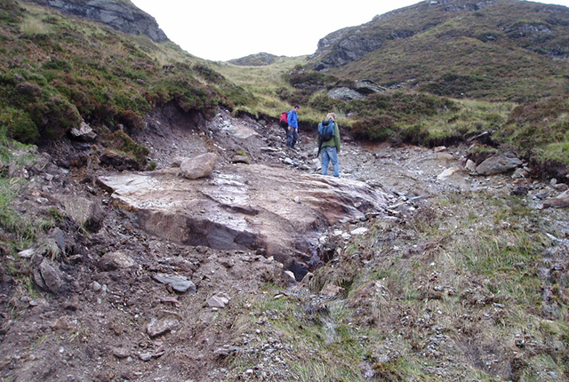
The uppermost part of the slope failure was identified by the presence of a curved backscarp and depletion zone within superficial materials. Detachment of material appeared to have occurred close to the superficial deposit/bedrock interface, at a depth from surface of between 0.6 and 1.8 m. The width of the displacement zone was approximately 8 m. The length of the surface of rupture appeared to have been constrained to 14 m by the presence of a topographic ‘bench’ formed by bedrock.
Immediately downslope of this bench, the ground surface appeared to be intact, with vegetation inclined downslope — this was considered to be an indicator that the displaced mass travelled over this area, leaving it relatively undisturbed. The failure occurred within a pre-existing depression in which vegetation was noticeably lighter in colour than surrounding areas. The depression was interpreted as a source area and track of one or more previous failures. The material involved at this part of the failure was a head deposit.
The displaced mass from this failure appeared to have moved in a shallow, almost planar movement. Several smaller failures of similar style were also noted in this area, each exposing bedrock.
The exposed backscarp was relatively clear of debris, with only a few scattered blocks of broken head observed. This was thought to indicate that the slide mass disaggregated and became a flow soon after initial failure.
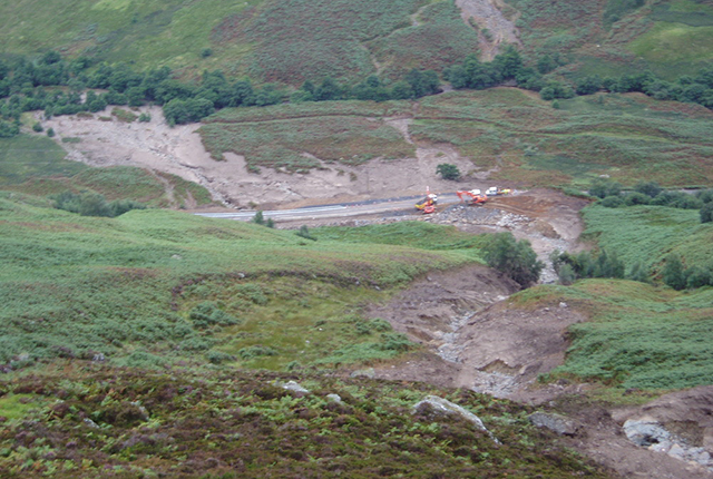
The landslides on the A85, Glen Ogle Lochearnhead, Scotland. BGS © UKRI.
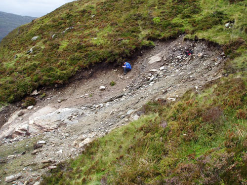
Backscarp of the shallow planar slide at Glen Ogle. BGS © UKRI.
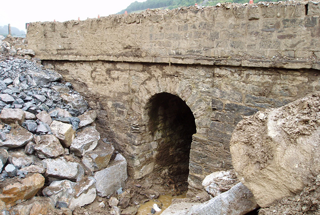
Stone culvert where the stream is normally diverted. BGS © UKRI.
Debris fan at slope base
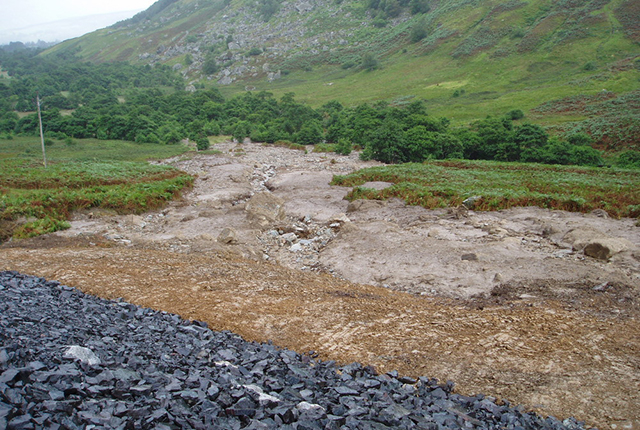
At the base of the slope, some 40 m upslope from the roadway, the natural channel abruptly changes direction. At the junction with the roadway, the channel stream is normally diverted through a stone culvert. A significant amount of debris bypassed this, overwhelming the banks of the gully (at this point estimated to be approximately 4 m in height) and flowed directly downslope. The majority of the debris fan was deposited to the east of the main channel outlet, following the direction of the gully at the roadway.
Summary of field observations
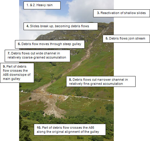
Summary of field observations. BGS © UKRI.
Sequence of events
The following interpretation of events has been inferred.
- Rainfall in the weeks and months preceding the event had saturated the ground — the superficial deposits (peat, head and till).
- Sudden localised rainfall occurred immediately before the landslide event and further saturated the superficial deposits.
- Several small, shallow, planar slides took place in debris at the top of the slope.
- Debris from these slides disaggregated and moved down slope as a debris flow.
- The debris flow turbulently joined the stream near the top of the slope and started to travel down the route of the stream.
- The debris flow entered the steepest section of the gully and the turbulent flow eroded superficial deposits either side and in the base of the channel.
- As the debris flow entered the lower, flatter slopes of the gully, it cut a wide channel through relatively coarse-grained material. Eroded material would have been incorporated into the debris flow.
- The debris flow continued onto flatter slopes again and cut a narrow channel in relatively fine-grained, cohesive material. Erosion along this lower section is still likely to have been significant, as the debris flow would have been travelling at considerable velocity.
- As the debris flow approached the roadway, it encountered a sharp bend in the gully. A portion of the debris flow overrode the bend, overwhelming the south-western bank of the gully, and flowed over the road.
- The remainder of the flow broadly followed the alignment of the gully and formed a debris fan that extended in a south-easterly direction across the roadway.
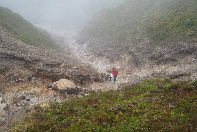
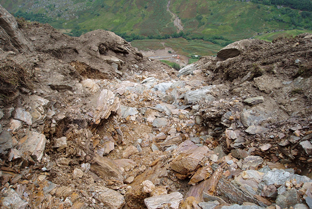
Gallery
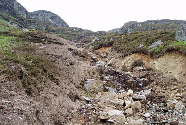
View of landslide track. BGS © UKRI.
View of landslide track. BGS © UKRI.
View down landslide. BGS © UKRI.
View down landslide. BGS © UKRI.
Small, shallow, planar landslide at top of slope. BGS © UKRI.
Debris fan at base of slope. BGS © UKRI.
Further Reading
Winter, M G, Heald, A P, Parsons, J A, Shackman, L. and Macgregor, F. 2006. Photographic feature: Scottish debris flow events of August 2004. Quarterly Journal of Engineering Geology and Hydrogeology, Vol. 39, 73–78.
Winter, M G, Macgregor, F, and Shackman, L (editors). 2008. Scottish Road Network Study:
You may also be interested in

Landslide case studies
The landslides team at the BGS has studied numerous landslides. This work informs our geological maps, memoirs and sheet explanations and provides data for our National Landslide Database, which underpins much of our research.

Understanding landslides
What is a landslide? Why do landslides happen? How to classify a landslide. Landslides in the UK and around the world.

How to classify a landslide
Landslides are classified by their type of movement. The four main types of movement are falls, topples, slides and flows.

Landslides in the UK and around the world
Landslides in the UK, around the world and under the sea.