New geological maps of the Yorkshire Wolds to better inform groundwater management and policy decisions
The new mapping provides crucial data on localised geological issues that may assist in protecting water supplies.
17/12/2025 By BGS Press

Geologists at BGS have completed a major update to the geological map of the Yorkshire Wolds, where the underlying rocks and sediments play a vital role as natural reservoirs for the region’s underground water resources.
The distinctive white chalk rock of the Chalk Group, which forms the magnificent coastal cliffs, is also present beneath the wolds. The chalk is an ‘aquifer’ and is important as the primary drinking-water source for the area. The new geological mapping will provide detailed and accurate information to inform decision making around the use of groundwater resources.
The geology of some of the area was last mapped in the 1800s, before modern understanding of the impact of tectonics (movement of the ’plates’ that make up the Earth’s crust) on the chalk and before information about differences in the properties of the chalk layers was recorded. At that time, there was no satellite data and underground data was limited, so maps were mostly based on ground observations, with much of it done from horseback! The new mapping provides updated geological data and information for the region and plays a central role in the current BGS national geological mapping programme.
The five-year project involved different remote techniques, including interpretation of 2D seismics (information from small, controlled vibrations that create waves through the rock, which can then be used to map the subsurface), digital elevation models, aerial imagery and borehole records along with field surveys and palaeontological (fossil) analysis. Collectively, these methods and data have significantly improved geological understanding of the chalk aquifer.
The aquifer currently faces a number of pressures, including:
- increased water demand from a growing population as well as industrial uses
- risk of nitrate contamination from agricultural land practices
- risk of salt water from the Humber estuary reaching the aquifer and mixing with drinking water
- improvements to habitats, for example chalk streams
We need to better understand and model how water flows in the Chalk aquifer and the interaction between springs, rivers and abstraction. The new mapping delivers enhanced knowledge that will help to improve regional understanding of both the aquifer and the groundwater resources, as well as localised geological issues that may assist in reducing risks to specific water supply assets, such as water abstraction sites.
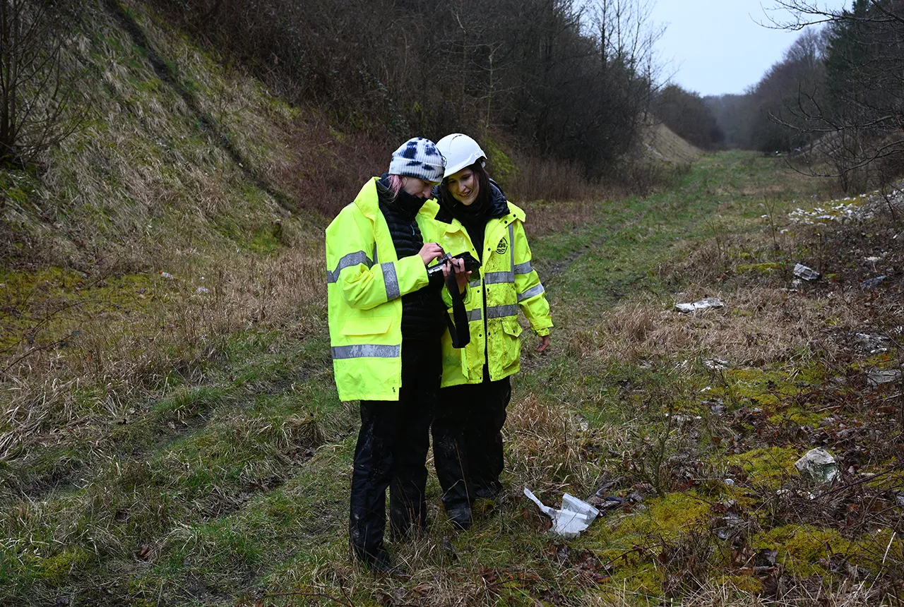
BGS geologists completing fieldwork for the project. BGS © UKRI.

Over the past hundred years since the geology of the Yorkshire Wolds was last mapped, our ability to better understand what lies beneath our feet has vastly improved thanks to technological advances and a modern understanding of geology. The updated geological maps will help companies, farmers, local planners and regulators make more informed decisions around the management and protection of the chalk aquifer in the Yorkshire Wolds.
The data also provides a solid geological framework to underpin future work to help mitigate present and future issues faced in the Yorkshire Wolds, including drought, coastal erosion, water quality and saline intrusion into the aquifer.
Laura Burrel Garcia, survey geologist at BGS.
The project was a collaboration between the Environment Agency (EA), Yorkshire Water Services Limited (YWS) and BGS. Recently, EA, YWS and WSP attended BGS’s headquarters in Keyworth, Nottinghamshire, to discuss the conclusion of the project and its outcomes.
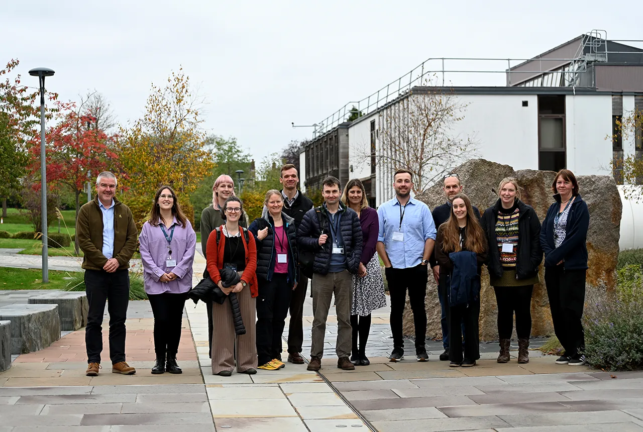
Members of BGS, the Environment Agency, Yorkshire Water Services Limited and WSP at BGS’s headquarters in Keyworth, Nottinghamshire. BGS © UKRI.
The team at the BGS has not just remapped the Yorkshire Wolds; they have also shared their expertise and enthusiasm with all. The outputs of this project will benefit the people of Yorkshire for centuries to come and will greatly assist the Environment Agency in our work to create better places for people and wildlife, while supporting sustainable development.
Ruth Buckley, Environment Agency.
This project has been a wonderful example of collaboration and shared learning. The BGS team members were generous with their time, sharing their expert knowledge of field mapping and interpreting the modern information. It was a pleasure to work with them. The end result is a huge improvement in the collective understanding of the geology, which will feed into improvements in understanding of groundwater flow and a new groundwater model based on the new geology maps. This gives us the ability to better manage East Yorkshire’s water resources and protect the environment now and into the future. A big thank you to all involved.
Mark Morton, Yorkshire Water Services Limited.
The data produced from this work will form part of the national geological map, which will be freely accessible via the Onshore GeoIndex.
Relative topics
Related news

Ukraine and the UK strengthen their commitment to geological cooperation
10/06/2026
A new Memorandum of Understanding reaffirms the UK’s support of Ukraine’s ambitions to develop its critical mineral resources, paving the way for collaboration through capacity-building programmes.

New geological maps of Berwick-upon-Tweed to help future-proof natural water supply
20/05/2026
Scientists have mapped the geology under the town to better understand the groundwater system to inform decisions around abstraction.
BGS GeoClimate – dataset launch webinar
Event on 02/06/2026
The virtual launch of our new BGS GeoClimate dataset – helping mitigate the economic risk from shrink-swell subsidence. Event recording now available

Updated geological assessment of the Southern North Sea set to underpin future offshore infrastructure development
25/03/2026
The first regional assessment for 30 years will support offshore marine and subsurface planning for the UK’s low-carbon energy infrastructure, including the 2030 target of 45 to 50 GW generated through offshore wind.

New research could help provide a more reliable water supply for millions in rural Africa
24/03/2026
A new BGS-led study has revealed crucial insights into the longstanding challenges affecting the reliability and performance of rural water supply infrastructure in sub-Saharan Africa.

Map of BGS BritPits showing the distribution of worked mineral commodities across the country
18/02/2026
BGS’s data scientists have generated a summary map of the most commonly extracted mineral commodities by local authority area, demonstrating the diverse nature of British mineral resources.

Extensive freshened water confirmed beneath the ocean floor off the coast of New England for the first time
09/02/2026
BGS is part of the international team that has discovered the first detailed evidence of long-suspected, hidden, freshwater aquifers.

Funding secured to help mitigate ground risk in UK construction sector
05/02/2026
The BGS Common Ground project has been awarded new funding to help unlock the value of ground investigation data.

Can sandstones under the North Sea unlock the UK’s carbon storage potential?
02/02/2026
For the UK to reach its ambitious target of storing 170 million tonnes of carbon dioxide per year by 2050, it will need to look beyond the current well-studied geographical areas.

Quaternary UK offshore data digitised for the first time
21/01/2026
The offshore wind industry will be boosted by the digitisation of a dataset showing the Quaternary geology at the seabed and the UK’s shallow subsurface.

Hole-y c*@p! How bat excrement is sculpting Borneo’s hidden caves
23/12/2025
BGS researchers have delved into Borneo’s underworld to learn more about how guano deposited by bats and cave-dwelling birds is shaping the subsurface.
New geological maps of the Yorkshire Wolds to better inform groundwater management and policy decisions
17/12/2025
The new mapping provides crucial data on localised geological issues that may assist in protecting water supplies.