AI and Earth observation: BGS visits the European Space Agency
The newest artificial intelligence for earth science: how ESA and NASA are using AI to understand our planet.
02/07/2025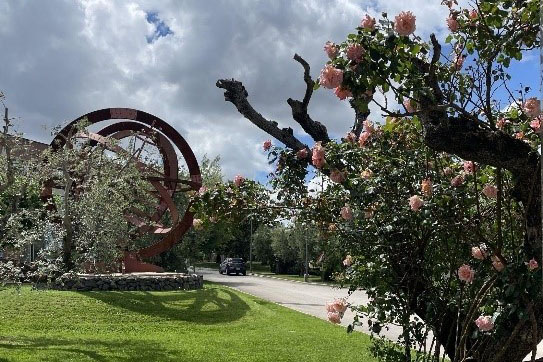

The European Space Agency (ESA) has many offices around Europe but, as an Earth observation scientist myself, the Earth observation headquarters at ESA’s European Space Research Institute (ESRIN) office in Frascati, just outside Rome, is the pinnacle!
ESRIN coordinates and manages the ground-based activities of ESA’s Earth observation missions: data acquisition and processing, and satellite communication. It is the home of innovation and management of software used across the agency, and houses ESA’s records of legacy projects, with missions dating back to the 1970s. It also holds the largest archive of environmental data in Europe, coordinating over 20 ground stations and ground segment facilities across Europe.
Earth observation at ESRIN and BGS
ESA’s Earth-observing activities include satellite missions that monitor many of our planet’s natural processes, such as snow and ice cap accumulation and melt, wildfires, landslides, earthquakes and tectonic movements. It also tracks human-induced changes like city growth, deforestation and groundwater abstraction. Many of these processes and changes are also researched at BGS, using the data from these satellites alongside our expertise in geohazards and geological processes.
The typical challenge we face nowadays as Earth observation scientists is the sheer volume of data available to analyse — we have too much data to sift through manually. One avenue for allowing timely analyses of these large datasets is to use specific artificial intelligence (AI) models called foundation models.
What are foundation models?
Foundation models are designed to take in millions of pieces of data and find relationships between different datasets that we don’t have the time to do manually. Additionally, if the model is trained on several images of the Earth through time, it can make predictions about how our planet might change in the future. For BGS research, this could be used to help provide advice on a multitude of crucial future geological hazards faced by countries around the world; for example, how our coasts may change with sea-level rise.
Last month, I had the pleasure of attending ESA’s joint workshop with NASA on ‘Foundation models for Earth observation at ESA ESRIN’. We stayed near the Colli Albani volcanic complex, which has formed some of the beautiful hills and volcanic lakes surrounding this area, just south-east of Rome.

Some of the ESA member state flags flying outside ESA ESRIN under stormy Italian skies. BGS © UKRI.
At the workshop
My job at BGS is to use both classical and newly devised methods to analyse satellite data and find patterns between the behaviour of the ground beneath us and our other geospatial datasets, and what this means for the people and surface infrastructure. This workshop was ideal for my role. I attended the sessions that focused on applications of AI models to real scenarios; on day one, sessions included using foundation models for various applications in earth sciences, weather prediction and climate science.
On day two, I attended a morning session on how scientists are adapting foundation models for geospatial and Earth observation tasks, which is exactly what I’m aiming to do! In the late morning and afternoon, I had my poster presentation slot, where I showed how my team at BGS envisions using AI alongside Earth observation and BGS data. This includes our bedrock and superficial deposit maps created by our survey geologists, hazard susceptibility maps from our hazards specialists, and more. I also presented some of the machine learning (ML) tools BGS has developed so far to help with this task. I got talking to some really engaging researchers, learning a lot from the people I spoke to about what data works well in these models (and what doesn’t!) and the field of AI in earth sciences as a whole. This was the most beneficial day to me as an early career scientist; talking to so many people from different organisations with different areas of expertise has been invaluable in my development as a scientist.
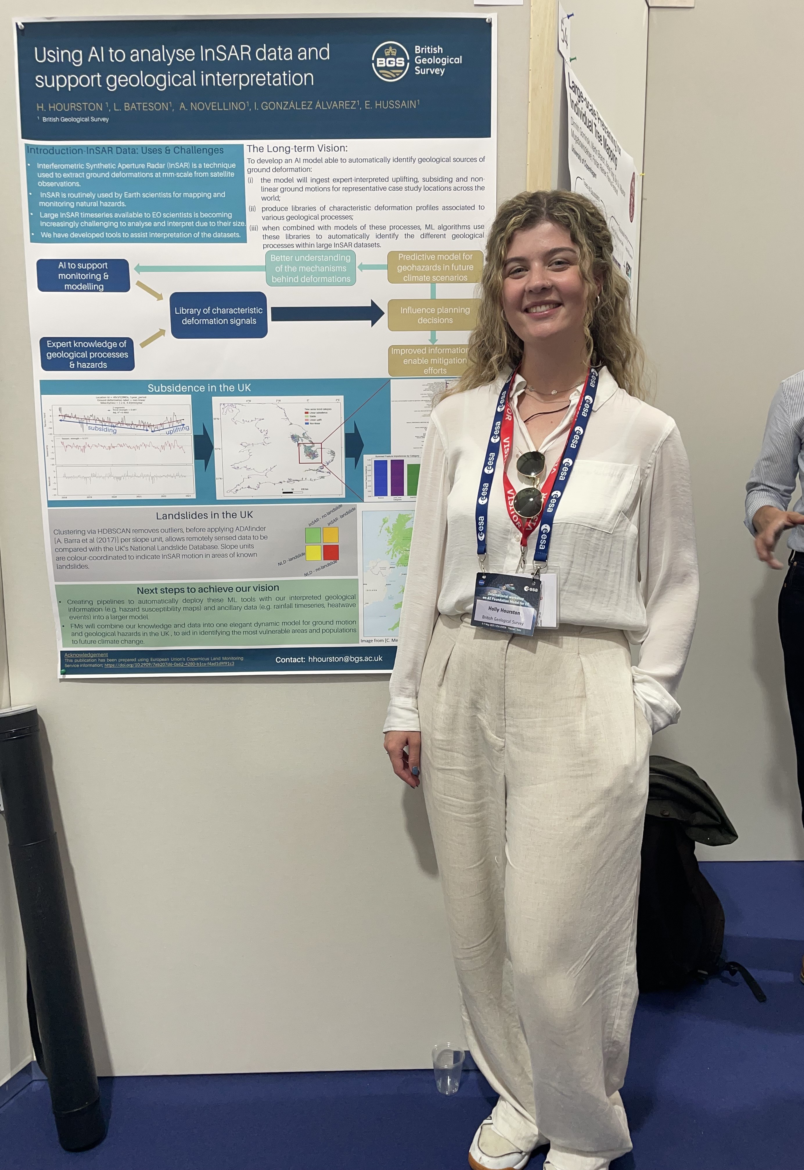
Standing next to a poster by me and some members of my team entitled ‘Using AI to analyse InSAR data and support geological interpretation’. The poster describes various current ML tools we have developed at BGS to analyse a type of satellite data known as InSAR, which measures how much the ground beneath us moves. BGS © UKRI.
When in Rome…
A trip to Lazio wouldn’t be complete without a little sightseeing, so on my penultimate night in Rome I managed to squeeze in some touristy activities. A great thing about working for BGS is being able to experience different cultures and their food — and to have your Italian speaking skills completely humbled by the locals…!

The Pantheon at night in central Rome. BGS © UKRI.

The Trevi Fountain at night in central Rome. BGS © UKRI.
The final day consisted of hands-on training workshops in three of the foundation models that ESA and NASA have developed over the years, which is what I was most looking forward to. The training was delivered by the scientists at NASA Impact and IBM, who helped write the models, who were all fantastically knowledgeable.
Putting my knowledge to work
Now, a few weeks after coming back and with my newfound knowledge from world-leading experts in artificial intelligence, I’ve started to piece together more about how BGS could incorporate our data into such powerful models and I’m excited to practise my new skills. Unfortunately though, I couldn’t bring back buckets of Roman carbonara… so I’ll just have to get back to Rome as soon as I can!
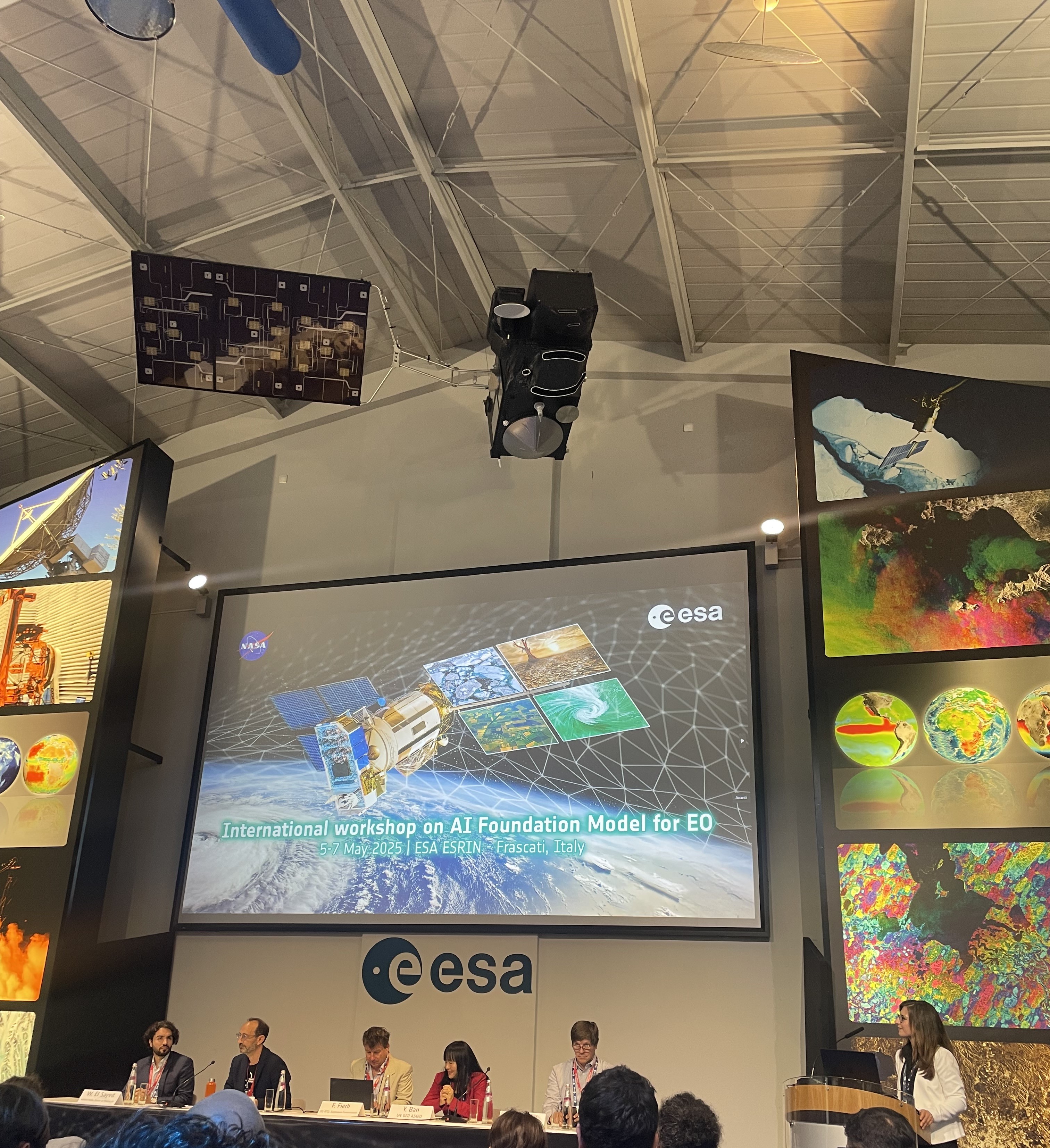
The panel discussion on Day 1 of the workshop, featuring representatives from NASA’s Science Mission Directorate, the Group on Earth Observations AI4EO, European universities and the European Commission. BGS © UKRI.
About the author

Holly Hourston
Earth observation scientist
Relative topics
Related news

Ukraine and the UK strengthen their commitment to geological cooperation
10/06/2026
A new Memorandum of Understanding reaffirms the UK’s support of Ukraine’s ambitions to develop its critical mineral resources, paving the way for collaboration through capacity-building programmes.

International science consortium to survey the health, economic value and social importance of Lake Victoria
22/05/2026
The project will replicate the 1927 survey to assess changes in the lake’s health, economic value and social importance.

New geological maps of Berwick-upon-Tweed to help future-proof natural water supply
20/05/2026
Scientists have mapped the geology under the town to better understand the groundwater system to inform decisions around abstraction.

BGS contributes to UN sand and sustainability report
19/05/2026
The new report highlights the impact of poor governance and unsustainable sand mining practices, calling on policymakers to take action.
BGS engineering geologist elected to CCOP
29/04/2026
Marcus Dobbs has been elected as vice-chair of the advisory group for the Coordinating Committee for Geoscience Programmes in East and Southeast Asia.

Strengthening capacity through partnership: a critical minerals perspective
28/04/2026
BGS has been working in partnership with the Geological Survey Department of Zambia (GSD) to build national capacity, improve data accessibility and support long-term, sustainable development.

Updated geological assessment of the Southern North Sea set to underpin future offshore infrastructure development
25/03/2026
The first regional assessment for 30 years will support offshore marine and subsurface planning for the UK’s low-carbon energy infrastructure, including the 2030 target of 45 to 50 GW generated through offshore wind.

New research could help provide a more reliable water supply for millions in rural Africa
24/03/2026
A new BGS-led study has revealed crucial insights into the longstanding challenges affecting the reliability and performance of rural water supply infrastructure in sub-Saharan Africa.

Map of BGS BritPits showing the distribution of worked mineral commodities across the country
18/02/2026
BGS’s data scientists have generated a summary map of the most commonly extracted mineral commodities by local authority area, demonstrating the diverse nature of British mineral resources.

New UK/Chile partnership prioritises sustainable practices around critical raw materials
09/02/2026
BGS and Chile’s Servicio Nacional de Geología y Minería have signed a bilateral scientific partnership to support research into critical raw materials and sustainable practices.

Extensive freshened water confirmed beneath the ocean floor off the coast of New England for the first time
09/02/2026
BGS is part of the international team that has discovered the first detailed evidence of long-suspected, hidden, freshwater aquifers.

Can sandstones under the North Sea unlock the UK’s carbon storage potential?
02/02/2026
For the UK to reach its ambitious target of storing 170 million tonnes of carbon dioxide per year by 2050, it will need to look beyond the current well-studied geographical areas.