Dynamics of land-to-lake transfers in the Lake Victoria Basin
In June 2024, a UK/Kenya research team shared research findings from a collaborative, four-year field and experimental programme within Kenya.
09/12/2024 By BGS Press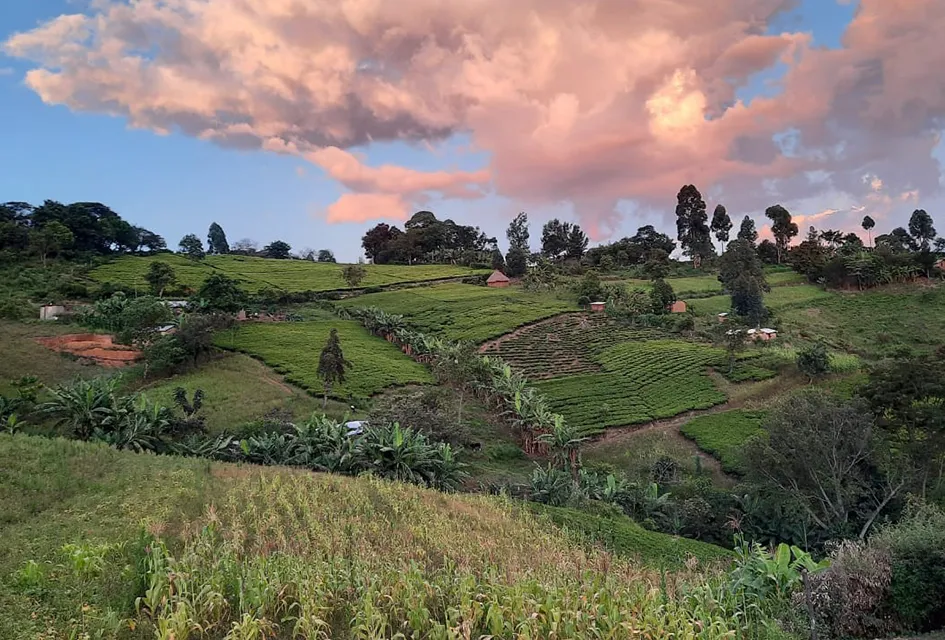

They presented their findings at a stakeholder workshop in Kisumu at the Kenya Marine Fisheries Research Institute (KMFRI). Stakeholders were gathered from academia, research institutes and government, along with community representatives and they were all invited to share their experiences in land and lake management.
Changes to Kenyan land-management practices are urgently needed for sustainable agricultural productivity and to reduce the growing problem of soil erosion and transfers into Lake Victoria, which compromise the growing economic and food security dependence on fisheries aquaculture. The goal of the workshop was to find a way to better coordinate disparate research and create partnerships to improve communications that will better inform land-management decision makers.
The workshop
The workshop covered three exercises across three groups, with the first two set up as ice breakers and to help participants consider how they could translate research findings into impact. These exercises directed discussion towards the preparation of policy briefs: what they are, who reads them and how they can be effective, alongside examples of community engagement to change behaviour or practice.
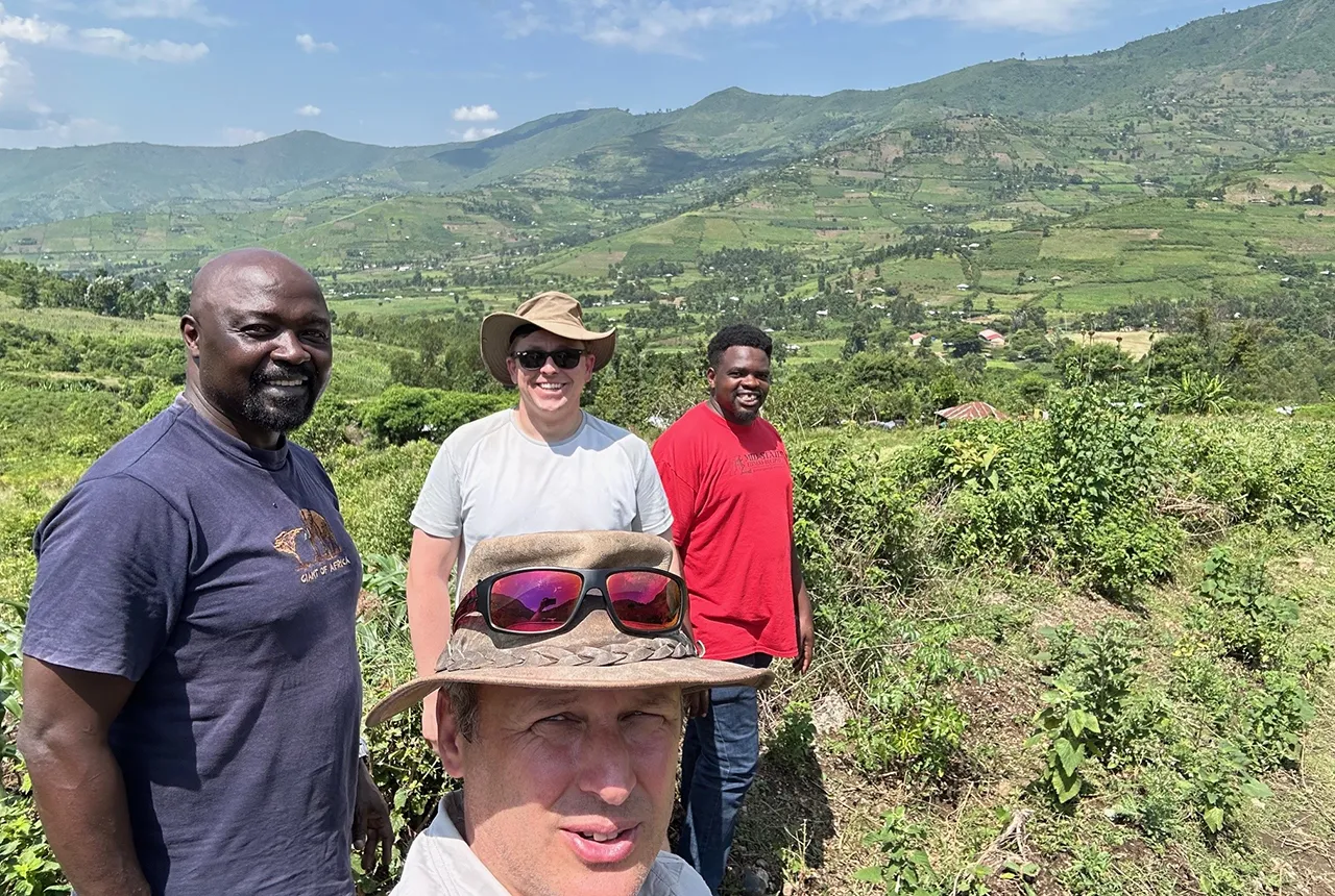
BGS’ Michael Watts and Olivier Humphrey in the field with Kenyan partners. BGS © UKRI.
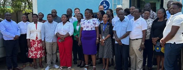
Stakeholder workshop group photo. BGS © UKRI.
The third exercise generated the most discussion on how data and research should be coordinated and shared, with examples of good practice being quite rare owing to a lack of resources and expertise. Additionally, the exercise discussed whether there could be a process to enforce the delivery of research harmonisation, improved reliability of data quality and the ability to consider multiple research outcomes from numerous projects. Again, examples of good practice were limited, although less direct means of communication to policy decision makers were discussed; for example, via media or a community bottom-up approach.
Overall, the workshop demonstrated that the key to enabling a positive change in behaviour and practice for land and lake management is ensuring community engagement from the outset of a research project, such as engaging with focus groups, having community representatives or enabling citizen science participation. The workshop participants agreed that a committee was essential to share research outputs with relevant stakeholders in the Lake Victoria basin. A virtual platform is also essential to a functional framework, so that research outcomes are better shared, data is used in multiple ways to realise efficiency gains and long-lasting impact is created from research. However, such a platform would require adequate resourcing and continued support from stakeholders, alongside engagement from policy decision makers.
Joint research with the University of Eldoret and KMFRI
Research shared with this group was funded via previous Royal Society and NERC grants. It initially involved mapping the geochemistry across the Winam Gulf catchment of the Lake Victoria basin, to model the areas at greatest risk of soil erosion and identify more precisely the locations within a river catchment suitable for targeting limited resources to train farmers and test intervention methods to reduce soil erosion.
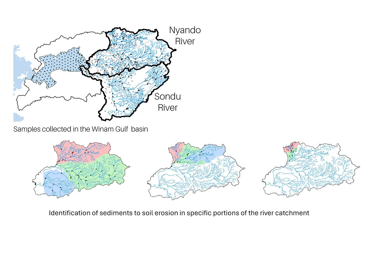
Maps showing the Nyando and Sondu river catchments to sub-catchments. BGS © UKRI.
Secondly, sediments and sediment cores were surveyed across the Winam Gulf catchment, to generate a chronology of sediment run-off over the past 100 years, as well as the extent of metal and nutrient land-to-lake transfers. This will help us to better understand the effects of poor land management on the lake environment.
Field collections, measurements, and digitisation and modelling of data were described in previous blogs, with partnerships cemented by the exchange of technicians, early career researchers and principal researchers. The opportunities created by this collaborative project collectively and individually demonstrate the potential for scientific research to address environmental issues whilst developing scientific capacity in Kenya and the UK. The two-way exchange of staff and paired UK/Kenya PhD students provided an enriching experience for all involved.
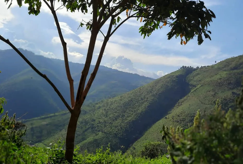
Nandi, Victoria Basin. BGS © UKRI.
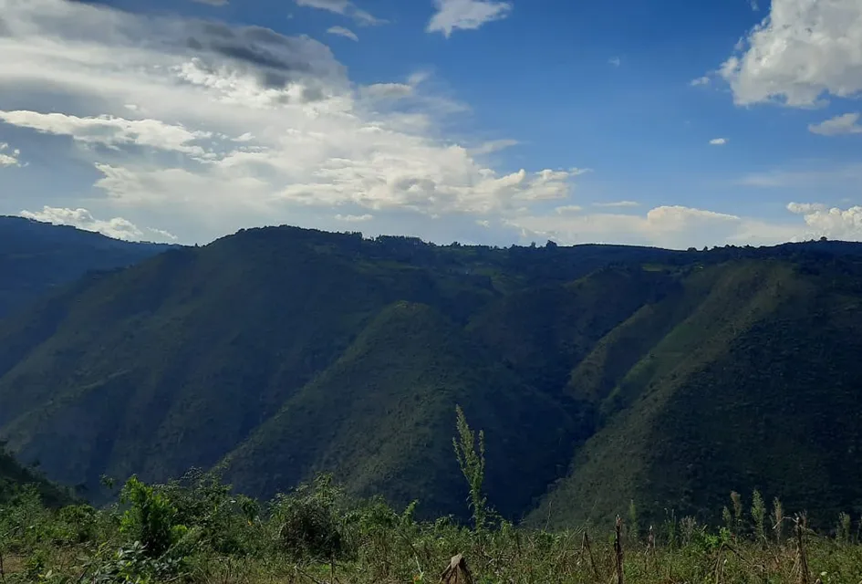
Nandi, Victoria Basin. BGS © UKRI.
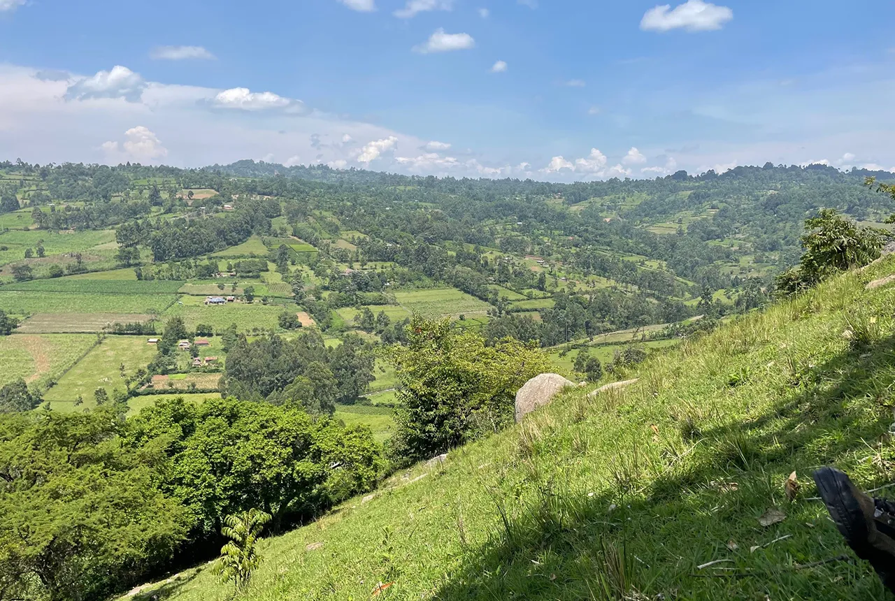
Oroba Valley. BGS © UKRI.
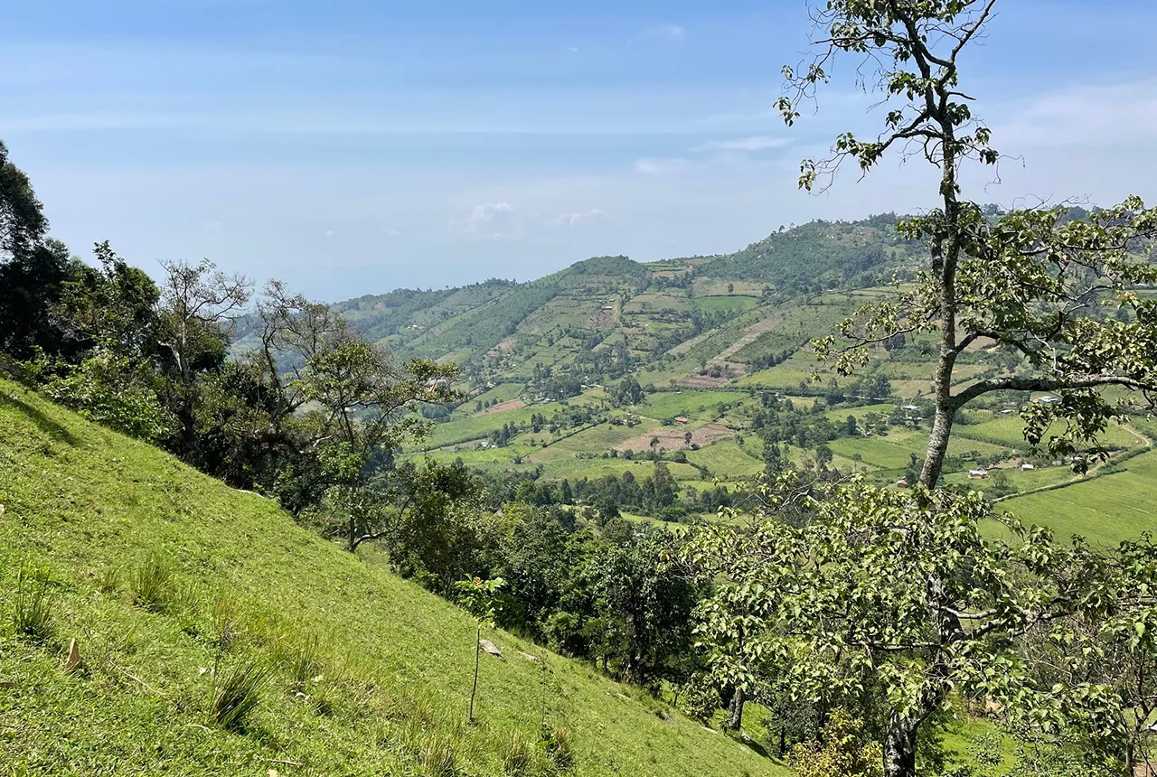
Oroba Valley. BGS © UKRI.
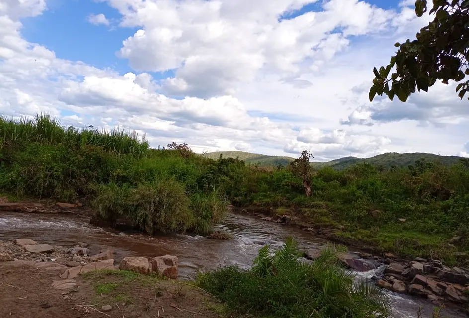
Stream confluence. BGS © UKRI.
Continuing partnerships
Ongoing efforts will see improvements to modelling the risk associated with soil erosion, including translating a machine-learning model for predicting risk at the sub-catchment scale to other similar land-lake environments, to determine changes in soil losses/sediment transfer at historical scales (100 years) and through dynamic modelling (within few years). Funding to support an advisory forum for Lake Victoria has the potential to set a template for the region on how to better coordinate research data. This will be of particular value to developments in machine learning, which can analyse vast amounts of data quickly. Machine learning could provide a broader, more effective perspective beyond the typical scope of a research project but is dependent on harmonised approaches to data capture and quality.
Data and information are very expensive due to their endless nature and the value attached to them; thus, quality collaboration between KMFRI, BGS and UoE has created a unique platform to provide baseline and useful data and information on lake-land interphase, which will form the foundation of lake-basin management, planning and conservation in the region.
Data and information are very expensive due to their endless nature and the value attached to them; thus, quality collaboration between KMFRI, BGS and UoE has created a unique platform to provide baseline and useful data and information on lake-land interphase, which will form the foundation of lake-basin management, planning and conservation in the region.
Acknowledgements
We would like to thank:
- Olivier Humphrey and Andy Marriot, who provided expertise in machine learning, and sampling strategy and fisheries, respectively (BGS)
- Job Isaboke and Sophia Dowell, joint UK/Kenya PhD students
- Staff from all three institutes that supported laboratory and field work, logistical arrangements and community engagement
- Collins Ongore, Job Mwamburi and George Basweti (KMFRI)
- Elliott Hamilton and Amanda Gardner (BGS)
- Prof William Blake for guidance on soil erosion sampling strategy and translation of data outcomes into useful data tools to advise on land management (University of Plymouth).
Funding
This work was financially supported by:
- Natural Environment Research Council (grant numbers NE/R000069/1, NE/X006255/1, NE/S007334/1 and GA/19S/017)
- Royal Society (grant number ICA/R1/191077])
- British Academy (grant number WW21100104] )
- Commonwealth Scholarship Council UK for professional fellowships
About the authors
Dr Christopher M Aura: Director of Freshwater Research at the Kenya Marine Fisheries Research Institute. Chris was a co-PI on the joint research, with oversight on the lake management, sampling and community engagement.
Prof. Odipo Osano: Professor of Environmental Sciences at the University of Eldoret. Odipo was a co-PI on the joint research, with oversight on the land sampling and community engagement, overall coordination of Kenyan activities.
Dr Michael Watts: Head of Inorganic Geochemistry and Lead for International Geoscience R&D at BGS. Michael was the PI for UK funded grants and overall coordinator for the project.
Aura, C M, Humphrey, O S, Marriott, A L, Watts, M J, Ongore, C A, Mwamburi, J M, Osano, O, and Coffey, T J. 2024. Assessing the spatial distribution of elemental concentrations in surface sediments of Lake Victoria Kenya: implications for ecological health and management. Environmental Geochemistry and Health, Vol. 46, 137. DOI: https://doi.org/10.1007/s10653-024-01930-7
Dowell, S, Humphrey, O S, Gowing, C J B, Barlow, T S, Chenery, S R, Isaboke, J, Blake, W H, Osano, O, and Watts, M J. 2024. Suitability of 210Pbex, 137Cs and 239+240Pu as soil erosion tracers in western Kenya. Journal of Environmental Radioactivity, Vol. 271, 107327. DOI: https://doi.org/10.1016/j.jenvrad.2023.107327
Dowell, S, Humphrey, O, Isaboke, J, Barlow, T. Blake, W, Osano, O, and Watts, M. 2024. Plutonium isotopes can be used to model soil erosion in Kenya. Environmental Geochemistry and Health, Vol. 46, 338. DOI: https://doi.org/10.1007/s10653-024-02084-2
Dowell, S M, Barlow, T S, Chenery, S R, Humphrey, O S, Isaboke, J, Blake, W H, Osano, O, and Watts, M J. 2023. Optimisation of plutonium separations using TEVA cartridges for ICP-MS/MS analysis of soil samples. Analytical Methods, Vol. 15, 4226–4235. DOI: https://doi.org/10.1039/d3ay01030a
Dowell, S, Humphrey, O S, Blake, W H, Osano, O, Chenery, S, Watts, MJ. 2023. Review: ultra-trace analysis of fallout plutonium isotopes in soil: emerging trends and future perspectives. Chemistry Africa, Vol. 6, 2429–2444. DOI: https://doi.org/10.1007/s42250-023-00659-7
Humphrey, O S, Aura, C, Ongore, C, Isaboke, J, Osano, O, and Watts, M J. 2024. Dynamics of land to lake transfers in the Winam Gulf: second stakeholder engagement meeting, June 2024. British Geological Survey Open Report OR/24/035. (Nottingham, UK: British Geological Survey.) Available at: https://nora.nerc.ac.uk/id/eprint/537888
Humphrey, O S, Aura, C, Ongore, C, Osano, C, and Watts, M J. 2023. Workshop on dynamics of land to lake transfers in the Winam Gulf. British Geological Survey Open Report OR/23/056. (Nottingham, UK: British Geological Survey.) Available at: https://nora.nerc.ac.uk/id/eprint/536603
Humphrey, O S, Cave, M, Osano, O, Menya, D and Watts, M J. 2023. Predictive geochemical mapping using machine learning in western Kenya. Geoderma Regional, Vol. 35, e00731. DOI: https://doi.org/10.1016/j.geodrs.2023.e00731
Humphrey, O S, Osano, O, Aura, C, Marriott, A, Dowell, S, Blake W, and Watts, M J. 2022. Evaluating spatio-temporal soil erosion dynamics in the Winam Gulf catchment, Kenya for enhanced decision making in the land-lake interface. Science of the Total Environment, Col. 815, 151975. DOI: https://doi.org/10.1016/j.scitotenv.2021.151975
Marriott, A L, Osano, O, Coffey, T J, Humphrey, O S, Ongore, C, Watts, M J, and Aura, C M. 2023. Considerations for environmental biogeochemistry and food security for aquaculture around Lake Victoria, Kenya. Environmental Geochemistry and Health, Vol. 45, 6137–6162. DOI: https://doi.org/10.1007/s10653-023-01585-w
Watts, M J, Menya, D, Humphrey, O S, Middleton, D R S, Hamilton, E M, Marriott, A L, McCormack, V and Osano, O. 2021. Human urinary biomonitoring in western Kenya for micronutrients and potentially harmful elements. International Journal of Hygiene and Environmental Health, Vol. 238, 113854. DOI: https://doi.org/10.1016/j.ijheh.2021.113854
Relative topics
Related news

Ukraine and the UK strengthen their commitment to geological cooperation
10/06/2026
A new Memorandum of Understanding reaffirms the UK’s support of Ukraine’s ambitions to develop its critical mineral resources, paving the way for collaboration through capacity-building programmes.

International science consortium to survey the health, economic value and social importance of Lake Victoria
22/05/2026
The project will replicate the 1927 survey to assess changes in the lake’s health, economic value and social importance.

BGS contributes to UN sand and sustainability report
19/05/2026
The new report highlights the impact of poor governance and unsustainable sand mining practices, calling on policymakers to take action.
BGS engineering geologist elected to CCOP
29/04/2026
Marcus Dobbs has been elected as vice-chair of the advisory group for the Coordinating Committee for Geoscience Programmes in East and Southeast Asia.

Strengthening capacity through partnership: a critical minerals perspective
28/04/2026
BGS has been working in partnership with the Geological Survey Department of Zambia (GSD) to build national capacity, improve data accessibility and support long-term, sustainable development.

New research could help provide a more reliable water supply for millions in rural Africa
24/03/2026
A new BGS-led study has revealed crucial insights into the longstanding challenges affecting the reliability and performance of rural water supply infrastructure in sub-Saharan Africa.

PhD adventures in Copenhagen, Denmark: revealing past recovery processes of tropical forest systems through ancient environmental DNA
12/03/2026
PhD student Chris Bengt visited the University of Copenhagen to carry out very delicate extraction of aeDNA from lake-sediment cores, in the hopes of unlocking the secrets of past volcanic eruptions.

New UK/Chile partnership prioritises sustainable practices around critical raw materials
09/02/2026
BGS and Chile’s Servicio Nacional de Geología y Minería have signed a bilateral scientific partnership to support research into critical raw materials and sustainable practices.

Extensive freshened water confirmed beneath the ocean floor off the coast of New England for the first time
09/02/2026
BGS is part of the international team that has discovered the first detailed evidence of long-suspected, hidden, freshwater aquifers.

Suite of ten new soil reference materials released
02/01/2026
BGS has a longstanding track record of producing high-quality reference materials and has released ten new soil reference materials.

Hole-y c*@p! How bat excrement is sculpting Borneo’s hidden caves
23/12/2025
BGS researchers have delved into Borneo’s underworld to learn more about how guano deposited by bats and cave-dwelling birds is shaping the subsurface.

BGS awarded funding to support Malaysia’s climate resilience plan
17/12/2025
The project, funded by the Foreign, Commonwealth & Development Office, will focus on minimising economic and social impacts from rainfall-induced landslides.