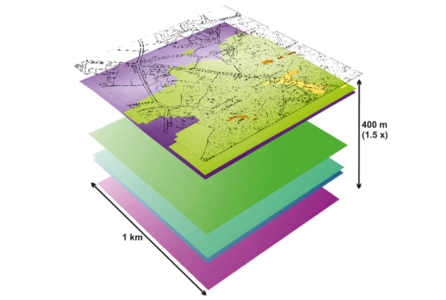

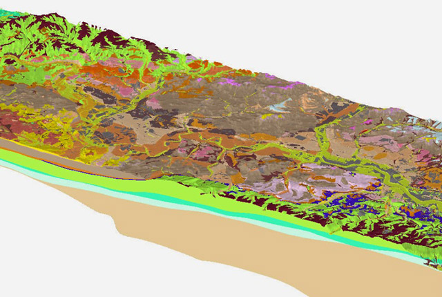
Sample model data (unit bases) viewed in ARC Scene. Ordnance Survey topographic data is for illustration purposes only and is not supplied with the model data. BGS © UKRI.
BGS LithoFrame
- Varied
- Great Britain (partial coverage)
- Open / Premium
Data outputs from 3D geological framework models are available at three different scales for parts of the onshore area of Great Britain.
Supporting documents:
Metadata reports for each model detailing its development and limitations, are supplied with licensed model data.
Key information
- Scale:
- Varied
- Coverage:
- Great Britain (partial coverage)
- Availability:
- Open / Premium
- Price:
BGS Lithoframe 10 £5.12 per sqkm
BGS Lithoframe 50 £0.68 per sqkm
BGS Lithoframe 250 £0.14 per sqkm
Subject to number of users, licence fee and data preparation fee.
- Format:
- Gridded surfaces (ASCII, ESRI, others available by request)
- Uses:
- Local to regional use depending on scale
- Themes:
- Geology, Geoscience information
BGS LithoFrame models provide 3D geological characterisation for parts of the onshore and offshore UK at a range of scales. They present framework geological interpretation consistent with the stratigraphic framing schemes and scales used in BGS geological maps.
Models have been constructed under a range of project activities and include:
- local-scale superficial and bedrock models covering sites and focused study areas
- medium-scale superficial and bedrock models covering many urban areas, transport corridors and smaller catchments
- regional-scale bedrock models covering large catchments, district areas, and geological basins
Information about the models available for licence can be found in the LithoFrame Models layer on the GeoIndex (onshore).
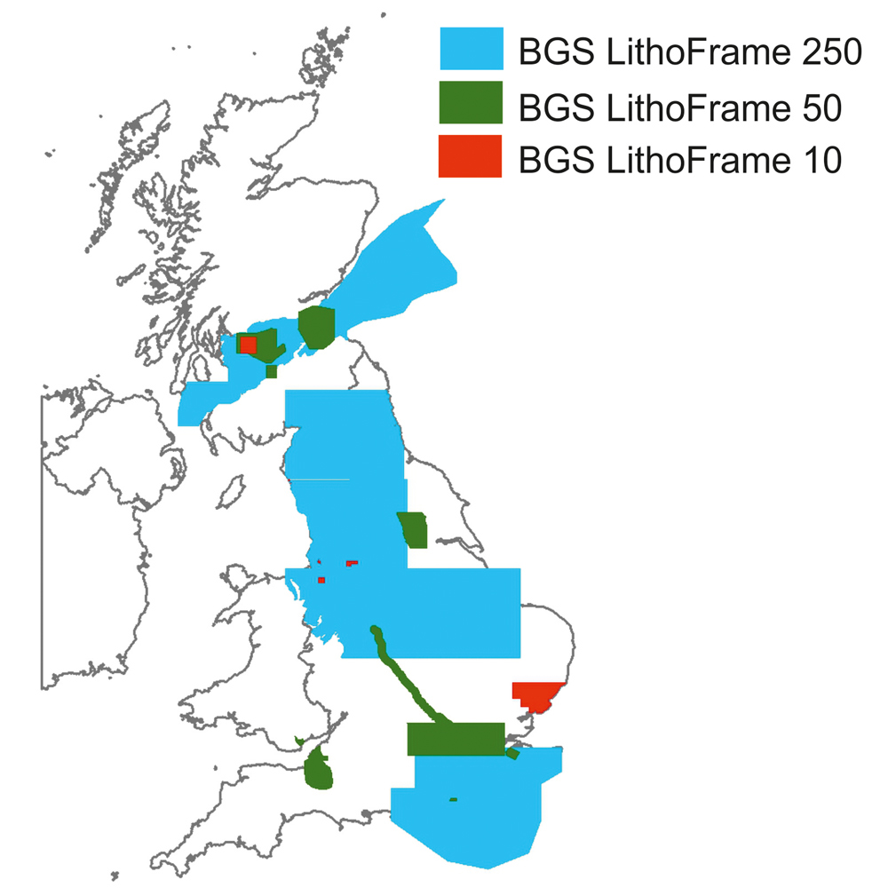
Lithoframe coverage. BGS © UKRI.
BGS LithoFrame models are available to licence as gridded stratigraphic horizons. Fault surfaces may also be available for some regional-scale bedrock models. Standard outputs include stratigraphic unit bases supplied in ASCII and ESRI grid formats. Unit tops and thickness, as well as alternative data formats, may be available on request. Grid resolutions are dependent on the model scale and the nature of the input data.
Each model is accompanied by a metadata report describing the input data, model specifications, geological characterisation and limitations. Information on using geological models and model construction is provided here.
| LithoFrame 10 | LithoFrame 50 | LithoFrame 250 | |
|---|---|---|---|
| Scale | Local: 1:10 000 | Medium: 1:50 000 | Regional: 1:250 000 |
| Depth | 50 – 100 m | 0.5 – 1 km | 1 – 5 km |
| Grid resolution | Typically 25 m | Typically 50 m | 100 – 500 m |
| Geology | Quaternary and recent deposits and/or near-surface bedrock | Quaternary and recent deposits and/or bedrock | Bedrock |
| Potential uses |
|
|
|
| Sources of input data |
|
|
|
You may also be interested in

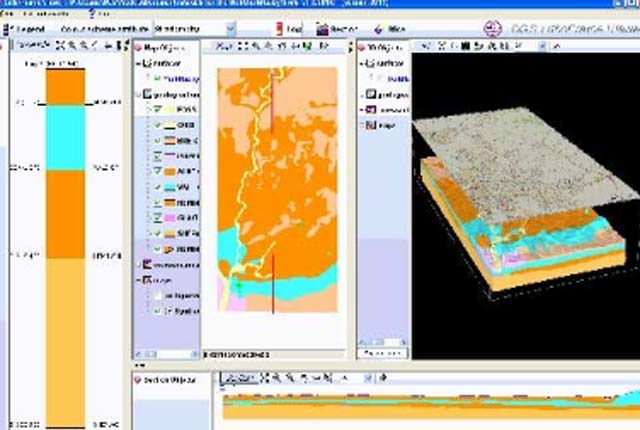
LithoFrame Viewer
Many of our geological models can be viewed and interrogated using the LithoFrame Viewer application.
3D urban geology
Providing conceptual understanding of the subsurface below our cities to support planning and development, using 3D urban models.