The Prees Borehole and the JET Project
A recent borehole in Shropshire is unearthing new information about the chronology and environments of the Early Jurassic.
24/02/2021 By BGS Press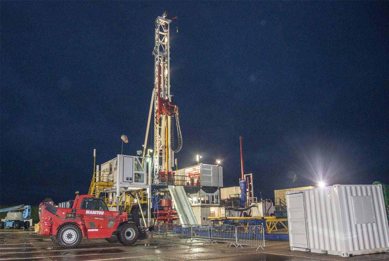

During November and December 2020, a deep borehole was drilled just off the A49, around a kilometre north of the village of Prees, south of Whitchurch in north Shropshire. The JET project science team behind this project, of which I am a member, needed to obtain a continuous core of Early Jurassic rocks in order to decipher the chronology and environments of the early part of the Jurassic Period between around 201 and around 174 million years ago.
The Early Jurassic was a fascinating epoch in the history of our planet. It was a greenhouse interval with no permanent polar ice, characterised by some major changes in the global carbon cycle. We believe that these events were mainly driven by greenhouse gases emitted by large pulses of volcanic activity.
These intervals of global warming caused substantial climatic and environmental shifts. The most dramatic of these led to a marked increase in surface water fertility and blooms in plankton populations making widespread areas of the ocean floors devoid of oxygen around 183 million years ago.
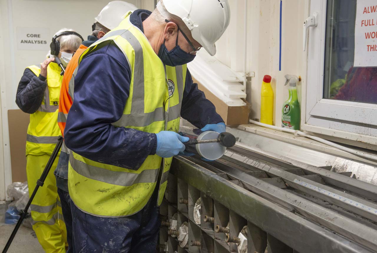
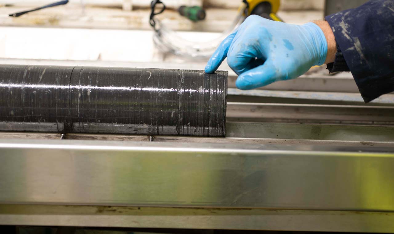
Processing the core in the core curation facility on the drill site. In this photograph, Jim is gently hammering a plastic endcap into place on one end of a one-metre section of core inside a strong clear plastic liner. BGS © UKRI.
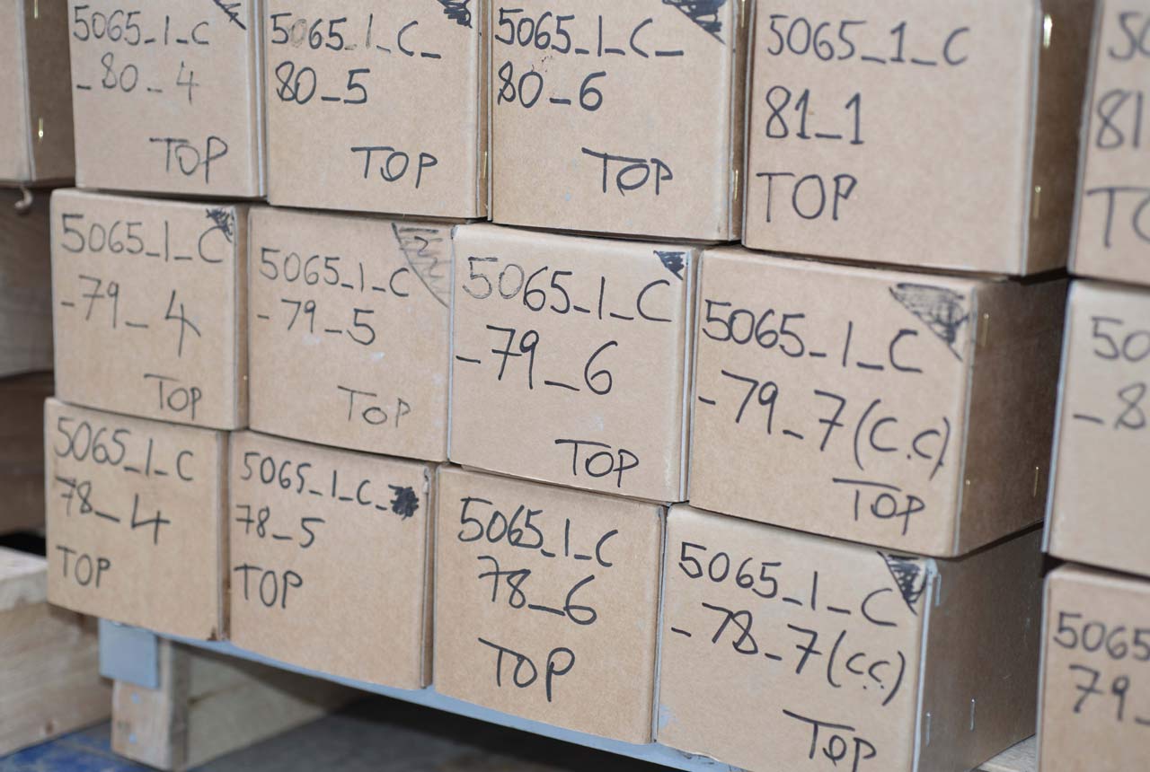
Inside the large steel shipping container which we used as a core repository at the drill site. The curated one-metre sections of core are placed in labelled cardboard boxes and carefully stacked on pallets ready for transportation to the core store at Keyworth. The BGS number of the Prees Borehole is 5065_1_C. The rest of the code are the six-metre core barrel number (e.g. 79) and the one-metre core section within that core barrel (e.g. 6). It is particularly important for this project that the core sections are not inverted, so ‘top’ and ‘base’ are clearly marked. BGS © UKRI.
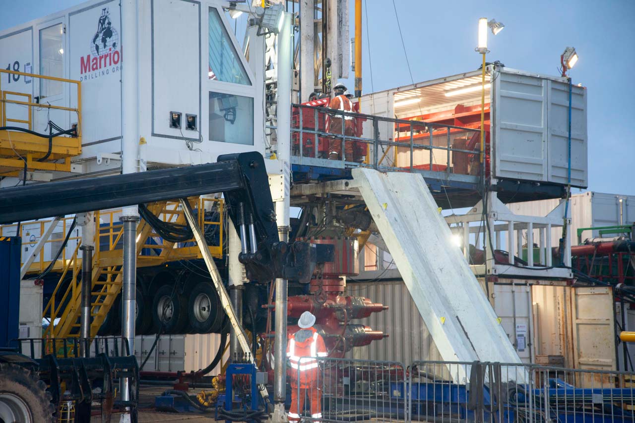
A closeup of the rig floor. The red apparatus with the large valves in front of the person at ground level is the blowout preventer (or BOP) and is a safety feature that shuts the well down if pressurised gas and/or liquid is encountered. BGS © UKRI.
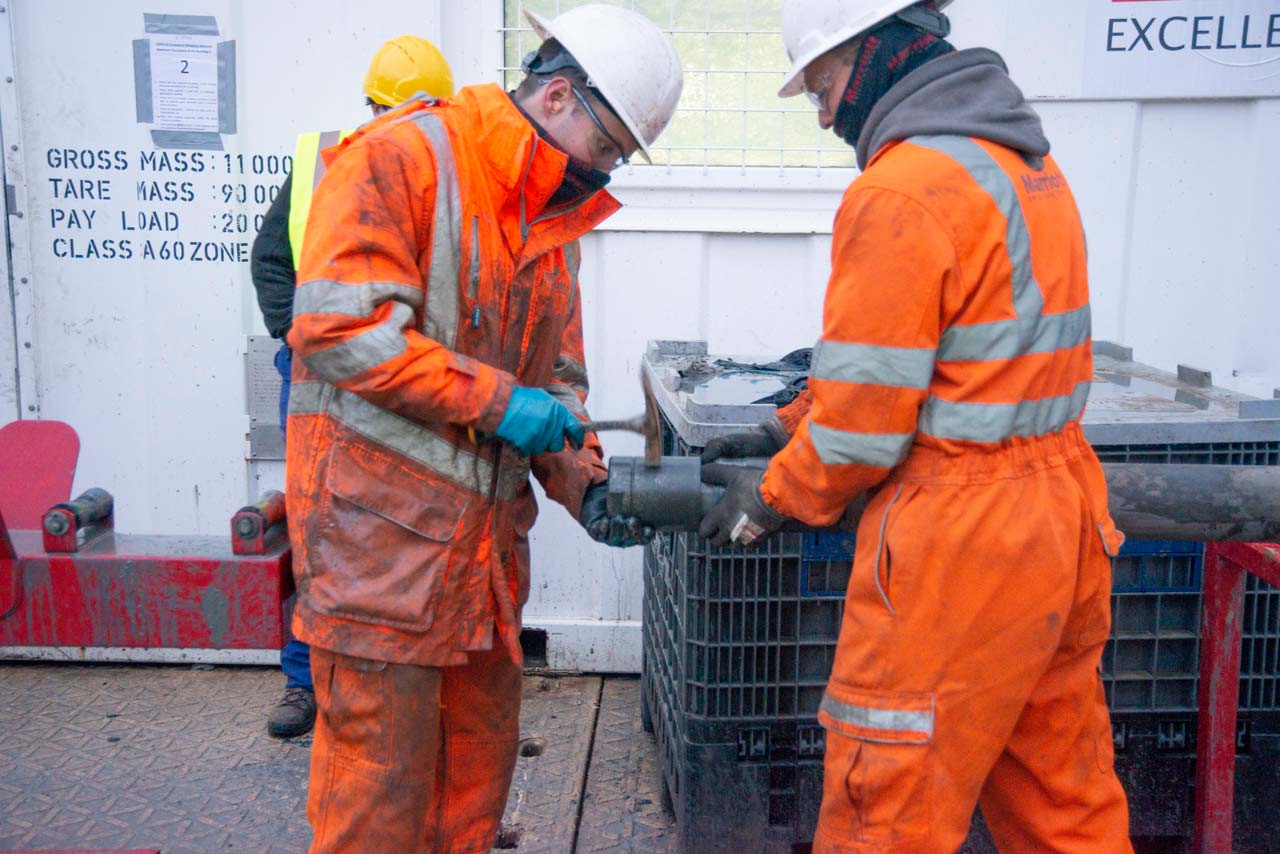
A six-metre section of core being extracted from the core barrel. Specifically, the core catcher is being taken off using a geological hammer. The core catcher holds the core in the barrel during the recovery of the core barrel from the borehole. BGS © UKRI.
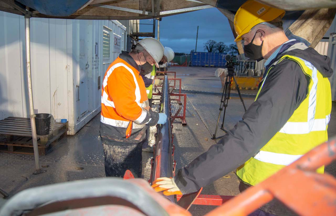
Jim and colleagues examining and marking the depths on a six-metre section of core in its plastic liner, fresh from the ground. BGS © UKRI.
Jim pointing out a fossil bivalve in a newly cored, one-metre section of core from the Prees Borehole. BGS © UKRI.
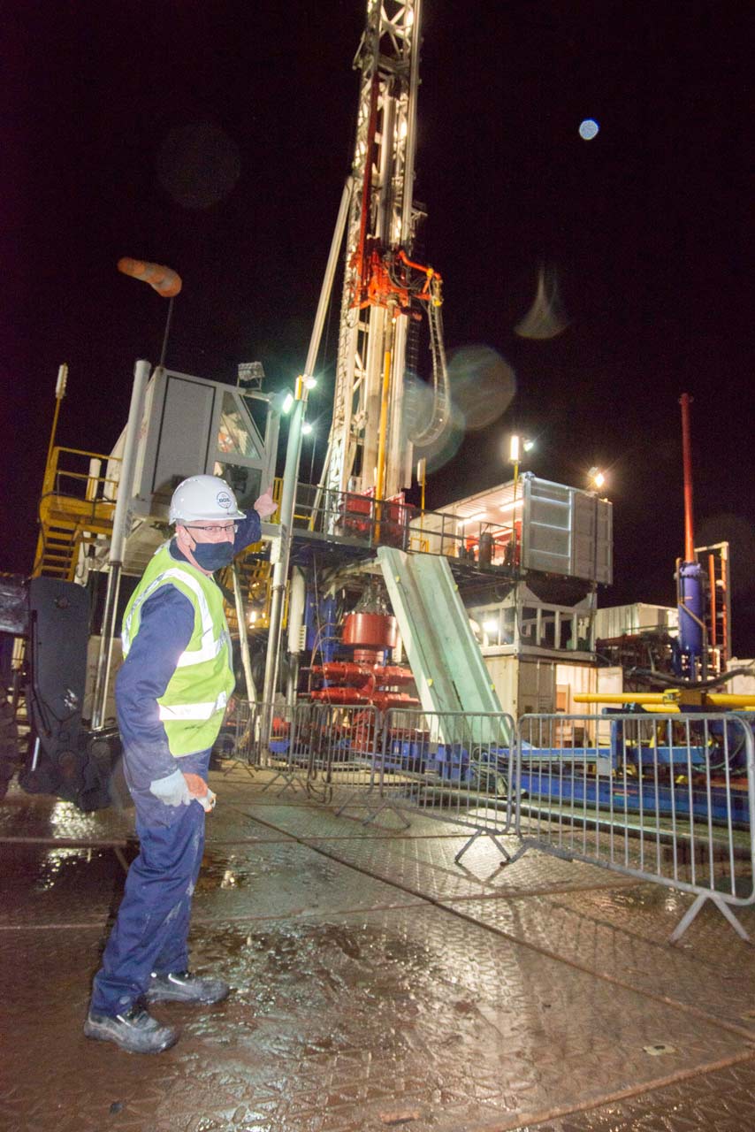
Jim Riding at the rigsite at night, pointing to the main rig. BGS © UKRI.
It is really important to understand all aspects of these climatic perturbations in the geological record, not least the timing of them. We are currently of course experiencing a changing climate and it is imperative that we know the timings of the onset, overall duration and recovery of fluctuating environments on our planet based on past events. It is hoped that this will help us understand what may be happening right now. We aim to help to do this by working out the astrochronology of the Early Jurassic rock record. To do this we will attempt to decipher three different cycles of sedimentation which were controlled by regular rhythms of the Earth’s orbit around the Sun. If we can work these cycles out effectively, using techniques such as detailed geochemistry and geophysical logging, we can use the number of cycles to determine how long it took to deposit the rock succession being studied, as well as the durations of the environmental shifts. We will also work on the environments based on aspects such as fossils and sedimentology.
The geological picture
In the UK we are fortunate to have some fantastically complete and well-preserved successions of Early Jurassic sedimentary rocks and therefore we can study Early Jurassic environments in great detail. So, a number of interested researchers put together a proposal and applied for grants from the Natural Environment Research Council (NERC) and the International Continental Scientific Drilling Program (ICDP) based on a new borehole at Prees and an existing borehole drilled by BGS at Mochras in west Wales in the late 1960s. NERC and ICDP accepted our proposals and we began to plan for the Prees Borehole in the spring and summer of 2018. The science team came up with a project name of Early Jurassic Earth System and Timescale, abbreviated to JET. This latter acronym pays homage to the famous black gemstone from Whitby that is found in Early Jurassic rocks.
@JET_Prees scientists turned up an example of Teichichnus in the core for #FossilFriday! @icdpDrilling Prees coring is progressing well and we look forward to more #Jurassicrocks Photo credit: Jim Riding pic.x.com/n5oQSswsz3
— JET Project (@JET_Prees) December 4, 2020
Planning the drilling operation
We knew from legacy BGS geological mapping and two old boreholes in the vicinity that there is a really good Lower Jurassic record around Prees, so the search was on for a good site. It had to be accessible in terms of getting the borehole infrastructure set up easily, and be as far away from houses as possible because boreholes can be quite noisy! A site was found: a small corner of a farmer’s field, close to a main road. The science team also had to find a drilling contractor so a tendering process was instigated. As you can imagine, processes such as landowner negotiations, planning permission, tendering, etc. are relatively far from the normal day-to-day activities of a geologist’s working life!
The drilling operation
When all this was complete, we could finally start the drilling operation at Prees. There were a few relatively minor delays, and the pandemic did not make things easier, but we finally began to drill in early November 2020. The drilling rig was a relatively large one and it used core barrels six metres in length. A continuous core was drilled using a rotating drill string and the core barrel was brought to the surface using a steel cable when it was full, which normally took around six hours.
Teams of two geologists worked 12-hour shifts round the clock and seven days a week throughout the two month drilling operation. The geologists curated the core, which meant cleaning it, describing it, labelling the depths, way-up etc. and carefully placing it in one-metre core boxes for transporting back to the BGS core store at Keyworth. We halted drilling on 29 December 2020 and the borehole was terminated at 656 m. The ‘terminal depth’ was in the Late Triassic, which meant that our objectives of drilling through the Early Jurassic had been fulfilled.
The first test shallow geotechnical Jurassic aged core from Prees! @JET_Prees pic.x.com/Z6udYU4Bac
— Prof Melanie Leng (@MelJLeng) January 28, 2020
The JET project science team will now begin to study the Prees Borehole in detail. We will be putting the one-metre core sections through a core scanner to analyse the overall geochemistry. Samples will also be analysed for carbon isotopes to reconstruct changes in the carbon cycle throughout the Early Jurassic. Other highlights include examining clay minerals, magnetic field reversals, sedimentary structures and detailed studies on the fossils in the core especially ammonites, microfossils and trace fossils.
The JET project is primarily funded through a NERC Large Grant led by Prof Steve Hesselbo of University of Exeter.
Relative topics
Related news

Delving deep into mountains for future water security
16/07/2026
A BGS-led project is using new water-tracing investigation methods, geophysics and modelling to understand how water moves from mountains to the lowlands, helping to improve water security for billions of people.

Updated national 3D model will determine the depth to the solid bedrock beneath our feet
13/07/2026
The BGS Superficial Deposit Thickness Model now includes an elevation model of geological rockhead for the first time, providing important data for civil engineers, geoscientists and environmental scientists.

UK’s world-class research organisations launch new collective
10/07/2026
The launch of the National Research Organisations Group brings together more than 100 science leaders to provide an authorativive voice on science, research policy and long-term investment.

Cheshire Geoenergy Observatory releases key geological datasets for UK thermal energy storage scheme design
09/07/2026
A new report and data packs from BGS will provide a unique resource for scientists working on the geology and hydrogeology of the Sherwood Sandstone Formation, an important aquifer and reservoir rock.

New geological mapping underway to help manage flooding along the River Tweed
08/07/2026
Scientists are surveying the Tweed catchment for the first time in over 100 years to enhance understanding of localised groundwater and improve flood forecasting.

Geological research in North Sea helping to safeguard subsea cables
06/07/2026
Subsea power and telecommunications cables are critical to the UK’s energy infrastructure and global connectivity, yet they remain vulnerable to damage from ship anchors, fishing activity and natural hazards.

UK Critical Minerals Intelligence Centre makes recommendations for the next UK criticality assessment
01/07/2026
CMIC has outlined the enhancements made to the next assessment update to ensure it is better tailored to the structure of the UK economy.

From archive to discovery: historical mineral reports support gold exploration in Scotland
25/06/2026
Digitised geological records show potential to unlock untapped mineral resources in Ardlochan, Argyllshire.

UK and Philippines scientists investigate natural hydrogen generation processes at atomic scale
22/06/2026
BGS researchers were granted access to use the Diamond Light Source facility in order to study hydrogen in light brighter than the sun.

Shortage of end-of-life materials presents challenge to UK critical minerals security
17/06/2026
A new report by the UK Critical Minerals Intelligence Centre reveals insufficient end-of-life material stocks present a supply risk over the coming decade, but offer significant long-term potential to meet critical mineral demand through recycling.

UK geothermal catalogue receives update
16/06/2026
BGS releases the second digital version of the UK geothermal catalogue of subsurface temperature and rock thermal conductivity measurements and heat flow calculations.

Scientists make new discovery in the history of the Giant’s Causeway
15/06/2026
New research is changing our scientific understanding of the formation of one of the UK’s most iconic landmarks and has revealed that Northern Ireland’s volcanic past occurred over a much shorter period than previously thought.