Project findings provide essential insight into the last British–Irish ice sheet
Understanding more about the north-west European continental shelf and improving forecasting for the Antarctic and Greenland ice sheets.
29/09/2022 By BGS Press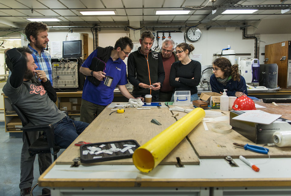

A paper marking the culmination of a highly successful project into a former ice sheet is helping researchers to understand more about the north-west European continental shelf. It’s also helping improve forecasting for the Antarctic and Greenland ice sheets.
The five-year, £3.7 million BRITICE-CHRONO consortium, funded by NERC, took on the most ambitious geochronological project yet, encompassing on- and offshore mapping around the UK and Ireland to better describe and understand the growth and decay of the last British–Irish ice sheet.
BRITICE research included 1500 days of field investigation yielding 18 000 km of marine geophysical data, 377 cores of sea-floor sediment and geomorphological and stratigraphical information at over one hundred sites on land. This enabled the generation of 690 new geochronometric ages, which were collected to understand the timings, coverage and retreat of the British–Irish ice sheet and to provide a geochronological framework between 31 000 and 15 000 years ago.
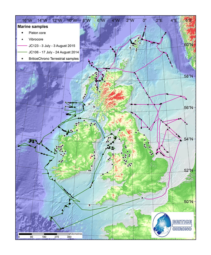
Voyages around a former ice sheet. © BRITICE-CHRONO
The findings bear a strong similarity to the dynamics and evolving configuration in the Antarctic today, enabling scientists to refine and improve current ice sheet modelling approaches. It will also aid researchers investigating regional palaeoenvironments as well as those working on offshore development (e.g. offshore renewables) and marine management.

BGS is proud to have played a role in this important project. The paper compiles and distils many of the detailed findings from the onshore work and offshore transects of the project and will serve as a useful resource to inform and expand on current knowledge on the evolution of the British–Irish ice sheet.
Dayton Dove, BGS Marine Geoscientist.
BGS scientists participated in and contributed to the project by providing expertise, data and information to support planning, implementation and interpretation of survey and project results. The offshore coring was also carried out by BGS engineering teams.
Two reconstructions of the ice sheet were developed: an empirical version and one that combines modelling and the new empirical evidence. Palaeoglaciological maps of ice extent, thickness, velocity and flow geometry at thousand-year time intervals were also produced.
The paper, Growth and retreat of the last British–Irish Ice Sheet, 31 000 to 15 000 years ago: the BRITICE-CHRONO reconstruction, was published in BOREAS.
Relative topics
Related news

Updated geological assessment of the Southern North Sea set to underpin future offshore infrastructure development
25/03/2026
The first regional assessment for 30 years will support offshore marine and subsurface planning for the UK’s low-carbon energy infrastructure, including the 2030 target of 45 to 50 GW generated through offshore wind.

New research could help provide a more reliable water supply for millions in rural Africa
24/03/2026
A new BGS-led study has revealed crucial insights into the longstanding challenges affecting the reliability and performance of rural water supply infrastructure in sub-Saharan Africa.

Call for new members and Chair to join the NERC facilities steering committees
25/02/2026
New members are needed to join the committees over the next four years.

Your views wanted: developing a geothermal energy subsurface data portfolio
24/02/2026
BGS is aiming to support the growth of the sector by providing the best-available, location-specific geothermal and ground source heat information as an accessible product or service.

Map of BGS BritPits showing the distribution of worked mineral commodities across the country
18/02/2026
BGS’s data scientists have generated a summary map of the most commonly extracted mineral commodities by local authority area, demonstrating the diverse nature of British mineral resources.

Funding awarded to map the stocks and flows of technology metals in everyday electronic devices
12/02/2026
A new BGS project has been awarded Circular Electricals funding from Material Focus to investigate the use of technology metals in everyday electrical items.

New UK/Chile partnership prioritises sustainable practices around critical raw materials
09/02/2026
BGS and Chile’s Servicio Nacional de Geología y Minería have signed a bilateral scientific partnership to support research into critical raw materials and sustainable practices.

Extensive freshened water confirmed beneath the ocean floor off the coast of New England for the first time
09/02/2026
BGS is part of the international team that has discovered the first detailed evidence of long-suspected, hidden, freshwater aquifers.

Funding secured to help mitigate ground risk in UK construction sector
05/02/2026
The BGS Common Ground project has been awarded new funding to help unlock the value of ground investigation data.

Can sandstones under the North Sea unlock the UK’s carbon storage potential?
02/02/2026
For the UK to reach its ambitious target of storing 170 million tonnes of carbon dioxide per year by 2050, it will need to look beyond the current well-studied geographical areas.

Quaternary UK offshore data digitised for the first time
21/01/2026
The offshore wind industry will be boosted by the digitisation of a dataset showing the Quaternary geology at the seabed and the UK’s shallow subsurface.

Suite of ten new soil reference materials released
02/01/2026
BGS has a longstanding track record of producing high-quality reference materials and has released ten new soil reference materials.