New lead isoscape map for archaeological provenance studies in Great Britain
A new study aims to determine lead isotope ratios in soil and rock across Great Britain which could inform future archaeological studies about human and animal origins.
28/10/2022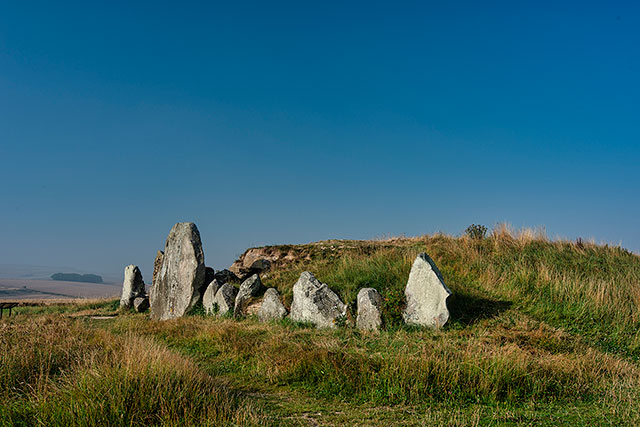

Lead that is naturally present in underlying geology is incorporated in teeth and can be used to inform us of the origins of past humans and animals. Teeth incorporate elements such as carbon, nitrogen and lead from food and water as they form and studying these elements can help us to determine geographical origins and can even tell us more about diet and cultural affinity.
To distinguish the different lead ratios from different parts of the country in teeth samples, a new study, ‘Applying lead (Pb) isotopes to explore mobility in humans and animals‘, sets out to map lead ratios in the soil and rock across Great Britain. The study uses lead isotope analysis to determine the origins of Neolithic animals, some of the earliest domesticated animals in Great Britain.
Understanding isotopes
Every chemical element, for example carbon or lead, is made up of atoms. Each atom has a nucleus, which contains protons and neutrons. The number of protons in the nucleus in each particular element always stays the same and determines what the element is, but the number of neutrons can vary. Atoms of the same element that have different numbers of neutrons in their nuclei are termed ‘isotopes’. For example, naturally occurring carbon atoms always contain six protons, but may contain six, seven or eight neutrons. This means there are three naturally occurring isotopes of carbon, called carbon-12, carbon-13 and carbon-14.
The problem with lead
Lead is found in low concentrations in rocks and soils all over Great Britain. Different areas of the country have different lead isotope ratios. Lead isotopes in our natural environment are incorporated into teeth during feeding.
However, humans have mined lead through time, causing lead pollution that contaminates the signal in teeth. Such studies can therefore only be applied to individuals who predate the onset of mining, or who show no evidence of lead contamination through their measured lead levels.

Analysing the lead content of teeth can help constrain the geographical areas in which the tooth formed. This is because animals, including humans, ingest the lead in their food and it is incorporated into their body tissues. To distinguish the different lead ratios from different parts of the country in teeth samples, we first need to establish what the lead ratios in the soil and rock across Great Britain are.
Unfortunately, we can’t take direct measurements of lead in the modern world because of the effect of modern lead pollution, caused by the use of lead in petrol. We therefore need to find alternative methods of defining the distribution of lead isotope compositions.
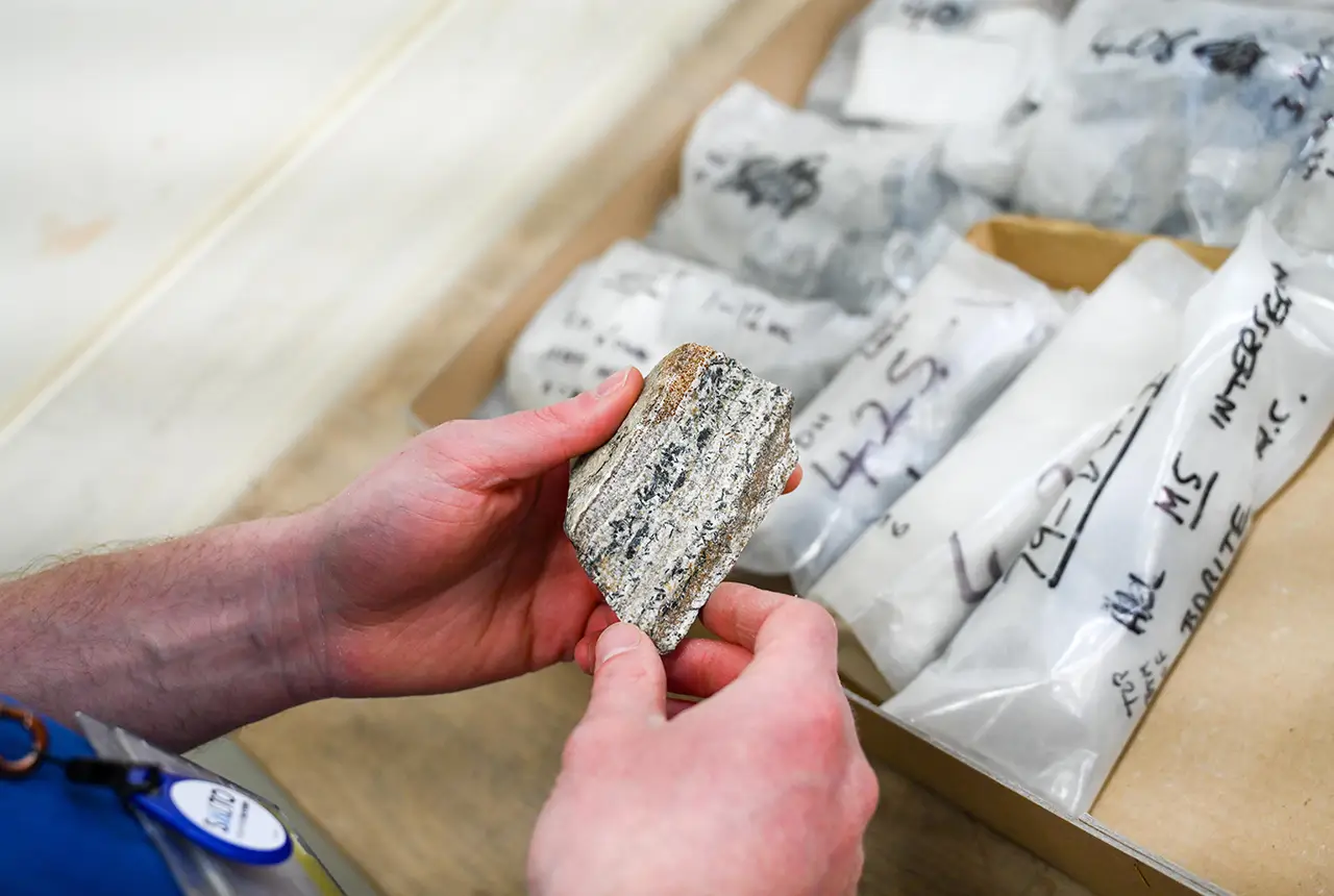
This was done by using lead ore (predominantly galena) to define ‘domains’ and then to validate these fields to show the geogenic signature was transmitted into the biosphere, using well-provenanced archaeological animals and humans.
Prof Jane Evans, BGS.
The Iapetus Suture
Key to the study is the ability to distinguish between northern and southern British lead sources and this can be achieved because of differences in the underlying geology between these two parts of Great Britain.
There is major geological boundary, called the Iapetus Suture, running between Berwick-upon-Tweed in the east and the Solway Firth in the west. This provides a compositional boundary in lead isotope domains that approximates to the geographical areas of Scotland versus England and Wales.
The Iapetus Suture formed approximately 490 to 400 million years ago, when two tectonic plates called Laurentia and Avalonia came together and closed the Iapetus Ocean, which once separated Scotland from England and Wales. The geology north of this line is very different to the geology to the south and consequently so are the lead isotope domains.
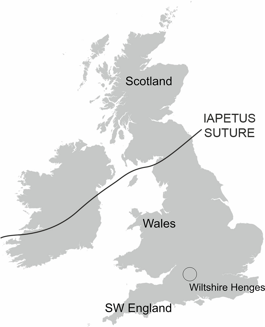
The Iapetus Suture across Great Britain. BGS © UKRI.
A new lead ‘isoscape’ for Great Britain
The study, published by PLOS, has produced a lead isoscape map of Great Britain.
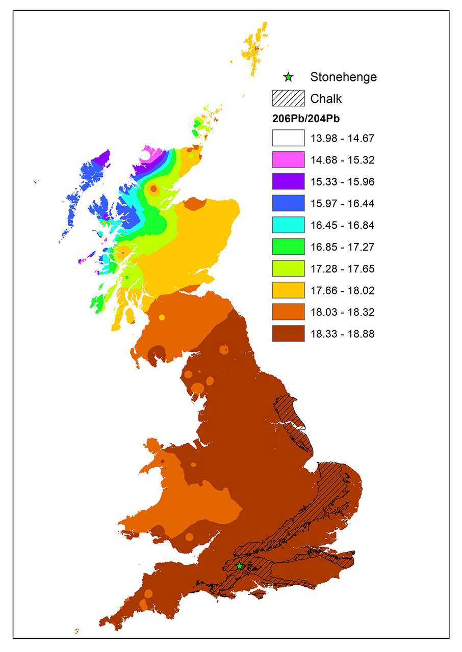
A contoured map of (A) 206Pb/204Pb isotope compositions. Superimposed over this contour map is the outcrop area of the Chalk Group. Chalk underlies much of southern Britain but it does not host much lead. Contains OS data © Crown copyright and database rights 2022. BGS © UKRI.
The map shows that there is a strong zonation of the lead isotope domains across the Iapetus Suture and throughout Scotland, which reflects the influence of the very old basement rocks that underlie much of Scotland.
England is dominated by mineralisation that occurred about 300 million years ago (Ma), whilst the ore fields in Wales have an older signature (about 450 Ma) than those in England. Chalk, which is an important lithology in archaeological studies, was superimposed on the mineral map.
Could neolithic animals found in southern Britain have been sourced north of the Iapetus Suture, from Scotland?
The Neolithic henges in southern England, were a focal point for gatherings during Neolithic times (7000 to 2000 BCE). The geographical origin of the people who created and used them is a key question to understanding their construction and use. Neolithic human remains are less common at the henge sites in Great Britain and those that are present tend to have been cremated, which reduces the range of analytical approaches that can be employed.
Isotope studies have focused on the origins of animal remains that have been used as a proxy for the origin of their human ‘owners’. Whilst generating much data on provenance and diet, they could not provide a method of discriminating between origins north and south of the Iapetus Suture.
This study has demonstrated, using lead isotope analysis of Neolithic pig tooth enamel, that these animals originated south of the Iapetus Suture.
About the author
Relative topics
Latest news

From archive to discovery: historical mineral reports support gold exploration in Scotland
Digitised geological records show potential to unlock untapped mineral resources in Ardlochan, Argyllshire.

UK and Philippines scientists investigate natural hydrogen generation processes at atomic scale
BGS researchers were granted access to use the Diamond Light Source facility in order to study hydrogen in light brighter than the sun.

Shortage of end-of-life materials presents challenge to UK critical minerals security
A new report by the UK Critical Minerals Intelligence Centre reveals insufficient end-of-life material stocks present a supply risk over the coming decade, but offer significant long-term potential to meet critical mineral demand through recycling.

UK geothermal catalogue receives update
BGS releases the second digital version of the UK geothermal catalogue of subsurface temperature and rock thermal conductivity measurements and heat flow calculations.

Scientists make new discovery in the history of the Giant’s Causeway
New research is changing our scientific understanding of the formation of one of the UK’s most iconic landmarks and has revealed that Northern Ireland’s volcanic past occurred over a much shorter period than previously thought.

Latest research emphasises climate-related subsidence risk to millions of British homes
New data from BGS highlights the projected future impact of warmer, drier summers and underlines the need for mitigation measures in susceptible regions.

Ukraine and the UK strengthen their commitment to geological cooperation
A new Memorandum of Understanding reaffirms the UK’s support of Ukraine’s ambitions to develop its critical mineral resources, paving the way for collaboration through capacity-building programmes.
Newly released core could hold clues on potential mineral prospectivity in Perthshire
A comprehensive collection of geological samples from the vicinity of a former mine in Scotland is now available to scientists for further research.

Extractive Industry Geology (EIG) Conference 2026
University of Liverpool
Latest data on world mineral production now available
BGS has released the updated statistics on the global production of over 70 commodities between 2020 and 2024.

International science consortium to survey the health, economic value and social importance of Lake Victoria
The project will replicate the 1927 survey to assess changes in the lake’s health, economic value and social importance.

New geological maps of Berwick-upon-Tweed to help future-proof natural water supply
Scientists have mapped the geology under the town to better understand the groundwater system to inform decisions around abstraction.