Latest BGS Geology 50K mapping data launched
Some of our most widely used maps have received a major update, including the 1:50 000-scale map series that now includes enhanced coverage of Great Britain.
06/11/2025 By BGS Press

BGS Geology, BGS’s digital geological maps covering Great Britain, is based on a suite of published paper maps enhanced with latest digital mapping. It is periodically updated with information from field surveys as well as including previously unpublished maps or additional interpretation.
The latest version of BGS Geology 50K now covers the majority of Great Britain plus the Isle of Man, an estimated 236 000 km2. This includes coverage for approximately 99 per cent of the bedrock and approximately 95 per cent of the superficial deposits across the country.
These geological maps provide crucial information like rock types and faults, forming a valuable resource for a wide range of uses, such as infrastructure planning and development, including ground source heat pumps, and environmental assessment.
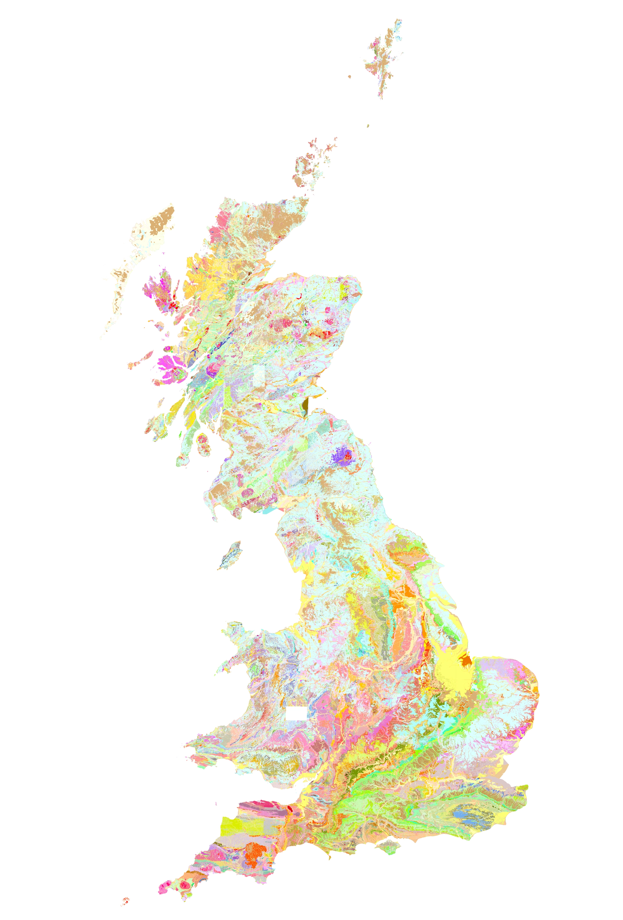
The latest version of BGS Geology 50K now covers the majority of Great Britain and the Isle of Man, an estimated 236 000 km2. BGS © UKRI.

The 50K-scale map offers a balance between detail and coverage, making it highly useful for a wide range of applications, from regional assessment to local-scale intelligence.
The latest update incorporates all edits to the dataset since the previous version’s release in 2017. This includes new and revised tiles of geology data, updates to the coastline and various corrections to geological features across the country. Also included is additional attribution on linear features depicting fault trace handedness and hanging-wall orientation on fault features.
Henry Holbrook, data sharing lead at BGS.
In addition to the 50K maps, BGS has also updated its 10K and 25K maps. BGS Geology 10K and 25K is the most detailed geological dataset we have produced Around half of the country is now covered with this update, including many urban centres and transport routes in Great Britain.
This latest release of BGS Geology 10K and 25K includes new maps and is based on our highest-resolution survey mapping. It will continue to be of great help to the public sector, the construction industry and academics.
Henry Holbrook
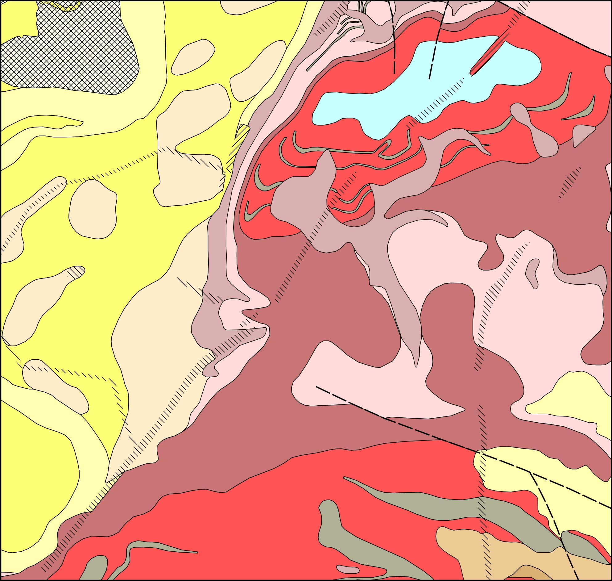
BGS Geology 10K and 25K in the south Nottinghamshire region. BGS © UKRI.
BGS’s data for both BGS Geology 50K and BGS Geology 10K and 25K is available under licence. You can also view the BGS Geology 50K map data in the GeoIndex viewer. Further information about BGS Geology 50K and BGS Geology 10K maps is available on the BGS website.
Relative topics
Related news

Updated geological assessment of the Southern North Sea set to underpin future offshore infrastructure development
25/03/2026
The first regional assessment for 30 years will support offshore marine and subsurface planning for the UK’s low-carbon energy infrastructure, including the 2030 target of 45 to 50 GW generated through offshore wind.

New research could help provide a more reliable water supply for millions in rural Africa
24/03/2026
A new BGS-led study has revealed crucial insights into the longstanding challenges affecting the reliability and performance of rural water supply infrastructure in sub-Saharan Africa.

Call for new members and Chair to join the NERC facilities steering committees
25/02/2026
New members are needed to join the committees over the next four years.

Your views wanted: developing a geothermal energy subsurface data portfolio
24/02/2026
BGS is aiming to support the growth of the sector by providing the best-available, location-specific geothermal and ground source heat information as an accessible product or service.

Map of BGS BritPits showing the distribution of worked mineral commodities across the country
18/02/2026
BGS’s data scientists have generated a summary map of the most commonly extracted mineral commodities by local authority area, demonstrating the diverse nature of British mineral resources.

Funding awarded to map the stocks and flows of technology metals in everyday electronic devices
12/02/2026
A new BGS project has been awarded Circular Electricals funding from Material Focus to investigate the use of technology metals in everyday electrical items.

New UK/Chile partnership prioritises sustainable practices around critical raw materials
09/02/2026
BGS and Chile’s Servicio Nacional de Geología y Minería have signed a bilateral scientific partnership to support research into critical raw materials and sustainable practices.

Extensive freshened water confirmed beneath the ocean floor off the coast of New England for the first time
09/02/2026
BGS is part of the international team that has discovered the first detailed evidence of long-suspected, hidden, freshwater aquifers.

Funding secured to help mitigate ground risk in UK construction sector
05/02/2026
The BGS Common Ground project has been awarded new funding to help unlock the value of ground investigation data.

Can sandstones under the North Sea unlock the UK’s carbon storage potential?
02/02/2026
For the UK to reach its ambitious target of storing 170 million tonnes of carbon dioxide per year by 2050, it will need to look beyond the current well-studied geographical areas.

Quaternary UK offshore data digitised for the first time
21/01/2026
The offshore wind industry will be boosted by the digitisation of a dataset showing the Quaternary geology at the seabed and the UK’s shallow subsurface.

Suite of ten new soil reference materials released
02/01/2026
BGS has a longstanding track record of producing high-quality reference materials and has released ten new soil reference materials.