Geological Society honours BGS scientists
The Geological Society has recognised the contributions of two members of BGS: director Dr Karen Hanghøj and volcanologist Dr Samantha Engwell.
14/06/2023 By BGS Press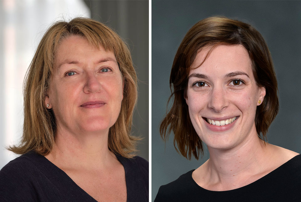

BGS Director receives William Smith Medal 2023
Dr Karen Hanghøj is the recipient of the William Smith Medal 2023, bestowed by the Geological Society. The William Smith Medal is one of the society’s highest honours and is awarded for excellence in applied and economic aspects of geology.
Dr Hanghøj is a key driving force in ensuring geological research and information are at the forefront of addressing global societal challenges, such as the transition to net zero. She is making significant steps in communicating the challenges and opportunities for geology for this transition: her experience of working in Europe and America means she is well-placed to convey the importance of raw materials for the energy transition to policymakers. She is an effective ambassador for geoscience at the highest level in the UK and across the world.

As the director of the British Geological Survey, it is an honour and a privilege to receive a medal named after the scientist who made the first geological map of Britain. It is especially timely as BGS has just launched its new strategy with a clear commitment to develop more maps and models for the 21st century, in the UK and internationally.
This medal recognises the importance of communicating and advocating for the crucial role that geology plays in our society, something that I am passionate about. I will continue to talk to the wider community and inform societal debate on geological solutions to our global challenges.
Dr Karen Hanghøj, BGS Director.
Early career scientist receives William Smith Fund
Dr Samantha Engwell is the recipient of the Geological Society’s William Smith Fund 2023, which is awarded to geoscientists within the first 10 years of their career. The fund recognises excellent contributions to geoscience research and its application, in the UK and internationally.
Dr Engwell is a member of BGS’s volcanology team. She uses computer modelling to understand volcanic eruptions and their associated hazards, such as ash in terms of hazards to aviation, and the formation of tsunamis.
It is a real honour to be awarded the William Smith Fund by the Geological Society. I feel incredibly privileged to have been recognised for my work in volcanology, a career that has brought me so much reward, and to be recognised alongside so many other talented scientists.
Dr Samantha Engwell, BGS Geologist and Volcanologist.
I would like to congratulate Dr Samantha Engwell on her award. She has already made invaluable contributions to the field of volcanology. She provides expert advice to UK and EU governmental institutions on volcanic activity and contributes to our understanding of volcanoes’ future behaviour — essential for the people who live alongside these geological hazards.
Telling our stories and successes will hopefully help inspire more people from all walks of life to consider geology as a career.
Dr Karen Hanghøj, BGS Director.
Recognition of world-leading science and scientists
Dr Karen Hanghøj has made significant contributions to the field of geoscience throughout her career and is an eminent geoscientist.
Since her appointment to BGS in 2019, she has pushed the organisation to develop its role and deliver world-class data, advice and research that will help address some of the fundamental challenges the UK and the world faces.
I would also like to congratulate Dr Samantha Engwell on receiving the William Smith Fund, which is an incredible recognition of the contribution she has made in her early career.
Sir Keith O’Nions, Chair of the BGS Board.

Updated national 3D model will determine the depth to the solid bedrock beneath our feet
13/07/2026
The BGS Superficial Deposit Thickness Model now includes an elevation model of geological rockhead for the first time, providing important data for civil engineers, geoscientists and environmental scientists.

UK’s world-class research organisations launch new collective
10/07/2026
The launch of the National Research Organisations Group, brings together more than 100 leaders from government, research, industry and funding organisations, providing an authorativive voice on science, research policy and long-term investment.

Cheshire Geoenergy Observatory releases key geological datasets for UK thermal energy storage scheme design
09/07/2026
A new report and data packs from BGS will provide a unique resource for scientists working on the geology and hydrogeology of the Sherwood Sandstone Formation, an important aquifer and reservoir rock.

New geological mapping underway to help manage flooding along the River Tweed
08/07/2026
Scientists are surveying the Tweed catchment for the first time in over 100 years to enhance understanding of localised groundwater and improve flood forecasting.

Geological research in North Sea helping to safeguard subsea cables
06/07/2026
Subsea power and telecommunications cables are critical to the UK’s energy infrastructure and global connectivity, yet they remain vulnerable to damage from ship anchors, fishing activity and natural hazards.

UK Critical Minerals Intelligence Centre makes recommendations for the next UK criticality assessment
01/07/2026
CMIC has outlined the enhancements made to the next assessment update to ensure it is better tailored to the structure of the UK economy.

From archive to discovery: historical mineral reports support gold exploration in Scotland
25/06/2026
Digitised geological records show potential to unlock untapped mineral resources in Ardlochan, Argyllshire.

UK and Philippines scientists investigate natural hydrogen generation processes at atomic scale
22/06/2026
BGS researchers were granted access to use the Diamond Light Source facility in order to study hydrogen in light brighter than the sun.

Shortage of end-of-life materials presents challenge to UK critical minerals security
17/06/2026
A new report by the UK Critical Minerals Intelligence Centre reveals insufficient end-of-life material stocks present a supply risk over the coming decade, but offer significant long-term potential to meet critical mineral demand through recycling.

UK geothermal catalogue receives update
16/06/2026
BGS releases the second digital version of the UK geothermal catalogue of subsurface temperature and rock thermal conductivity measurements and heat flow calculations.

Scientists make new discovery in the history of the Giant’s Causeway
15/06/2026
New research is changing our scientific understanding of the formation of one of the UK’s most iconic landmarks and has revealed that Northern Ireland’s volcanic past occurred over a much shorter period than previously thought.

Latest research emphasises climate-related subsidence risk to millions of British homes
11/06/2026
New data from BGS highlights the projected future impact of warmer, drier summers and underlines the need for mitigation measures in susceptible regions.