BGS completes first mapping expedition to Ascension Island
BGS marine geoscientists travelled to Ascension Island to support its government with an ongoing, conservation-driven mapping programme.
11/12/2023 By BGS Press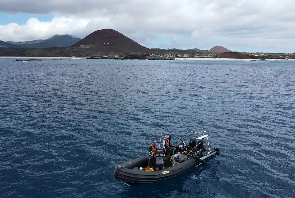

On 30 October 2023, BGS project manager and senior surveyor Rhys Cooper and marine geoscientist Catriona Macdonald took the 4000-mile journey to Ascension Island, an isolated volcanic island in the Atlantic Ocean, to undertake the first stage of a UK Government-funded project.
In 2019, BGS was awarded funding from the UK Government through Darwin Initiative, a grant scheme by the Department for Environment, Food and Rural Affairs (Defra) that funds projects aiming to protect unique biodiversity and improve resilience to climate change within the UK Overseas Territories. Following a four-year delay due to COVID-19, the project is now underway. The first expedition focused on mapping the shallow waters surrounding Ascension Island, including an area of the island that has never been mapped or surveyed before.
Working with the Ascension Island Government, this BGS-led project will determine the character, distribution and extent of the nearshore habitats of the Ascension Island Marine Protected Area (AI-MPA) through an integrated programme of surveys. The AI-MPA is rich in biodiversity; however, protected areas such as this are most at risk from anthropogenic development and climate change.
We've had a fantastic couple of weeks working with Rhys and Catriona from the @BritGeoSurvey !
The duo spent 10 days mapping #Asi's shallow waters on board the Moray with our team – no easy feat given Ascension's choppy waters!#smallislandBIGVISION
🎶:https://t.co/EUchP4ZcyO pic.twitter.com/aolJyuMgO3— Ascension Island MPA (@AscensionMPA) November 16, 2023
Resulting sea-floor habitat maps will provide the Ascension Island Government with urgently needed tools to better monitor and protect marine ecosystems, as well as underpin the evidence-based management of the AI-MPA. The data will be merged with an existing dataset collected by the Royal Navy UK Hydrographic Office (UKHO) in 2021, which has already enabled the deployment of an array of sensors to monitor the movement of sharks. The combined datasets will also allow the first detailed geomorphology, substrate and habitat maps to be produced for the island, down to a maximum depth of 1000 m.

Ascension Island is a remote location and therefore presents many unique challenges that need to be overcome if we are to be successful. We have had numerous delays that proved fortuitous: the Royal Navy completed a survey around Ascension Island during COVID-19 lockdowns, which significantly reduced the amount of data we needed to collect, lowering costs and enabling us to refine and focus our survey campaigns.
The Ascension Island Government owns a boat that was made available to the project. This simplified logistics but required a totally different methodology for deploying the survey equipment. An appropriate solution was found and trialled in the UK before shipping the equipment to Ascension Island. This ‘warm-up’ survey allowed us to check it worked, was safe to operate and ensured we had all the equipment needed.
Rhys Cooper, project manager and senior surveyor.
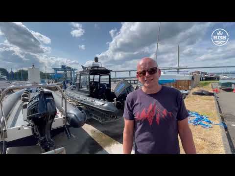

Ascension Island expedition preparation in Port Edgar. BGS © UKRI
The team is set to return to Ascension Island in January 2024 to complete the next stage of the project, which will focus on seabed sampling. A high-definition drop camera with laser scaling will be deployed to enable accurate mapping of the sea floor. The project is expected to be completed in April 2024.
This project is funded by the UK Government through Darwin Plus.

Relative topics
Related news

Updated geological assessment of the Southern North Sea set to underpin future offshore infrastructure development
25/03/2026
The first regional assessment for 30 years will support offshore marine and subsurface planning for the UK’s low-carbon energy infrastructure, including the 2030 target of 45 to 50 GW generated through offshore wind.

New research could help provide a more reliable water supply for millions in rural Africa
24/03/2026
A new BGS-led study has revealed crucial insights into the longstanding challenges affecting the reliability and performance of rural water supply infrastructure in sub-Saharan Africa.

UK Critical Minerals Intelligence Centre 2026 showcase
Event on 31/03/2026
Join us for a special live webinar with the team from the Critical Minerals Intelligence Centre showcasing the latest research from 2026 on copper, the future of digital, and what’s next for the criticality assessment.

PhD adventures in Copenhagen, Denmark: revealing past recovery processes of tropical forest systems through ancient environmental DNA
12/03/2026
PhD student Chris Bengt visited the University of Copenhagen to carry out very delicate extraction of aeDNA from lake-sediment cores, in the hopes of unlocking the secrets of past volcanic eruptions.

Call for new members and Chair to join the NERC facilities steering committees
25/02/2026
New members are needed to join the committees over the next four years.

Your views wanted: developing a geothermal energy subsurface data portfolio
24/02/2026
BGS is aiming to support the growth of the sector by providing the best-available, location-specific geothermal and ground source heat information as an accessible product or service.

Map of BGS BritPits showing the distribution of worked mineral commodities across the country
18/02/2026
BGS’s data scientists have generated a summary map of the most commonly extracted mineral commodities by local authority area, demonstrating the diverse nature of British mineral resources.

MARC Conference 2025: highlighting the importance of conferences to PhD students
16/02/2026
BGS and University of Nottingham PhD student Paulina Baranowska shares her experience presenting her research on nuclear forensics at her first international conference.

Funding awarded to map the stocks and flows of technology metals in everyday electronic devices
12/02/2026
A new BGS project has been awarded Circular Electricals funding from Material Focus to investigate the use of technology metals in everyday electrical items.

New UK/Chile partnership prioritises sustainable practices around critical raw materials
09/02/2026
BGS and Chile’s Servicio Nacional de Geología y Minería have signed a bilateral scientific partnership to support research into critical raw materials and sustainable practices.

Extensive freshened water confirmed beneath the ocean floor off the coast of New England for the first time
09/02/2026
BGS is part of the international team that has discovered the first detailed evidence of long-suspected, hidden, freshwater aquifers.

Funding secured to help mitigate ground risk in UK construction sector
05/02/2026
The BGS Common Ground project has been awarded new funding to help unlock the value of ground investigation data.