A new suite of AGS file utilities and public API
BGS has released an online AGS file utilities tool validator.
24/11/2021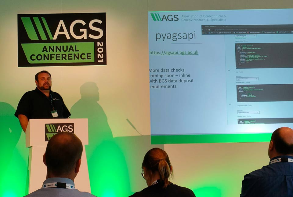

BGS has released an online AGS file utilities tool validator, offering the ability to validate AGS files against both the official AGS data format rules (v4.x) and BGS data submission requirements. It also to converts AGS data format files to and from MS Excel.
The AGS file utilities tool also has a public API for programmatic access. The tool accepts multiple AGS files, up to a 50MB total size limit.
AGS
AGS is a data format for sharing information about geotechnical projects, which includes boreholes, geological information, samples and test results. They are particularly useful for preliminary desk-based studies in the early stages of a project.
It’s a key data type that the industry is required to submit to the National Geoscience Data Centre (NGDC), which is managed by BGS to collect and preserve key geoscientific data, making it available in the long-term to a wide range of users and for the benefit of future geotechnical projects.
Previous tool
BGS had an existing AGS validation tool, which performed data checking against rules set out in the NGDC submission guidelines. However, we recognised there were some limitations and features we would like to add, such as AGS schema validation, and further data checks.
AGS committee and Python library
The AGS Data Management Working Group recently released a AGS v4.x Python library, which offers AGS data format validation and file conversion to or from .ags or .xlsx. This is a fantastic resource for the AGS community and the first official AGS file validator.
On top of this library, the working group has also released a MS Windows validation tool. The AGS Validator (BETA) standalone software program was launched earlier this year by the Association of Geotechnical & Geoenvironmental Specialists, to provide a single source for validating electronic transfer of AGS4’ (AGS data format) files. This is available as a free download.
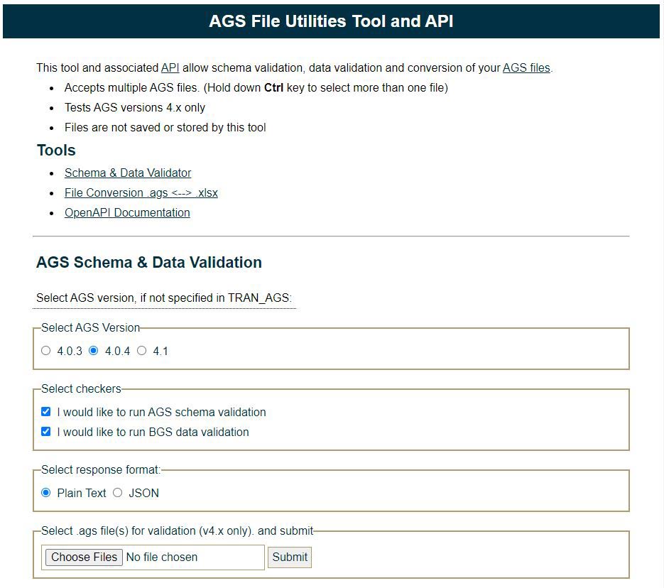
Web user interface. BGS © UKRI.
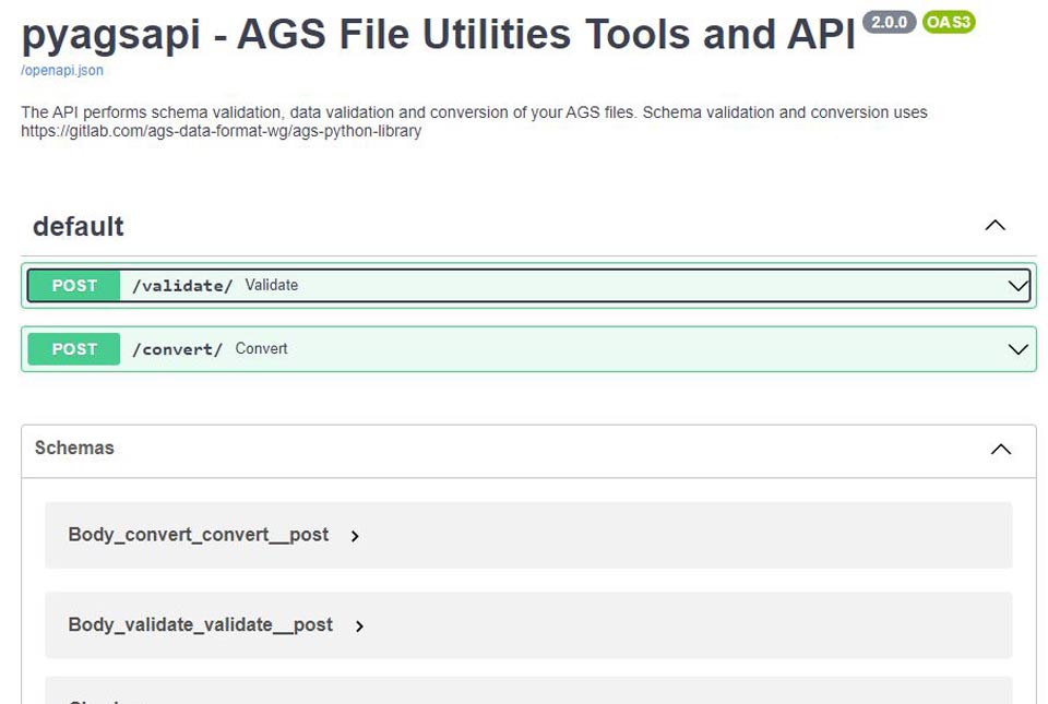
API documentation. BGS © UKRI.
New tool
Recognising the potential of the Python library to benefit the geotechnical community and as part of our commitment to the AGS data format, wewanted to make a web-accessible tool that included an API for programmatic access. This came to be the AGS file utilities tool, which complements the release of AGS Validator (BETA). The BGS tool supports wider efforts by the industry to standardise the validation process and reduce additional work for users, contractors and software providers.
The AGS file utilities tool validator provides the capability to validate AGS files against both the official AGS data format rules (v4.x) and BGS data submission requirements. It also converts AGS data format files both to and from MS Excel format.
Development was undertaken over 20 days, with three of BGS’s software developers working on the project. A key feature for us was to make a public API available to allow others in the community to build their own applications or web pages that could use our tool to perform AGS validation or conversion, rather than having to host a server themselves, hopefully facilitating further use and uptake of AGS data format.
Open source
Another requirement we had was for the application to be free, open source and released under an open license. This aligns with the BGS Digital Strategy and the wider Government digital service standard, the value of which we recognise for the wider community. The source code for the application can be found on the BGS GitHub site.
Future work
If there is sufficient interest from the AGS community, we hope to continue to develop this tool and add new features in line with further development of the underlying AGS Python library.
About the author

Edd Lewis
Data standards lead
Edd Lewis is the Standards Lead at the British Geological Survey, with responsibility for improving the organisation’s data provision through using geospatial data standards to better align with FAIR data principles (and hopefully driving economic growth through improved data accessibility). He is a member of the British Standard Institute IST/36 Geographic Information committee, MEDIN standards committee, Association of Geotechnical and Geoenvironmental Specialists (AGS) AGS Data Format committee and contributor to ISO/TC 211 & OGC standards.
Find out moreRelative topics
Related news

Map of BGS BritPits showing the distribution of worked mineral commodities across the country
18/02/2026
BGS’s data scientists have generated a summary map of the most commonly extracted mineral commodities by local authority area, demonstrating the diverse nature of British mineral resources.

Funding secured to help mitigate ground risk in UK construction sector
05/02/2026
The BGS Common Ground project has been awarded new funding to help unlock the value of ground investigation data.

New geological maps of the Yorkshire Wolds to better inform groundwater management and policy decisions
17/12/2025
The new mapping provides crucial data on localised geological issues that may assist in protecting water supplies.

New 3D model to help mitigate groundwater flooding
08/12/2025
BGS has released a 3D geological model of Gateshead to enhance understanding of groundwater and improve the response to flooding.

Latest BGS Geology 50K mapping data launched
06/11/2025
Some of our most widely used maps have received a major update, including the 1:50 000-scale map series that now includes enhanced coverage of Great Britain.

World Cities Day: the geological story of our cities
31/10/2025
Understanding the rocks that underlie our towns and cities, the risks they can present and how they influence urban planning and redevelopment.

New BGS GeoIndex viewer released for user testing
24/09/2025
The premium map-viewing application has been given a major upgrade and made available as a beta release.

New seabed sediment maps reveal what lies beneath the waves
03/09/2025
Marine ecosystem science and offshore infrastructure will be boosted by a new dataset showing sediment composition across the UK continental shelf.

New tool helps identify coal mine gas risk for housing developments in Scotland
05/08/2025
Scientists have co-developed a new tool for North Lanarkshire Council to help screen coal mine gas emissions prior to the development of new houses and buildings.
BGS digital geology maps: we want your feedback
29/05/2025
BGS is asking for user feedback on its digital geological map datasets to improve data content and delivery.

Celebrating 20 years of virtual reality innovation at BGS
08/04/2025
Twenty years after its installation, BGS Visualisation Systems lead Bruce Napier reflects on our cutting-edge virtual reality suite and looks forward to new possibilities.
New data reveals latest mineral workings around Great Britain and Northern Ireland
01/04/2025
The newest release of BGS BritPits provides information on an additional 6500 surface and underground mineral workings.