The East African Rift (EAR) is a unique natural laboratory because a wide range of dynamic geological processes, such as rifting, magmatic intrusions and different types of volcanic eruptions, can be directly observed and studied there. Living in such an active environment brings many benefits and opportunities, including geothermal energy and good soils, but there are also many hazards, including landslides, earthquakes, lava flows and gas emissions.
Understanding hazards, their potential impacts, exposure of populations and assets, vulnerabilities and capacities for response are essential steps towards understanding geohazard risk and enabling communities to live and work safely in these dynamic environments.

Nomadic pastoralist farmers living in the shadow of central volcanoes and associated fissure swarms in northern Ethiopia. BGS © UKRI.
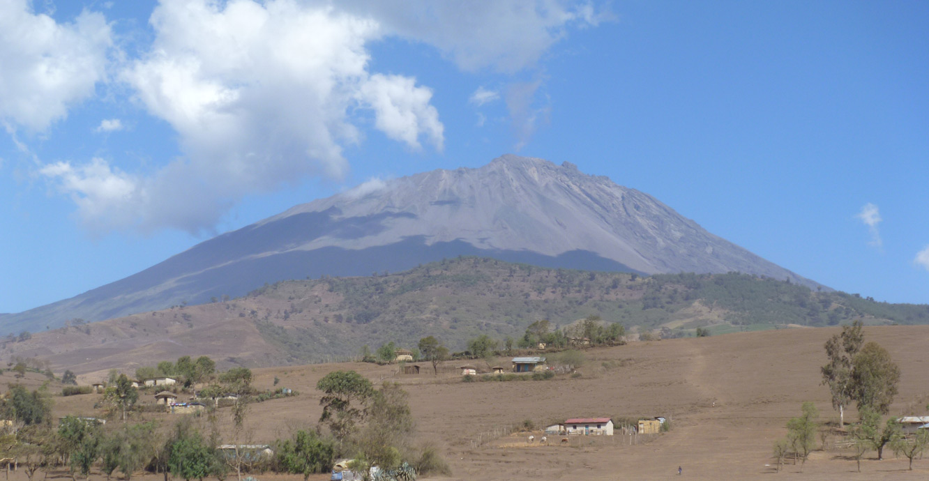
Homes overlooked by Mt Meru volcano in northern Tanzania. BGS © UKRI.
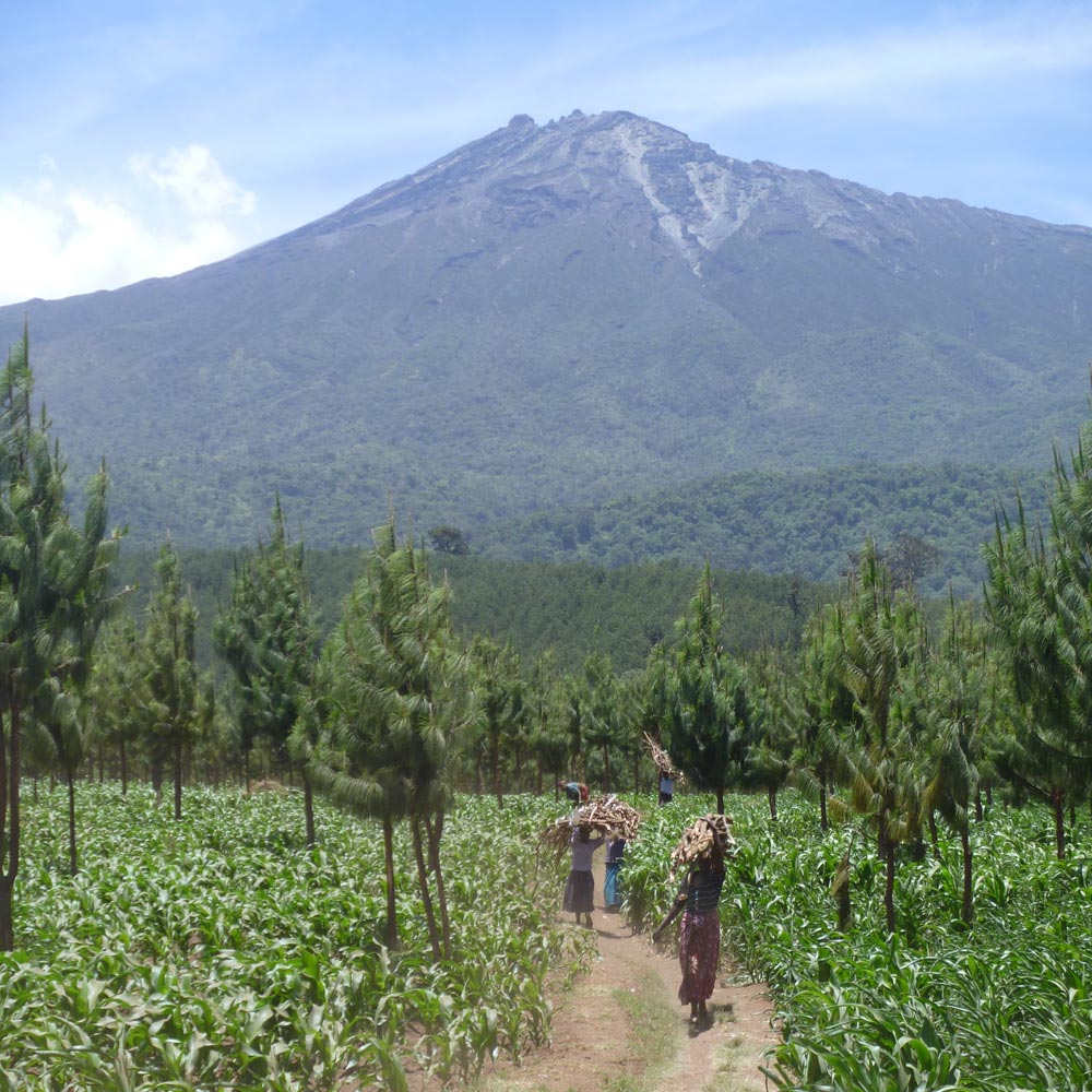
Plantations on the slopes of Mt Meru volcano, northern Tanzania. BGS © UKRI.
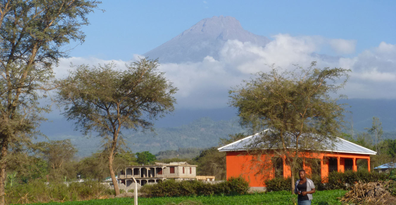
Homes overlooked by Mt Meru volcano in northern Tanzania. BGS © UKRI.
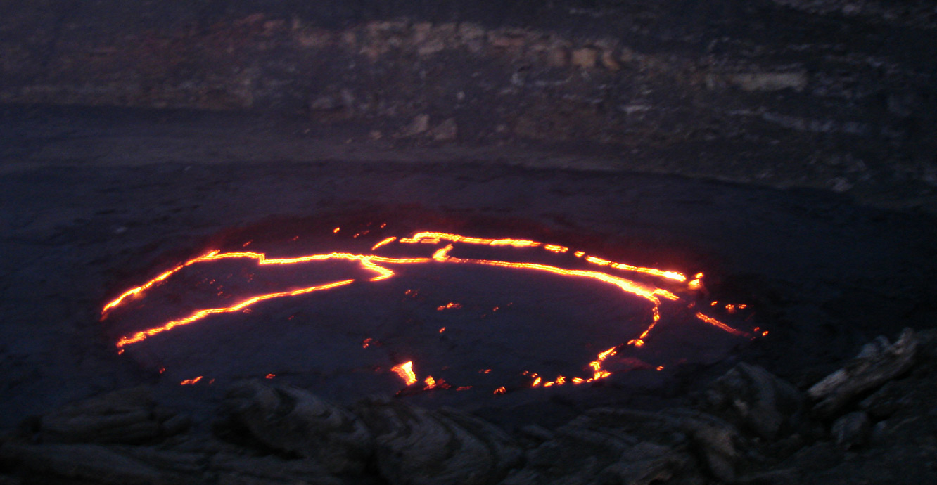
Erta Ale lava lake in the Afar Depression, northern Ethiopia. BGS © UKRI.
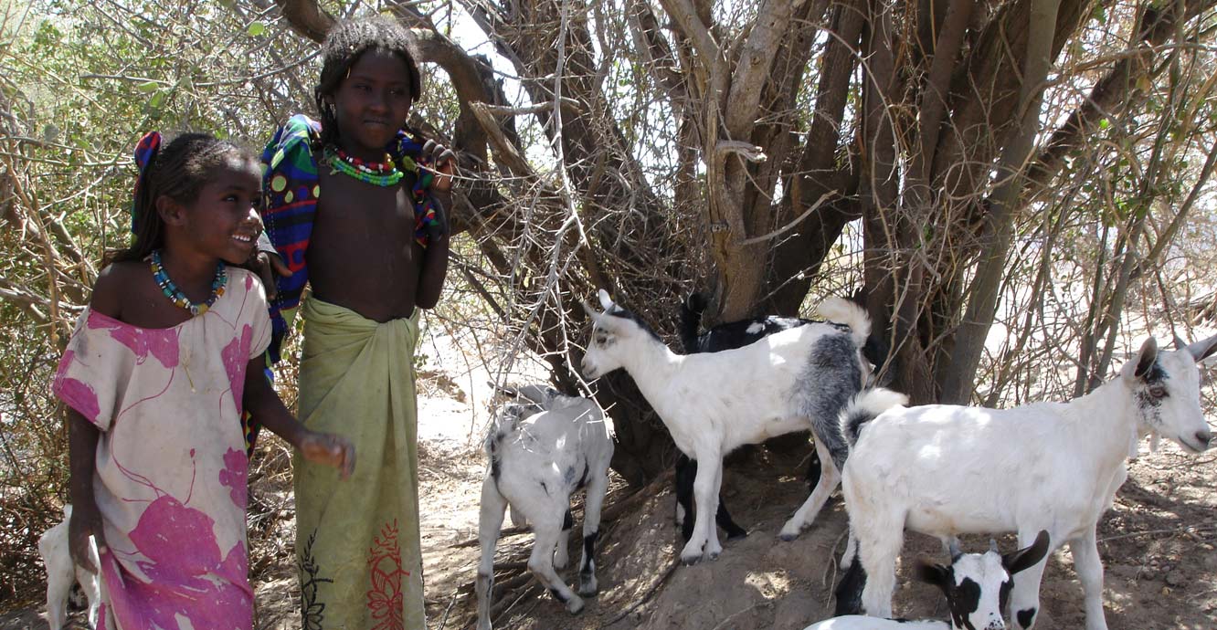
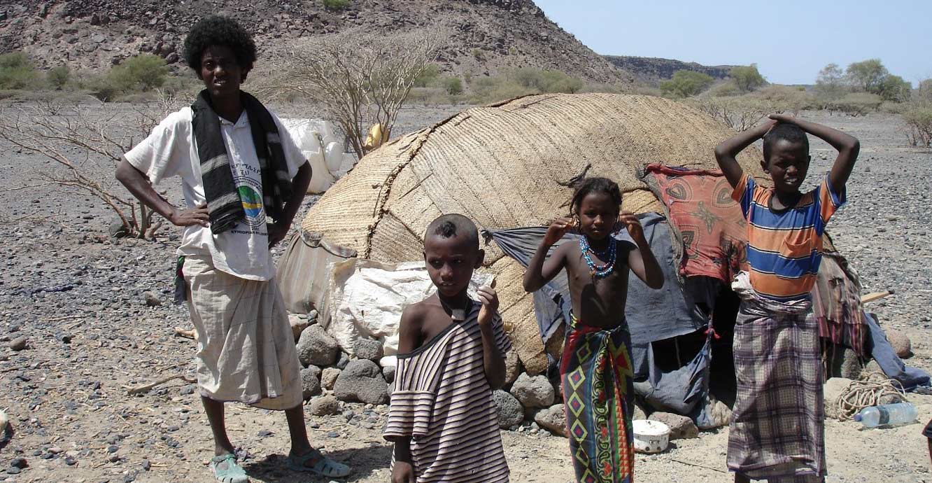
Children and goats find shade in the Afar region of northern Ethiopia. BGS © UKRI.
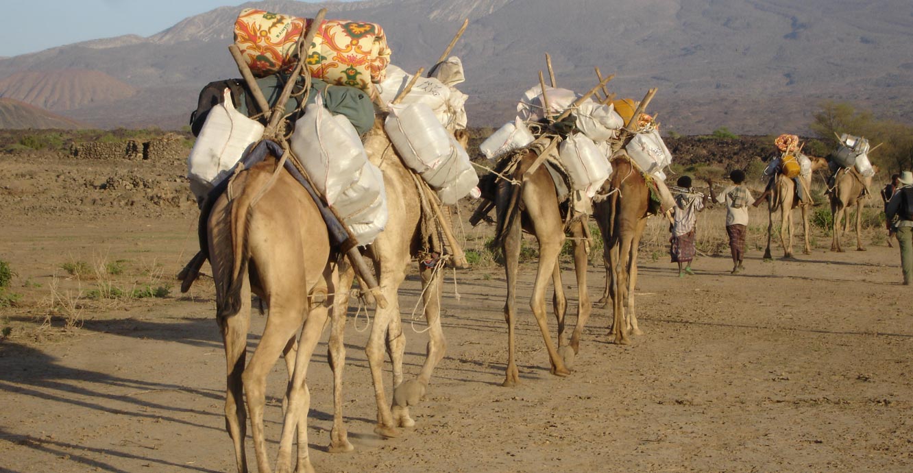
Setting off on fieldwork on Dabbahu volcano in the Afar region of northern Ethiopia. BGS © UKRI.
BGS has a long history of geological mapping and groundwater research in the EAR. BGS volcanologists and seismologists began research in the EAR in 2008, investigating magmatism and volcanism in the Afar Depression, in the Main Ethiopian Rift and in Tanzania.
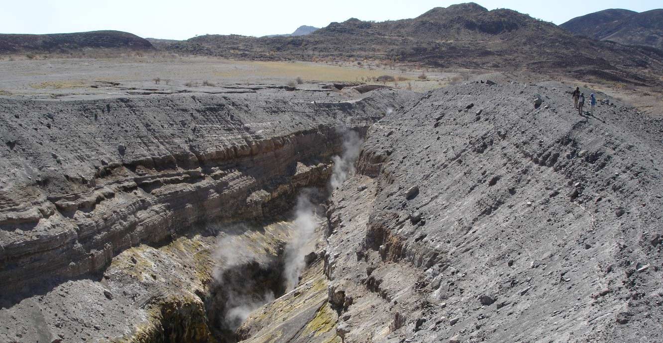
The 2005 Da Ure eruption site, associated with the onset of a rifting episode in the Afar Depression. BGS © UKRI.
Collaborations
BGS’s geohazards research and project staff are in partnership with colleagues from the National Disaster Risk Management Commission (NDRMC), Geological Survey of Ethiopia, Geospatial Information Institute and Addis Ababa University in Ethiopia.
In Tanzania, we collaborate with the Geological Survey of Tanzania, National Meteorological Agency, Dodoma University and Dar es Salaam University.
These partners and others, including local authorities, regional universities, civil society and non-governmental organisations, are engaged directly with communities, building partnerships to exchange knowledge and identify strategies to reduce risk.
Our work
We aim to enhance the resilience to natural hazards of institutional networks, systems and communities by enhancing knowledge of hazards and risk. Our approach includes co-designed research projects, training and capacity building, knowledge exchange and co-production of hard and soft tools to enhance the capacity of geoscience stakeholders to plan for, respond to and recover from disasters.
In Ethiopia, BGS has worked with partners to co-design a series of workshops supporting the creation of a ‘geohazards task force’ at national level, which includes:
- national institutions (Geospatial Institute; Geological Survey of Ethiopia)
- higher education institutions (Addis Ababa University)
- disaster risk managers (NDRMC)
- the responsible ministry (Ministry of Mines and Energy)
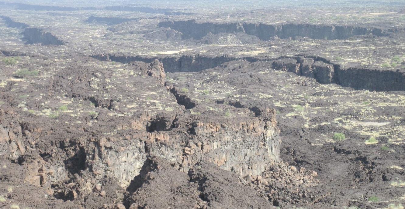
Closely spaced fault scarps through basaltic lava flows, marking the centre of a rift segment within the Afar Depression. BGS © UKRI.
We’re taking a whole system approach to studies in the Fentale/Lake Basaka area of Ethiopia, using geophysics, geochemistry, geology, groundwater, surface water, Earth observation and geothermal studies to better understand rifting, resources, hazards and environmental change. In addition, with partners across disciplines and sectors, we’re developing research on the exposure and vulnerabilities of communities, infrastructure and supply chains.
Our work has also contributed to the understanding of volcanic threat for these nations in a global context (Brown et al., 2015) and identified key knowledge gaps that are presented in the Global Assessment Report for volcanoes in 2015 (Loughlin et al., 2015).
Brown, S K, Sparks, R S J, Mee, K, Ilyinskaya, E, Jenkins, S F, Loughlin, S C, and Vye-Brown, C. 2015. Country and regional profiles of volcanic hazard and risk. Appendix B, Part 1 in Global Volcanic Hazards and Risk. Loughlin, S C, Sparks, S, Brown, S K, Jenkins, S F, and Vye-Brown, C (editors). (Cambridge, UK: Cambridge University Press.)
Loughlin, S C, Sparks, S, Brown, S K, Jenkins, S F, and Vye-Brown, C (editors). 2015. Global Volcanic Hazards and Risk. (Cambridge, UK: Cambridge University Press.)
Medynski, S, Pik, R, Burnard, P, Dumont, S, Grandin, R, Williams, A, Blard, P-H, Schimmelpfennig, I, Vye-Brown, C, France, L, Ayalew, D, Benedetti, L, Yirgu, G, and ASTER team. 2016. Magmatic cycles pace tectonic and morphological expression of rifting (Afar Depression, Ethiopia). Earth and Planetary Science Letters, Vol. 446, 77–88.
Vye-Brown, C, Medynski, S, Smith, K B, Field, L, Hofmann, B, and Wright, T. 2016. Geological map of the Dabbahu (Manda-Hararo) Rift, Afar, Ethiopia, 1:100 000 scale. Second Edition. (Nottingham, UK: British Geological Survey.)
Vye-Brown, C, Sparks, R S J, Lewi, E, Mewa, G, Asrat, A, Loughlin, S C, Mee, K, and Wright, T J. 2016. Ethiopian volcanic hazards: a changing research landscape. 355–365 in Magmatism, Rifting and Active Volcanism. Wright, T J, Ayele, A, Ferguson, D J, Kidane, T, and Vye- Brown, C (editors). Geological Society of London Special Publication, 420.
Contact
If you want to discover more then please contact Charlotte Brown.
You may also be interested in
Global geological risk
Our research focuses on characterising complex, multi-hazard processes with the aim of improving resilience of communities to hazards.