BGS scientists are collaborating with researchers from the Institute for Geoscience, Space Science and Astronomy (IGSSA) at Addis Ababa University to improve knowledge of landslide susceptibility in Ethiopia. We are also co-developing novel Earth observation systems to detect and monitor landslides.
Landslide risk in Ethiopia
Landslides are particularly common in Ethiopia between July and September, which is the main wet season, as well as April and May when there is heavy seasonal rain. Millions of people in Ethiopia live in areas at risk from landslides, with the annual average damage to building stock expected to be US$3 million (estimated by World Bank (pdf)). Improving our understanding of landslide risk is very important to help build resilience and ensure sustainable development.
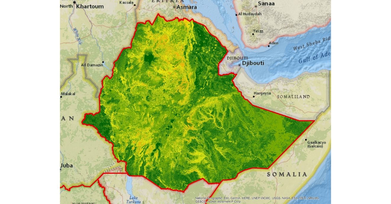

Landslide susceptibility map of Ethiopia. Produced for the World Bank National Risk Profile (2016). BGS © UKRI.
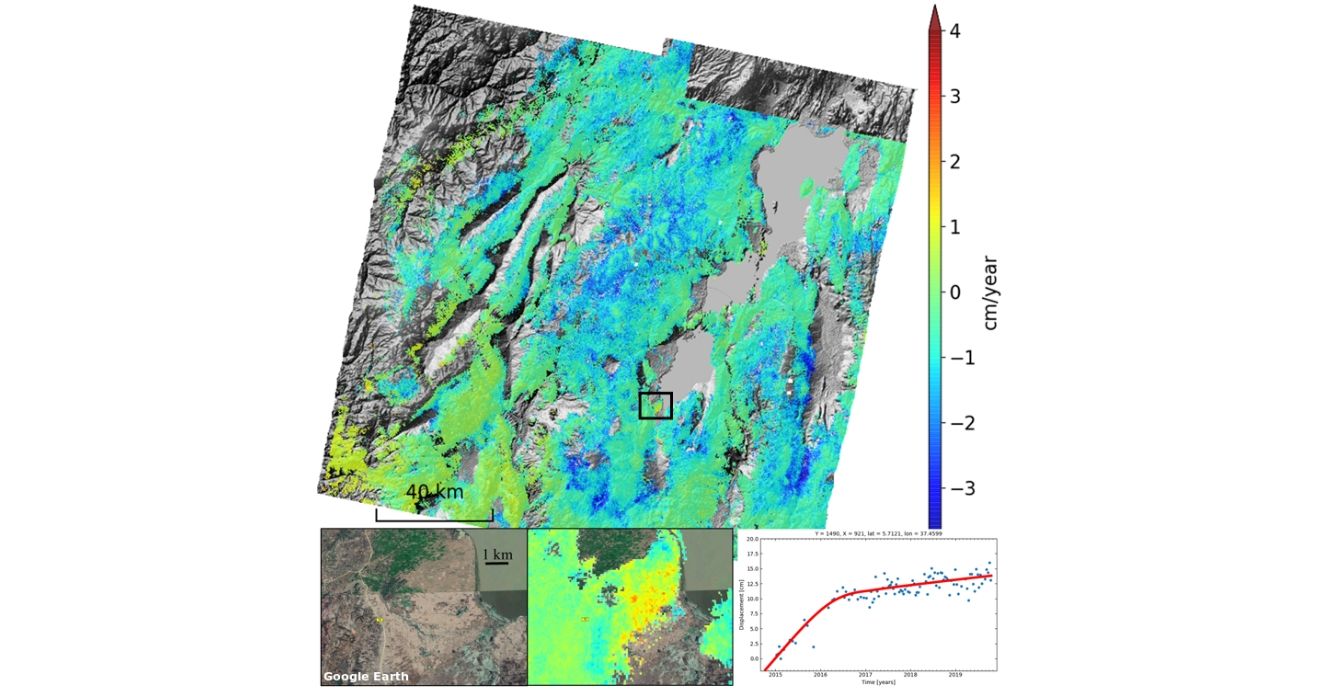
An InSAR map showing the rates of ground motion in southern Ethiopia. The three bottom panels are a zoom of the region in the black box where we have identified a landslide. The time series shows a curious change in motion in the middle of 2016. The cause behind this is currently under investigation. BGS © UKRI.
Collaborative research
There are two main avenues of collaborative research taking place within the project.
The BGS delivered a national landslide susceptibility model for Arup as part of the World Bank-funded national landslide risk project. Building on that desk-based analysis, researchers from both the BGS and Addis Ababa University are collaborating to improve and update the susceptibility results using a more complete landslide inventory and revised input data such as elevation models and in-country expertise.
Satellite Earth observation data enables us to monitor large regions remotely. In Ethiopia, we are using novel interferometric synthetic aperture radar (InSAR) techniques to monitor landslide motion. Using this method, we have been able to build up a time series of ground deformation from 2015 to the present, showing the details of how landslide movement can change with time.
Contact
If you want to discover more then please contact Claire Dashwood.
You may also be interested in
International geoscience
BGS is active across the globe delivering institutional strengthening programmes and applied research projects across a wide variety of sectors.
Global geological risk
Our research focuses on characterising complex, multi-hazard processes with the aim of improving resilience of communities to hazards.