The iconic hill of Mam Tor, along with the beautiful surrounding landscape of the Peak District in Derbyshire, were all formed during a period of Earth history called the Carboniferous Period (about 300 to about 360 million years ago), a time when the country sat around the equator and enjoyed tropical weather conditions. During this time period, the landscape varied but was made up of a series of small inland seas surrounded by dry land. The dry land played host to numerous rivers that drained in to these inland seas, sometimes forming deltas at the sea margins.

Mam Tor landslide. Photo taken from the debris flow looking towards the backscarp. BGS © UKRI.
The lush, tropical conditions led to shallow, tropical waters occupied by large reefs that teemed with all manner of marine life. Next to these lush reef environments, deeper sea settings where the sun’s light couldn’t reach, were by contrast dark and inhospitable areas that slowly accumulated thin layers of muddy sediment that drifted and settled upon the sea floor.
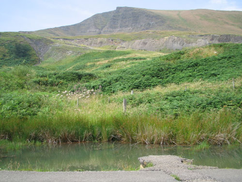
It would be a failure on my part at this point to not now mention why Mam Tor looks different from the chain of hills around it and why it has a rather infamous reputation regionally. Looking at the east-facing cliff of Mam Tor, you can quickly spot the difference with the surrounding hills due to the steep-sided cliff face, a face with lots of layers of rocks visible. This steep cliff face formed as a result of a number of landslides.
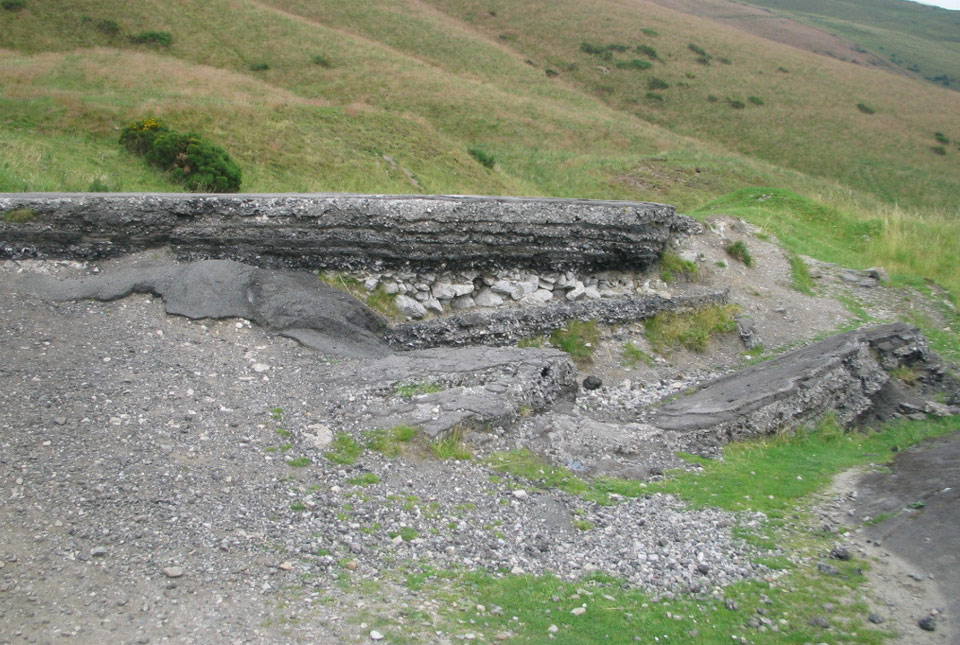
The Turn Pike Road damaged by the Mam Tor landslide. Source: BGS © NERC
These landslides are responsible for the quite dramatic damage done to the now derelict A625 Manchester to Sheffield road, which is situated below the hill. The remains of the road today look like something from an earthquake disaster movie, with the broken road surface suddenly ‘popping up’ a metre or two higher as if an earthquake had occurred. I suspect this broken road, alongside the numerous impressive cracks, would make any Hollywood action film set designers jealous!
Joking aside, it is very important to note that caution should always be exercised when visiting any uneven or steep ground and especially as some parts of the road may require some small scrabbling (climbing), depending on which parts you visit. Having said that, if you are able to access the remains of the road it’s well worth a close-up view. The stacked layers of road seen in some of the broken parts provide an interesting glimpse into the Anthropocene, or the geological period of today, in which human influence dominates. Within the remains of the road you can see numerous layers of tarmac and pebbles constructed as part of the numerous and ultimately vain attempts to repair the road after each landslide damaged it.
The landslides themselves can actually be seen today. Casting your eyes down the slope you can see ‘lumpy’, grassy ground with some blocks of rock sticking out. Follow this lumpy or hummocky grassland until it ends and you will see it is surrounded by more ‘normal’, gently sloping or flat grassland. The lumpy/hummocky ground is the now grassed-over, stabilised landslide that broke away from Mam Tor.
Looking at Mam Tor itself, you can see lots of layers of rock made up of two difference types; mudstone and sandstone. The sandstone layers are easier to see as they are the predominately thicker layers that stand out more from the cliff. Looking at these layers carefully, you’ll notice that they thin and thicken, with some disappearing completely along their length. The mudstones are harder to see, though there is a small ‘mound’ near the car park just past the gate, where you can see dark grey to black rock. It forms very good chipping-style pebbles that are likely scattered over the entire outcrop. These mudstones are also present between the sandstone in the Mam Tor cliff, although they can only be seen up close.
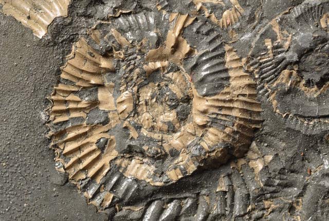
The mudstones represent the deposition of fine ‘sea dust’ that slowly settled within the sea accumulating on the sea floor. The sandstones are much more ‘energetic’ deposits, formed as a series of small underwater landslides or gravity flows. These landslides would have been really gloopy and somewhat like a slurry of sediment hugging the sea floor, moving downslope until it reached flat areas. These slurries (termed ‘linked debrites’) originated much higher in the sea at shallower locations and brought all manner of material trapped within them into the deeper sea. This notably includes leaves and bits of wood. These plant and wood fossils can take some effort to find, but look for black, coal-looking fragments near the bottom of the larger sandstone layers, which will require you getting face-to-face with the rock. A small section of exposed sandstone can be reached relatively easily near the bottom of Mam Tor off to the side. Happy fossil hunting!
The area is well worth a visit: the views are spectacular, the walks can be quite dramatic and the geology is exceptional.
When visiting Mam Tor, please stay well clear of overhangs and cliff faces, and watch your footing, especially on any uneven or loose ground.
About the author

Dr Oliver Wakefield
BGS Regional Geologist, Midlands and East Anglia
Relative topics
You may also be interested in
Discovering Geology
Discovering Geology introduces a range of geoscience topics to school-age students and learners of all ages.
Maps and resources
Download and print free educational resources.
Postcard geology
Find out more about sites of geological interest around the UK, as described by BGS staff.