Aberystwyth is one of the biggest towns in Mid Wales and home to the University of Aberystwyth which recently (June 2023) celebrated its 150-year anniversary.
Aberystwyth, which means ‘mouth of the river Ystwyth’, is in the Ceredigion region and is famous for its mile-long Victorian promenade and the oldest pier in Wales (built in 1864). At the northern end of the prom is the 430 foot-high Constitution Hill, where you will find the world’s largest Camera Obscura, which provides a bird’s eye view of 1000 square miles of a 360° sweep of the town. Constitution Hill is accessible via the Cliff Railway, which is the longest cliff railway in Britain.
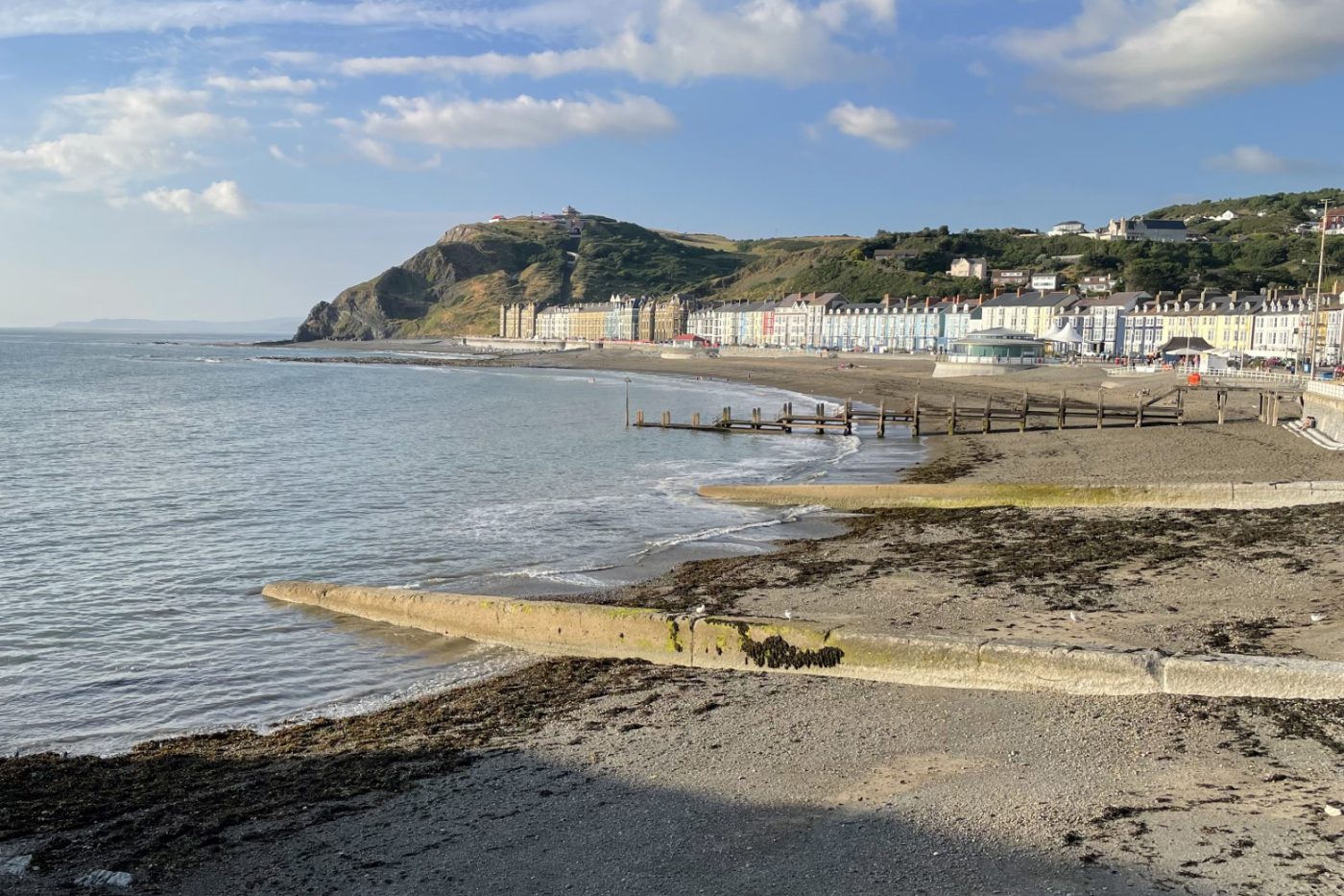

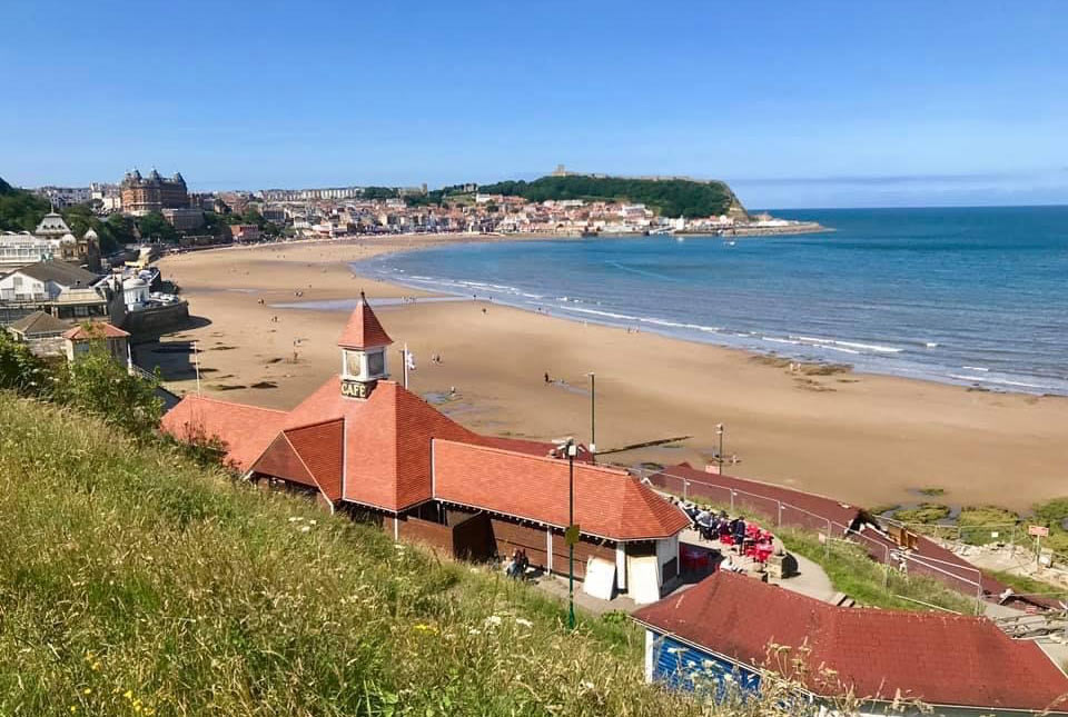
View of Constitution Hill from the pier on Aberystwyth promenade. Note the breakwaters and groynes that intersect the beach and reduce longshore drift, and the cliff railway, which is the longest in Britain. © Melanie Leng.
Towards the south of the prom is Pen Dinas Hill and Aberystwyth Castle, where there is an Iron Age hillfort and a memorial to the first Duke of Wellington. There are also the ruins of a 13th century English castle, built to keep the Welsh out! The castle is made of the local stone from the Aberystwyth Grits Group.
Geology
The headlands to the north and south of the town are formed from the Aberystwyth Grits Group, comprising Silurian-aged mudstones and sandstones that form rock sequences known as turbidites, which were laid down in the marine Welsh Basin. These turbidites crop out all along Ceredigion Bay. The fine-grained sediments contain fossils called graptolites (enabling the rocks to be correlated between outcrops) and were probably deposited in deep water. We know this because shelly material, which is more typical of shallower waters, is rare.
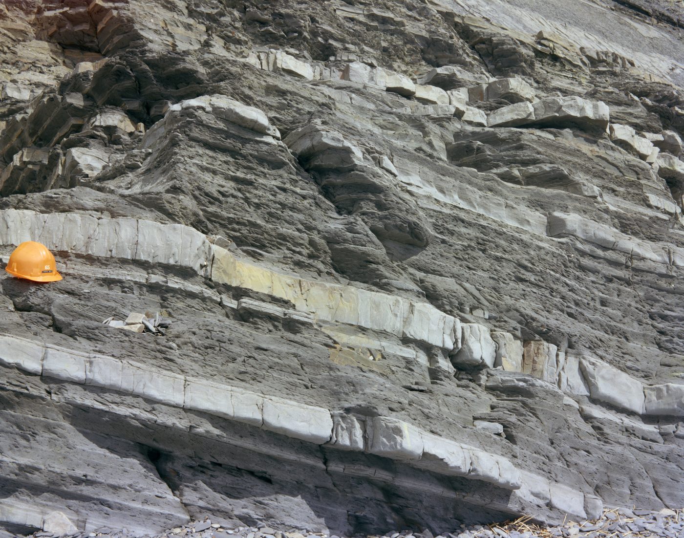
Cliffs below Constitution Hill, Aberystwyth. Typical Aberystwyth Grits Group lithology in the Aberystwyth area. The succession is mudstones with numerous sandstone turbidites up to 0.24 m thick. BGS © UKRI.
After burial, the rocks were subjected to folding and metamorphism, then eroded so we see them at the surface today. A metamorphic cleavage, which developed due to squeezing, is seen in most of the rocks, depending on the amount of clay and position of the rocks within the fold. Some very mudstone-rich parts have been used in the past to produce roofing ‘slates’, but the best roofing slates are from elsewhere in Wales.
A detailed description of the geology around Aberystwyth can be found in the BGS Memoir of the Geology of the Country Between Aberystwyth and Machynlleth.
Beaches
Fringing the coastline along the promenade there are large expanses of beach. Sand and in parts pebbles are exposed at low tide. The pebbles are blue-grey mudstones and paler sandstones. There are rocky platforms around the pier and Bath Rocks, where steeply dipping turbidites can be clearly seen.
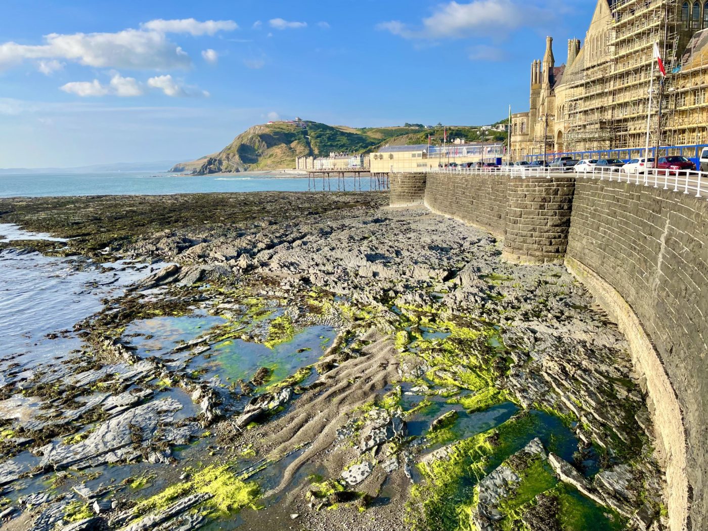
The steeply dipping Aberystwyth Grits Group below the southern part of the promenade, beneath the Old College, University of Aberystwyth. View looking north. © Melanie Leng.
Wildlife
One of Aberystwyth’s most spectacular natural phenomena occurs in the autumn and winter when thousands of starlings fly around the bay and roost under the pier at night. The are known as murmurations and some spectacular synchronised flying can be seen as the starlings ‘swarm dance’.
Safety information
Do not walk near the cliffs, where rockfalls can occur without warning. Take care on the rocky outcrops, as algae, marine plants and mud make these areas very slippery. The steeply dipping outcrops are also a hazard. Always check tide times before venturing out on the rocky outcrops.
About the author

Prof Melanie Leng
BGS Chief Scientist, environmental change, adaptation and resilience
Relative topics
You may also be interested in
Discovering Geology
Discovering Geology introduces a range of geoscience topics to school-age students and learners of all ages.
Maps and resources
Download and print free educational resources.
Postcard geology
Find out more about sites of geological interest around the UK, as described by BGS staff.