Key information
Scale:
N/ACoverage:
Various areas in the UKAvailability:
LicensedFormat:
Tape Image File (TIF) and LAS (Log ASCII Standard)Price:
£47.25 per tape file.
£10 per LAS curve.
Subject to number of users, licence fee and data preparation fee.
Uses:
Site-level to Local-level useGet data
Free access
Our free data is available under the Open Government Licence. Please acknowledge reproduced BGS materials.
View index onlineWeb service (OGC WMS) – Geophysics themePaid access
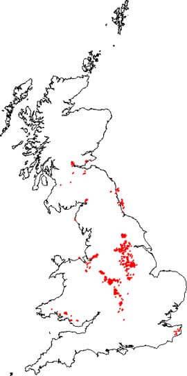
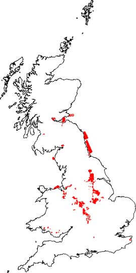
The map shows the location of borehole records containing digital geophysical logs acquired by the former National Coal Board and British Coal during their exploration for coal in the United Kingdom.
Following the privatisation of the UK coal industry, ownership of UK coal exploration data was transferred to The Mining Remediation Authority, who appointed the BGS as custodian of this important national geological data archive. In general, the data is publicly available, however, access to data within active mining licences requires the consent of the mining licensee.
The Mining Remediation Authority data archive includes digital data for some of the geophysical borehole logging. The original tapes have been transcribed and the data are available as tape image files (TIF) or, in some cases, as digital log ASCII standard (LAS) files.
We can provide information on data availability for named boreholes or those within a specified area, together with cost estimates and options for supply. To find the names of boreholes please use the GeoIndex, click on ‘Map layers’, select ‘Map Theme: GeoPhysics’ and tick on ‘British Coal Geophysical Logs’

Map of borehole records containing geophysical logs. BGS © UKRI.
You may also be interested in

Coal Authority seismic survey
This data is the original digital data for seismic reflection surveys conducted by the National Coal Board (NCB) and its successor, British Coal Corporation (BCC).


