Origins
The Geological Survey began in 1832 as a private venture by Henry de la Beche, mapping in south-west England. By 1835, it was agreed to continue the survey of the English counties as part of the Ordnance Survey.
The Ordnance Geological Survey was formed as a constituent part of the Ordnance Survey, giving it a more formal and official footing. The survey’s position was consolidated in the much broader and fully independent Geological Survey of Great Britain and Ireland by the Act of Parliament (Victoriae Reginae Cap LXIII on 31 July 1845) with Henry de la Beche as the first director.
For sixty years, the survey organisation covered England and Wales, Scotland and Ireland. In 1905, the Irish Survey separated and the remaining survey became Geological Survey of Great Britain.
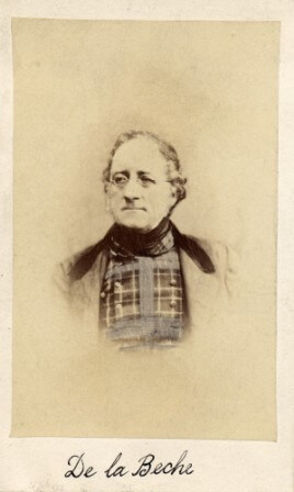

Sir Henry de la Beche, director general 1835–1855. BGS © UKRI.
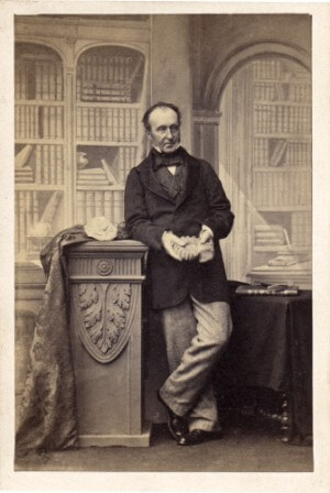
Sir Roderick Impey Murchison, director general 1855–1871. BGS © UKRI.
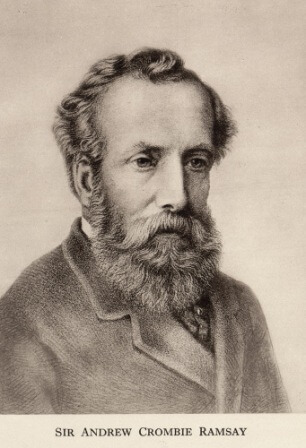
Sir Andrew Crombie Ramsay, director general 1871–1881. BGS © UKRI.
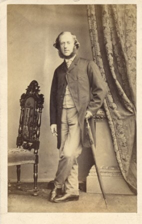
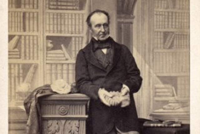
Sir Archibald Geikie, director general 1882–1901. BGS © UKRI.
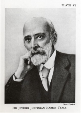
Sir Jethro Justinian Harris Teall, director 1901–1914. BGS © UKRI.

Dr Karen Hanghøj, current director (2019 onwards). BGS © UKRI.
1:63 360 map series in the early survey
There were three main geological map series in the early survey:
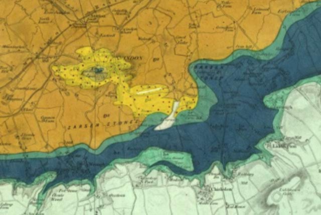
- Geological Survey of England and Wales 1:63 360 geological map series [Old Series]. These maps consist of sheets 1110 with Sheet 1 starting north-east of London and then sheet numbers increasing west to Cornwall and then north to the Scottish Border. Early sheets were ‘full sheets’ later ones were issued as ‘Quarter sheets’. Almost all sheets were hand coloured.
- Geological Survey of England and Wales, New Series 1:63 360/1:50 000 geological map series. This series superceded the Old Series, although there was some overlap in Northern England.
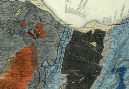
- Geological Survey of Scotland, 1:63 360 geological map series. This series was issued in around 121 sheets. Numbering started in the south of Scotland and proceeded north. The first sheet was published in 1859. All early sheets were hand coloured.
- Geological Survey of Ireland 1:63 360 geological map series. This series had 205 maps and was published between 1853 and 1914.
Early map production process
The production method of maps remained largely unchanged during the early period. The chief published output was the 1:63 360 [one inch to one mile] geological maps along with horizontal and vertical sections.
Geological maps and sections were printed by the Ordnance Survey in ‘lines’ editions. The maps were then individually hand coloured with watercolour paints according to an agreed schedule of colours. The colours evolved, were added to and changed over time.
Around 1900, the survey introduced colour printing and new maps for England and Wales and Scotland were issued in this form.
Bibliography
- Bate, D G. 2010. Sir Henry Thomas de la Beche and the founding of the British Geological Survey. Mercian Geologist, Vol. 17(3), 149–165.
- Bailey, E B. 1937. Geological Survey of Great Britain. (London: Murby.)
- Flett, J S. 1937. The First Hundred Years of the Geological Survey of Great Britain. (London: HMSO.)
- Herries Davies, G L. 1983. Sheets of Many Colours: the mapping of Ireland’s rocks 1750–1890. (Dublin: Royal Dublin Society.)
- Herries Davies, G L. 1995. North from The Hook: 150 years of the Geological Survey of Ireland. (Dublin: Geological Survey of Ireland.)
- McKenna, G (editor). [Unpublished manuscript] Instructions for the Local Directors of the Geological Survey of Great Britain and Ireland (330 KB pdf) by Henry de la Beche 22nd May 1845. Selected documents from the BGS Archives No. 1.
- McIntosh, R P. 2012. Geological Survey of Great Britain and Ireland — a contemporary account of the Survey, 1897 (3.17 MB pdf). Extract and illustrated from 1897 Geological Survey of Great Britain. Summary of Progress. [Unpublished].
- McIntosh, R P. Origins of the British Geological Survey. (3.39 MB pdf)
- Wilson, H. 1985. Down to Earth: one hundred and fifty years of the British Geological Survey. (Edinburgh: Scottish Academic Press.)
You may also be interested in

BGS maps portal
High-resolution viewing of images of almost all the small- and medium-scale geological maps produced by the BGS since mapping started in 1832.
Geological Survey history — England and Wales
A short history of the Geological Survey of England and Wales.
Geological Survey history — Ireland
A history of geological mapping in Ireland
Geological Survey history — Scotland
A history of geological mapping in Scotland, including timeline and early beginnings.
Geological survey historical notes
Brief historical notes and links to key documents on the early 1:63 360 map series for England and Wales, Scotland and Ireland.