In April 2008, a landslide occurred on the wooded slope at Cayton Bay in North Yorkshire, just south of Scarborough. This is a large landslide complex (Fish et al., 2006) and throughout April 2008, reports of landslide activity were occurring nearly daily and were reported in both the local and national media. The slope movements resulted in two properties being demolished and other properties in the Knipe Point Estate and the A165 Filey Road being threatened.
Specialist staff from the BGS Landslides Team carried out a walkover survey of the landslide to record the nature and location of the mass movement for entry into the National Landslide Database. The BGS routinely responds to major landslide events in this way, sending specialist staff to the scene of landslide events to collate data from landslides whilst they are relatively fresh and often active, offering invaluable information.
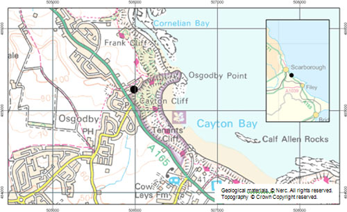

Location of Cayton Bay, North Yorkshire. The black point marks the position of the backscarp. National Landslide Database ID 6882/1 and 6882/2.
Gallery
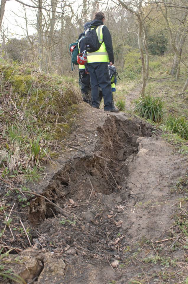
A fresh shear plane exposed in woodland indicates active movement. BGS © UKRI.
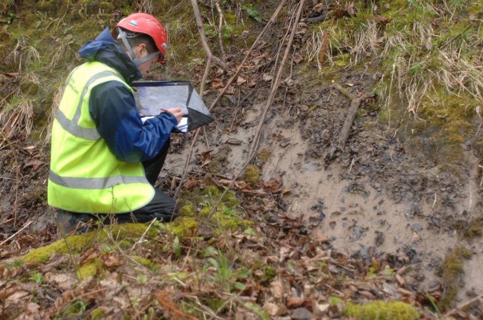
A fresh tension crack spanned by roots provides evidence of extensional movements in the middle of the woodland area. BGS © UKRI.
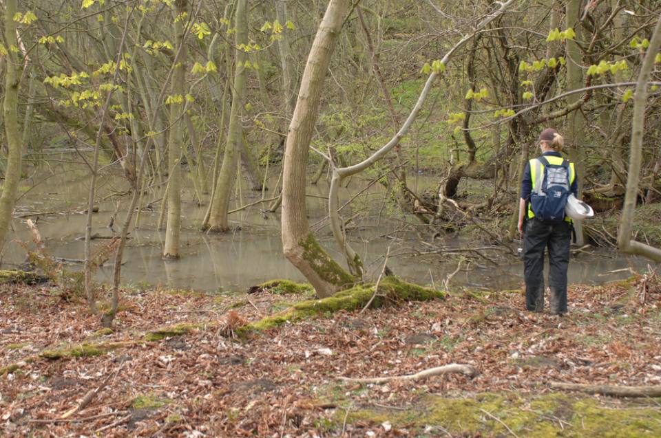
Free-standing water is held in a depression created by back tilting in woodland. BGS © UKRI.
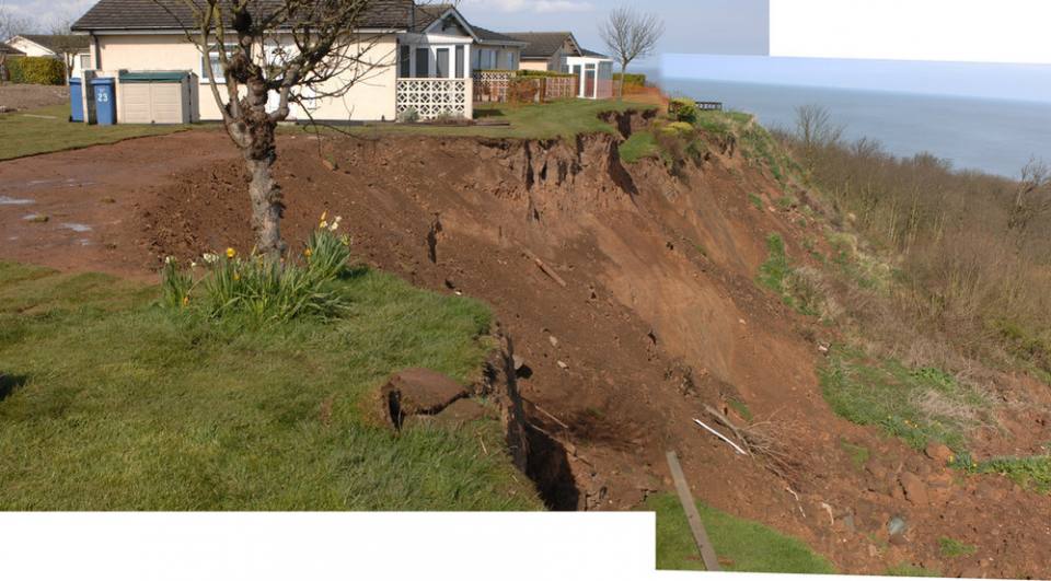
Merged photographs showing the head of the landslide at Knipe Point. Two bungalows occupied the flat ground on the left of the photograph before being demolished. BGS © UKRI.
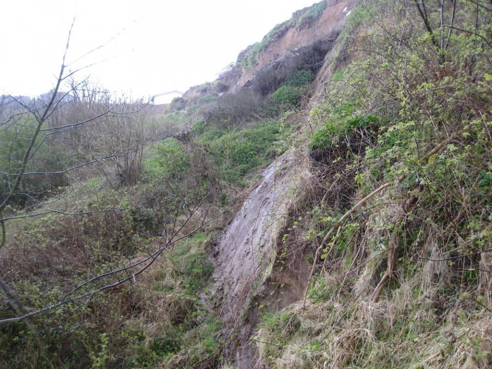
The rear scarp exposing grey glacial till. Photo taken looking west from slope below the eastern end of Knipe Point. Note the bungalows in the top left of photograph. BGS © UKRI.
Reference
Fish, P, Carey, J and Moore, R. 2006. Landslide Geomorphology of Cayton Bay, North Yorkshire. Proceedings of the Yorkshire Geological Society, Vol. 56(1), 5–14.
You may also be interested in

Landslide case studies
The landslides team at the BGS has studied numerous landslides. This work informs our geological maps, memoirs and sheet explanations and provides data for our National Landslide Database, which underpins much of our research.

Understanding landslides
What is a landslide? Why do landslides happen? How to classify a landslide. Landslides in the UK and around the world.

How to classify a landslide
Landslides are classified by their type of movement. The four main types of movement are falls, topples, slides and flows.

Landslides in the UK and around the world
Landslides in the UK, around the world and under the sea.