Standardised framework provides assessment of carbon dioxide storage site readiness
Geoscientists have developed a practical framework for assessing the degree of ’readiness’ of a prospective carbon dioxide storage site.
28/10/2021 By BGS Press
A practical framework for assessing the degree of ’readiness’ of a prospective carbon dioxide (CO2) storage site, drawing on decades of North Sea basin experience, has been shared in a new paper published by the International Journal of Greenhouse Gas Control.
Geoscientists from the ALIGN-CCUS project have developed a framework of CO2 Storage Readiness Levels (SRLs), which capture the entire picture of technical appraisal, permitting and planning activities for a potential storage site and what must be completed before it can become operational.
The framework is based on the national CO2 storage portfolios of the UK, Norway and the Netherlands, which represent 742 saline formation and hydrocarbon field sites. However, the methodology can be applied to a potential storage site at whatever stage of appraisal anywhere in the world.
The system has allowed a comparison of investment levels and the amount of appraisal time required to achieve a permit-ready North Sea CO2 storage site.
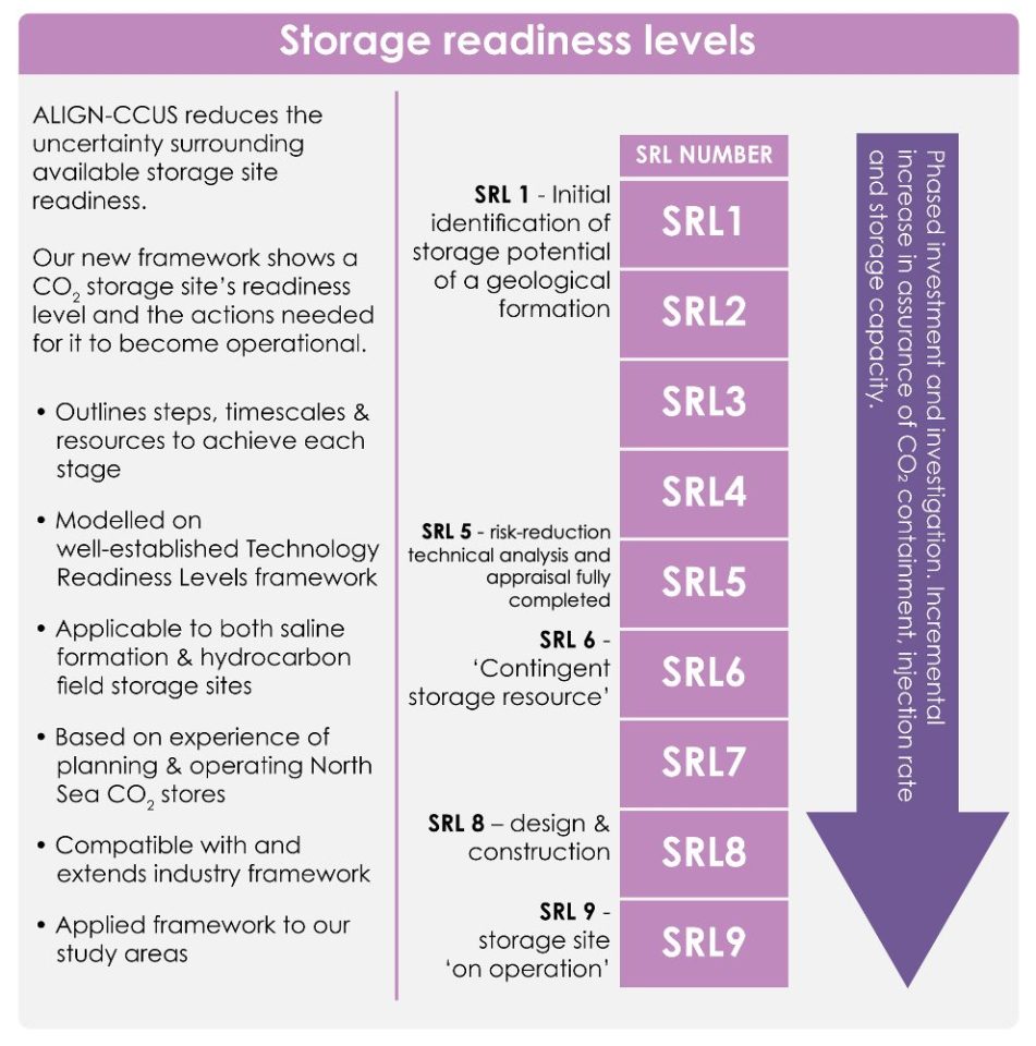
Storage Readiness Levels show the actions that need to be taken for a storage site to be ready for operation. © ALIGN-CCUS/MJD Design.
The researchers took inspiration from Technology Readiness Levels (TRLs), which are used to mark progress in the development of an innovative technology from inception to commercial delivery.
Objectivity is very important for scientific research so we completed our framework first before applying it to the portfolio of prospective and planned sites in each of our countries.
Our system of nine levels benefited greatly from discussion with regulators and offshore industry representatives, which ensured the progression through the SRLs is consistent with the licensing steps required by European legislation. It also ensured that our SRLs are consistent with industry management systems.
Learning from North Sea experience gives realistic estimates of the time and cost needed to bring a site to operational storage and so increase the confidence of investors and operators.
Dr Maxine Akhurst, lead author from the British Geological Survey.
The multidisciplinary ALIGN-CCUS project, which concluded last year, was funded through the EU’s ERA-NET ACT programme to help transform six European industrial regions into economically robust, low-carbon centres by 2025.
Relative topics
Related news

Quaternary UK offshore data digitised for the first time
21/01/2026
The offshore wind industry will be boosted by the digitisation of a dataset showing the Quaternary geology at the seabed and the UK’s shallow subsurface.

Suite of ten new soil reference materials released
02/01/2026
BGS has a longstanding track record of producing high-quality reference materials and has released ten new soil reference materials.

Perth and Kinross tops the UK’s earthquake activity charts for 2025
29/12/2025
Seismologists at BGS have published data on the number of seismic events over the past 12 months with over 300 earthquakes recorded.

BGS awarded funding to support Malaysia’s climate resilience plan
17/12/2025
The project, funded by the Foreign, Commonwealth & Development Office, will focus on minimising economic and social impacts from rainfall-induced landslides.

New geological maps of the Yorkshire Wolds to better inform groundwater management and policy decisions
17/12/2025
The new mapping provides crucial data on localised geological issues that may assist in protecting water supplies.
‘Three norths’ set to leave England and not return for hundreds of years
12/12/2025
The historic alignment of true, magnetic, and grid north is set to leave England, three years after they combined in the country for the first time since records began.
BGS agrees to establish collaboration framework with Ukrainian government
11/12/2025
The partnership will focus on joint research and data exchange opportunities with Ukrainian colleagues.

Making research matter: BGS joins leading research organisations in new national initiative
10/12/2025
A new alliance of 35 organisations has been formed that is dedicated to advancing science for the benefit of people, communities, the economy and national priorities.

New 3D model to help mitigate groundwater flooding
08/12/2025
BGS has released a 3D geological model of Gateshead to enhance understanding of groundwater and improve the response to flooding.
Scientists gain access to ‘once in a lifetime’ core from Great Glen Fault
01/12/2025
The geological core provides a cross-section through the UK’s largest fault zone, offering a rare insight into the formation of the Scottish Highlands.

New research shows artificial intelligence earthquake tools forecast aftershock risk in seconds
25/11/2025
Researchers from BGS and the universities of Edinburgh and Padua created the forecasting tools, which were trained on real earthquakes around the world.
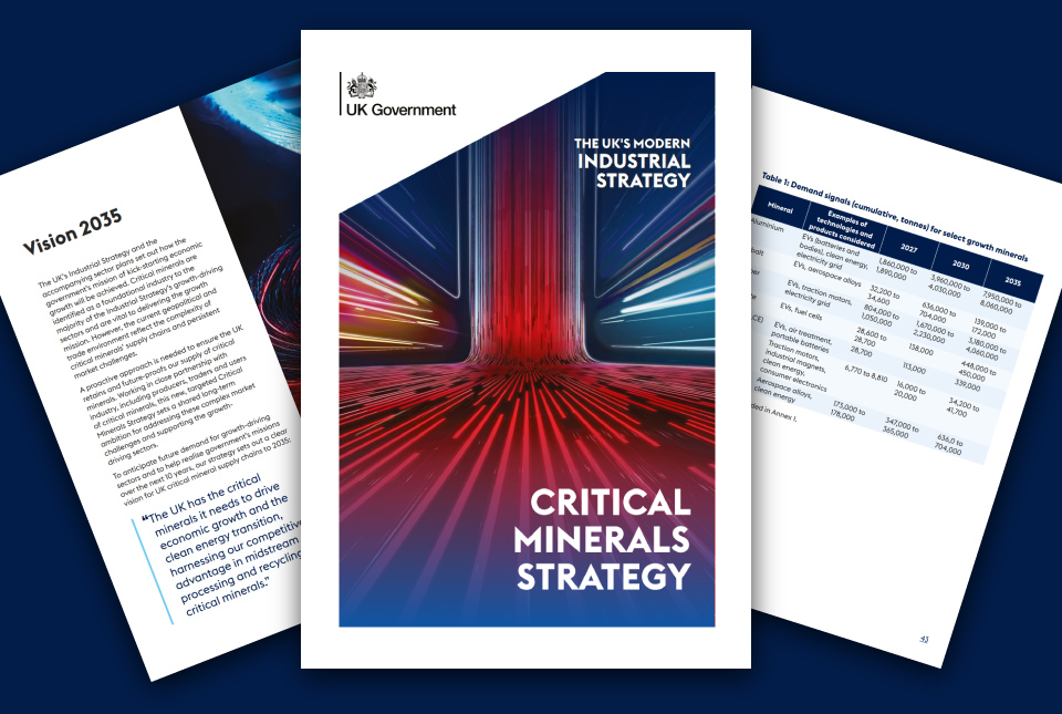
BGS welcomes publication of the UK Critical Minerals Strategy
23/11/2025
A clear strategic vision for the UK is crucial to secure the country’s long-term critical mineral supply chains and drive forward the Government’s economic growth agenda.


