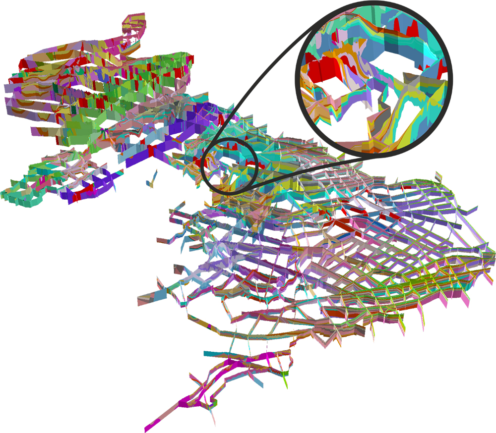

The UK3D dataset. BGS © UKRI.
UK3D
- 1:625 000
- UK
- Open
UK3D is a national-scale network of intersecting cross-sections (also known as a ‘fence diagram’) that provides a unique visualisation of the complex rocks and structures that make up the UK landmass. Comprising over 20 000 km of section line, extending up to 20 km offshore and to depths of 1.5 to 6 km below the ground surface, UK3D provides a 3D geological framework characterisation designed to complement BGS Geology 625K.
Key information
- Scale:
- 1:625 000
- Coverage:
- UK
- Availability:
- Open
- Format:
- 3D Shapefile, LithoFrame Viewer
- Uses:
- Regional to national
- Themes:
- Geology, Geoscience information
- Sector:
- 3D modelling, Education, Natural resources
UK3D is freely available in formats compatible with a range of visualisation software and is suitable for informing regional- to national-scale strategic geological assessments as well as general interest.
The model has been used by the BGS and partner organisations to develop national-scale understanding of aquifers and groundwater flow and to inform screening processes for identifying potential sources of energy and sites for waste storage.
UK3D development
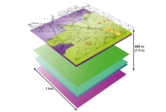
The UK3D cross-sections were created using the GSI3D geological modelling software, incorporating information on the geology at depth from boreholes and BGS LithoFrame250 models.
The latest update of UK3D (v2015), including offshore extension and full coverage of England, Wales, Scotland and Northern Ireland, was released in February 2016.
UK3D was developed under BGS’s national programme for 3D geoscience and has been financially supported by Nuclear Waste Services and other stakeholders.
Related resources
Open access Regional visualisation models providing 3D interactive visualisations based on the UK3D dataset are available for 14 regions of England and Wales and Northern Ireland in 3D pdf format.
You may also be interested in

BGS LithoFrame
Data outputs from 3D geological framework models are available at three different scales for parts of the onshore area of Great Britain.
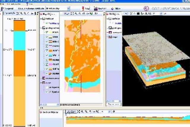
LithoFrame Viewer
Many of our geological models can be viewed and interrogated using the LithoFrame Viewer application.