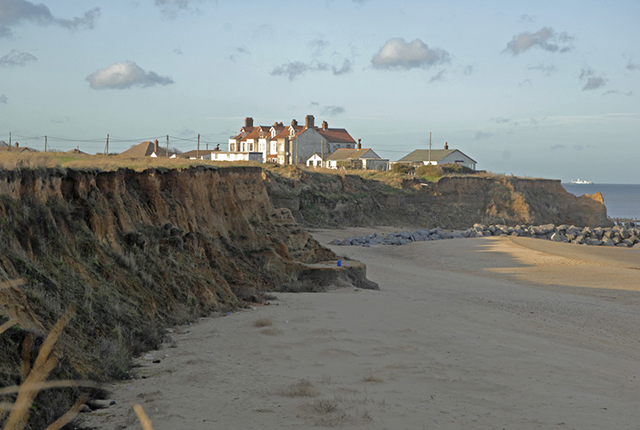
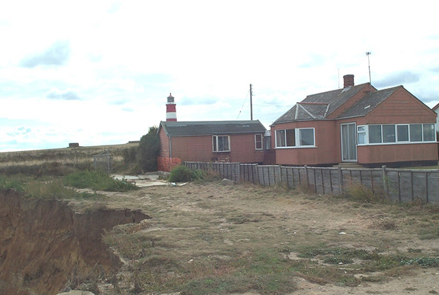
Happisburgh, on Norfolk’s North Sea coast, is a village with a population of 1400 people in about 600 houses. The village contains a notable stone church dating from the 14th century, an impressive manor house, listed buildings and a famous red and white striped lighthouse.
Although now a coastal village, Happisburgh was once some distance from the sea, parted from the coast by the parish of Whimpwell, long since eroded away. Historic records indicate that over 250 m of land were lost between 1600 and 1850.
More recently the village was affected by the tragic floods of 1953 that claimed the lives of 76 Norfolk residents.
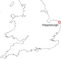

Happisburgh, Norfolk location map. BGS © UKRI.
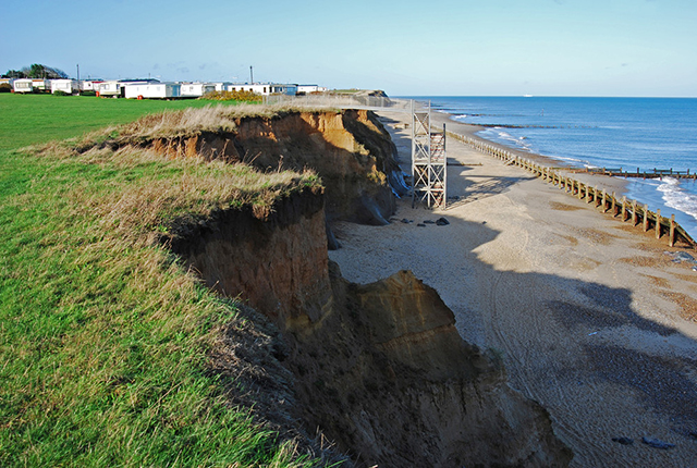
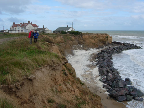
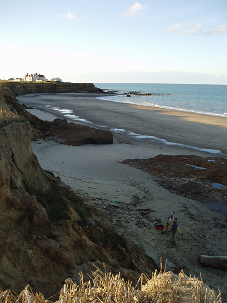
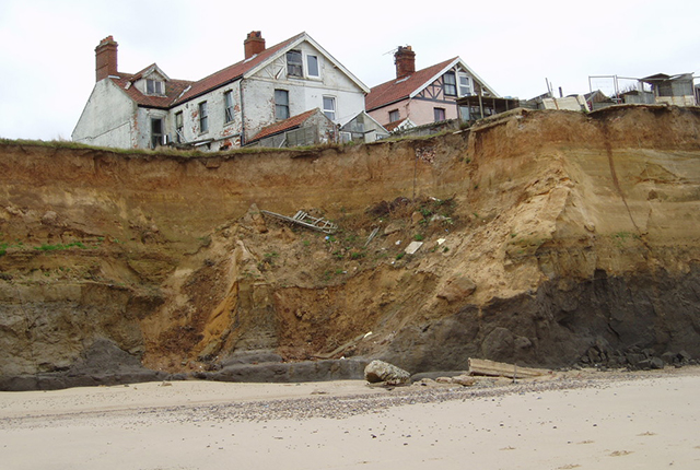
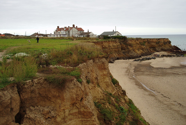
Coastal defences built at Happisburgh have slowed down the rate of retreat. However, large sections are now in disrepair. Sea-level rise and climate change, including increased storminess, may also increase the rate of erosion. Agriculture and tourism contribute significantly to the economy of the village and surrounding hinterland and this is threatened by the receding cliff line that, prior to the construction of a rock embankment at the northern end of the survey site, had claimed at least one property per year plus significant quantities of agricultural land.
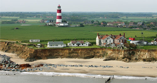
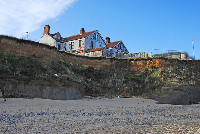
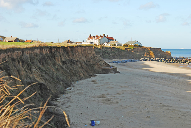
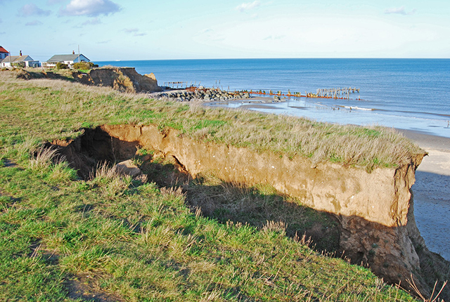
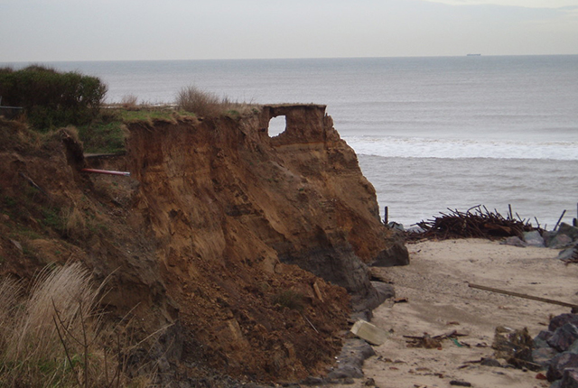
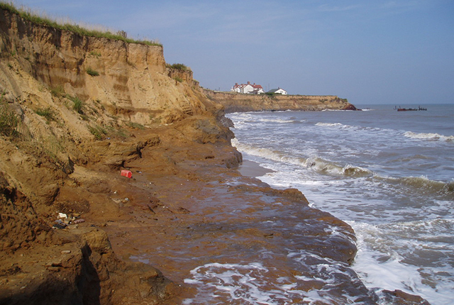
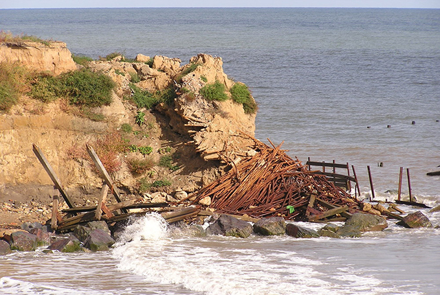
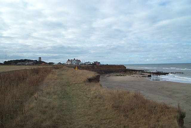
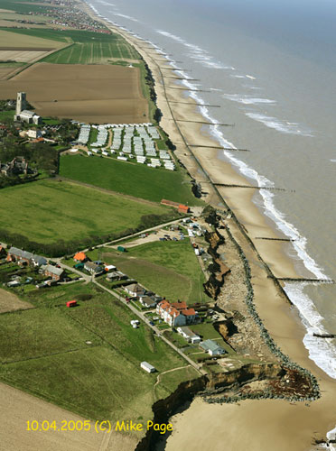
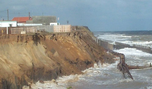
The eroding coast at Happisburgh in Norfolk. © Mike Page.
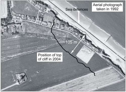
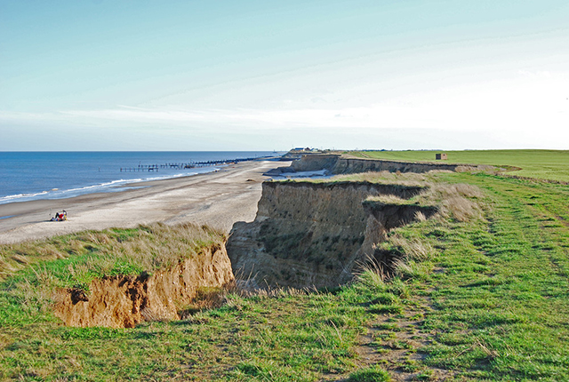
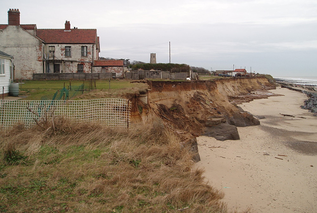
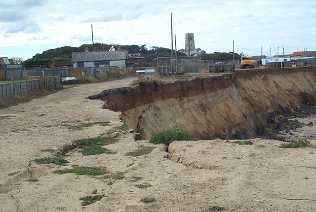
Cliff-top position in 2004. This had retreated a further 20 m in 2007. 1992 aerial photograph © Environment Agency, reproduced with kind permission of the Shoreline Management Group (Anglian Region).
Detailed geology
The cliffs at Happisburgh range in height from 6 to 10 m and are composed of a layer-cake sequence of several glacial tills, separated by beds of stratified silt, clay and sand (Hart, 1987; Lunkka, 1988; Hart, 1999; Lee, 2003). The basal unit within the stratigraphic succession at Happisburgh is the How Hill Member of the Wroxham Crag Formation. These deposits are typically buried beneath modern beach material but are periodically exposed following storms (Figure 3). They consist of stratified brown sands and clays with occasional quartzose-rich gravel seams that are interpreted as intertidal/shallow marine in origin.
Unconformably overlying these marine deposits are a series of glacial lithologies deposited during several advances of glacier ice into the region during the middle Pleistocene (about 780 to 430 ka BP) (Lee et al., 2002; Lee et al., 2004). The survey site has a tripartite geological succession.
The Happisburgh Till Member crops out at the base of the cliffs and its base is frequently obscured by modern beach material: it has a maximum thickness of 3 m. The Happisburgh Till Member is a dark grey, highly consolidated till with a matrix composed of a largely massive clayey sand with rare (less than one per cent) pebbles of local and far-travelled material.
The upper surface of the till undulates and comprises a series of ridges and troughs upon which the overlying Ostend Clay member crops out. This unit is between 2.3 and 3.4 m thick and consists of thinly laminated light grey silts and dark grey clays.
In turn, these beds are overlain by 2 to 4 m, of weak, stratified sand (Happisburgh Sand Member) with occasional silty clay horizons.

The geology of the cliffs at Happisburgh. BGS © UKRI.
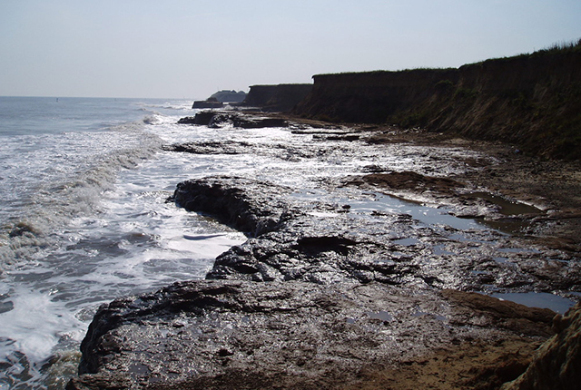
Coastal erosion
It is likely that the Norfolk cliffs have been eroding at the present rate for about the last 5000 years, when sea level rose to within a metre or two of its present position (Clayton, 1989). Therefore, the future predictions of sea-level rise and storm frequency due to climate change are likely to have a profound impact on coastal erosion and serious consequences for the effectiveness of coastal protection and sea defence schemes in East Anglia in the near future (Thomalla and Vincent, 2003).
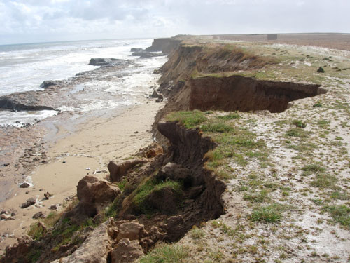
Rapid erosion of the cliffs at Happisburgh means that we can observe processes that, for other sites, may normally take thousands of years. This means that we can look for patterns in the erosion at Happisburgh, which may help our understanding of sites elsewhere that are eroding more slowly.
Survey results
As part of a programme of work monitoring coastal erosion and landsliding at several sites around the coast of Great Britain, we surveyed the cliffs adjacent to the village of Happisburgh in Norfolk with LiDAR.
The resulting computer model enables volume calculations and observations to be made as to the way in which the coast is eroding. The results from the survey provide data for models of coastal recession.
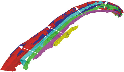
3D laser scan solid models for 2001 to 2006 at Happisburgh. 2001 is yellow ranging annually to dark blue (2006). BGS © UKRI.
From this survey, the following conceptual model has been proposed.
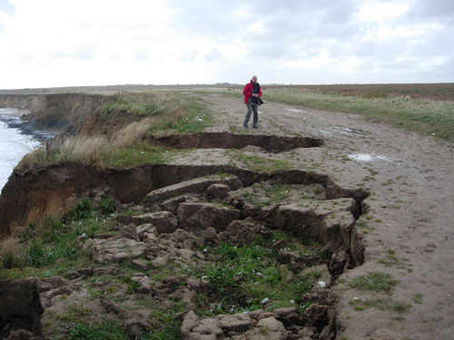
In winter, erosion caused by groundwater as seen in the gullying of the cliff face, coupled with increased seasonal storminess, causes small-scale, frequent, shallow landsliding in the Happisburgh Sand Member. The Happisburgh Sand Member is easily eroded and undercutting of the cliff toe reduces slope stability and cliff failure occurs. The beach surface is low and scouring of the upper surface of the till extends the till platform.
In summer, the beach surface is higher and covers the ‘winter platform’. Wave attack is the dominant form of erosion accompanied by landsliding in the Happisburgh Sands.
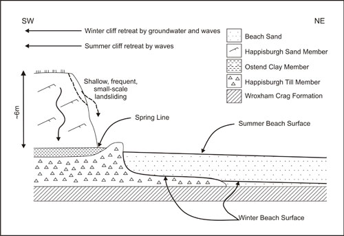
Cross-section at Happisburgh, showing cliff and platform stratigraphy. BGS © UKRI.
The cliff surface profiles show that the erosion process is non-uniform, involving the cyclic formation of a series of embayments that continually enlarge. This could imply landsliding processes involving block falls, mudflows and running sand.
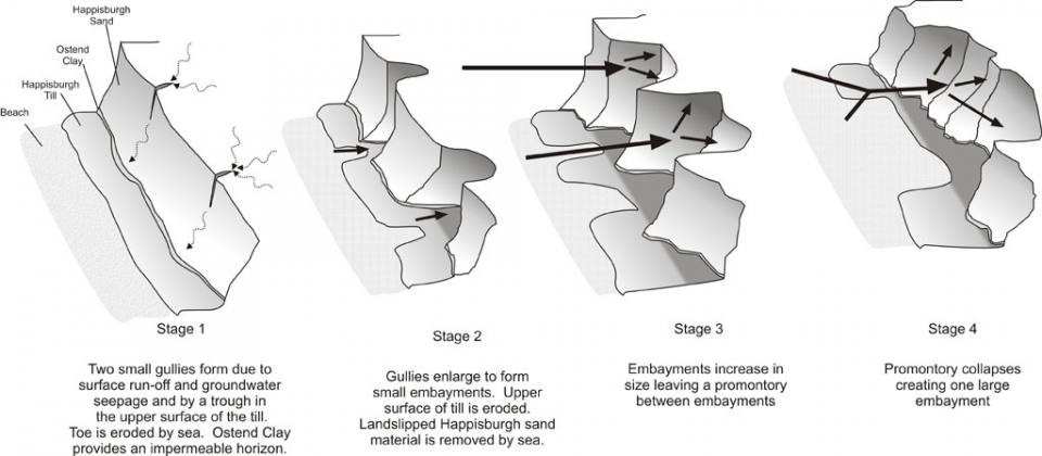
Process model for embayment formation at Happisburgh. BGS © UKRI.
Publications
Poulton, C V L. 2004. Disappearing coasts. Planet Earth, Summer 2004, 26–27.
Poulton, C V L, Lee, J R, Jones, L D, Hobbs, P R N, and Hall, M. 2006. Preliminary investigation into monitoring coastal erosion using terrestrial laser scanning: case study at Happisburgh, Norfolk, UK. Bulletin of the Geological Society of Norfolk, Vol. 56, 45 – 65.
Hobbs, P R N, Pennington, C V L, Pearson, S G, Jones, L D, Foster, C, Lee, J R, and Gibson, A. 2008. Slope Dynamics Project Report: Norfolk Coast (2000 – 2006). British Geological Survey Open Report OR/08/018. (Nottingham, UK: British Geological Survey.)
Gallery
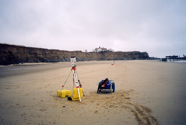
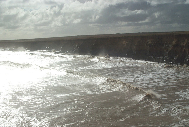
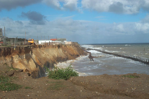
Happisburgh, November 2009. BGS © UKRI.
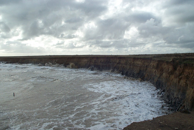
Happisburgh, November 2009. BGS © UKRI.
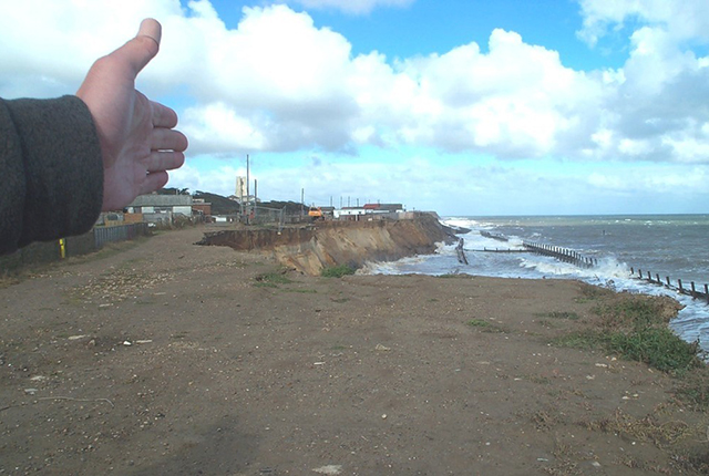
Happisburgh, November 2009. BGS © UKRI.
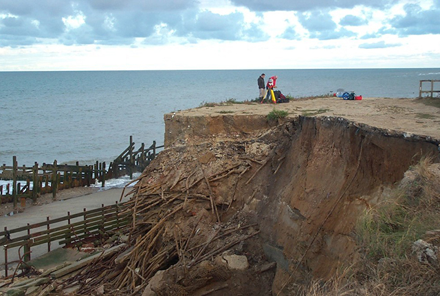
Happisburgh, November 2009. BGS © UKRI.
Happisburgh, November 2009. BGS © UKRI.
Happisburgh, November 2009. BGS © UKRI.
Happisburgh, November 2009. BGS © UKRI.
Happisburgh, 2007. BGS © UKRI.
Happisburgh, 2007. BGS © UKRI.
Happisburgh, 2007. BGS © UKRI.
Happisburgh, 2007. BGS © UKRI.
Happisburgh, 2007. BGS © UKRI.
Happisburgh, 2005. BGS © UKRI.
Happisburgh, 2005. BGS © UKRI.
Happisburgh, 2005. BGS © UKRI.
Happisburgh, 2005. BGS © UKRI.
Happisburgh, 2005. BGS © UKRI.
Happisburgh, 2004. BGS © UKRI.
Happisburgh, 2004. BGS © UKRI.
Happisburgh, 2004. BGS © UKRI.
Happisburgh, 2003. BGS © UKRI.
Happisburgh, 2003. BGS © UKRI.
Happisburgh, 2003. BGS © UKRI.
Happisburgh, 2003. BGS © UKRI.
Happisburgh, 2002. BGS © UKRI.
Happisburgh, 2002. BGS © UKRI.
Happisburgh, 2002. BGS © UKRI.
Happisburgh, 2002. BGS © UKRI.
Happisburgh, 2002. BGS © UKRI.
Happisburgh, 2002. BGS © UKRI.
Happisburgh, 2002. BGS © UKRI.
Happisburgh, 2002. BGS © UKRI.
Happisburgh, 2002. BGS © UKRI.
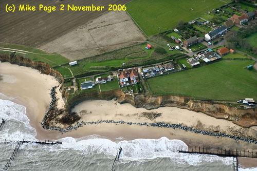
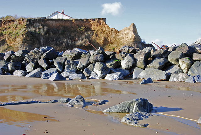
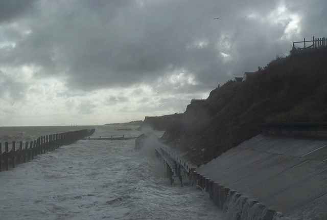
Happisburgh rock bund, 2006. © Mike Page.
Happisburgh rock bund, 2006. © Mike Page.
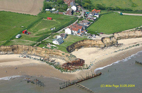
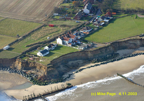
Happisburgh rock bund, 2004. © Mike Page.
Happisburgh rock bund, 2003. © Mike Page.
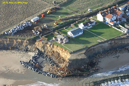
Happisburgh rock bund, 2002. © Mike Page.
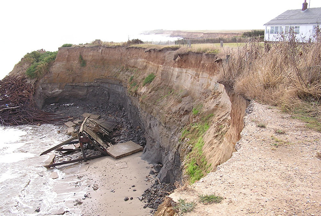
Landsliding due to toe removal at Happisburgh. BGS © UKRI.
You may also be interested in

Landslide case studies
The landslides team at the BGS has studied numerous landslides. This work informs our geological maps, memoirs and sheet explanations and provides data for our National Landslide Database, which underpins much of our research.

Understanding landslides
What is a landslide? Why do landslides happen? How to classify a landslide. Landslides in the UK and around the world.

How to classify a landslide
Landslides are classified by their type of movement. The four main types of movement are falls, topples, slides and flows.

Landslides in the UK and around the world
Landslides in the UK, around the world and under the sea.