As part of our ongoing programme of application upgrades and redevelopment, the Geology of Britain map viewer was retired on 1 August 2022.
If you are looking for an interactive geological map of Great Britain then you may be interested in one of our newer online map viewers listed below:
- BGS Geology Viewer is a lightweight viewer designed to provide geology enthusiasts and the general public with bedrock and superficial geology maps of Great Britain
- BGS GeoIndex, which is recommended for professional users and provides access to a wide range of data, including both borehole scans, fault information and interactive 3D models
For more information about the retirement of the Geology of Britain viewer please see our FAQ section below
Geology of Britain update FAQs
The Geology of Britain map viewer was retired on 1 August 2022 and is no longer available. This includes both the classic 2D Geology of Britain and the 3D version.
Since 2009, BGS has maintained three core map viewer applications:
- Geology of Britain (classic and 3D versions): a web viewer aimed at the general public
- iGeology: a native mobile app aimed at the general public
- GeoIndex: a web viewer aimed at GeoScience professionals.
In the years since their launch, there have been a number of advancements in both browser and mobile technology. We believe that now is the correct time to consolidate some of these services, and our resources, into a new bespoke map viewer that provides greater accessibility and is available to a wider audience. BGS made the decision to retire both iGeology and Geology of Britain, replacing them with the BGS Geology Viewer, a lightweight web-based application aimed at the public for general use, and the BGS GeoIndex, a premium map viewer service for professional use.
BGS host a number of mobile optimised map viewers that offer many of the same features and data as was available in the Geology of Britain viewer.
The BGS Geology Viewer is a free-to-use, lightweight viewer, offering access to bedrock and superficial deposit data across most modern browser-enabled devices.
The BGS GeoIndex is a web tool for professional users who need to access BGS data as part of their business requirements, including borehole records, fault information, and interactive 3D models.
3D cross section data is available via our UK3D dataset on the BGS website.
Interactive 3D models are also available on the BGS GeoIndex.
- Modern instrument recorded earthquakes can be viewed on the BGS GeoIndex application
- Full information and data can be found in the BGS Seismology webpages.
- Modern instrument recorded earthquakes are available as a Web Map Service WMS (Boreholes theme) and from ESRI’s Living Atlas
Our borehole data is available through a number of BGS sources:
- Borehole data can be found in the BGS GeoIndex application.
- Full borehole information and data downloads are available on the BGS website
- Borehole data is available as a web map service WMS (Hazards theme) and through ESRI’s Living Atlas
Who can I contact about this change?
If you have any comments or questions about this change that is not covered by this page, please contact the BGS Enquiries team.
What was the Geology of Britain viewer?
The Geology of Britain viewer was a simple tool, aimed at the general public, which allowed users to explore the geology of Great Britain.
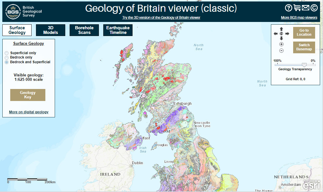

Geology of Britain map viewer. BGS © UKRI
Terms of use
These data are delivered under the terms of the Open Government Licence, subject to the following acknowledgement accompanying the reproduced BGS materials: “Contains British Geological Survey materials © UKRI [year]”. Contact us if you create something new and innovative that could benefit others.
We encourage users to use OpenGeoscience material with their own data.
The BGS provides no warranty as to the quality, accuracy or completeness of this free map data or the medium on which it is supplied. This includes any warranty as to the continued provision of material or that the material taken from this site is compatible with your computer system and/or any other data with which the material is to be used.
You may also be interested in
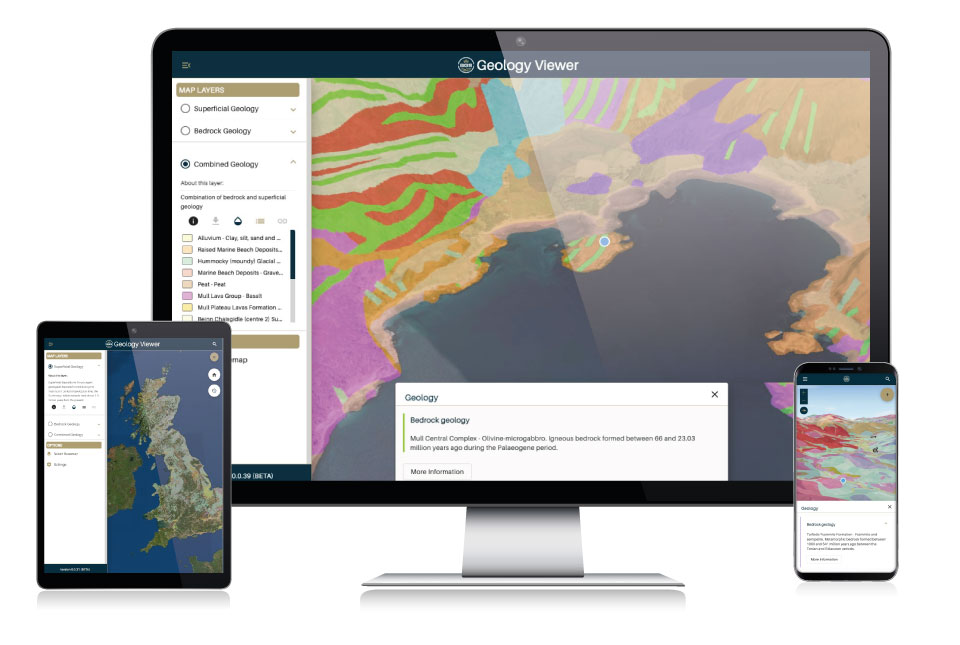
BGS Geology Viewer
The BGS Geology Viewer has been designed to provide geology enthusiasts and the general public with bedrock and superficial geology maps of Great Britain.
GeoIndex (onshore)
Search BGS datasets using GeoIndex, a map-based index of a wealth of information that we have collected or have obtained from other sources.