Relative topics
55 results for "digital data"

Map of BGS BritPits showing the distribution of worked mineral commodities across the country
BGS’s data scientists have generated a summary map of the most commonly extracted mineral commodities by local authority area, demonstrating the diverse nature of British mineral resources.

Funding secured to help mitigate ground risk in UK construction sector
The BGS Common Ground project has been awarded new funding to help unlock the value of ground investigation data.

New geological maps of the Yorkshire Wolds to better inform groundwater management and policy decisions
The new mapping provides crucial data on localised geological issues that may assist in protecting water supplies.

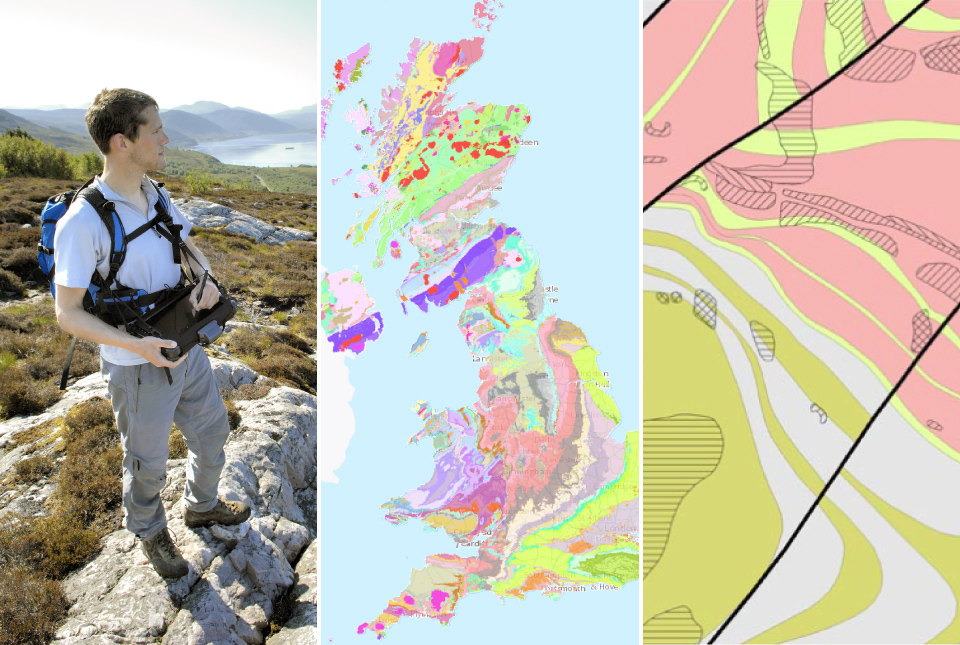
Latest BGS Geology 50K mapping data launched
Some of our most widely used maps have received a major update, including the 1:50 000-scale map series that now includes enhanced coverage of Great Britain.

World Cities Day: the geological story of our cities
Understanding the rocks that underlie our towns and cities, the risks they can present and how they influence urban planning and redevelopment.

New BGS GeoIndex viewer released for user testing
The premium map-viewing application has been given a major upgrade and made available as a beta release.

New seabed sediment maps reveal what lies beneath the waves
Marine ecosystem science and offshore infrastructure will be boosted by a new dataset showing sediment composition across the UK continental shelf.
BGS digital geology maps: we want your feedback
BGS is asking for user feedback on its digital geological map datasets to improve data content and delivery.