Summary
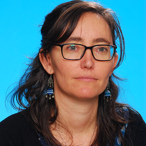
Marieta Garcia-Bajo’s biography
- 2014 – 2017: National Geological Model defining the rockhead surface.
- 2014 – 2017: Anthropocene project leader: aiming to push BGS into in a new way of mapping by trying to capture the human geological layer, a layer that identifies where human activity may have moderated the land surface/environment.
- 2014 – 2017: Domesday project leader: investigating potential data linkages and analyses for combining geological, environmental and demographic data to aid the analysis of natural capital and geology
- 2014 – 2014: 3D modelling of Aquifers and shales: a set of national scale maps showing the spatial relationships between Principal Aquifers and major shale units in England and Wales.
- 2010 – 2014: Peat: linking ecosystem services and geology.
- 2010 – 2011: Pluvial flooding project leader: using lidar data to model urban pluvial flooding.
- 2006 – 2008: Geological indicators of flooding, GIF Project leader and co-author.
- 2004 – 2008: Superficial thickness models project leader and Author.
- 2001 – 2004: GIS and 3D modeller, BGS
- 1999 – 2001: Assistant Geologist ASO,BGS
- 1998 – 1999: Leonardo Grant, Assistant Geologist at BGS
- 1997 – 1998: Mining exploration Geologist, Andean Silver Ltd. Bolivia
- 1995 – 1996: Erasmus program. Geology Department, University College Galway, Ireland
- 1992 – 1997: 5-year degree Geology, Structural and mining geology. University of Oviedo.
Research interests
- The Anthropocene
- Defining the Rockhead surface and the Superficial Deposits thickness
- Natural capital and its interaction with geology
- Surface water flooding, Pluvial flooding
- River Flooding
Current projects and collaboration
- The anthropocene project push BGS into in a new way of mapping by trying to depict the anthropocene. To capture a layer that identifies where human activity may have moderated the land surface/environment.
- Collaboration with the Health and Safety Laboratories, HSL investigating potential data linkages and analyses for combining geological, environmental and demographic data.
- NGM national Rockhead surface model
Key papers
Lawley, R S, Garcia-Bajo, M, Lawley, R S, Walsby, J C, and Harrison, M. 2009. British Geological Survey. Natural Environment Research Council. National superficial deposit thickness model (version 5): a user guide: British Geological Survey report OR/09/049 – Barcode Shelfmark Location.
Garcia-Bajo, M, and Walsby, J C. 2008. Exploiting geoscience collections: from paper collections to 3D models [abstract]: In: Exploiting Geoscience Collections: 12th and 13th May 2008, Burlington House, Piccadilly, London: abstract book / Exploiting Geoscience Collections (London) (2008). [s.l.]: [s.n.], 2008. p 4–5
Garcia-Bajo, M, and Booth, K A. Geological Indicators of Flooding Version 5, Methodology Review Information Products Programme Internal Report IR/09/010.
Colman, T B, Garcia-Bajo, M, Hargreaves, R L, Mankelow, J M, Nice, M, and Talbot, J C. 2007. British Geological Survey. Direccao Nacional de Geologia. Mozambique Documentation Centre and Mineral Information System Project: Final Report: British Geological Survey report CR/07/076.
Hough, E, Terrington, R L, and Garcia-Bajo, M. 2006. British Geological Survey. A 3D model of the Preesall Halite: a review of the modelling process: British Geological Survey report CR/06/087. Barcode Shelfmark Location.
Coats, J S, Garcia-Bajo, M, Sassoon, M, and Klinck, B A. 2005. British Geological Survey. Environmental management and information system for the Ministry of Mineral Resources and Energy, Mozambique: British Geological Survey report CR/05/058.
Evans, D J, Hough, E, Crofts, R G, Terrington, R L, Williams, G A, Garcia-Bajo, M, Musson, R M W, Royles, C P, Robson, C, Robins, N S, and Feigl, A. 2005. British Geological Survey. IMC. Mott MacDonald. The geology of the Preesall Saltfield area: British Geological Survey report CR/05/183N.
Garcia-Bajo, M, Lawley, R S, Walsby, J C, and Turner, P. 2004. British Geological Survey. Generation of superficial deposits-thickness maps and rockhead elevation contours for England, Scotland and Wales: GeoHazards project: British Geological Survey report IR/04/082R – Barcode Shelfmark Location.
Bridge, D M, Humpage, A J, Sheppard, T H, Lelliott, M, and Garcia-Bajo, M. 2003. British Geological Survey. Lowland catchment research (LOCAR) geological framework study River Tern catchment, east Shropshire: British Geological Survey Report CR/02/183N.
Published outputs
Skills
- Spatial data analysis
- Geographical Information Systems
- Project Management
- Languages: Spanish (native), Portuguese (medium), French (basic)
- Communicating science to the public
- 3D geological modelling


