Datasets
These are our most popular and influential datasets. For a comprehensive list of all BGS data, please visit the BGS Metadata Catalogue
 Data Preview
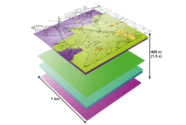
Data outputs from 3D geological framework models are available at three different scales for parts of the onshore area of Great Britain.
- Open / Premium
- Varied
- Great Britain (partial coverage)
Data Preview
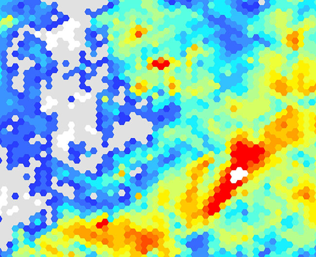
The BGS superficial thickness hex grid map shows the variation of the thickness of superficial deposits across Great Britain.
- Open
- 1 km hex grid (approx. 1:1 000 000)
- Great Britain
 Data Preview
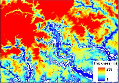
The superficial thickness model shows the depth of the bedrock surface below unconsolidated deposits
- Premium
- 1:50 000
- Great Britain
Data Preview
As a result of our annual price review BGS will apply, in most cases, a 3 percent increase* to our direct licence fees for our data products from 1st April 2026. This means that any direct licence issued or renewed on or after 1 April 2026 will reflect this increased price. Existing data licensees will not be affected until such time as their licence is next due for renewal, after 1 April 2026. BGS undertakes annual price reviews and will communicate any future licence fee changes (from 2027) as appropriate.
If you have any queries regarding this matter, please contact the IPR digital team (iprdigital@bgs.ac.uk).
* Due to the specific pricing of individual datasets please note not all price changes will equate exactly to 3%.