Latest

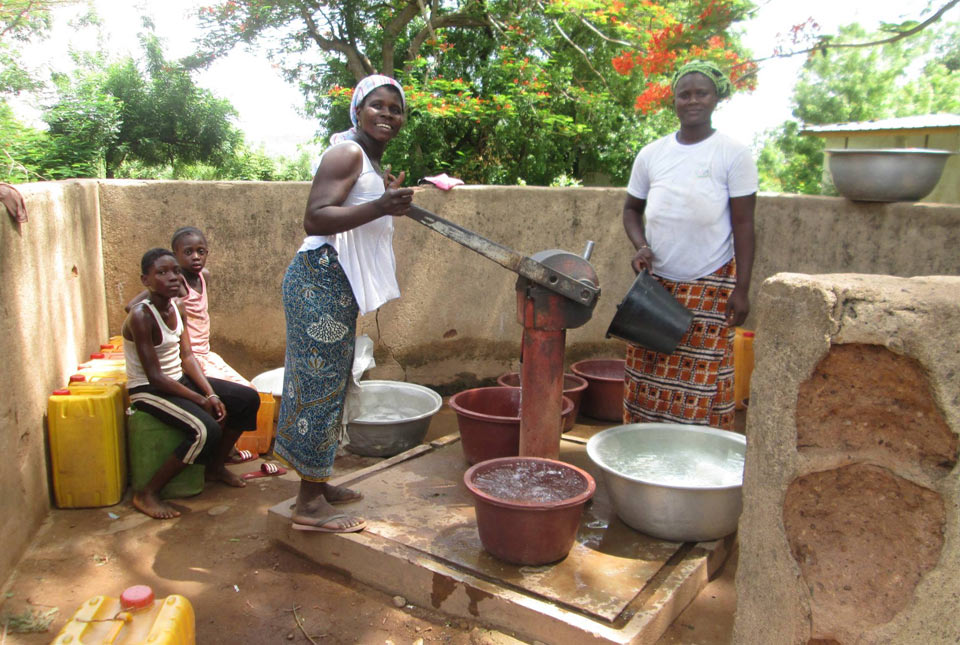
New research could help provide a more reliable water supply for millions in rural Africa
24/03/2026
A new BGS-led study has revealed crucial insights into the longstanding challenges affecting the reliability and performance of rural water supply infrastructure in sub-Saharan Africa.

Call for new members and Chair to join the NERC facilities steering committees
25/02/2026
New members are needed to join the committees over the next four years.


PhD adventures in Copenhagen, Denmark: revealing past recovery processes of tropical forest systems through ancient environmental DNA
12/03/2026
PhD student Chris Bengt visited the University of Copenhagen to carry out very delicate extraction of aeDNA from lake-sediment cores, in the hopes of unlocking the secrets of past volcanic eruptions.
Explore more news
Browse all news and events by category
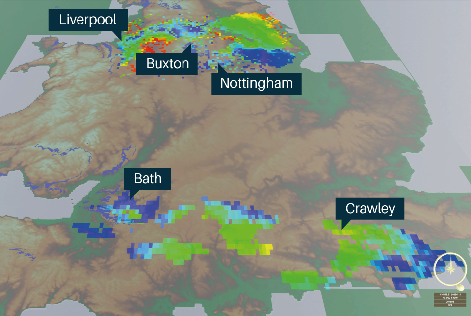
Scientists discover regions of the UK with greatest potential to use heat from deep thermal waters
30/03/2023
BGS geologists have mapped the UK’s potential to use heat from thermal groundwater deep beneath central and southern Britain.
BGS laboratories become first in UKRI to receive gold LEAF accreditation
28/03/2023
BGS achieved gold certification in the Laboratory Efficiency Assessment Framework (LEAF) accreditation in March 2023.
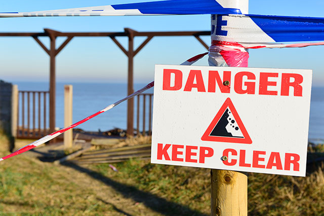
Hemsby coastal erosion: the scale of the transformational challenge around the coastlines of England and Wales
24/03/2023
The recent closure of Hemsby beach in Norfolk provides key information on the transformational challenge of coasts around England and evidence of historical change along the coastlines of England and Wales.
Six ways we’re improving recycling at BGS Keyworth
24/03/2023
Sustainability at the BGS site in Keyworth, Nottingham, is being improved by recycling, managing our waste, making our labs more efficient and more...

World Water Day 2023: groundwater photo stories
22/03/2023
A showcase of groundwater use from around the world highlighting how developing groundwater has benefited the lives of many people.
A tale of two groundwaters
21/03/2023
Why the United Nations 2023 Water Conference needs to know more about groundwater.
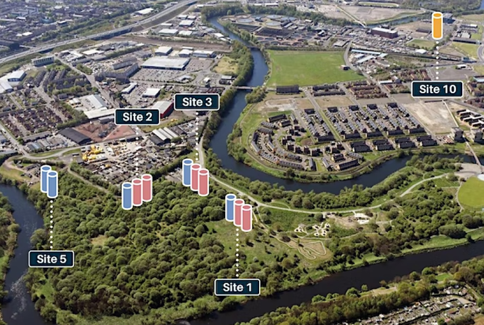
UK Geoenergy Observatories — open events in Glasgow
Event from 26/04/2023 to 27/04/2023
You are invited to visit the UK Geoenergy Observatory in Glasgow, to find out more about what the facility can offer you as a potential user.
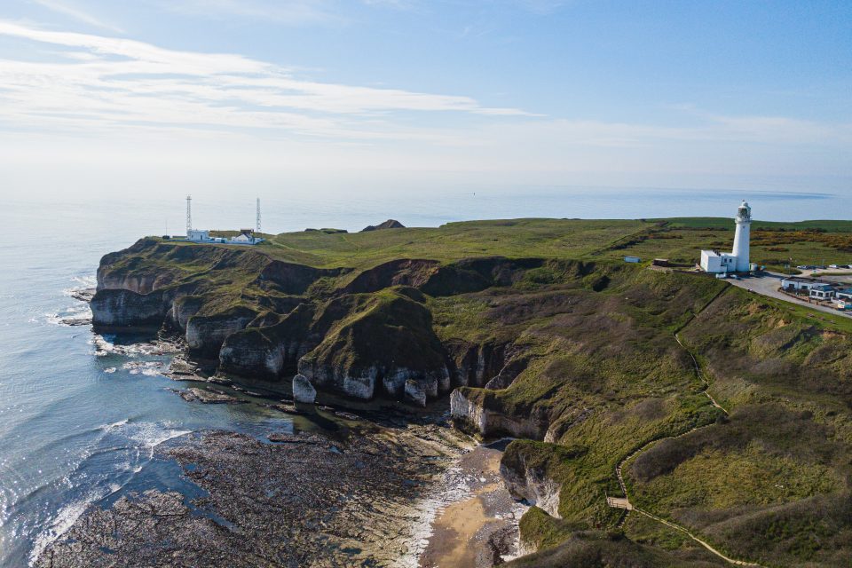
New seabed geology maps for offshore Yorkshire
14/03/2023
Offshore Yorkshire is the latest map to be released in BGS's series of fine-scale digital seabed maps.