Dick Merriman is a former geologist at BGS geologist and retired from service in 2004. In 1971, he was chosen as part of a team to land on Rockall, a small, uninhabited islet and Site of Special Scientific Interest (SSSI). Today, on the fiftieth anniversary of the expedition, Dick recounts his experience.
It was a dream start to a career in geology. A year after graduating I was selected by my employer, the British Geological Survey (then the Institute of Geological Sciences), to join an expedition to land on Rockall in the summer of 1971. The lone rock, which is just over 70 feet high, is the only subaerial part of a submerged microcontinent, the Rockall Plateau, which underlies the north-east Atlantic Ocean. The purpose of the expedition was to attach a flashing navigation beacon to the rock, which is surrounded by several dangerous reefs.
With fellow geologist Dr Jan Hawkes, I was part of a team that included army engineers, two Royal Navy helicopters and Royal Marine climbing experts, all on board the RFA Engadine. Jan and I had both been on a rock climbing course with the Marines and were trained to land from a helicopter.
My first sighting of Rockall was a complete surprise. At a distance it looked like a ship in full sail, but as we got closer I could see it was a pointed dome, covered in white guano. The climbing experts were the first to land and attach safety ropes. We geologists were on the next helicopter on 9 June 1971 and joined army engineers making a reconnaissance of the main landing place, Hall’s Ledge.
For the next 10 days Jan and I were on the rock for a few hours each day making a detailed map of variations in the unusual aegirine-riebeckite granite and taking samples for geochemical, petrological and age-dating analyses. We also made magnetic and radiometric measurements and, in 1972, I drilled small rock cores for paleomagnetic studies.
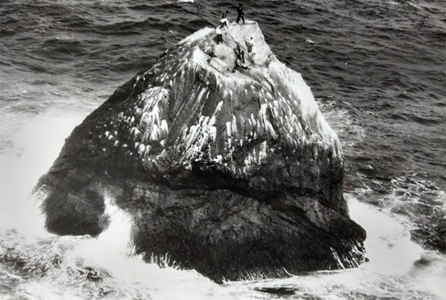

Expedition members scaling Rockall. UK Ministry of Defence © Crown copyright (Photo taken during 1971-72) Released: Open Government Licence (nationalarchives.gov.uk).
Age dating of Rockall and its surrounding reefs produced some unexpected results. Rockall is around 53 million years old and was probably part of a Tertiary volcano, similar to those found in the Inner Hebrides and the Atlantic island of St Kilda.
Helen’s Reef is about 3.3 km east of Rockall and named after the brigantine Helen that struck the reef in 1824 with the loss of 16 lives. Divers from the Institute of Oceanographic Sciences sampled the reef on the 1972 expedition. To our great surprise, age dating showed that Helen’s Reef was a basaltic rock formed in the late Cretaceous around 81 million years ago, substantially earlier than Rockall. These ages were the first to indicate that the crustal rifting that formed the North Atlantic Ocean began earlier than was previously suspected and led to the detachment of the Rockall Plateau from north-west Europe.
Rockall had one more hidden surprise for the geologists. Some two years after the 1971 landing I was using X-ray diffraction (XRD) techniques to examine mineral residues separated from the granite. One unusual XRD pattern kept appearing but I could not match it with any naturally occurring minerals. My colleagues, who were experts in crystallography and electron microscope techniques, got to work and discovered it was a new mineral, a barium-zirconium-silicate. We named it bazirite and 50 years on it has yet to be found in any rocks other than the Rockall granite.
For more information about the 1971 expedition, please visit the publication record details for Expeditions to Rockall 1971–72.
Latest blogs

Collecting beach pebbles: fun hobby but is it legal?
14/07/2026
The UK coastline will be inundated with keen holidaymakers this summer, many of whom will take a memento of their trip home in the shape of a pebble or two — but is it legal?

Strengthening capacity through partnership: a critical minerals perspective
28/04/2026
BGS has been working in partnership with the Geological Survey Department of Zambia (GSD) to build national capacity, improve data accessibility and support long-term, sustainable development.

PhD adventures in Copenhagen, Denmark: revealing past recovery processes of tropical forest systems through ancient environmental DNA
12/03/2026
PhD student Chris Bengt visited the University of Copenhagen to carry out very delicate extraction of aeDNA from lake-sediment cores, in the hopes of unlocking the secrets of past volcanic eruptions.

MARC Conference 2025: highlighting the importance of conferences to PhD students
16/02/2026
BGS and University of Nottingham PhD student Paulina Baranowska shares her experience presenting her research on nuclear forensics at her first international conference.

Hole-y c*@p! How bat excrement is sculpting Borneo’s hidden caves
23/12/2025
BGS researchers have delved into Borneo’s underworld to learn more about how guano deposited by bats and cave-dwelling birds is shaping the subsurface.

How the geology on our doorstep can help inform offshore infrastructure design
19/11/2025
BGS is part of a new collaboration using onshore field work to contextualise offshore data and update baseline geological models which can inform the sustainable use of marine resources.

Fieldwork on Volcán de Fuego
13/10/2025
Understanding how one of the world’s most active volcanoes builds up material, and how they collapse to feed hot flows
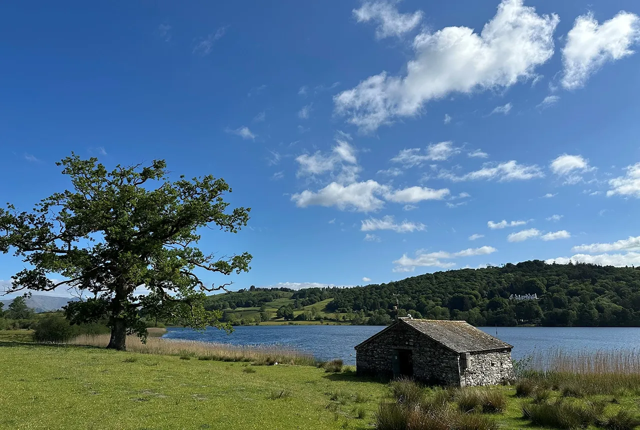
Esthwaite Water: applying novel approaches to understand lake-water nutrient pollution
19/09/2025
Andi Smith (BGS) and Savannah Worne (Loughborough University) embarked on fieldwork in the Lake District, applying a novel stable isotope method for tracing phosphorus sources.

Opening up the geosciences: making work experience more accessible
19/09/2025
BGS has been working with partners to make the geosciences more accessible to young people, including those from under-represented backgrounds.
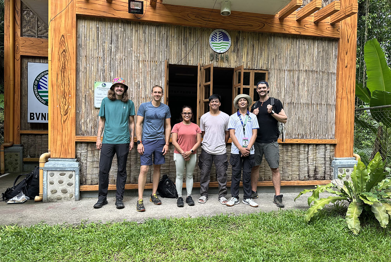
PhD adventures in the Philippines: coring around Lake Bulusan
05/09/2025
Chris Bengt recounts his two-week field trip to Bulusan Volcano Natural Park in the Philippines to collect lake sediment cores, fresh soil and water samples.
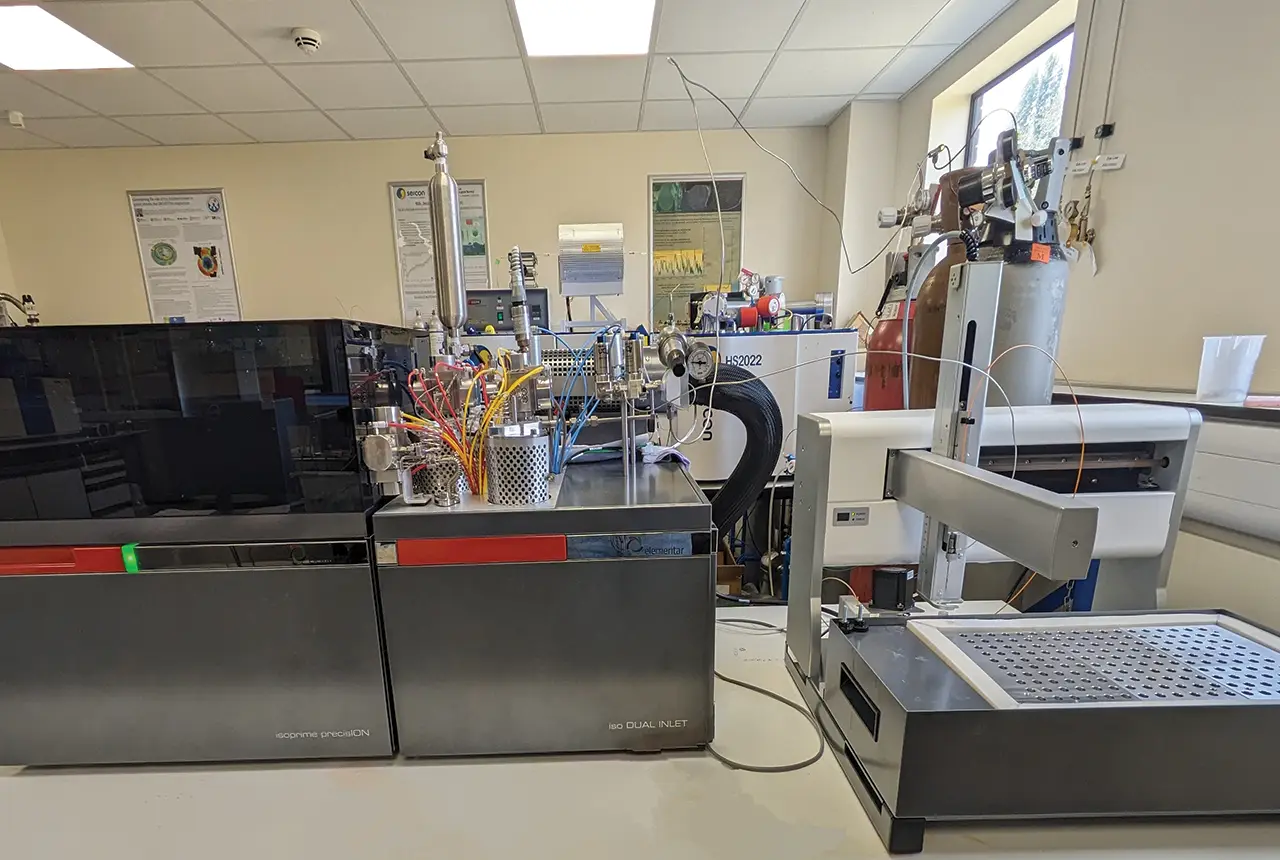
Gemini: a new stable isotope tool
21/08/2025
BGS’s Stable Isotope Facility has new mass spectrometer equipment for analysing carbon and oxygen isotopes from carbonates and water.
BGS hosts India for ‘deep dive’ on carbon capture and storage
30/07/2025
Some of India’s top scientists visited BGS to explore the UK’s carbon dioxide storage research potential.