BGS releases first in a series of new offshore maps of the UK seabed
BGS has released the first high-resolution, offshore map in a new series featuring the seabed around the UK.
06/04/2022 By BGS Press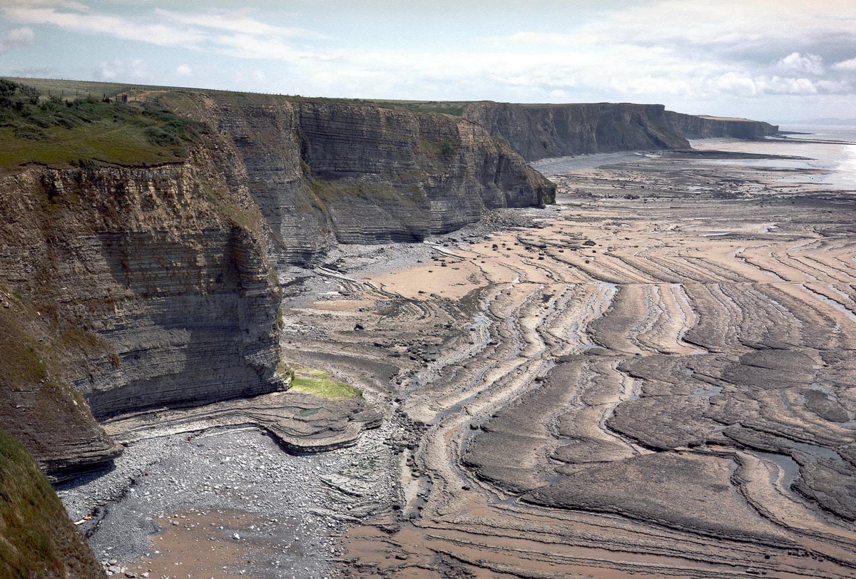

New combined bedrock, sediment, bedrock structure and seabed geomorphology maps are available from BGS under the fine-scale maps section of the Offshore GeoIndex and are designed to be viewed at 1:10 000 scale or online as downloadable shapefiles.
Based primarily on data produced by UK Civil Hydrography Programme of the Maritime and Coastguard Agency and made available by the UK Hydrographic Office, they are of relevance to offshore developers who require a detailed understanding of the geology of the seabed. The maps include bathymetry data, backscatter imagery, grab samples and other existing datasets such as seismic, marine conservation zones, sediment texture sheets and existing 1:250 000-scale geological maps.
As the UK’s transition to renewable energy gathers pace, these maps will become increasingly valuable to industry and stakeholders with an interest in developing clean energy, from offshore wind to tidal streaming, and in carbon capture and storage.
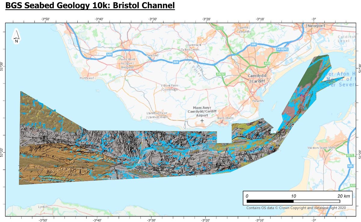
Extent of the new Bristol Channel map. Contains OS data © Crown Copyright and database right 2020. The derived bathymetric layer was produced from Maritime and Coastguard Agency (MCA) data © Crown copyright. Not to be used for navigational purposes.
The first area to be published this month features a central section of the Bristol Channel, from Swansea Bay to Newport, which is home to the second largest tidal range in the world. The high-energy environment of the channel has attracted much interest in recent years for the use of the seabed for tidal power schemes, including tidal power schemes that have the potential to produce electricity from wave energy.

Adopting renewable energy and technologies requires a deep understanding of the seabed and so developers have a growing need for access to bathymetric data, enabling more detailed observations of seabed geomorphology that are central to such evaluations.
As well as being of use to offshore developers, the release of our new maps will benefit all kinds of applications: marine spatial planning, technological research and development, fishery resource management, environmental impact studies and climate change models, providing evidence for policy and decision makers.
Prof Emrys Phillips, BGS Quaternary and Glacial Scientist.
While mapping the seabed has been a major challenge for marine geoscientists over the years, the development in acoustic technologies has allowed for the collection of more, and much better resolution, data in much less time.
BGS has plans to release a suite of high-resolution maps in the future, including offshore Anglesey, Yorkshire and East Anglia, and further areas will be added to BGS GeoIndex Offshore as its marine mapping programme progresses.
This is a great example of using the excellent high quality freely available data collected under the CHP for a different reason from its original purpose and gaining extra geological insights and value from the data.
Mary Mowat, BGS Marine Data Manager
Relative topics
Related news

Isotopes and science: my student placement at BGS
08/04/2026
Industrial placements at BGS for undergraduate students give real-life experience of working in laboratories and learning different analytical techniques.

Updated geological assessment of the Southern North Sea set to underpin future offshore infrastructure development
25/03/2026
The first regional assessment for 30 years will support offshore marine and subsurface planning for the UK’s low-carbon energy infrastructure, including the 2030 target of 45 to 50 GW generated through offshore wind.

New research could help provide a more reliable water supply for millions in rural Africa
24/03/2026
A new BGS-led study has revealed crucial insights into the longstanding challenges affecting the reliability and performance of rural water supply infrastructure in sub-Saharan Africa.

Call for new members and Chair to join the NERC facilities steering committees
25/02/2026
New members are needed to join the committees over the next four years.

Your views wanted: developing a geothermal energy subsurface data portfolio
24/02/2026
BGS is aiming to support the growth of the sector by providing the best-available, location-specific geothermal and ground source heat information as an accessible product or service.

Map of BGS BritPits showing the distribution of worked mineral commodities across the country
18/02/2026
BGS’s data scientists have generated a summary map of the most commonly extracted mineral commodities by local authority area, demonstrating the diverse nature of British mineral resources.

Funding awarded to map the stocks and flows of technology metals in everyday electronic devices
12/02/2026
A new BGS project has been awarded Circular Electricals funding from Material Focus to investigate the use of technology metals in everyday electrical items.

New UK/Chile partnership prioritises sustainable practices around critical raw materials
09/02/2026
BGS and Chile’s Servicio Nacional de Geología y Minería have signed a bilateral scientific partnership to support research into critical raw materials and sustainable practices.

Extensive freshened water confirmed beneath the ocean floor off the coast of New England for the first time
09/02/2026
BGS is part of the international team that has discovered the first detailed evidence of long-suspected, hidden, freshwater aquifers.

Funding secured to help mitigate ground risk in UK construction sector
05/02/2026
The BGS Common Ground project has been awarded new funding to help unlock the value of ground investigation data.

Can sandstones under the North Sea unlock the UK’s carbon storage potential?
02/02/2026
For the UK to reach its ambitious target of storing 170 million tonnes of carbon dioxide per year by 2050, it will need to look beyond the current well-studied geographical areas.

Quaternary UK offshore data digitised for the first time
21/01/2026
The offshore wind industry will be boosted by the digitisation of a dataset showing the Quaternary geology at the seabed and the UK’s shallow subsurface.