The BGS aims to make available information about underground mining records, drawing together a range of mine plans from a variety of sources including the Health and Safety Executive mine abandonment plans, published mine plans and plans of mine workings. This is not a comprehensive catalogue, but represents the information currently available in our database for non-coal mine plans. (For details of coal workings contact The Mining Remediation Authority.)
Our collection of non-coal mine plans is ongoing and updates are carried out intermittently. Search our database to find out where records are held. A limited number of the plans have been spatially located and can be identified via a spatial or map-based search, which opens in a new window.
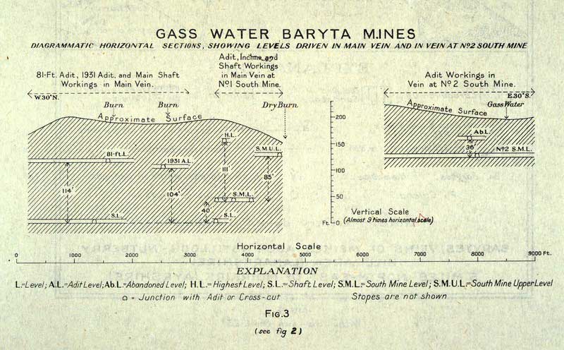
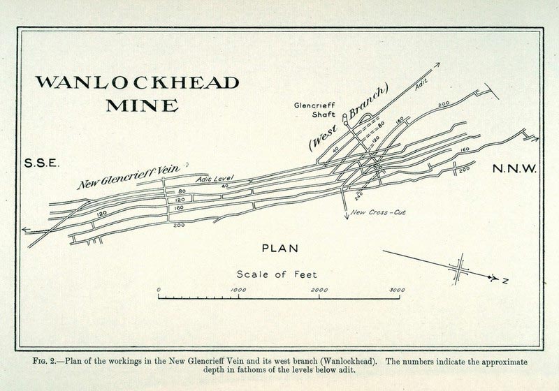
Historical mining plan of Gas Water baryte mine, near Cumnock, East Ayrshire. BGS © UKRI.
Background
Mining has occurred in Great Britain since approximately 2700 BCE. A diverse range of minerals has been extracted by underground mining, from industrial minerals such as limestone to precious metals like gold. Plans, sections and shaft information exist, recording many of these workings. However, with the exception of coal mining, there has been no coordinated effort to catalogue and create a national database of these records. A variety of collections, catalogues and indexes exist in disparate public and private hands but individually, these cover only parts of the total holding (thought to be in excess of 40 000 documents).
Maps and plans are prepared for a particular purpose and only represent a snapshot at a point in time. For instance, topographical maps such as those produced by the Ordnance Survey are intended to show surface features such as buildings, roads, field boundaries etc. as they stand at the time the survey was made and in as much or as little detail as the scale of the map will allow. Such maps often resort to the use of symbols to identify named features where it is not possible to accurately represent the feature by other means.
Legislation
Prior to 1840, there was no requirement for mining plans to be prepared and it was not until 1850 that the Inspection of Coal Mines Act 1850 required a coal mine owner to keep a plan at each mine.
In 1872, the Coal Mines Regulation Act and the Metalliferous Mines Regulation Act made the deposition of plans of abandoned mines with the Secretary of State a statutory requirement. Non-coal mines were not required to deposit plans if there had been less than 12 men employed below ground and this relaxation was perpetuated in all subsequent legislation until 1993. All that was required to be shown on these plans were the boundaries of the mine workings up to the time of abandonment. There was no requirement for orientation with the surface, depth of workings or section extracted information to be shown.
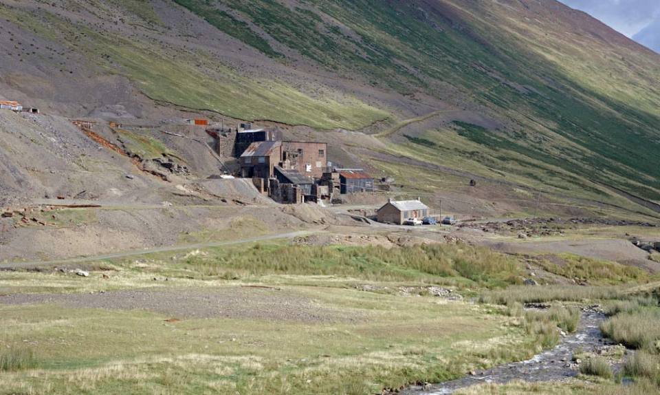
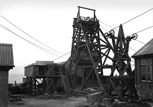
Force Crag Mine, Braithwaite, Cumbria. BGS © UKRI.
Gaps in our knowledge
It is unfortunate that many thousands of workings had been abandoned by the time this legislation was introduced and the knowledge and understanding of those unrecorded workings were, in many cases, lost forever. It is also worth noting that the earlier mine plans would have been produced using simple surveying equipment, which did not give the accuracy expected in mine plans of today.
Many records relating to mining, particularly that which occurred prior to 1872, are likely to be incomplete and unreliable. Users should always seek professional advice from a suitably qualified mining surveyor or engineer before relying on the information contained within the records.
Hazards
The voids caused by underground mining activity may pose a potential hazard to both life and assets, and the risk of ground movement can reduce property values. Mineral workings and associated spoil can frequently cause a pollution hazard.
Mining records can provide important cultural information on the distribution and past extraction of mineral resources and are a key source of information for geological surveying and scientific research. However, safety, the risk to health, the physical threat to property and the real or perceived impact on property values are the most compelling reasons for action to establish a coherent national database of non-coal mine plans.
The mining plans portal
The mining plans portal was established in 2002 as a result of a partnership between a group of public bodies including the Health and Safety Executive, the Mining Remediation Authority, the BGS, the National Archives, the Mineral Valuer (part of the Valuation Office) and the Camborne School of Mines, who agreed to work together to create a national database of non-coal mine plans. The consortium agreed the following:
- There should be a digital register (index or catalogue) of all known non-coal underground mine plans, sections and entrances, which should be made publicly available.
- It was neither practical nor desirable to physically transfer all non-coal underground mine plans and sections to one location, thus where plans are held locally they should remain so.
- The digital register should hold information on both formal abandonment plans and any other non-coal underground mine plans and sections.
Whilst this partnership no longer exists, BGS and the Mining Remediation Authority have continued to work together to make information about the extent of historic underground mining of non-coal minerals in Britain more accessible.
The website includes plans for Great Britain and, where available, the Isle of Man. The Geological Survey of Northern Ireland (GSNI) holds a comprehensive collection of Northern Irish mine plans accessible via the GSNI GeoIndex.
History of coal mining plans
| Year | Historical event |
|---|---|
| 1840 | The first Mining Records Office (MRO) was established by the Government for the voluntary registration and preservation of abandoned mine plans. The office was housed in the then newly established Museum of Practical Geology in London. A few plans, sections and even models were deposited but the vast majority chose not to deposit anything. |
| 1850 | The Select Committee on Accidents report led to the passing of the Inspection of Coal Mines Act in 1850 for Great Britain. The Act required a coal mine owner to keep a plan at each mine. This act was meant to be temporary and stay in force for only five years but was re-enacted in 1855. |
| 1872 | The Coal Mines Regulation Act and Metalliferous Mines Regulation Act made the deposition of plans of abandoned mines with the Secretary of State a statutory requirement. Both acts placed an obligation on mine owners to deposit their plans within a period of three months from the date of abandonment. Non-coal mines were not required to deposit plans if there had been less than 12 people employed below ground and this relaxation was perpetuated in all subsequent legislation until 1993.
All that was required to be shown on these plans were the boundaries of the mine workings up to the time of abandonment. There was no requirement for orientation with the surface, or depth or section information to be shown. Once deposited, no person except a mines inspector could view the plans for a period of 10 years. |
| 1883 | To establish a closer association between the MRO and the Inspectorate of Mines, the MRO was transferred from the Museum of Practical Geology to the Home Office. |
| 1886 | The first listing of plans deposited with the Home Office was published. The listing differentiated between open and closed plans depending on whether they had been held for 10 years. |
| Year | Historical event |
|---|---|
| 1923–1931 | There were two accidents, one in Stirlingshire in September 1923, resulting in the death of 40 workers, and one in Northumberland in March 1925, when 38 people were killed. Both accidents were as a consequence of an inrush of water from old workings. In July 1925 the Secretary for Mines made a widespread appeal for plans of old workings not covered by the statutory requirements or for the supply of information where it was not desired to give up the plans. The appeal was widely responded to and particulars of such plans were included in a new cataloguing system that was published in five volumes between 1928 and 1931.
The catalogue was based on the 1:10 560 Ordnance Survey county map series, with each three miles by two miles map area subdivided into a graticule of 96 squares with alphanumeric references. This cataloguing system has been maintained ever since. |
| 1939 | All the plans and records were transferred to Buxton from London and the MRO operated from there for the duration of the Second World War and for some time afterwards. |
| 1950 | A Memorandum of Agreement was made between the ministry and the recently formed National Coal Board (NCB). Under this agreement, coal plans were segregated from the plans of other minerals and transferred to the custodianship of the National Coal Board (NCB). The collection of coal plans was then further split into regional areas to allow the plans to be made more easily accessible.
Oil shale abandonment plans were transferred to Scottish Oils Ltd. The plans for ‘minerals other than coal and oil shale’ were then returned to London and stored at Thames House, Millbank. |
| Year | Historical event |
|---|---|
| 1960 | Scottish Oils Ltd. closed and oil shale plans were transferred to NCB Edinburgh. |
| 1973 | A national appeal for plans was made following the Lofthouse Colliery disaster. Non-coal plans for Cornwall were transferred to the Cornwall Record Office under a Memorandum of Agreement between the minister and Cornwall County Council. |
| 1975 | The Health and Safety Executive (HSE) was set up and took over the ministry’s role of arranging archiving of abandonment plans. |
| 1980 | Plans of mines other than coal and oil shale in Scotland were transferred to BGS Edinburgh. |
| 1984 | Remaining non-coal abandonment plans were transferred from London to HSE Bootle, Merseyside. |
| 1989 to 1993 | English and Welsh non-coal plans from Bootle were dispersed to county record offices. Those for Cumbria were temporarily held by BGS Edinburgh between 1991 and 2000. |
| 1992 to 1993 | The collections of coal and oil shale abandonment plans were re-united at British Coal’s Bretby site near Burton-on-Trent. They were inherited by the Coal Authority on privatisation of the coal industry in 1994 under a new Memorandum of Agreement with the HSE. |
| 1993 | The anomaly, perpetuated in legislation made down the years since 1872, whereby abandonment plans were not required from non-coal mines employing less than 12 people, was removed by the Management and Administration of Safety and Health in Mines Regulations. |
| 2001 | The collection of coal abandonment plans was transferred to the Coal Authority’s headquarters at Mansfield in Nottinghamshire. |
Non-coal mining plans database
Contact
There are plans in our database that are not shown or are poorly located on the map because we do not know their exact location in Great Britain. This means that we have plans that show up in the database search but not the map search.
Please help us improve the map search. If you have mine plans or related information that you are willing to allow us to add to our database, or if you wish to report errors, please contact us.
We also welcome information that allows us to provide more accurate information on unlocated or poorly located plans. If you have such information please contact us.
You may also be interested in
Scanned records
Open access to a number of our digital scan collections, including borehole log scans and published maps.
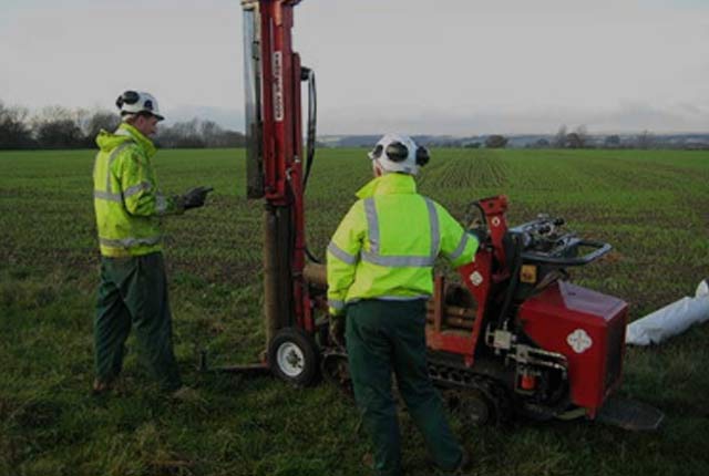
Borehole records
The BGS Borehole record viewer offers direct, online access to the National Geoscience Data Centre collection of onshore scanned boreholes, shafts and well records.


