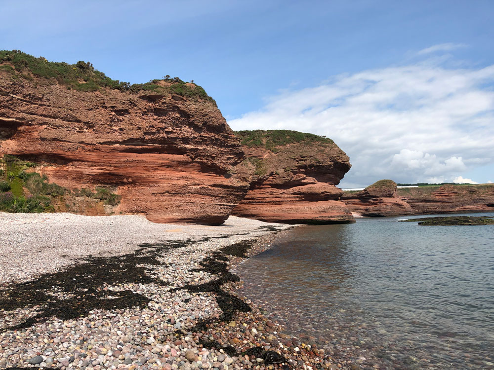
The seaside town of Arbroath lies on the east coast of Scotland, roughly 15 miles from Dundee. To the north of the town, at the end of the Victoria Park promenade, lie the striking red Seaton Cliffs showcasing Devonian red sandstone formed roughly 410–370 million years ago. A walkway stretches up the hillside to the cliff tops, where a coastal path offers breathtaking coastal views and access to the wildlife reserve. The walk stretches around three miles to the picturesque village of Auchmithie and is punctuated with several iconic landmarks, complete with authentic local names such as the Needle E’e arch, Dickmont’s Den and the Deil’s Heid stack.
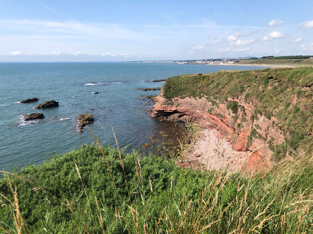

Looking back towards Whiting Ness, with the town of Arbroath in the distance. BGS © UKRI.
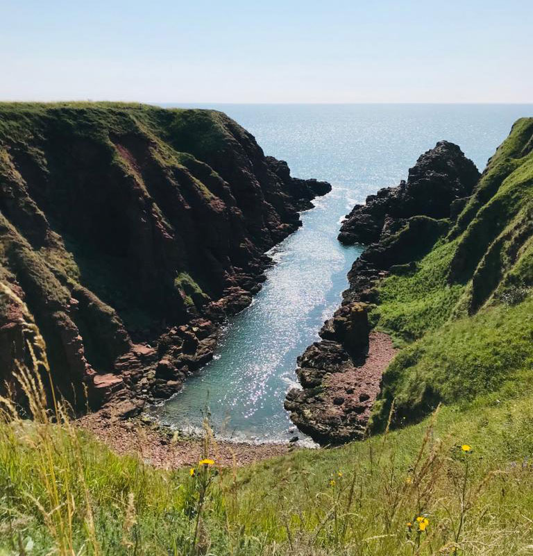
The views begin from the promenade, where the cliffs of Whiting Ness mark the start of the walk. Here you can see the red sandstones and conglomerates of the Stratheden Group (formerly known as Upper Old Red Sandstone) unconformably overlying the red sandstones of the Arbuthnott-Garvock Group (Lower Old Red Sandstone ) in the cliff at the back of the beach. Whiting Ness can be seen from the promenade before starting on the trail path. There are also access points to the rocky beach, and at low tide it is possible to take a short walk around the initial cliff at Whiting Ness.
If accessing the beach great care should be taken. Please stay well back from the foot of the cliffs and be aware of the incoming tide, as parts of the bay at Whiting Ness do get cut off.
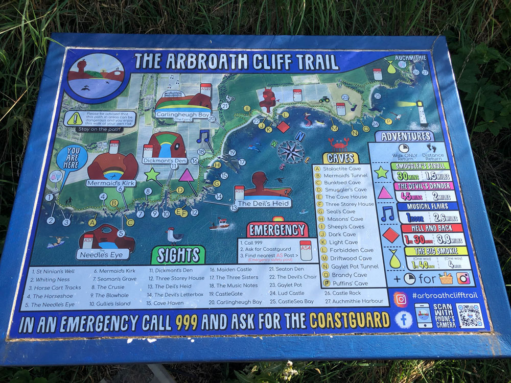
Arbroath Cliff Trail Map. A trail guide is also available to download via Angus Council. BGS © UKRI.
From the promenade, a footpath winds its way up onto the cliff tops to start the trail. In total, over 40 landmarks, consisting of caves, coves and bays are listed on the coastal trail map. The full six-mile round trip to Auchmithie can easily fill a full-day excursion, but as the features are spread along the length of the coastline a shorter trip is always worthwhile, with plenty to enjoy within the first mile alone.
Please proceed with caution as the length of the trail is lined with unstable and eroding cliff edges. It is vital that you stick to the designated footpath and follow all diversions.
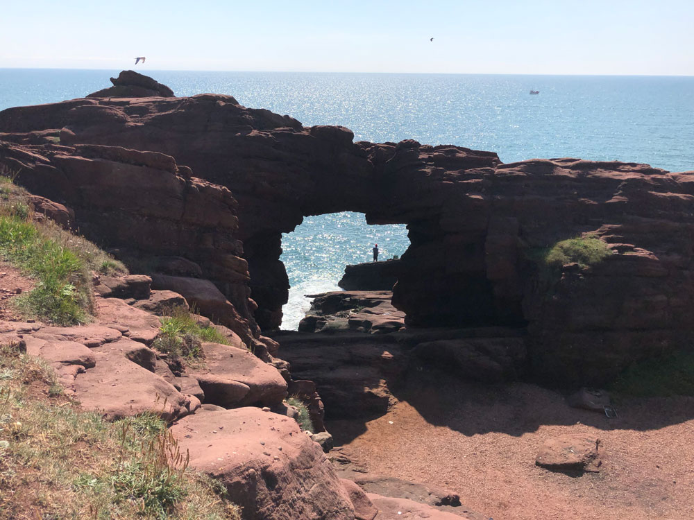
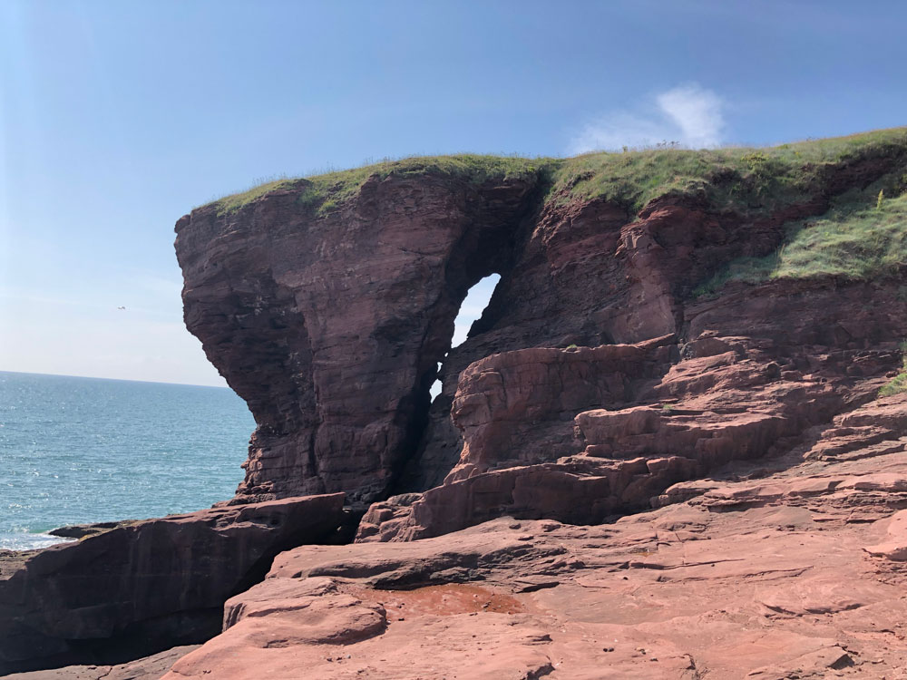
A short way into the walk is the Needle’s E’e, a natural arch originally formed through coastal erosion but now lying several metres above current sea level. BGS © UKRI.
A large sea cave runs underneath the Needle’s E’e and leads to a secluded pebble beach nestled in the cliffs, known as the Mermaid’s Kirk. BGS © UKRI.
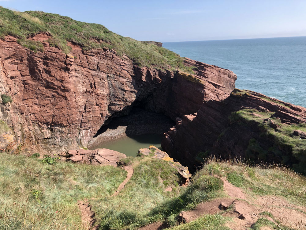
Dickmont’s Den is a large and distinctive geo, a former sea cave that has since completely collapsed. BGS © UKRI.
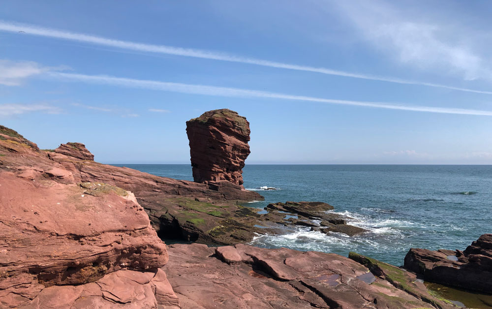
A sea stack known as the Deil’s Head. BGS © UKRI.
The length of the trail is lined with unstable and eroding cliff edges. It is vital that you stick to the designated footpath and follow all diversions. BGS © UKRI.
As well as boasting a wealth of geological features and beautiful views over the North Sea, the cliffs also provide a range of habitats and is a designated Scottish Wildlife Trust reserve. Summer months provide an excellent opportunity to view seabird colonies, butterflies and wildflowers, whilst it is not unusual to see dolphins at any time of year. There is also a thriving tourism industry, with boat trips along the coast and kayak trips into the sea caves for those who are feeling more adventurous.
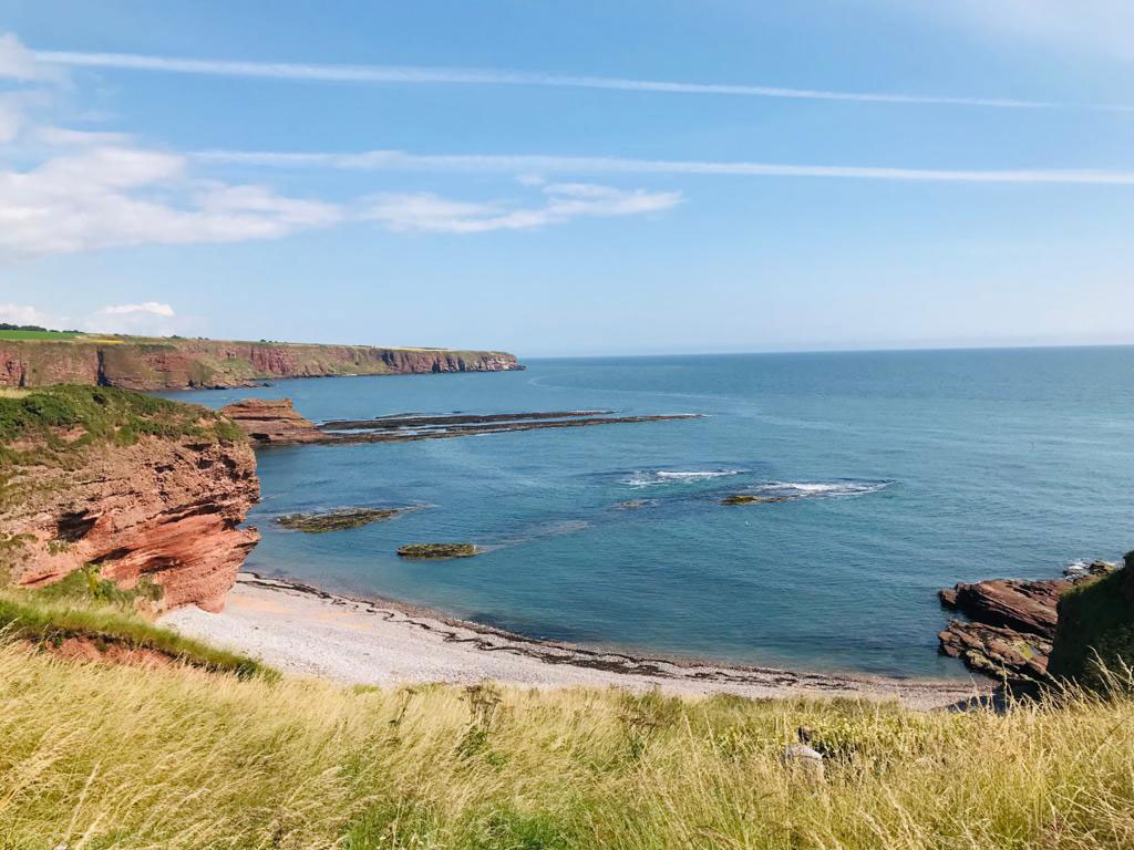
As well as a host of interesting geological features, the trail also boasts spectacular views across the North Sea. BGS © UKRI.
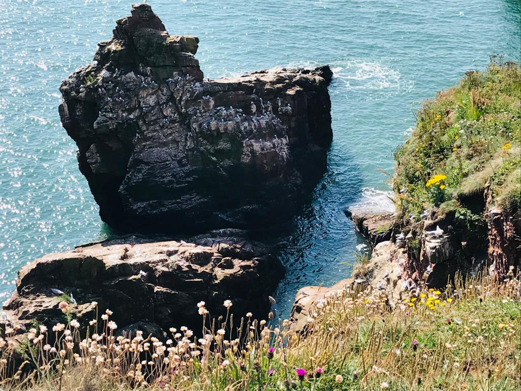
Seaton Cliffs are also provide ideal habitat for a variety of wildlife, especially seabirds. BGS © UKRI.
Red sandstone cliffs. BGS © UKRI.
As you pass through the town, the iconic red sandstone remains on display as a construction material in many of the older buildings, including the famous Arbroath Abbey. It is thought that the sandstone was taken from the shore at Whiting Ness, where the ruts from cart wheels can still be seen worn into the beach at low tides.
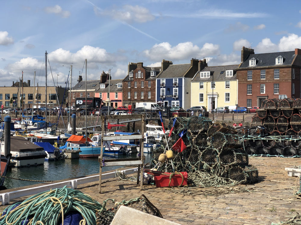
The marina at Arbroath harbour. BGS © UKRI.
Of course, no visit to Arbroath is complete without an ice cream or fish supper at the end and the harbour marina makes for the perfect scenic spot. Alternatively, if you like seafood, then be sure to try an Arbroath Smokie, which is a local delicacy and can be purchased from one of several traditional smokehouses and fishmongers. If you decide to eat outside, just keep an eye out for the gulls!
Further information
Please be aware that there are unstable cliff edges along walk and for your own safety, it is important to stay on the designated footpaths. Please follow all diversions.
- Scottish Wildlife Trust – Seaton Cliff Wildife Reserve
- BGS Earthwise
- Visit Scotland
- A trail leaflet, produced by BGS, is available to download from the Angus Council website
About the author

Jon-Paul Orsi
Head of BGS Digital Communications and Design
Relative topics
You may also be interested in
Discovering Geology
Discovering Geology introduces a range of geoscience topics to school-age students and learners of all ages.
Maps and resources
Download and print free educational resources.
Postcard geology
Find out more about sites of geological interest around the UK, as described by BGS staff.