To the south-west of Edinburgh, the Pentland Hills rise above the surroundings, forming an iconic and ancient volcanic landscape carved by recent glacial history (Figure 1). This particular walk investigates the geology and some archaeological sites around one of the most northerly summits, Caerketton Hill, rising 478 m above sea level.
One theory to the origin of the name ‘Caerketton’ is from ‘caer’ or ‘fort’, where the remains of an iron-age fort at Hillend exist (NT 2452 6620). On this walk we’ll visit a prehistoric burial cairn that sits proud at the summit.
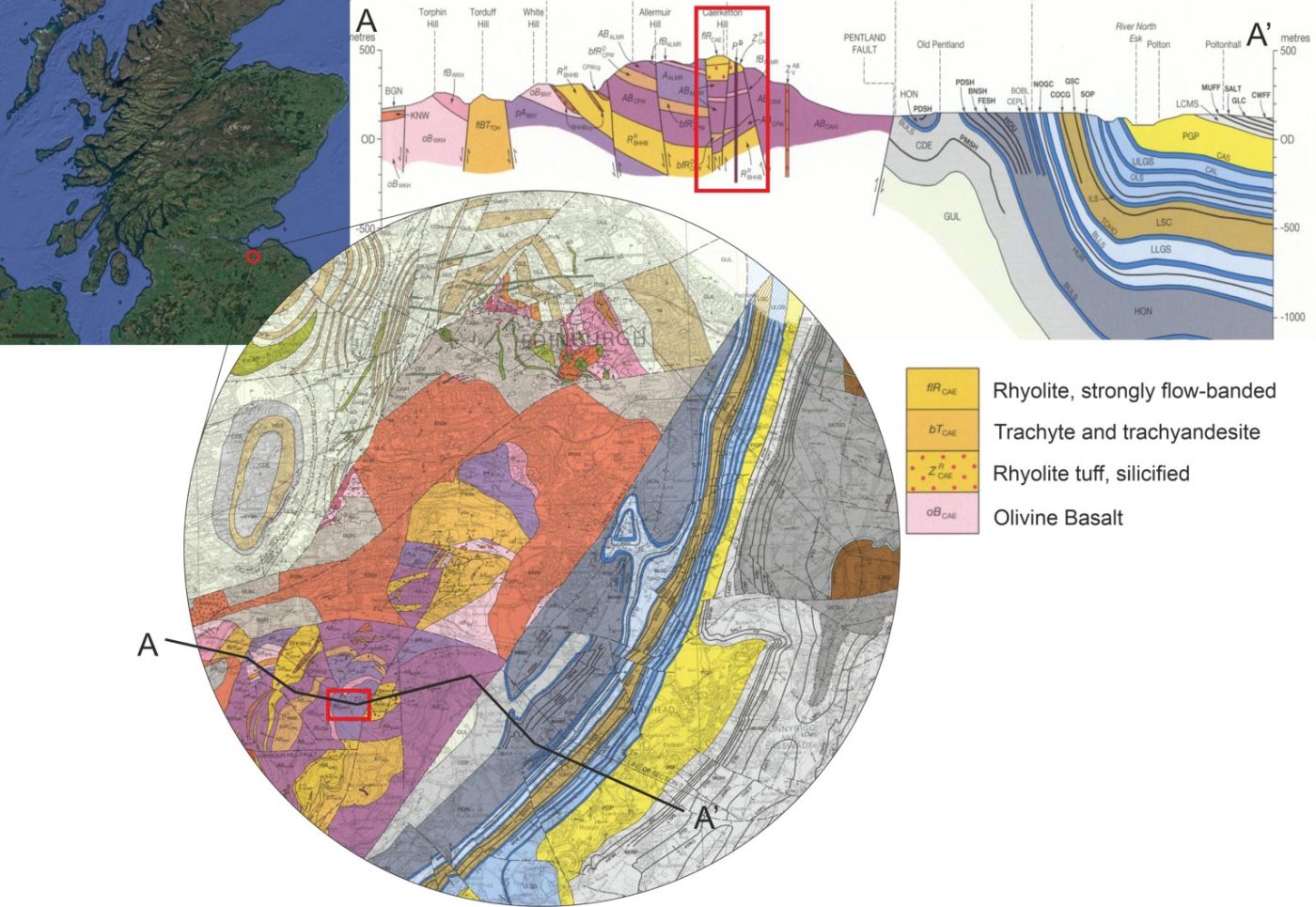

Figure 1 Location and geological map of Edinburgh with the location of Caerketton Hill highlighted in the red box. View map source. BGS © UKRI.
Geological background
The geological story starts in the Silurian Period, around 440 million years ago, when Scotland was in the southern hemisphere. The oldest rocks of the Pentland Hills are composed of mudstones and siltstones that were formed in the Iapetus Ocean. Evidence of these rocks is visible in the heart of the Pentlands (not covered on this walk). As the landmasses drifted north, continents collided and a mountain range up to 2 km high was formed. The rocks are remnants of this ancient mountain range and form a south-west trending range of hills about 30 km long and around 8 km wide.
During the Devonian Period, volcanic eruptions around the northern Pentlands ejected ash into the atmosphere, which fell to the ground and was preserved as a rock called rhyolitic tuff.
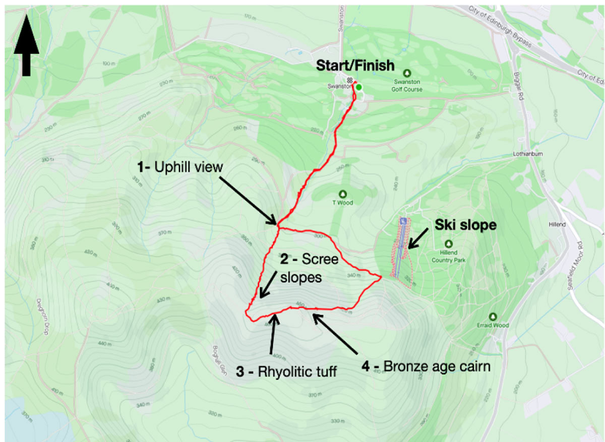
Figure 2 Grid reference NT240673 is the start and finish point of this walk, easily found next to Swanston golf club (where scones can be found at the brasserie). Contains OS data © Crown Copyright 2022.
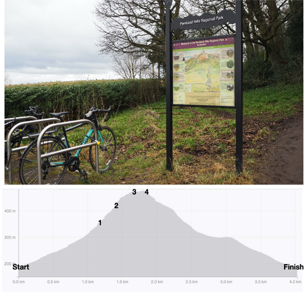
Elevation profile showing gradient and the summit where incredible panoramic views of the Pentland Hills and beyond are found. Numbers 1 to 4 highlight localities in this walk where we’ll briefly observe the history of the area. BGS © UKRI.
The walk
At a little over 4 km long and with around 303 m of elevation gain, this loop has a relatively short but steep climb (Figure 2). The walk starts at Swanston car park, near the golf club. Walking southwest for about 1.2 km along a well-marked path (past ‘Edinburgh Exmoor pony trekking’ on your right), a gentle uphill slope leads you to Locality 1, looking at the north face of Caerketton Hill and a series of scree slopes. Around here you’ll often stumble across the friendly free-roaming Highland cows belonging to Swanston Farm.
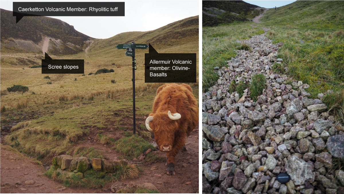
Figure 3 Views looking south at Localities 1 and 2 showing the scree slopes of Caerketton Hill with recent landslips forming screes that mark the path to the summit. BGS © UKRI.
The scree slopes are composed of fine-grained fractured cobbles fallen form the scarp, likely caused by human activity (Locality 2; Figure 3). The path diverts ‘off road’ and up the gully directly next to these scree slopes on the east and olivine-basaltic lava flows on the west.
At the top of the slope, the views are well worth the effort. Head east for around 100 m and you’re at the summit. There is a small outcrop of lighter-coloured tuff near the path (Locality 3; Figure 4A), a small reminder of the once explosive volcanic history of the area.
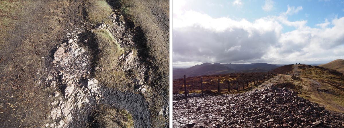
Figure 4A (left) Locality 3 showing volcanic outcrops underfoot along Caerketton Ridge. BGS © UKRI.
Figure 4B (right) Locality 4 looking south-west at the summit of Caerketton Hill, at the cairn. The Pentland Hills behind include Castle Law and Scald Law. BGS © UKRI.
A Bronze Age cairn is found at Locality 4 (Figure 4B), which marks the summit and provides a 360° panoramic view of other ancient volcanic hills:
- the Pentland range to the south-west
- the Lammermuir Hills, Berwick Law and Bass Rock to the east
- Arthur’s Seat, the Braid Hills (Figure 5), Castle Rock, Corstorphine and Craiglockhart Hills to the north
Many of these are slightly younger, formed in the Carboniferous Period. After this viewpoint, a path leads north-east and downhill to the top of the dry ski slope, where you head north-west back towards the start point.
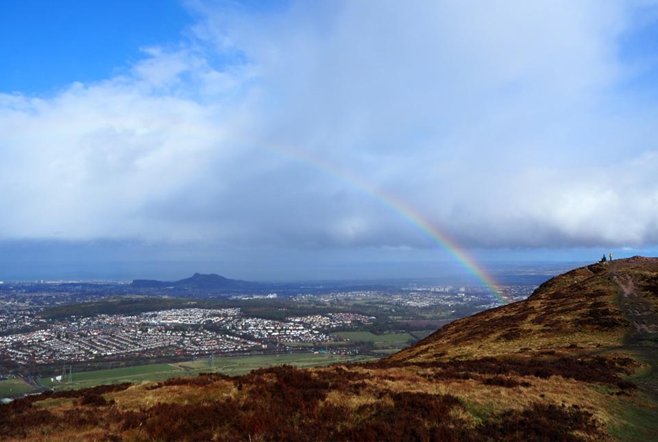
Figure 5 View looking north-east from near the summit of Caerketton Hill. A rainstorm created this a rainbow to frame Arthur’s Seat (note – always take warm layers and wet weather gear… it can be very windy with surprise showers up top!) BGS © UKRI.
From geological to archaeological history; hiking to skiing, and even climbing to paragliding (I’ve watched people do this in summer), Caerketton Hill is a great place to start exploring the Pentland Regional Park.
Further information
- Scree slopes
- Geological map
- Friends of the Pentlands
- A geological walk through the centre of the Pentland Regional Park
About the author

Nicola Dakin
Marine geoscientist
Relative topics
You may also be interested in
Postcard geology
Find out more about sites of geological interest around the UK, as described by BGS staff.