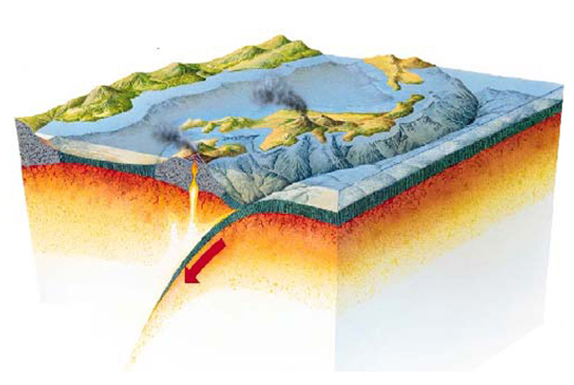
If we look at the pattern of where earthquakes occur around the world, it is clear that most of the activity is concentrated in a number of distinct earthquake belts; for instance the edge of the Pacific Ocean, or in the middle of the Atlantic Ocean. Over 80 per cent of large earthquakes occur around the edges of the Pacific Ocean, an area known as the ‘Ring of Fire’; this where the Pacific plate is being subducted beneath the surrounding plates. The Ring of Fire is the most seismically and volcanically active zone in the world.


The distribution of earthquakes (black dots) around the world, showing their relationship to the Earth’s main tectonic plates. Source: BGS ©UKRI. All rights reserved.
The Earth under our feet has many faults caused by our turbulent geological past. Some of these faults can be observed at the surface and mapped by geologists; others are hidden many kilometres below the surface. These faults are places where earthquakes can occur.
Recent earthquake data feeds:
– Earthquakes in and around the UK (last 50 days)
– Induced seismicity in and around the UK (last 50 days)
– Significant world earthquakes (last 200 days)
– Online data feeds (GeoRSS & KML)
Earthquakes in the UK
Although distant from the nearest plate boundary, the Mid-Atlantic Ridge, earthquakes in the UK occur as crustal stresses within the tectonic plates are relieved by movement occurring on pre-existing fault planes.
The driving forces for earthquake activity in the UK are unclear. They include regional compression caused by motion of the Earth’s tectonic plates and uplift resulting from the melting of the ice sheets that covered many parts of Britain thousands of years ago.
Each year, between 200 and 300 earthquakes are detected and located in the UK by BGS. Between 20 to 30 earthquakes are felt by people each year and a few hundred smaller ones are only recorded by sensitive instruments. Most of these are very small and cause no damage. However, some British earthquakes have caused considerable damage, although nothing like the devastation caused by large earthquakes in other parts of the world.
A magnitude 4 earthquake happens in Britain roughly every two years. We experience a magnitude 5 roughly every 10–20 years. Research suggests that the largest possible earthquake in the UK is around magnitude 6.5.
BGS routinely studies earthquake hazards for engineering projects. This work can influence construction methods and operating procedures for large projects like the Channel Tunnel or for new power stations, for example.
Where do earthquakes occur in the UK?
A map of earthquake activity in the UK and Ireland shows a number of regional variations. Most earthquakes occur on the western side of the British mainland. Earthquakes are almost completely absent from eastern Scotland and north-east England. Similarly, the island of Ireland is almost completely free of earthquakes. The North Sea is more active than the mainland.
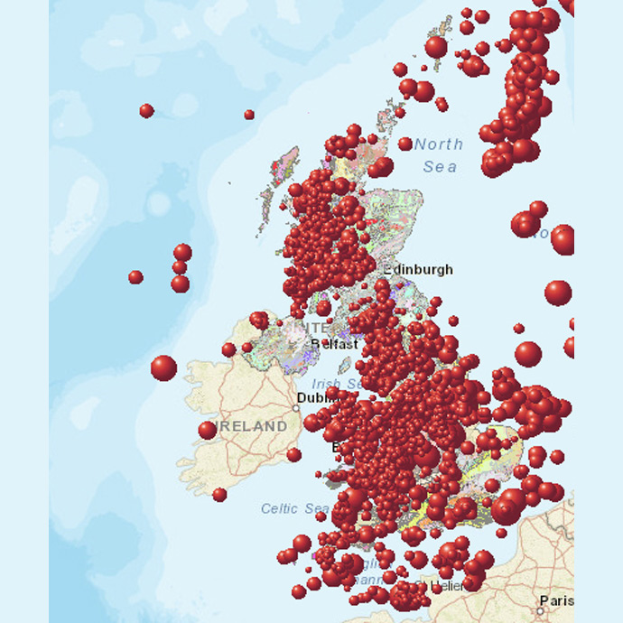
Earthquakes around the UK and Ireland, 2000 to 2020. Geology of Britain Viewer. BGS © UKRI.
Significant UK earthquakes
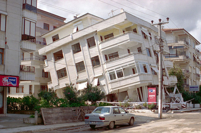
The largest known British earthquake occurred near the Dogger Bank in 1931, with a magnitude of 6.1. Fortunately, it was 60 miles offshore but was still powerful enough to cause minor damage to buildings on the east coast of England. The most damaging UK earthquake was in the Colchester area in 1884. Some 1200 buildings needed repairs, chimneys collapsed and walls were cracked.
Map of significant earthquakes (greater then magnitude 4) in the UK. Red pins show instrumentally recorded earthquakes. Yellow pins show historical earthquakes. This map is best viewed in full screen mode. To enter full screen mode use button below the zoom controls. Click on the map circles for more information. BGS © UKRI.
 – recorded |
 – historical
You may also be interested in:
Earthquakes
Earthquakes are among the most deadly natural hazards. They strike without warning and many earthquake zones coincide with areas of high population density.
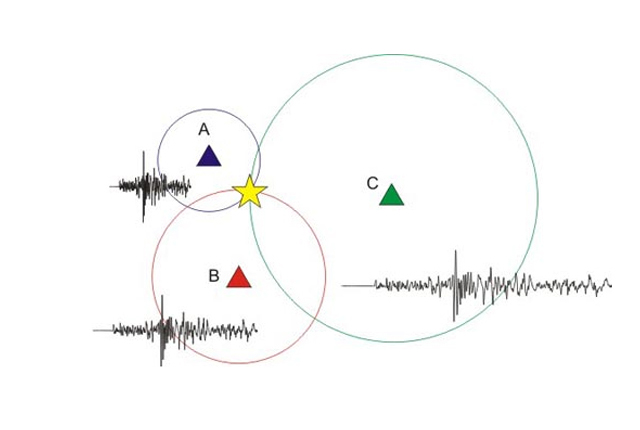
How are earthquakes detected?
Seismometers are used to record the seismic waves produced by earthquakes. Relative arrival times of these waves is used to determine earthquake location.
How do earthquakes affect people?
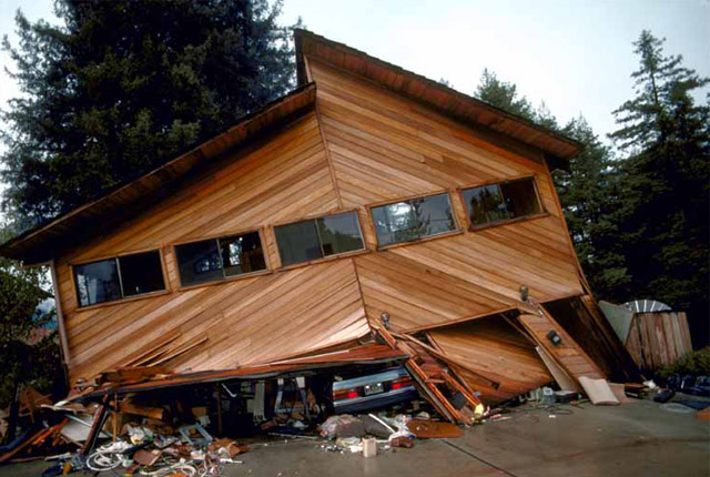
The extent of damage an earthquake causes depends not only on the magnitude of the earthquake, but also on local geology and on building techniques.
What causes earthquakes?
The causes of earthquakes and the different types of tectonic boundaries and faults on which they usually occur.