

The 1:250 000-scale offshore geological maps for seabed sediments are available digitally. BGS © UKRI
Seabed sediments 250K
- 1:250 000
- UK and adjacent European waters
- Open
The BGS Seabed Sediments 250k dataset is a digital geological map portraying the distribution of seabed substrate types of the UK Continental Shelf at a scale of 1:250 000.
Key information
- Scale:
- 1:250 000
- Coverage:
- UK and adjacent European waters
- Availability:
- Open
- Price:
Free for commercial, research and public use under the Open Government Licence. Please acknowledge the material.
- Format:
- GIS polygon data (ESRI, GeoPackage)
- Uses:
- Regional-level use
- Themes:
- Geology, Marine geoscience
- Sector:
- Construction and planning, Monitoring and surveying
The 1:250 000-scale offshore geological maps for seabed sediments are available digitally.
The overlying column of sea water imposes major limitations offshore that makes it impossible to use normal, onshore, geological mapping techniques. However, other techniques such as ship-board geophysical surveys can be used that allow geological interpretations using evidence not normally available onshore.
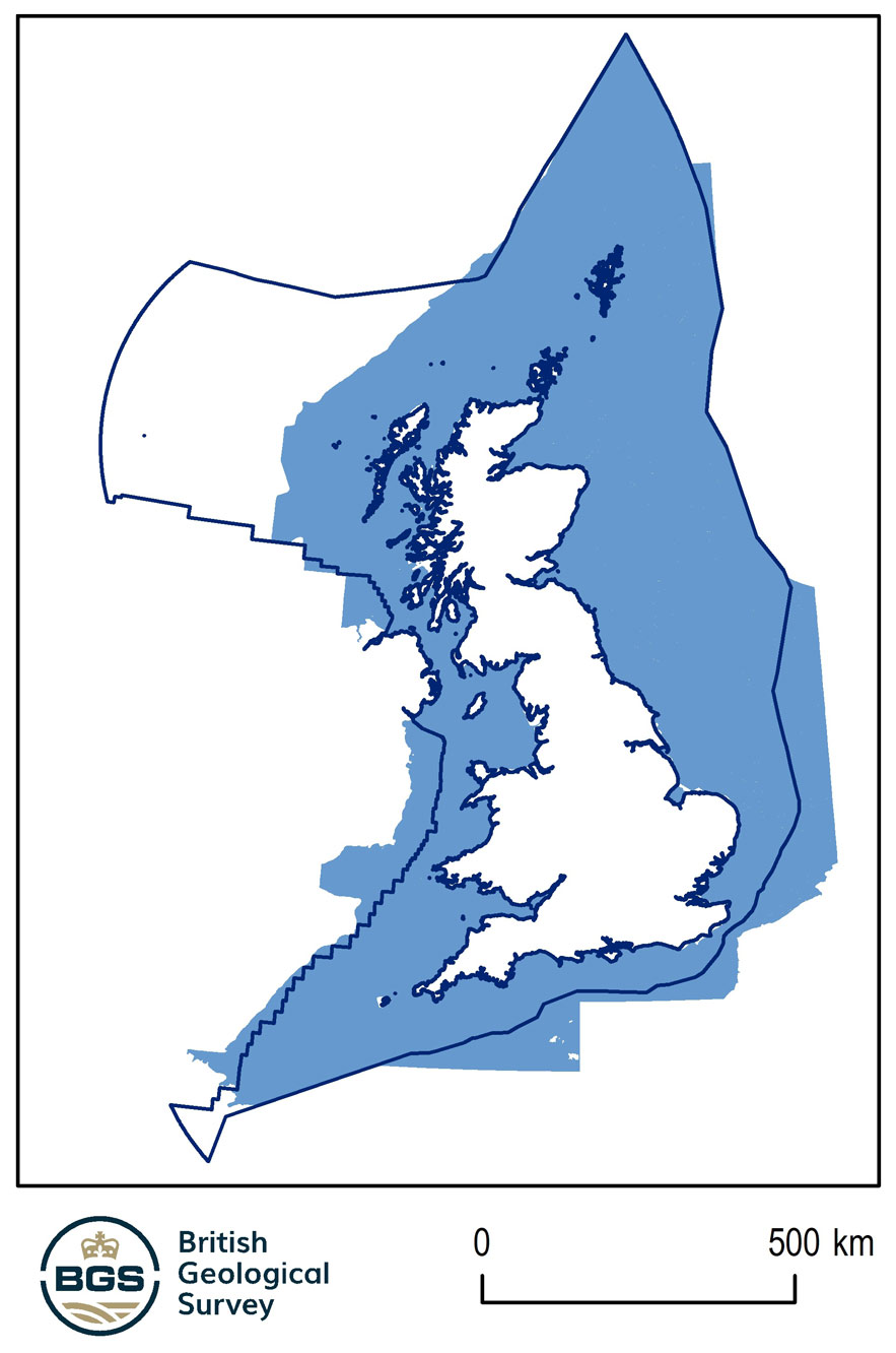
Coverage of the BGS seabed sediments 250K dataset and the limits of the exclusive economic zone. BGS © UKRI – Contains OS data © Crown copyright 2020.
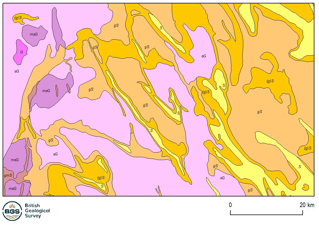
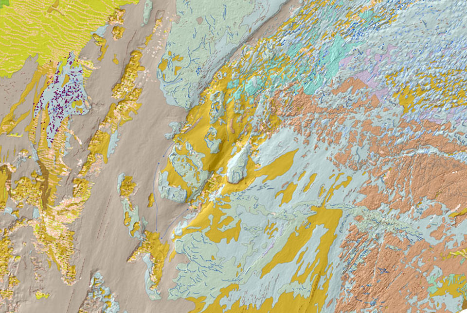
Example of the seabed sediments 250K dataset. BGS © UKRI
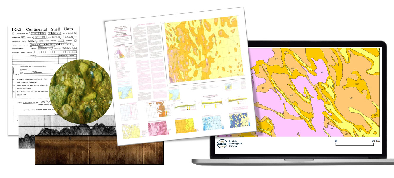
A visual summary of the development of the seabed sediments 250K dataset, from the data to the published paper maps and the released of seabed sediments 250K geospatial product. BGS © UKRI.
The seabed sediments theme is only mapped offshore, where it commonly forms a veneer on the seabed. The map is based on seabed grab samples of the top 0.1 m, combined with cores and dredge samples as available.
The sediments are classified according to Folk (1954), which divides sediments into 15 classes, according to the proportions of sand, gravel and mud present.
You may also be interested in
BGS Predictive Seabed Sediments (UK)
The BGS Predictive Seabed_Sediments (UK) data provide digital maps of seabed sediment (SBS) composition across the UK Continental Shelf (UKCS).
BGS Seabed Geology
The seabed geology map dataset covers regions on the UK’s continental shelf and details the substrate geology, structural geology and seabed geomorphology.

Offshore bedrock 250K
The BGS Offshore Bedrock 250k dataset depicts the distribution of the different types of bedrock on the UK Continental Shelf.

Offshore Quaternary 250K
The 1:250 000-scale offshore geological map for quaternary geology (BGS Geology: marine quaternary 250k) is available digitally.