

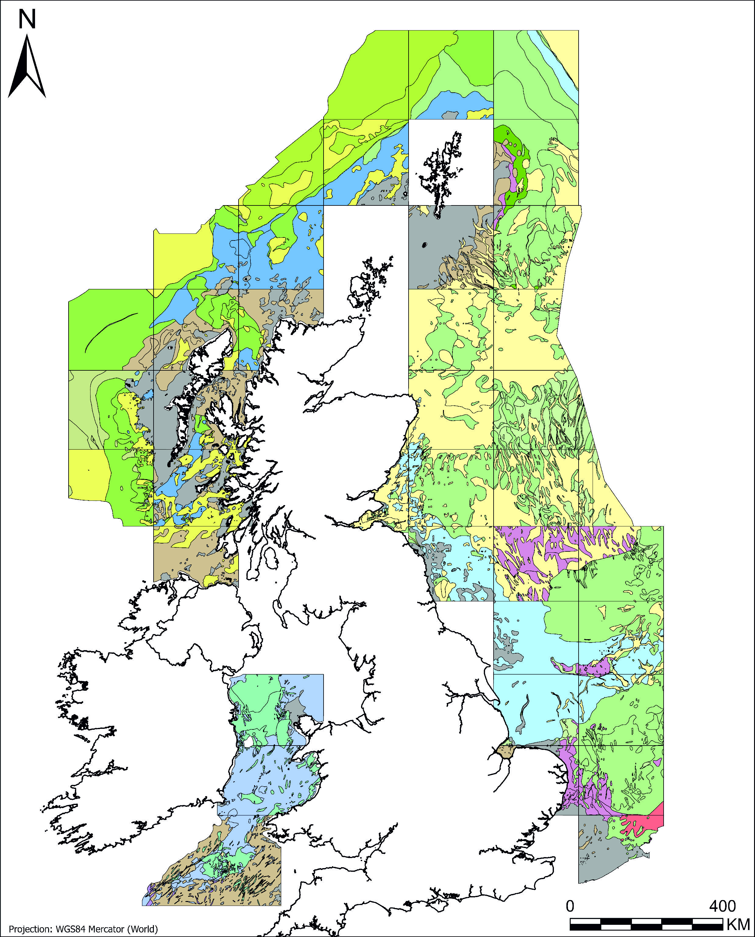
Example of the BGS offshore quaternary 250K dataset. BGS © UKRI.
Offshore Quaternary 250K
- 1:250 000
- UK and adjacent European waters
- Open
This offshore Quaternary geology dataset shows the distribution of interpreted lithostratigraphical units within the shallow subsurface. The dataset represents the Quaternary geology immediately beneath the active seabed sediment layer.
Key information
- Scale:
- 1:250 000
- Coverage:
- UK and adjacent European waters
- Availability:
- Open
- Price:
Free for commercial, research and public use under the Open Government Licence. Please acknowledge the material.
- Format:
- GIS polygon data (ESRI, GeoPackage)
- Uses:
- Regional-level use
- Themes:
- Geology, Marine geoscience
This dataset shows the distribution of previously interpreted Quaternary lithostratigraphic units within the shallow subsurface of the UK continental shelf. This dataset comprises a compilation of legacy BGS 1:250k Quaternary Geology map sheets, provided here in digital form for the first time. This is a GIS dataset composed of vector polygons, each representing an area where a particular formation has been mapped. Large areas of the UK offshore are covered, at a scale of 1:250 000.
The legacy 1: 250k map sheet interpretations (e.g. Spurn, Anglesey) have not been modified, and are presented in their original form, mosaiced together as a single digital product. As a result, there are known boundary mismatches between the previous map sheet areas that remain in the dataset. The map compilation is not informed by new data or analyses and no attempt was made to smooth or ‘correct’ the boundary issues. This was to avoid offering a false sense of accuracy that is not based on updated systematic analysis. Please see the User Guide for further information.
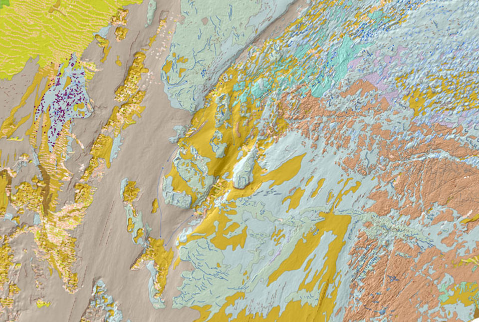
The BGS Offshore Quaternary 250K dataset symbolised by stratigraphical domain. BGS © UKRI. Coastline from Esri World Countries layer. Layer contains data from Esri, Garmin International, Inc., U.S. Central Intelligence Agency (The World Factbook), and International Organization for Standardization (ISO). Basemap created using ArcGIS. Copyright © Esri 2026. All rights reserved. www.esri.com
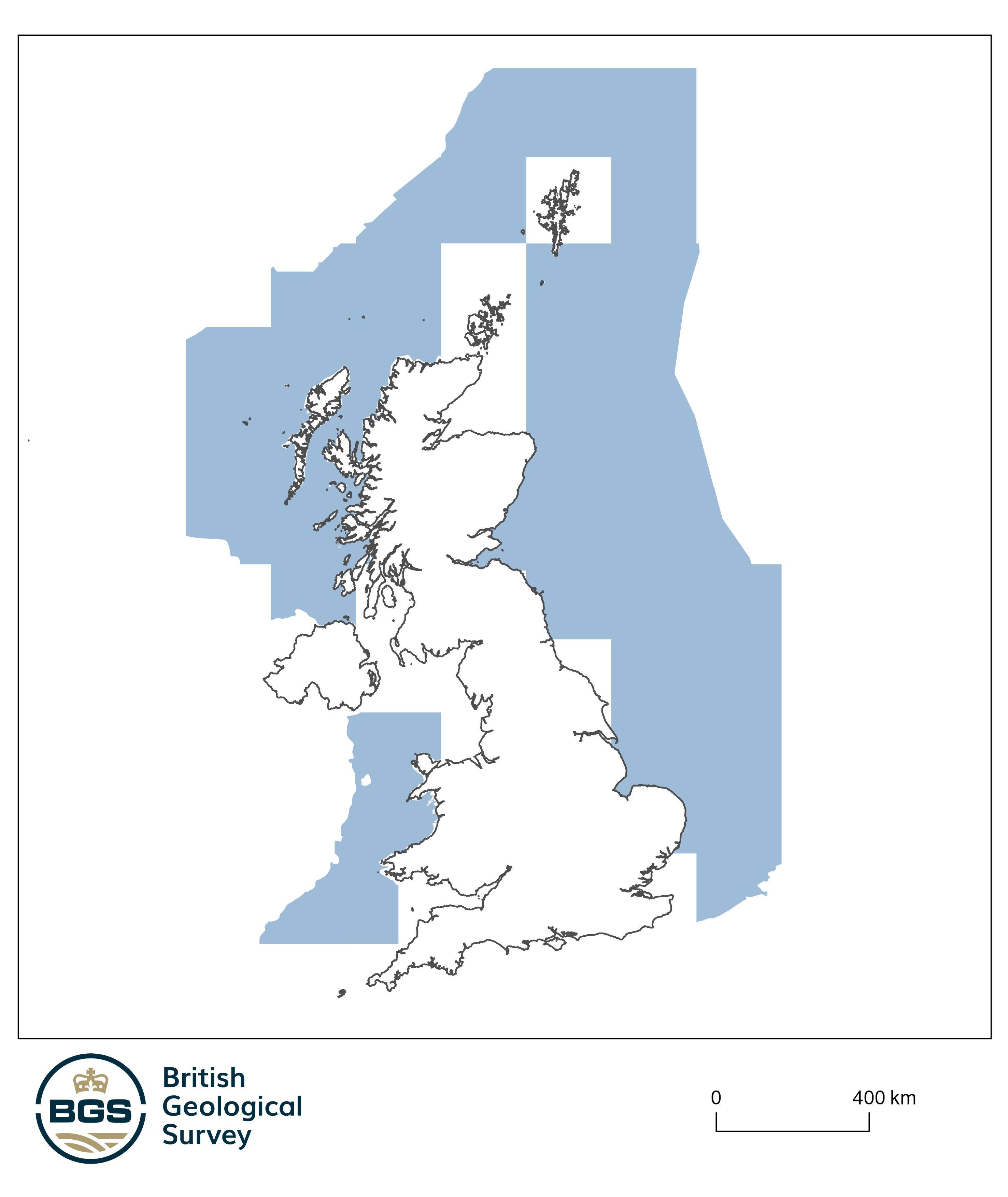
Coverage of the BGS Offshore Quaternary 250K dataset. BGS © UKRI. Coastline from Esri World Countries layer. Layer contains data from Esri, Garmin International, Inc., U.S. Central Intelligence Agency (The World Factbook), and International Organization for Standardization (ISO). Basemap created using ArcGIS. Copyright © Esri 2026. All rights reserved. www.esri.com
Additional information from the original map sheets has been included in the attribute fields, including a lithological description for each formation. The BGS lexicon code for each formation has been supplied, so users can research any formation of interest. The maximum and minimum age of each formation, in a variety of formats, has also been added. This key lithostratigraphic information was sourced from Stoker et al. (2011). While work to refine Quaternary stratigraphic frameworks is ongoing, the principal drive behind this release is to make original 1:250k map data available in a digital format.

Example of the BGS offshore quaternary 250K dataset. BGS © UKRI.
You may also be interested in
BGS Predictive Seabed Sediments (UK)
The BGS Predictive Seabed_Sediments (UK) data provide digital maps of seabed sediment (SBS) composition across the UK Continental Shelf (UKCS).
BGS Seabed Geology
The seabed geology map dataset covers regions on the UK’s continental shelf and details the substrate geology, structural geology and seabed geomorphology.

Offshore bedrock 250K
The BGS Offshore Bedrock 250k dataset depicts the distribution of the different types of bedrock on the UK Continental Shelf.

Seabed sediments 250K
This offshore Quaternary geology dataset shows the distribution of interpreted lithostratigraphical units within the shallow subsurface. The dataset represents the Quaternary geology immediately beneath the active seabed sediment layer.