

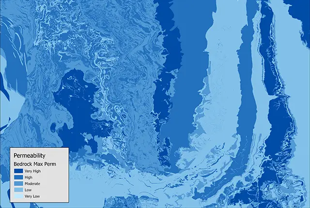

Permeability data. BGS © UKRI.
Permeability
- 1:50 000
- Great Britain
- Premium
BGS has prepared permeability information based on the 1:50 000-scale digital geological map of Great Britain (BGS Geology 50K). The permeability indices indicate the range of permeability likely to be encountered for each geological unit. The maximum and minimum permeability indices are divided into five classes: very high, high, moderate, low, and very low.

Key information
- Scale:
- 1:50 000
- Coverage:
- Great Britain
- Availability:
- Premium
- Price:
£0.12 per km2. Subject to number of users, licence fee and data preparation fee.
- Format:
- GIS polygon data. (ESRI, MapInfo, others available by request)
- Uses:
- Local-level use
- Themes:
- Geology, Hydrogeology
- Sector:
- Environmental protection, Groundwater
‘Permeability’ refers to whether and how water can flow through a rock. Permeability data is often used in studies of groundwater and in particular during investigations of pollution or aquifer contamination. We have prepared permeability information based on the 1:50 000-scale digital geological map of Great Britain (BGS Geology 50K).
The permeability indices are based on geological considerations:
- the predominant flow mechanism:
- intergranular flow
- fracture flow
- a mixture of intergranular and fracture flow
- a maximum permeability index
- a minimum permeability index
The permeability indices indicate the range of permeability likely to be encountered for each geological unit. The maximum and minimum permeability indices are divided into five classes: very high, high, moderate, low, and very low.
Permeability sample. BGS © UKRI
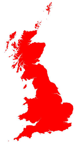
Permeability coverage. BGS © UKRI – Contains OS data © Crown copyright 2020.
Download BGS Permeability sample data
You may also be interested in
BGS Civils: bulking volume
BGS Civils is a suite of national maps of engineering properties based on geological data and the digital 1:50 000 scale geological map – BGS Geology 50k.
BGS Civils: corrosivity (ferrous)
The BGS corrosivity dataset is a GIS layer supporting the management of underground iron assets that has been created in response to the growing awareness of the cost of maintenance of structures such as pipelines and building foundations.
BGS Civils: discontinuities
This theme provides information on the discontinuities in bedrock and superficial deposits as part of a suite of GIS layers for different engineering parameters.
BGS Civils: engineered fill
This theme provides information on the suitability of a geological material to be used as engineered fill.
BGS Civils: excavatability
This theme provides information on the excavatability of geological deposits at surface.
BGS Civils: foundation conditions
This theme provides information on the suitability of a geological material for foundations as part of a suite of GIS layers for different engineering parameters.
BGS Civils: strength
This theme provides information on zones of rock strength and the local factors controlling it, as part of a suite of GIS layers for different engineering parameters.
BGS Civils: sulfate/sulfide potential
The BGS Civils: sulfates and sulfides dataset is a GIS layer that supports the management of underground assets
Groundwater vulnerability data
Our groundwater vulnerability maps provide an assessment of the vulnerability of groundwater in overlying superficial rocks and those that comprise the underlying bedrock.
Hydrogeological maps of Scotland
The BGS has produced a suite of hydrogeological maps of Scotland. The suite includes layers with groundwater vulnerability and aquifer productivity data.
Infiltration SuDS map
The BGS Infiltration SuDS map dataset is suitable for those involved in the design of sustainable drainage systems and approving SuDS planning applications.
Superficial deposit thickness model
The superficial deposit thickness model shows the depth of the bedrock surface below unconsolidated deposits