
GeoCoast Open. BGS © UKRI — contains OS data © Crown Copyright 2022.
GeoCoast Open
- Multiple
- Great Britain
- Open
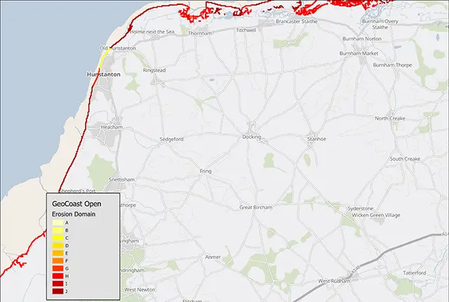
GeoCoast Open provides a range of historic images and diagrams extracted from our archives, memoirs and other publications that can provide a reference for coastal change. It also contains a detailed suite of statistical data based on the underlying datasets (GeoCoast Premium). These include, for example, percentage of county at threat from inundation and percentage of county coastline with high susceptibility to erosion. In addition, GeoCoast Open coastal domains provides a summary of the underpinning GeoCoast Premium datasets by classifying segements of coastline based on their morphological characteristics and geological properties, providing a benchmark for describing the coastline and coastal change which can be applied nationally.
Key information
- Scale:
- Multiple
- Coverage:
- Great Britain
- Availability:
- Open
- Format:
- GIS point data and vector polygon (ESRI, other formats available on request)
- Uses:
- National – regional level use
- Themes:
- Environmental change, Hazards
- Sector:
- Flooding, Weathering and erosion
GeoCoast Open consists of:
- historic data or images (point data)
- regional statistics (shapefiles)
- coastal domains for erosion and morphology
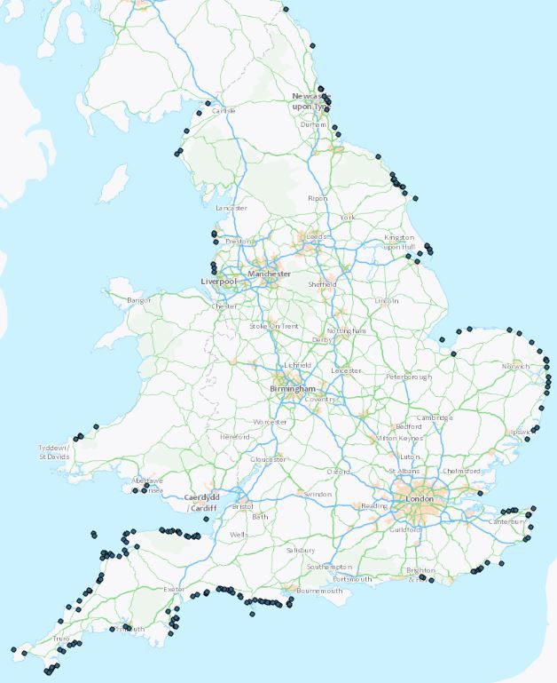
Example of GeoCoast Open historic data. BGS © UKRI — contains OS data © Crown Copyright 2022.
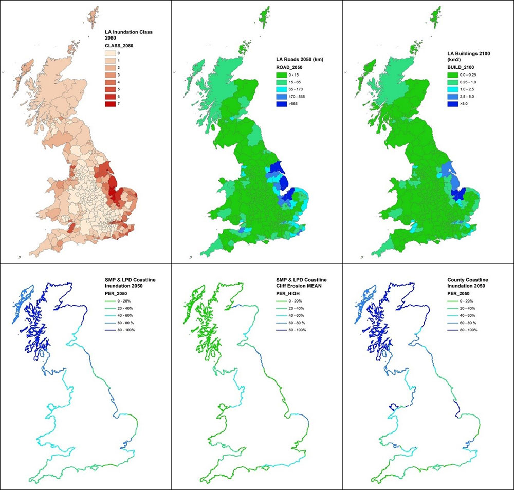
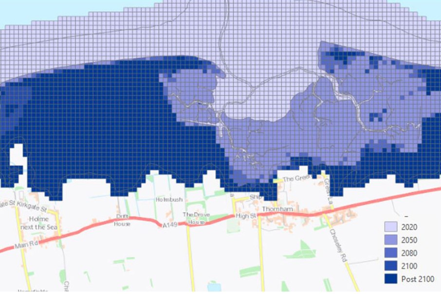
Example of GeoCoast Open statistics datasets. BGS © UKRI.
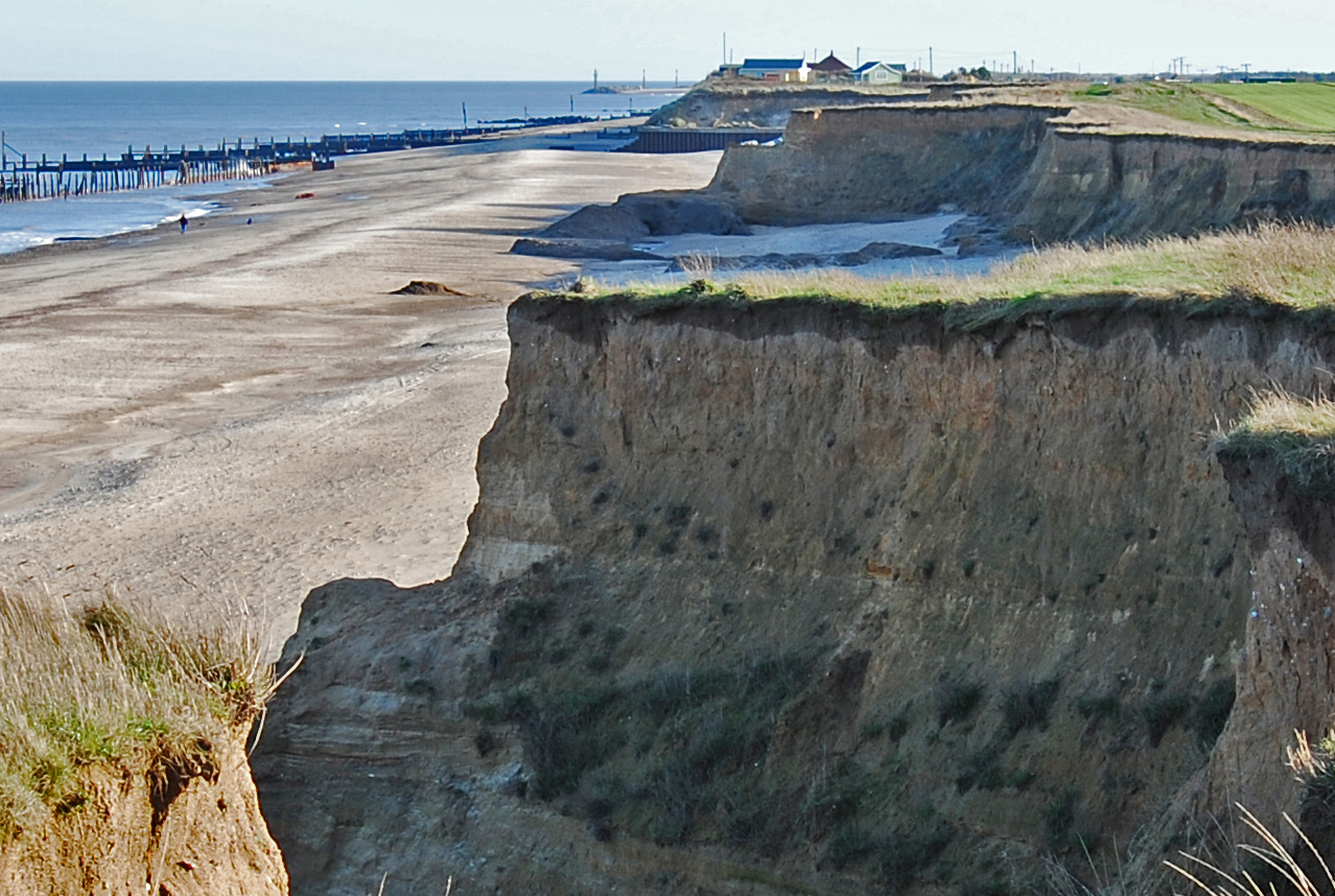
Varying glacial deposits at Happisburgh, Norfolk. BGS © UKRI.
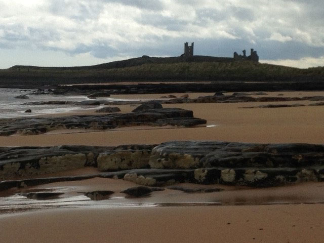
Mixed beach and hard rock outcrops at Dunstanburgh, Northumberland. BGS © UKRI.
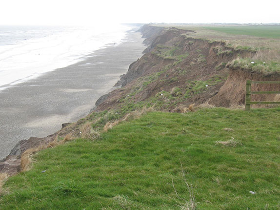
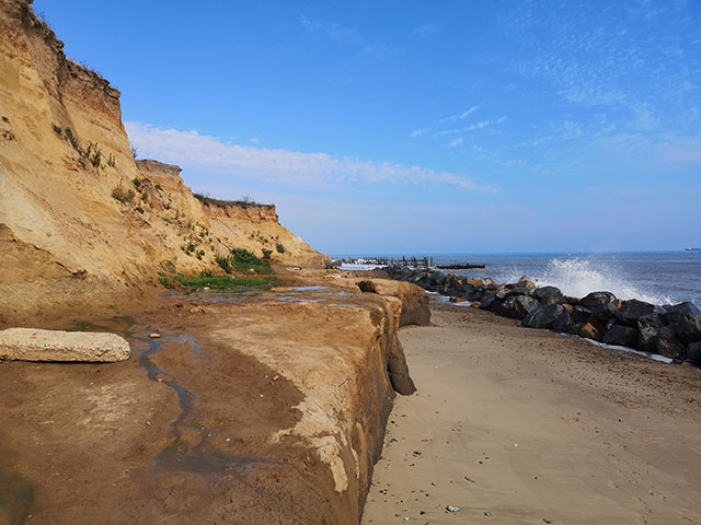
Cliff recession at Aldbrough, Holderness Coast, East Riding of Yorkshire. BGS © UKRI.
Frequently asked questions
Please visit our BGS GeoCoast Premium page for frequently asked questions regarding how the product can be used or how it can be interpreted. If you have any additional questions, please contact digitaldata@bgs.ac.uk
IPR statement
To meet with BGS’s commitment to the continuing openness of its data, the materials available through this portal are viewable under the Open Government Licence (OGL). This licence is subject to the following acknowledgement accompanying any use of the material: ‘British Geological Survey © UKRI [2022]’.
In some instances, material released under this portal contains not only BGS data, but also identified third-party data. Where third-party data is not covered by the OGL, users wishing to reuse any of this data must gain direct permission from the appropriate copyright owner to do so.
If you are a copyright holder and are concerned that you have found material on the portal belonging to you, and you have not granted permission for this use, please contact the BGS IPR team. Please ensure you include the below information in any communication:
- your contact details
- the full bibliographic details of the material
- the exact and full URL where you found the material
- proof that you are the rights holder and a statement confirming that you are the rights holder or are an authorised representative
Given proof of valid objection, BGS will take down the relevant material from the portal.
You may also be interested in
Coasts and estuaries geohazards
Providing independent and expert geoscientific tools and advice to assess different adaptation options to coastal flooding and erosion.
GeoCoast Premium
GeoCoast is an integrated GIS package of datasets designed to inform and support coastal management and adaptation.