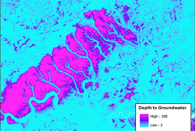

Depth to groundwater BGS © UKRI.
Depth to groundwater
- 1:50 000
- Great Britain
- Premium
The BGS depth to groundwater product is a national scale dataset of probable maximum depth to the phreatic water table.
Key information
- Scale:
- 1:50 000
- Coverage:
- Great Britain
- Availability:
- Premium
- Price:
£0.18 per km2. Subject to number of users, licence fee and data preparation fee.
- Format:
- GIS raster data (ESRI grid, ASCII grid, others available by request)
- Uses:
- Local-level to region-level use
- Themes:
- Environmental change, Hydrogeology
The depth to groundwater dataset is a gridded interpolation of depth to groundwater. The dataset is a raster grid, with 50 × 50 m pixels holding values that represent the probable maximum depth in metres to the phreatic water table. This represents the likely lowest water level, under natural conditions, in an open well or borehole drilled into the uppermost parts of a rock unit. The dataset has been modelled from topography and hydrology, assuming that surface water and groundwater are hydraulically connected. It has not used observations of groundwater level in wells or boreholes directly, but they have been used to validate its performance.
Groundwater plays a key role in many shallow geological processes and an estimate of the level of the water table is an important component of site investigations, assessments of water resources and environmental studies. Data on groundwater level is frequently used as a component within geological models, for example in studies of slope stability, groundwater flood susceptibility or the suitability of an area for sustainable urban drainage systems.
You may also be interested in
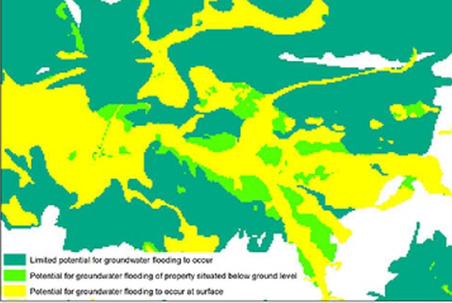
Groundwater flooding
In response to the need for more information on groundwater flooding, BGS has produced the first national dataset on the susceptibility across Britain.
Infiltration SuDS map
The BGS Infiltration SuDS map dataset is suitable for those involved in the design of sustainable drainage systems and approving SuDS planning applications.
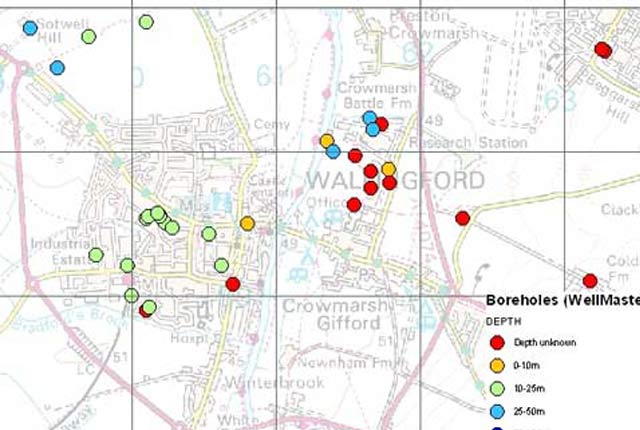
WellMaster hydrogeological database
Our digital version of the water well archive. Index level data is available for all water boreholes known to the BGS.