Latest BGS Geology 50K mapping data launched
Some of our most widely used maps have received a major update, including the 1:50 000-scale map series that now includes enhanced coverage of Great Britain.
06/11/2025 By BGS Press

BGS Geology, BGS’s digital geological maps covering Great Britain, is based on a suite of published paper maps enhanced with latest digital mapping. It is periodically updated with information from field surveys as well as including previously unpublished maps or additional interpretation.
The latest version of BGS Geology 50K now covers the majority of Great Britain plus the Isle of Man, an estimated 236 000 km2. This includes coverage for approximately 99 per cent of the bedrock and approximately 95 per cent of the superficial deposits across the country.
These geological maps provide crucial information like rock types and faults, forming a valuable resource for a wide range of uses, such as infrastructure planning and development, including ground source heat pumps, and environmental assessment.
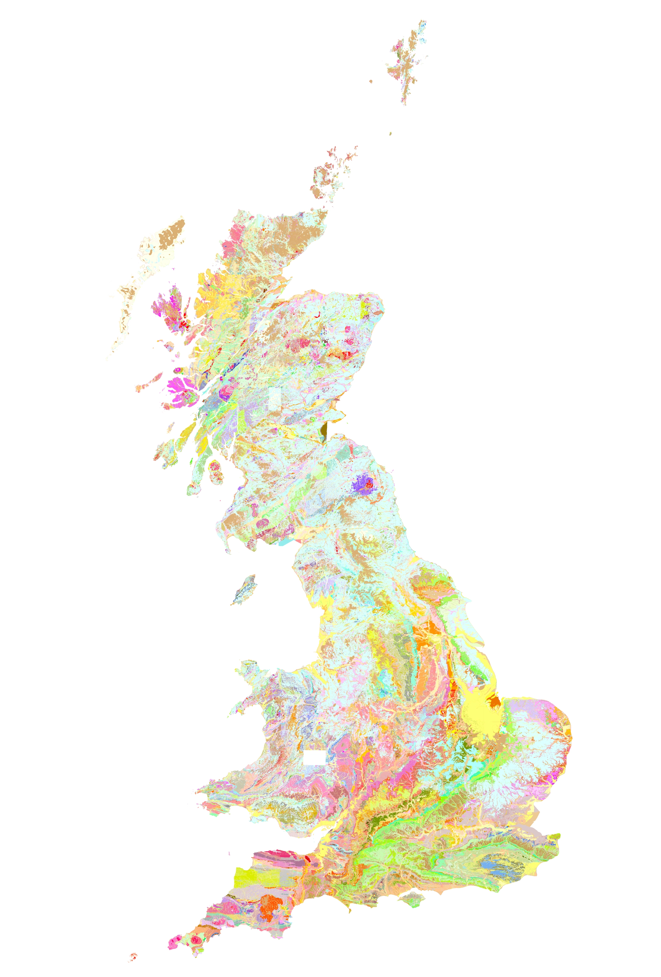
The latest version of BGS Geology 50K now covers the majority of Great Britain and the Isle of Man, an estimated 236 000 km2. BGS © UKRI.

The 50K-scale map offers a balance between detail and coverage, making it highly useful for a wide range of applications, from regional assessment to local-scale intelligence.
The latest update incorporates all edits to the dataset since the previous version’s release in 2017. This includes new and revised tiles of geology data, updates to the coastline and various corrections to geological features across the country. Also included is additional attribution on linear features depicting fault trace handedness and hanging-wall orientation on fault features.
Henry Holbrook, data sharing lead at BGS.
In addition to the 50K maps, BGS has also updated its 10K and 25K maps. BGS Geology 10K and 25K is the most detailed geological dataset we have produced Around half of the country is now covered with this update, including many urban centres and transport routes in Great Britain.
This latest release of BGS Geology 10K and 25K includes new maps and is based on our highest-resolution survey mapping. It will continue to be of great help to the public sector, the construction industry and academics.
Henry Holbrook
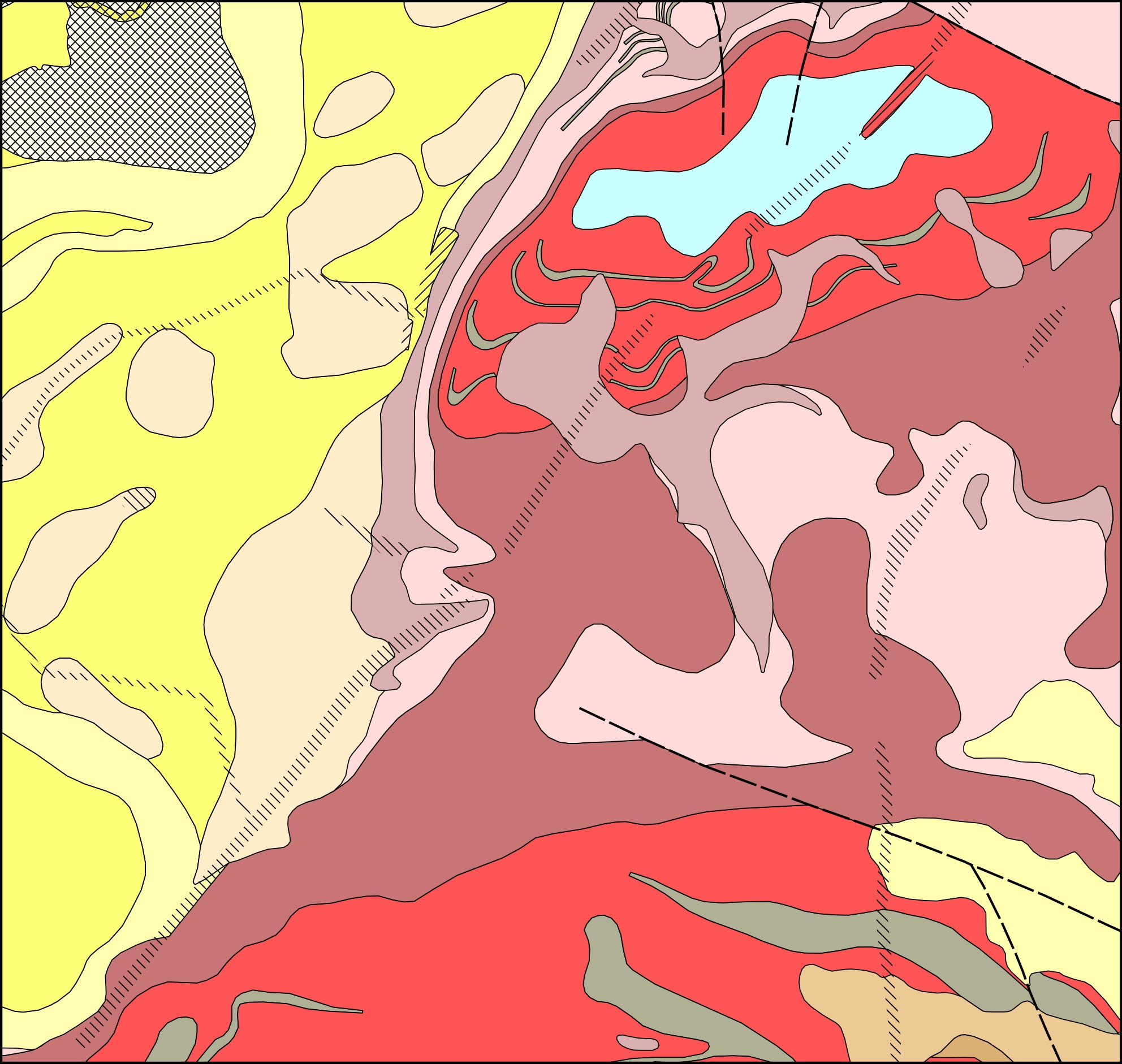
BGS Geology 10K and 25K in the south Nottinghamshire region. BGS © UKRI.
BGS’s data for both BGS Geology 50K and BGS Geology 10K and 25K is available under licence. You can also view the BGS Geology 50K map data in the GeoIndex viewer. Further information about BGS Geology 50K and BGS Geology 10K maps is available on the BGS website.
Relative topics
Related news

UK and Philippines scientists investigate natural hydrogen generation processes at atomic scale
22/06/2026
BGS researchers were granted access to use the Diamond Light Source facility in order to study hydrogen in light brighter than the sun.

Shortage of end-of-life materials presents challenge to UK critical minerals security
17/06/2026
A new report by the UK Critical Minerals Intelligence Centre reveals insufficient end-of-life material stocks present a supply risk over the coming decade, but offer significant long-term potential to meet critical mineral demand through recycling.

UK geothermal catalogue receives update
16/06/2026
BGS releases the second digital version of the UK geothermal catalogue of subsurface temperature and rock thermal conductivity measurements and heat flow calculations.

Scientists make new discovery in the history of the Giant’s Causeway
15/06/2026
New research is changing our scientific understanding of the formation of one of the UK’s most iconic landmarks and has revealed that Northern Ireland’s volcanic past occurred over a much shorter period than previously thought.

Latest research emphasises climate-related subsidence risk to millions of British homes
11/06/2026
New data from BGS highlights the projected future impact of warmer, drier summers and underlines the need for mitigation measures in susceptible regions.

Ukraine and the UK strengthen their commitment to geological cooperation
10/06/2026
A new Memorandum of Understanding reaffirms the UK’s support of Ukraine’s ambitions to develop its critical mineral resources, paving the way for collaboration through capacity-building programmes.
Newly released core could hold clues on potential mineral prospectivity in Perthshire
05/06/2026
A comprehensive collection of geological samples from the vicinity of a former mine in Scotland is now available to scientists for further research.
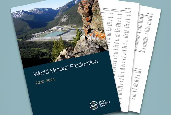
Latest data on world mineral production now available
25/05/2026
BGS has released the updated statistics on the global production of over 70 commodities between 2020 and 2024.

International science consortium to survey the health, economic value and social importance of Lake Victoria
22/05/2026
The project will replicate the 1927 survey to assess changes in the lake’s health, economic value and social importance.

New geological maps of Berwick-upon-Tweed to help future-proof natural water supply
20/05/2026
Scientists have mapped the geology under the town to better understand the groundwater system to inform decisions around abstraction.

BGS contributes to UN sand and sustainability report
19/05/2026
The new report highlights the impact of poor governance and unsustainable sand mining practices, calling on policymakers to take action.
BGS engineering geologist elected to CCOP
29/04/2026
Marcus Dobbs has been elected as vice-chair of the advisory group for the Coordinating Committee for Geoscience Programmes in East and Southeast Asia.