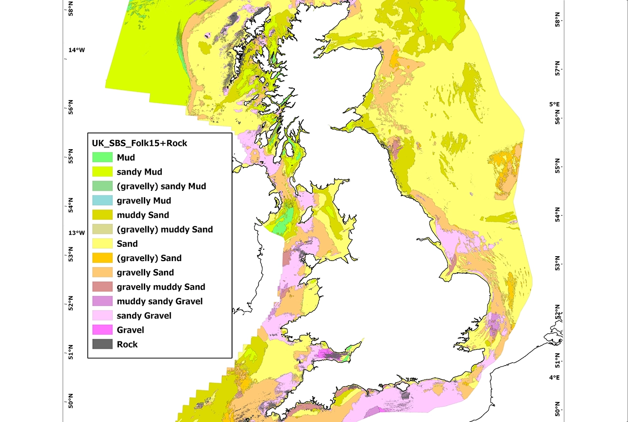

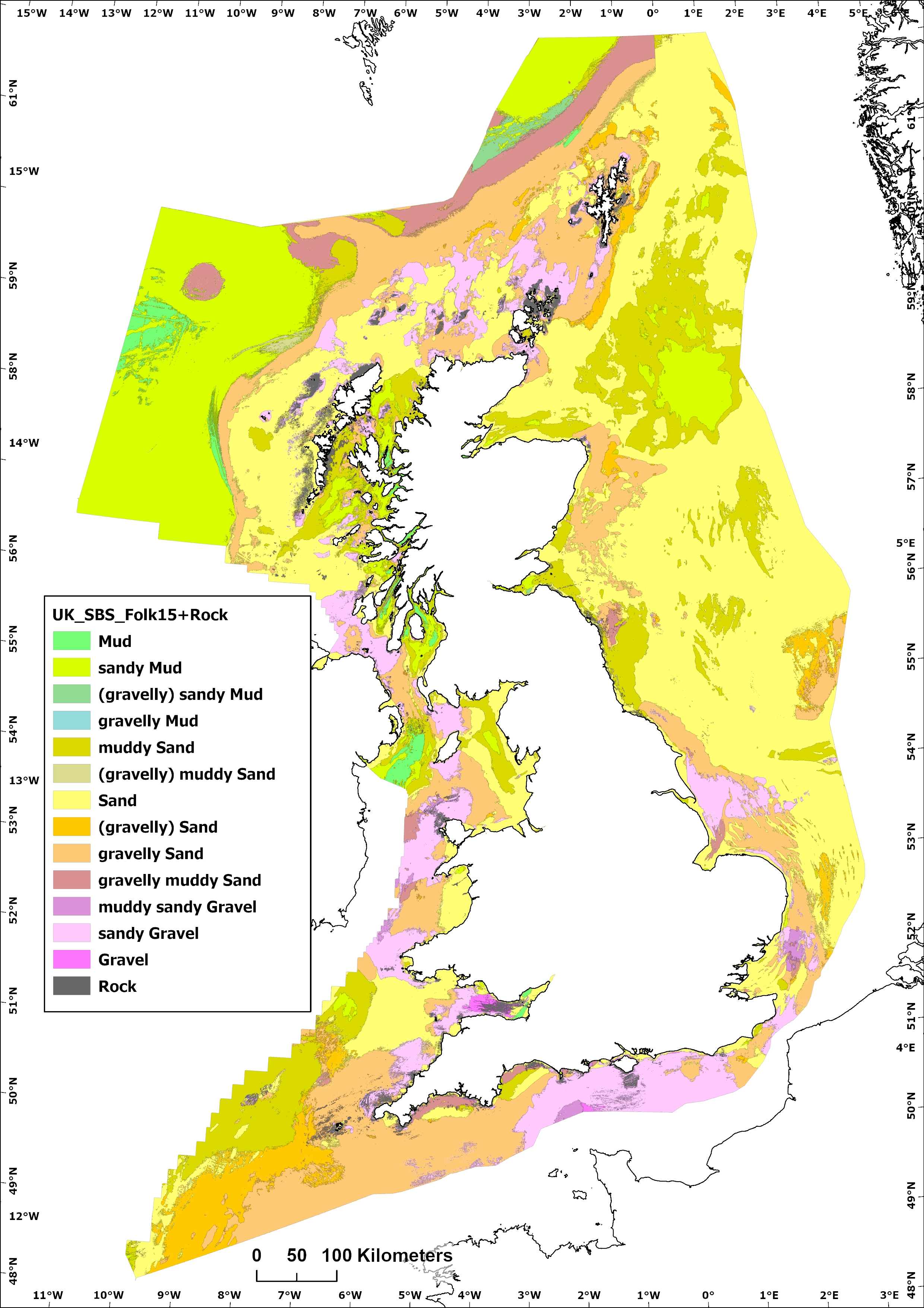
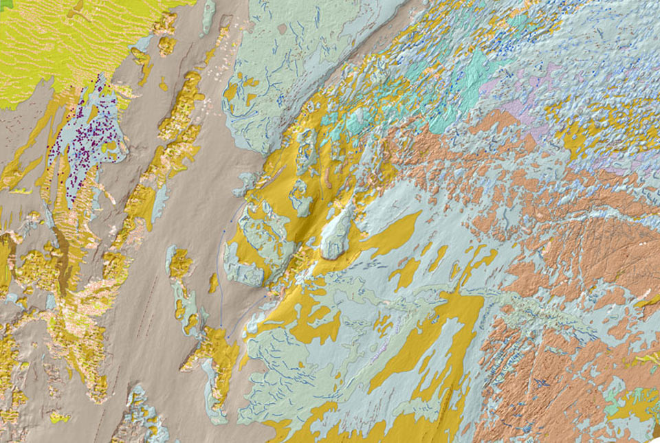
Predictive SBS map product: Mostly likely sediment class according to Folk15 classification + rock. BGS © UKRI 2025
BGS Predictive Seabed Sediments (UK)
- Approximately 110m spatial resolution
- UK Continental Shelf (UKCS)
- Open
The BGS Predictive Seabed_Sediments (UK) data provide digital maps of seabed sediment (SBS) composition across the UK Continental Shelf (UKCS). These sediments are those that are present at seabed, the interface between the geological substrate below, and the water column above.
Key information
- Scale:
- Approximately 110m spatial resolution
- Coverage:
- UK Continental Shelf (UKCS)
- Availability:
- Open
- Price:
Free for commercial, research and public use under the Open Government Licence. Please acknowledge the material.
- Format:
- GIS polygon data and raster imagery
- Themes:
- Engineering geology, Marine geoscience
The BGS Predictive Seabed_Sediments (UK) data provide digital maps of seabed sediment (SBS) composition across the UK Continental Shelf (UKCS). These sediments are those that are present at seabed, the interface between the geological substrate below, and the water column above. The physical properties and grain size (or composition) of these sediments depends on a variety of factors, including: the nature of the underlying geology (e.g. glacial vs. unconsolidated marine deposits), the hydrodynamic environment, terrigenous sediment input (e.g. fluvial), biogeochemical processes operating at seabed, and the physiography and geomorphology of the seabed environment. Seabed sediments are commonly unconsolidated, and as such are potentially transitory and mobile over variable timescales.
BGS Predictive Seabed Sediments (UK) data: Most likely sediment class according to Folk 15 classification + rock BGS © UKRI 2025
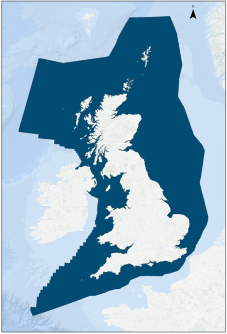
Coverage of the BGS Predictive Seabed Sediments (UK) data shown in dark blue. Background image from World Ocean Base dataset compiled by Esri, Garmin, GEBCO, NOAA NGDC, and others. BGS © UKRI 2025
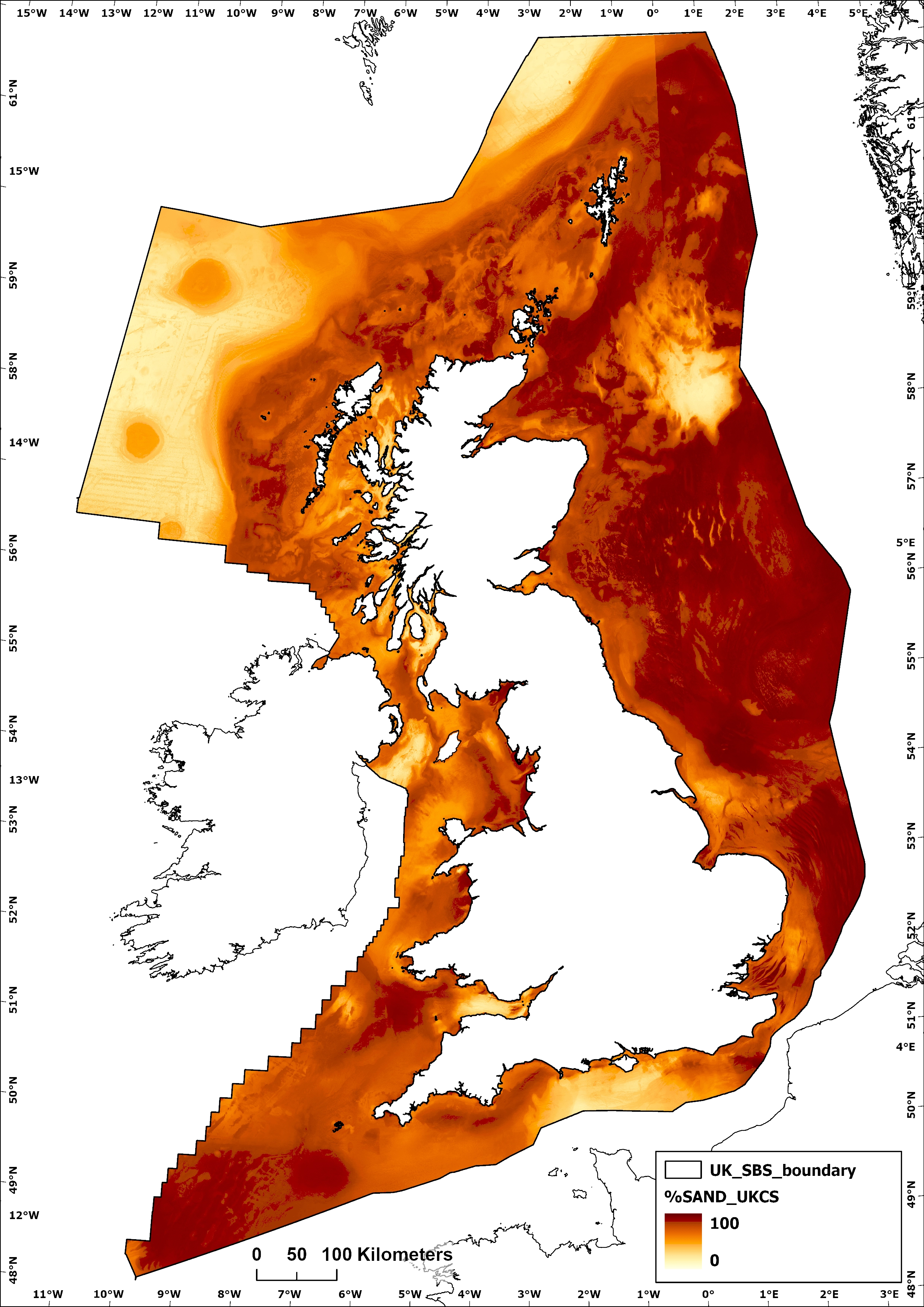
Predictive Seabed Sediments (UK) data: The expected proportion of sand. BGS © UKRI 2025
These predictive maps are generated using a machine learning algorithm known as a Distributional Random Forest (DRF). The input data consists of more than 38,000 seabed sediment samples (collated from various sources) with measurements of the proportion of mud, sand and gravel from locations across the study area. Model inputs also include numerous spatially-continuous covariates likely to have a degree of influence on the spatial distribution of seabed sediments. Covariates included bathymetry data, morphometric derivatives (at multiple spatial scales), as well as hydrodynamic data layers (currents and tidal).
The predictive maps include one classified SBS map (Folk sediment class; vector), and three percentage-sediment maps giving the proportions of gravel, sand, and mud (rasters). Further details on the development of these map products can be found with the User Guide.
These predictive SBS maps are intended as an update to, and can be contrasted with previous BGS Seabed sediments mapping.
You may also be interested in
BGS Seabed Geology
The seabed geology map dataset covers regions on the UK’s continental shelf and details the substrate geology, structural geology and seabed geomorphology.

Offshore bedrock 250K
The BGS Offshore Bedrock 250k dataset depicts the distribution of the different types of bedrock on the UK Continental Shelf.

Offshore Quaternary 250K
The 1:250 000-scale offshore geological map for quaternary geology (BGS Geology: marine quaternary 250k) is available digitally.

Seabed sediments 250K
This offshore Quaternary geology dataset shows the distribution of interpreted lithostratigraphical units within the shallow subsurface. The dataset represents the Quaternary geology immediately beneath the active seabed sediment layer.