These datasets are made available as Open Geospatial Consortium (OGC) web feature services (WFS) and access is via compatible software. They can also be accessed by websites that use a map-based interface to connect to WFS services, allowing integration of data from different providers.
Many of these services contribute to the BGS complying with the EU INSPIRE directive.
World Mineral Statistics dataset
This WFS delivers data from the World Mineral Statistics archive for all countries and commodities in the archive for the years 1970 to present. The service uses CGI Commodity Code vocabulary terms.
Service address:
http://ogc2.bgs.ac.uk/cgi-bin/UKWM/ows?service=WFS&request=GetCapabilities&
Example Queries:
Data for Antimony (production, imports, exports) 1970 to present in CSV format: http://ogc2.bgs.ac.uk/cgi-bin/UKWM/ows?service=WFS&version=2.0.0&request=GetFeature&STOREDQUERY_ID=CommodityURIByYearRangeStoredQuery&CGI_URL=http://resource.geosciml.org/classifier/cgi/commodity-code/antimony&YEAR-FROM=1970&YEAR-TO=2022&outputFormat=CSV&
Data on Iron Ore Production 1971 to 1985 in JSON format: http://ogc2.bgs.ac.uk/cgi-bin/UKWM/ows?service=WFS&version=2.0.0&request=GetFeature&STOREDQUERY_ID=CommodityImportsByYearRangeStoredQuery&ERML_COMMODITY=Iron%20ore&YEAR-FROM=1971&YEAR-TO=1985&&outputFormat=JSON&
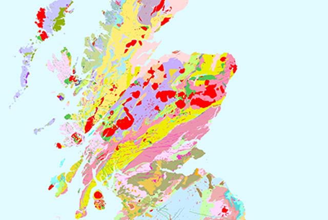
UK geology datasets
UK onshore bedrock geological data WFS services (1:625 000 scale)
Two WFS services are made available for this dataset.
This WFS service uses GeoSciML v4.1 and INSPIRE URIs for vocabulary terms and so is an INSPIRE data download service in accordance with the geology theme data specification. This service delivers MappedFeatures specified by GeologicUnits, the geological history of which is recorded by GeologicEvents.
Service address:
http://ogc.bgs.ac.uk/digmap625k_gsml_insp_gs/wfs?
This WFS service uses GeoSciML v4.1 and CGI URIs for vocabulary terms and so is a OneGeology data download service.
Service address: http://ogc.bgs.ac.uk/digmap625k_gsml_cgi_gs/wfs?
Can’t use WFS?
WFS are mainly intended for use in the development of advanced geospatial systems. The UK onshore bedrock geological data is also available via:
Terms of use
These data are delivered under the terms of the Open Government Licence, subject to the following acknowledgement accompanying the reproduced BGS materials: ‘Contains British Geological Survey materials © UKRI [year]. Contact us if you create something new and innovative that could benefit others.
The BGS provides no warranty as to the quality, accuracy, completeness of this free map data or the medium on which it is supplied. This includes any warranty as to the continued provision of material or that the material taken from this site is compatible with your computer system and/or any other data with which the material is to be used.
Please be aware that the BGS may make changes to this service. This will include, but not limited to, the level of attribution seen for each type of geology, and changes to zoom thresholds. Please contact us if you have any feedback.
You may also be interested in

Technologies
Applications, software and online services created by the BGS and our collaborators.
Web map services (WMS)
A standard method of providing map images that can be viewed in GIS software, virtual globes and portal-style websites using a map-based interface.