On 1 December 2011, a new landslide occurred along the A83 Rest and Be Thankful pass (Argyll and Bute, Scotland) that blocked the road. The road was subsequently closed in both directions, resulting in a 26-mile diversion. The landslide occurred after 65.8 mm of rain — a quarter of the expected average for the area in December — fell in 48 hours.
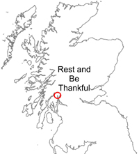

Rest and Be Thankful (A83) location map. BGS © UKRI.
Following the landslide, the road was fully closed for two days and was then only open during daylight hours for safety reasons from 3 December. The road was fully reopened at 08.30 hours on 13 December.
This is the third time that this section of road has been closed in the last five years. The BGS Landslide Response Team surveyed the previous landslides in 2007 and 2009.
The BGS Landslide Response Team made a visit to the landslide on 2 December 2011 to investigate the failure. Information collected from this survey is logged in the BGS National Landslide Database ID 18264/1.
A further, smaller landslide (30–50 tonnes) occurred on 22 February 2012, setting off tiltmeter alarms. Although no debris from the landslide reached the road, the A83 was closed for two days as a precaution.
News reports
The 2011 landslide was widely reported in the local and national news.
- Slip could close A83 Rest and Be Thankful for 24 hours 1 December 2011, BBC News
- A83 Rest and Be Thankful road closed again at night 13 December 2011, BBC News
Geology
The geology of the site is described on the 2009 landslide page.
Landslide
The landslide was a translational slide that degraded into a flow as it passed over a local break of slope, moving approximately 100 tonnes of material. In the lower section of the slope it has exploited a small gully.
This new landslide is approximately 370 m south-east of the 2007 and 2009 landslides, which exploited a much larger drainage channel. As with those landslides, this appears to be part of much older landslide features, with numerous tension cracks visible in the slope around the 2011 event.
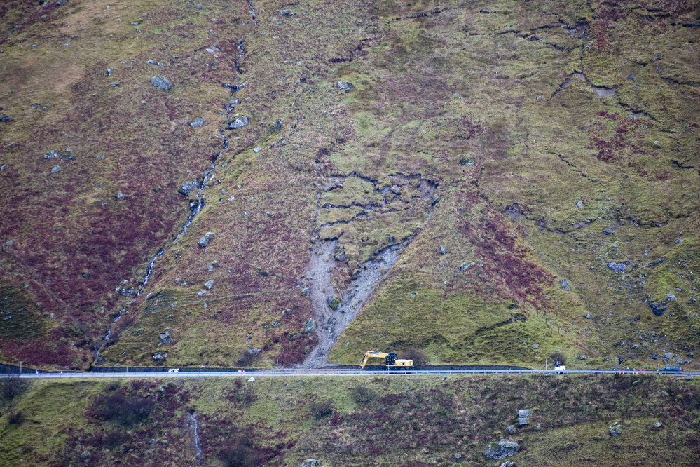
The 2011 A83 Rest and Be Thankful landslide. BGS © UKRI.
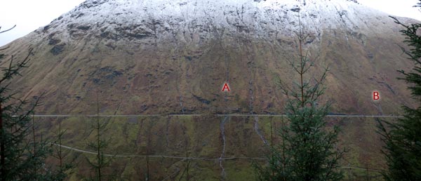
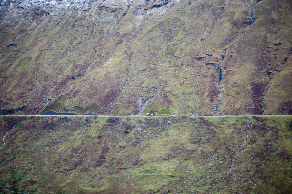
Eastern slope above the A83 showing the position of (A) the 2007 and 2009 landslides and (B) the 2011 landslide. BGS © UKRI.
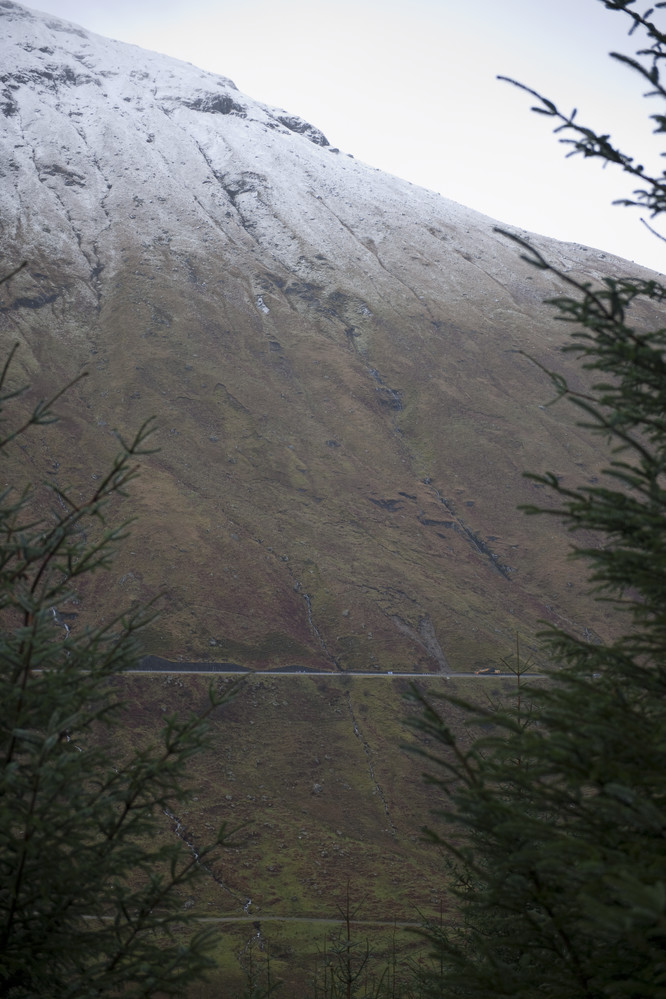
Slope above the 2011 landslide. BGS © UKRI.
Numerous tension cracks in the slope surrounding the 2011 landslide. BGS © UKRI.
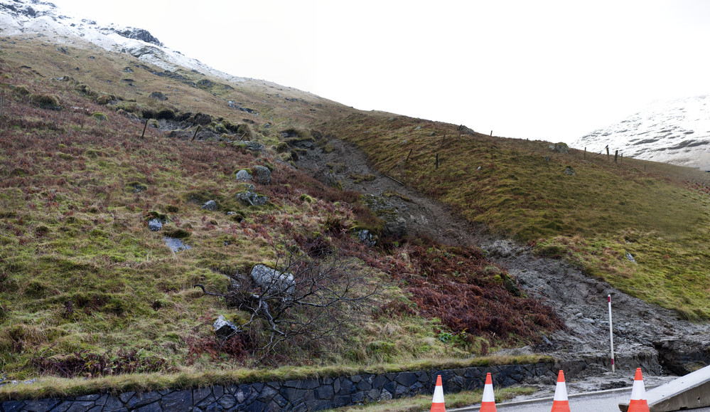
Lower portion of the 2011 slide, exploiting a small gully. BGS © UKRI.
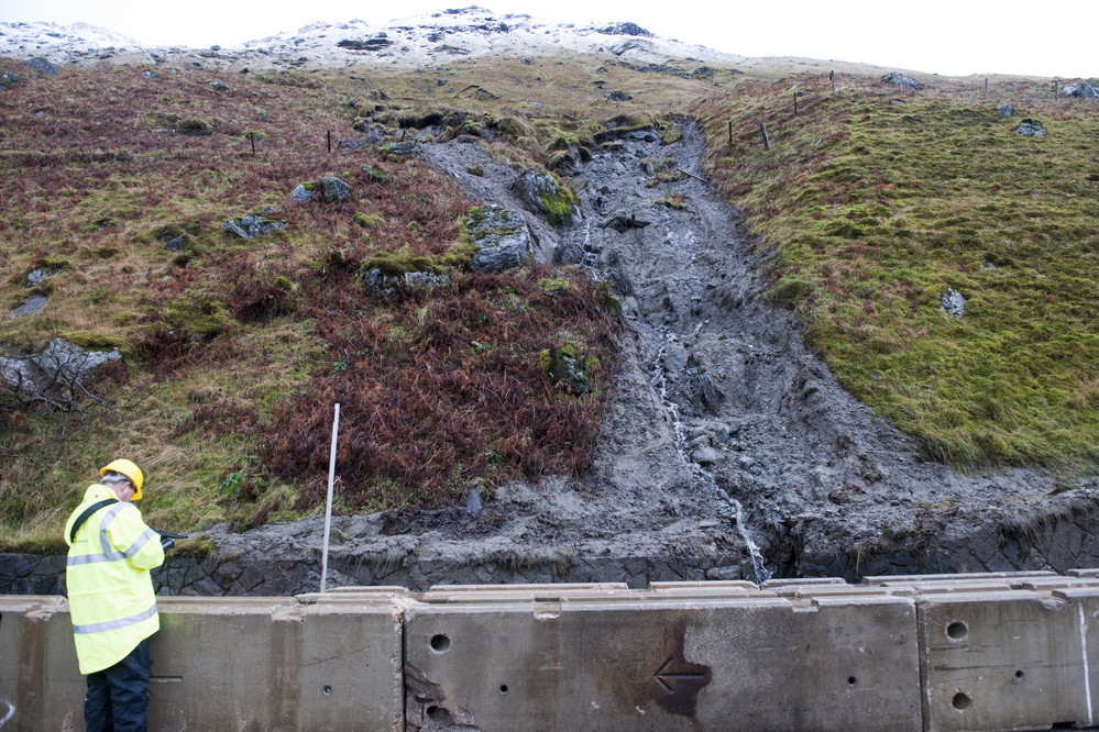
Lower portion of the 2011 slide with water emanating from the gully. BGS © UKRI.
You may also be interested in

Landslide case studies
The landslides team at the BGS has studied numerous landslides. This work informs our geological maps, memoirs and sheet explanations and provides data for our National Landslide Database, which underpins much of our research.

Understanding landslides
What is a landslide? Why do landslides happen? How to classify a landslide. Landslides in the UK and around the world.

How to classify a landslide
Landslides are classified by their type of movement. The four main types of movement are falls, topples, slides and flows.

Landslides in the UK and around the world
Landslides in the UK, around the world and under the sea.