Key information
Scale:
1:625 000Coverage:
Great Britain and Northern IrelandAvailability:
FreeFormat:
GIS line and polygon data. (ESRI, MapInfo, others available by request)Price:
Free for commercial, research and public use under the Open Government Licence. Please acknowledge the material
Uses:
National-level useGet data
Free access
Our free data is available under the Open Government Licence. Please acknowledge reproduced BGS materials.
The Geology Viewer is our online geological viewer intended for general use, the BGS GeoIndex is recommended for professional applications.
GeoIndex ViewerGeology ViewerArcGIS Living AtlasGIS line and polygons data (Shapefile format)GIS line and polygons data (GPKG Format)Generalised digital geological map data based on BGS’s published poster maps of the UK (north and south). Bedrock-related themes were created by generalisation of 1:50 000 data to make the 2007 fifth edition bedrock geology map. Superficial geology-related themes were digitised from the 1977 first edition Quaternary map (north and south).
Many BGS geology maps are now available digitally. The Digital Geological Map of Great Britain project (formerly known as DiGMapGB) has prepared 1:625 000, 1:250 000, 1:50 000 and 1:10 000-scale datasets for England, Wales and Scotland. Work continues to upgrade these.
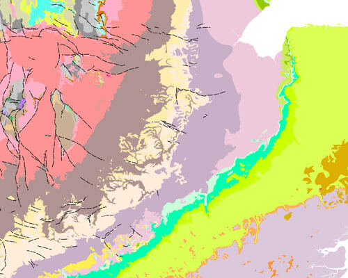

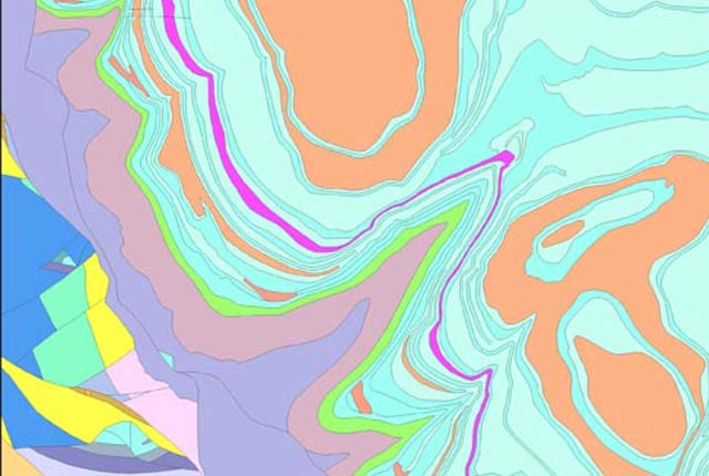
BGS Geology 625K sample. BGS © UKRI.
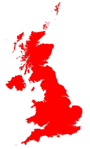
BGS Geology 625K coverage. BGS © UKRI – Contains OS data © Crown copyright 2020.
The geological areas (or polygons) are labelled or attributed with a name based on their lithostratographical, chronostratographical or lithodemic nomenclature and their composition (rock type or lithology). This information is arranged in two themes: bedrock geology and superficial deposits. Faults and other linear features are available in a separate theme.
Further information and resources
BGS Geology Resources
BGS Geology
The BGS Geology datasets are digital geological maps of Great Britain based on the different series of published BGS geological maps.
BGS Geology 10K
Detailed digital geological map data based on BGS’s National Grid and County series 1:10 000, 1:10 560 and 1:25 000 scale maps.
BGS Geology 50K
Generalised digital geological map data based on BGS’s New Series 1:50 000 and 1:63 360 scale (one-inch to one-mile) maps with updated nomenclature.

BGS Geology 250K
Generalised digital geological map data based on BGS’s series of 1:250 000-scale maps, reclassified with lithostratigraphic nomenclature.