
Ekbal Hussain is a remote sensing geoscientist in the Geodesy and Earth Observation capability within the Multi-hazards and Risk challenge area at the British Geological Survey. He is an analytical scientist with an interest in using satellite earth observation techniques to help address problems in international development, particularly in the areas of disaster risk reduction, climate change, poverty and global health.
Twitter: @ekh_sci
Ekbal Hussain’s biography
- 2017 – 2018: Postdoc, Seismic Cities – University of Leeds
- 2012 – 2016: PhD, Geophysics and Satellite Geodesy – University of Leeds
- 2018 – 2012: MSci, Geological Sciences – University of Cambridge
- 2008 – 2011: BA, Natural Sciences – University of Cambridge
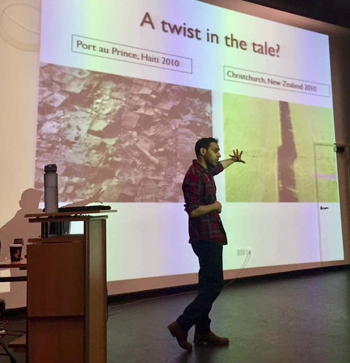
Outreach
Ekbal is a passionate advocate for STEM awareness. Each year at the BGS Open Days he manages the “Earthquakes and Tectonics” engagement activity at the Keyworth head office site.
Additionally, he gives public lectures on how poverty, ignorance and corruption exacerbate the impacts from natural hazards, the role of satellite data in geological sciences, and on the importance of managing our “ignorance” in addressing global and national development goals.
Recent presentations (invited / public)
Please get in touch if you’d like me to give a public talk on the themes of satellite earth observation, natural hazards and disaster risk or the “ignorance project”.
Eye in the Sky: The Earth from Space
Date: 16/10/2020
Institution / Meeting: BGS – Virtual Open Days
Location: via Zoom
Quakes, poverty and corruption: A recipe for disaster?
Date: 08/09/2020
Institution / Meeting: Materials Society of Cumbria
Location: via Zoom
Contrasting seismic risk for Santiago, Chile
Date: 29/06/2020
Institution / Meeting: Pontificia Universidad Católica de Chile
Location: via Zoom
A recipe for disaster: How natural hazards turn into catastrophes
Date: 09/12/2019
Institution / Meeting: Cafe Scientifique
Location: Vat and Fiddle, Nottingham
Quakes, poverty and corruption: A recipe for disaster?
Date: 07/12/2019
Institution / Meeting: OUGS meeting
Location: Keyworth, Nottingham
InSAR for understanding seismic hazard and risk in Bandung, Indonesia
Date: 04/12/2019
Institution / Meeting: BGS – RP3 workshop
Location: Keyworth, Nottingham
Radar remote sensing for monitoring geohazards
Date: 02/12/2019
Institution / Meeting:BGS – Multi-hazards workshop
Location: Keyworth, Nottingham
Radar remote sensing for monitoring geohazards in low-income countries
Date: 21/11/2019
Institution / Meeting: BGS – Exec
Location: Keyworth, Nottingham
InSAR for landslide, subsidence and tectonic monitoring
Date: 11/10/2019
Institution / Meeting: BGS – Philippines Innovation Council
Location: Keyworth, Nottingham
Seismic hazard and risk from the Lembang Fault, Indonesia
Date: 24/06/2019
Institution / Meeting: COMET annual meeting
Location: York
Contrasting Seismic Risk for Santiago, Chile, from Near-field and Distant Earthquake Sources
Date: 03/04/2019
Institution / Meeting: School of Earth and Environment
Location: Leeds
Sex, Drugs and Rock’n’Roll
Date: 22/03/2019
Institution / Meeting: Cadbury 6th Form College
Location: Birmingham
Quakes, poverty and corruption: A recipe for disaster?
Date: 22/03/2019
Institution / Meeting: Cadbury 6th Form College
Location: Birmingham
Sex, Drugs and Rock’n’Roll
Date: 27/02/2019
Institution / Meeting: BGS – lunchtime lecture
Location: Keyworth, Nottingham
Quakes, poverty and corruption: A recipe for disaster?
Date: 07/01/2019
Institution / Meeting: U3A STAR
Location: Keyworth, Nottingham
Towards an automated online change detection algorithm for InSAR timeseries
Date: 18/11/2018
Institution / Meeting: University of Leeds, School of Earth and Environment
Location: Leeds
Seismic Hazard and Risk in Santiago, Chile
Date: 03/07/2018
Institution / Meeting: COMET annual meeting
Location: London
Quakes, poverty and corruption: A recipe for disaster?
Date: 27/06/2018
Institution / Meeting: BGS – lunchtime lecture
Location: Keyworth, Nottingham
The spatial and temporal variation in strain accumulation along the North Anatolian Fault
Date: 18/05/2018
Institution / Meeting: University of Cambridge, Bullard seminar
Location: Cambridge
Research outputs:
ORCID: 0000000169212843
Research interests:
• Ground deformation monitoring with Interferometric Synthetic Aperture Radar (InSAR)
• Seismic hazard and risk
• Mapping multi-hazard interactions
• Disaster risk reduction
• Subsidence monitoring arising from groundwater extraction
• Change detection in InSAR time series
Current projects:
• IFF: Developing a near-real time early warning system using InSAR time series
• ACT2-SENSE: Assuring integrity of CO2 storage sites through ground surface monitoring
• GCRF: Tomorrow’s Cities multi-hazard cross-cutting theme
• BGS ODA: Seismic hazard and risk in Bandung, Indonesia
• BGS ODA: Remote landslide monitoring solutions in Ethiopia
• BGS ODA: Urban development in Hanoi, Vietnam
Current PhD Students:
• Ahmed Mahmoud – University of Nottingham: The Uses of Remote Sensing in Modelling Sand Movement in Sudan
• Manuel Diercks – University of Plymouth: What drives fault interaction and earthquake hazard in western Turkey?
• Michelle Rygus – University of Pavia: A-DInSAR technique as supporting tool for sustainable groundwater resources management in subsiding area
- Mahmoud, A M A , Novellino, A, Hussain, E, Marsh, S, Psimoulis, P and Smith, M. 2020. The Use of SAR Offset Tracking for Detecting Sand Dune Movement in Sudan. Remote Sensing, 12(20), 3410.
- Weiss, J R, Walters, R J, Morishita, Y, Wright, T J, Lazecky, M, Wang, H, Hussain, E, Hooper, A J, Elliott, J R, Rollins, C and Yu, C. 2020. High‐resolution surface velocities and strain for Anatolia from Sentinel‐1 InSAR and GNSS data. Geophysical Research Letters, 47(17), p.e2020GL087376.
- Hussain E, Elliott J R, Silva V, Vilar-Vega M, and Kane D. 2020. Contrasting seismic risk for Santiago, Chile, from near-field and distant earthquake sources. Natural Hazards and Earth System Sciences 20(5), 1533–1555.
- Hussain, E, Wright, T J, Walters, R J, Bekaert, D P S, Lloyd, R, and Hooper, A. 2018. Constant strain accumulation rate between major earthquakes on the North Anatolian Fault. Nature communications, 9(1), 1-9.
- Bufe, A, Bekaert, D P S, Hussain, E, Bookhagen, B, Burbank, D W, Thompson Jobe, J A , Chen, J, Li, T, Liu, L, and Gan, W. 2017. Temporal changes in rock uplift rates of folds in the foreland of the Tian Shan and the Pamir from geodetic and geologic data. Geophysical Research Letters, 44(21), 10-977.
- Hussain, E, Hooper, A, Wright, T J, Walters, R J, and Bekaert, D P S, 2016. Interseismic strain accumulation across the central North Anatolian Fault from iteratively unwrapped InSAR measurements. Journal of Geophysical Research: Solid Earth, 121(12), 9000-9019.
- Hussain, E, Wright, T J, Walters, R J, Bekaert, D P S, Hooper, A, and Houseman, G A. 2016. Geodetic observations of postseismic creep in the decade after the 1999 Izmit earthquake, Turkey: Implications for a shallow slip deficit. Journal of Geophysical Research: Solid Earth, 121(4), 2980-3001.
- Hussain, E, 2016. Mapping and modelling the spatial variation in strain accumulation along the North Anatolian Fault (Doctoral dissertation, University of Leeds).
- Reynolds, K, Copley, A, and Hussain, E. 2015. Evolution and dynamics of a fold-thrust belt: the Sulaiman Range of Pakistan. Geophysical Journal International, 201(2), 683-710.
- Gill, J, Tostevin, R, Hussain, E, 2014. Hazards and the Himalaya. (Institute for Risk and Disaster Reduction, University College London, UK.)
• Interferometric synthetic aperture radar data analysis (InSAR)
• Pixel offset analysis on SAR data
• Time series analysis
• Python programming
• Linux shell scripting and parallel processing
• LaTeX
• QGIS
• Trained first aider
• Outreach and public speaking